Zealotry and Gentrification: An Alluvial Pilgrimage
Posted in London on Saturday 1st September 2018 at 11:09pm
Arrival in Erith did little to dispel the strange gloom I'd sensed about the place on my last, fleeting, Sunday afternoon visit. Back then I'd been content to assume it was shuttered and drab because of the malaise which descends on all British towns on the afternoon of the Sabbath, thanks in part to antediluvian trading laws. While there were more people milling around the town centre today, the place still felt rather hopeless and grim. I headed under the main road and into town, soon being accosted by a group of Christian proselytisers who were hawking glossy cards urging passers-by to join them at an event. A loud choir was lending support by belting out hymns in the pedestrianised walkway. I slalomed around this, passing a string of little cafés with steamed windows and plastic-draped tabletops. The locals sat outside, smoking prodigiously and gazing into the middle distance. The morning was heating up already and I decided that I was going to need supplies from the nearby supermarket before beginning today's walk. I already felt like I was behind schedule after the long train journey out here, so I tried to make this a swift visit. Even in the huge Morrison's store, I was struck by the utter gloom of Erith. As I passed the in-store restaurant a minor scuffle broke out over ownership of a winning lottery scratchcard. I felt this very paragraph forming as I headed out of the store, knowing I'd need to compound my earlier remarks on this beleaguered spot and already feeling uneasy about it. It felt uncharitable to knock a place which was so clearly out-of-luck and on the edge of things. Once out of the store I made a dash across the fractious carpark where drivers wrangled into tiny spaces, and on to the waterfront. Soon, thankfully, I was beside the Thames. There was an unexpected relief in seeing the undulating rubbish-mounds of Rainham across the quiet waters and the strong sunlight reflecting back at me from the slick silver-grey mudbanks exposed a low tide. I turned west and began to walk with little expectation and only the loosest plan for today.
The Thames Path is broken at Erith, diverted inland to skirt industry around the Darent estuary, then occasionally reappearing as a plaza at the front of the tall blocks of modern apartments which have gradually filed into place along the waterfront. The Thames takes a turn to the north at Erith Reach and the foreshore returns to industrial use, meaning the path makes a zig-zagging course around the heads of various abandoned docks and inlets. I set off, pleased to be on the river for a brief spell at the start of the walk, and only mildly inconvenienced by the cyclists who attempted to negotiate the 90Ëš turns at the blind corners of these twists in the path at full speed, skittering to a halt as they misjudged their angle and encountered a pedestrian. The path opened out to run along the well-kept but rather sunburned edges of Riverside Gardens, a park laid out on the site of a former flour mill which is itself now threatened as the land is a prime riverside residential site. The walkway along the wharfside which formed part of Henry VIII's royal dockyard has a rather ill-chosen name in some senses. William Cory Promenade is named for a local collier who realised that he could avoid wharfage fees by unloading coal onto barges and lighters in mid-stream along the relative calm of Erith Reach, thus denying the town of employment and income, despite maintaining his base in Erith. As I turned a particularly grim looking corner where the path passed around a rusting crane and disappeared behind a forbidding looking fence, I met a dog walker who seemed distressed. She appeared to walk by before thinking twice and calling agitatedly after me to ask if "I knew anything about the horse?" I must have looked entirely confused so she gestured urgently to a gap in the corrugated iron beside us, through which a large, sad brown eye was gazing back at me. In a grubby scrapyard, marooned between the fence and the dock wall was a young pony, tethered and a little grubby looking but otherwise apparently healthy. I took some pictures and suggested I could send them to the local RSPCA. She seemed a little happier at this prospect and declared her intention to find the horse some grass to eat. We headed off in opposite directions to complete our missions. A swift email sent, I reluctantly turned aside from the Thames where the path ducked inland again. While I still felt I had business in Thamesmead which occupied the broad headland between Crossness and Erith, today wasn't the day. Instead, I intended to cut across the territory I'd begun to walk some months back but abandoned in the heat. It was likely to be no less hot today, but tackling the wooded hills of North Kent would surely be easier when I was less exhausted at the beginning of the day. The path led me beside the old church of St. John the Baptist, which has likely existed in some form on this site since Anglo Saxon invaders moved into the territory abandoned by the Romans and founded towns and farmsteads along the Thames. The church was squat and solid, situated in a cool and shady churchyard which, now disused, was returning to nature. This quiet spot, now largely marooned in the shadow of the passing dual-carriageway, was once at the heart of Erith - but the town crept slowly south along the river towards the wharves and docks leaving St. John's here on the edge of things.
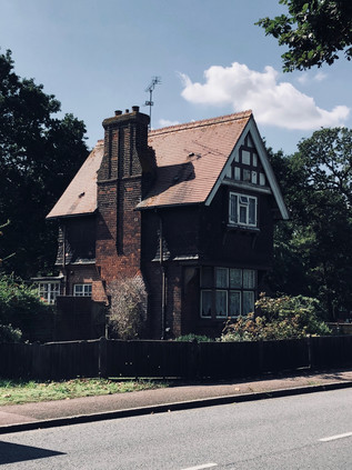
My path out of Erith involved the ascent of a rickety and somewhat litter-choked footbridge over the A2016 Bronze Age Way, which didn't appear to be used a great deal despite the challenge of passing this man-made barrier across the marshes. The busy spinal route takes traffic from the M25 into Thamesmead and seemed to flow remarkably busily beneath my feet. From the top of the bridge, I could see rising woodland to the west, and I confess to some trepidation: the day was getting hotter and my resolve for hill-climbing was weakening. I focused on how cool the air would be under the trees and descended from the bridge, beginning the climb of Valley Road towards the entrance of Franks' Park. This wedge of rather untamed woodland has been a fixture of these growing suburbs since the 1920s and remains generally little-changed. When Frank Beadle, local industrialist made-good, sold his business to Cory & Son in 1896 he played a part in kickstarting the massive Cory Environmental enterprise which transports, recycles and incinerates waste to this day, and not without controversy locally. Beadle's family later donated a substantial parcel of land to Erith Urban District Council - an area of woodland climbing the ridge of Lessness Heath which offered an impressive vista over the Thames. This lofty and isolated site had provided the ideal site for Belvedere House, built in the 1770s and later the home of philanthropist and campaigner for religious freedom Sir Culling Eardley. Much of the growth of Erith and Belvedere is due to Eardley's willingness to sell parts of his estate to develop decent housing for the rising middle classes in Kent, and to this day there is a distinct separation between the 'village' of Upper Belvedere on Eardley's lands and the former wharfside settlement of 'Picardy' - now known as Lower Belvedere. The grand house was sold to the Royal Alfred Seafarer's Society in 1865, finally providing them with a rest home for 'worn-out Merchant Seamen' which had been their goal for some years. It was demolished following a lengthy public enquiry in 1959 to make way for a modern facility for the charity which offered better accommodation, an 'Infirm Wing' for less able residents and staff quarters on site. This rather fine modernist building was soon found unsuitable: with declining numbers of residents and a cohort of users who were often now less able or ambulant, the Society acquired a more traditional convalescent home in Surrey. The modern Belvedere House was, in turn, demolished too and the site is now covered by a housing estate - a spaciously arranged redbrick crescent of 1980s vintage which climbs the valley of the now barely-extant Bedonwell Stream, looking resolutely provincial and unlike the usual homes in this part of London. Frank's Park, however, has changed little over the decades and much of it remains ancient, gloriously ungoverned woodland. I thrashed along for a while on the path which was pleasantly busy with Dads teaching children to cycle and 'phone-checking dog-walkers ambling behind their charges. Faced with a choice of climbing higher into the woods or edging along the inhabited fringe of the park, I chose the latter. I was curious about Erith and Belvedere and disappearing into the trees too soon wouldn't help me get a sense of the place. Instead, I walked a narrow path overhung by trees until I reached a cleared field in the middle of the park where I was decanted onto Parkside Road, the unadopted, rough track which caps the long terraces leading towards the heath from Lower Belvedere.
The intriguingly named Halt Robin Road felt like a country lane, disappearing into the dense western edge of Franks' Park before emerging to cross Picardy Road. This ancient thoroughfare snaked down the hill towards the marshes at the edge of the Thames, linking Upper and Lower Belvedere and likely becoming a much more significant route following the coming of the railway station to the flat land at the foot of the hill in 1859. I headed west again onto Upper Abbey Road, a rather odd little lane which dipped into a shallow sided gully before climbing steadily towards Heron Hill, a spur striking south from the ridge of land on which Lessness Heath sits. The heath was once a much wider expanse of open land, but even by the time of the Domesday Book, a settlement here recorded the largest population for some distance around. The origins of the name are debated - but it seems likely that it incorporates the Old English term for a headland with hlēosne - burial mound. Certainly, this stretch of high ground which is now largely carpeted with suburban homes has been a site of both ritual and more prosaic activity for thousands of years. At Heron Hill, I noted that I was again following one of the spurs of the Green Chain - and that other, more dedicated walkers were following the route too. I trailed a well-equipped, back-pack wielding fellow down the hill and into the inconspicuous entrance to Abbey Wood, one of the largest remaining tracts of the once vast expanse of heathland. There was a choice of paths here - to strike directly into the woodland and follow the undulating and circuitous paths under the trees, or to take the quiet country-lane like track which ran along the edge of the forest of tall, venerable trees. I took the later while my fellow walker headed into the woods - I knew I'd be heading uphill at some point soon, and putting off the clamber for a little longer couldn't hurt. The lane wound quietly along, mostly deserted but for a brief spell, I did follow an incongruously well-dressed man who ambled along the muddy, rutted path ahead in a fine suit, casually tossing away peanut shells as he snacked and walked. At one of the irregularly spaced opportunities to pass through the fence into the woodland, I decided it was time to plunge into the trees. I found myself on a well-made track which there was no hope of straying from, as well-hidden but sturdy wire barriers ensured that only the official routes were walked in Abbey Wood. The path bucked and weaved through the cool woodland, occasionally arriving at confusing junctions where either too few or a confusing profusion of waymarkers made my route ahead unclear. My aim was to head for the remains of Lesnes Abbey - an ending I'd trimmed from an earlier walk, but a place I was keen to finally visit. The path rather unexpectedly opened out into a broad, green area fringed by dense, rising woods to the south. In the midst of a natural bowl in the ground, the impressive ruined stone walls of a sizeable estate of buildings cast shadows on the grass. Lesnes Abbey was founded in 1178 by Richard De Luci, then Chief Justiciar of England - and the act may have been part of his penance for involvement in the murder of Thomas Becket. More certain is that this was neither a populous nor a prosperous Abbey, largely due to the costs of draining the surrounding marshes for farmland and shoring up defences against the Thames. Lesnes was one of the first ecclesiastical sites to fall after the Dissolution of the Monasteries in 1534 and soon returned to farmland. The site passed through various owner's hands over the following centuries and was often robbed for building materials - not least for Hall Place in Bexley. The site has been a public park since 1931, when it was purchased by the London County Council, and the well-kept grassland and striking profile of the ruined abbey walls against the trees provide a sense of the age of the site. The park was busy with walkers and sunbathers, the flags of the site's café flapping in the breeze. I contemplating resting awhile here - but it felt too early in the walk and I was intrigued to head instead for the impressive concrete footbridge and walkway which led north from the site, over the busy Abbey Road and the railway, and into the fringes of Thamesmead. A steady stream of locals made the long walk over the elevated walkway into the heart of the park, arriving near the protected Mulberry Tree, the aged trunk of which contorted over the ground. Said to be a survivor of the initiative by King James I to create a native British silk industry, the tree is delicate and carefully managed now. I was impressed by Lesnes Abbey - the park was well-managed and clearly popular, and there was a carefully maintained balance between history and amenity in evidence. I headed out via the west gate, passing a carved statue of an Abbot in a grove of trees, rather sad to be leaving.
The time had come for my ascent onto the top of Bostall Heath. I'd been avoiding this climb throughout the walk so far, likely put off by a memory of approaching the hill from the west at the end of a prior excursion and seeing buses creeping slowly up into the heat haze. As it happened, the climb was challenging for less expected reasons: eschewing what could have been an easier route via New Road or even the designated walk along the Green Chain, I decided instead to head along an intriguing public footpath which disappeared between the houses under an arch of trees. The walk was challenging - a steady but steep climb through a rutted, humid midge-infested tunnel between the trees, worn down by walkers over the years but almost abandoned today. It was suggested that this was some sort of route of pilgrimage to the Abbey, but it was hard to assess the provenance given the preponderance of religious links in the area. At the top of the rise the path rather abruptly ended against a railing beside Knee Hill. This much busier route between the low-lying settlements near the river and the top of Bostall Hill had no footpath to speak of, and I soon found myself climbing the road in short bursts of frantic walking, stepping into the heavily-littered undergrowth to allow a stream of vehicles to pass, before skittering forwards for a few more yards. The short walk up Knee Hill felt like a long, taxing drag, but my concern to remain safely out of traffic meant that I barely noticed the ascent of the hill which had been my chief concern. Near the summit I was able to divert briefly into Bostall Woods, noting with some concern the signs indicating a grid system for alerting the emergency services to ones' location should they be required to find you among the trees. I finally emerged on Bostall Hill, a plateau of level ground at the top of the long, steep rise from the west. The road snaked downhill, surrounded by trees on both sides, but with a tantalising glimpse of London on the horizon between the greenery. Walking downhill has always been a trial for me - my innate clumsiness and heavy-footed trudge turn into a momentum-fuelled stagger and I'm excessively conscious of my efforts to remain upright. As I've grown older and heavier, I've also noted that the forces at work on my knees feel far more disagreeable when stumbling down a hill. I steeled myself for the usual vague feeling of lost control and set off, passing the fine Victorian Heath Keeper's cottage which was built in 1880 after the Metropolitan Board of Works purchased the land to save it from the creeping tide of housing engulfing the area. Beside it, a fine granite vessel inscribed by the Metropolitan Drinking Fountain and Cattle Trough Association stood, filled with flowers which fared remarkably well despite the busy road nearby. The trough was not original - while the Association indeed placed a much-needed trough here for horses which had hauled coaches up the long, arduous climb, their records indicate a 9'6" long trough. This truncated replacement is of uncertain origin - but marks the brow of the climb well enough. The common land was extended in 1894 by the addition of Clam Field, and as the suburbs slowly engulfed the woodland, the mythology of the place grew with them. These ancient and mysterious islands of woodland in the expanding city always attract superstition and curiosity - and for some reason, almost all of them have apparently attracted the notorious Dick Turpin. The presence of chalk workings on Bostall Heath have provided a rich backstory of the dashing highwayman hiding-out in caverns between raids on rich folk climbing Shooters Hill. The reality of Turpin is, as I've discovered elsewhere, that he was neither quite so dashing nor so elegant in his practice. It seems in fact that he was a thug first and foremost, and while it's possible he did know these woods well enough to disappear into them when needed, the purpose of the caves is more prosaic. Chalk has been worked in North Kent for many hundreds of years, and the outcrop of land on which the heath sits is home to numerous abandoned pits where it has been dug. In 1899 the Royal Arsenal Cooperative Society began work on the Bostall Estate - a development of homes on the site of their former market gardens - excavating an eventually very extensive network of passages under the heath to extract chalk for the building works. The mine was abandoned in 1906 before briefly becoming a First World War air-raid shelter. Despite improvements to access, it was not reused in the Second World War due to frequent roof-falls and despite protests that it should be opened to locals. The tunnels were later sealed and the gardens are long disappeared under suburban streets, but the Cooperative Society continued to own land and property in the vicinity, eventually selling their large property Shornalls to the Greenwich & Bexley Cottage Hospice in 1988 for the princely sum of £1. A much-expanded community hospice still operates today, surrounded by the peace and quiet of Bostall Heath.
At the foot of Bostall Hill, Wickham Lane snaked away to the south - a venerable way across the heath towards Kent, and a boundary of sorts. Beyond here the quiet of the woodland gave way to a continuous strip of suburbia heading directly for London. Plumstead High Street stretched away into the distance between two long terraces of local shops, small businesses and housing. I began the long march west by falling foul of an angry van driver: as a few pedestrians including myself waited to cross at a light we noted that the driver at the front of the queue was busily composing a text message and paying no attention to the light which began to change back from red to green. We made it across the street safely before she realised and sped off at the last possible moment. The van driver recklessly sped after her, assuming that she'd waited because we were crossing in front of her. I responded to his volley of foul-mouthed abuse with a raised middle finger, which seemed to enrage him even further - but he was now gunning his van at alarming speed along the High Street and couldn't have stopped if he tried. I exchanged smirks with a fellow insulted pedestrian after one of the road's little victories for the day - and set off again. But this wasn't to be my last encounter on Plumstead High Street. As I trudged along a stretch of busy pavement beside a run of well-kept retirement flats and small shops a young, confident woman in a pristine London 2012 t-shirt flagged me down. I was momentarily bewildered by this - partly because I rarely expect to be stopped in the street here, but mostly because I thought it impossible that anyone would have kept a t-shirt in such impeccably good order for six years. Indeed, she would likely have been a small child back then based on my estimate of her current age. The sight of that logo here in London, beneath an open and hopeful, smiling face took me back to the summer of Gamesmakers and their jolly oversized pointing-hands. The bonhomie of that fateful summer was real even if the park and the event were a facade - those volunteers who jigged and capered their way through two long weeks of irritable queues and misdirected tourists meant every bit of their happy smiles. And so did this young woman who was, it seemed, about to ask me about my relationship with Jesus... I was wrong-footed enough to drop my guard and to answer the first question honestly: yes, I had been christened. I didn't get the chance to tell her about my long quest to get the Bishop of Worcester to reverse my baptism or my long association with atheism. Before I could trot out the familiar defences she was telling me how my soul could be saved with a swift prayer she was happy to say with me right now. Jerked back to reality with the realisation I was meant to respond to this suggestion, I counselled caution - shouldn't I be reflecting on such a weighty issue rather than committing foolishly to this course of action in the street? She bit her lip and pondered before agreeing that forming a personal relationship with the Saviour was serious stuff. Instead, she thrust a number of booklets into my hand, circled the prayer I needed to ponder and asked for my 'phone number because she wanted to invite me to one of the events in the leaflet - the same one that I'd been hustled to attend by way of a glossy flyer in Erith earlier in fact. I trotted out a string of random digits approximating a valid 'phone number and prepared to make an escape. "I'll just call you to make sure I've got it right" she said, raising her 'phone and waiting for the dialing tone. My heart sank. There was no escape - she was good at this, and I'd been exposed as both a heathen and a charlatan. I made an excuse about getting confused with my work number and gave her the real number. She called and checked it, letting it ring once before hanging up and letting me pass, satisfied she'd been able to persuade me into an appearance at this forthcoming festival of evangelism. As I wandered off, a little dazed by this experience and rapidly blocking the number which had just called, I almost felt guilty. It felt a little like being rude to one of those intrepid, cheerful, resolutely un-British Gamesmakers would have surely have seemed back in 2012? Kicking a puppy instead of Lord Coe was a poor substitute. I felt grubby and cruel, but also ill-used - a little like Plumstead High Street felt in fact as I hit my stride again, passing a parade of slightly down-at-heel stores which stretched along the seemingly endless road.
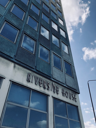
The road rose to divide at Plumstead Station where I crossed the tracks of my previous walks. Navigating the junction involved dodging more religious leafleteers, but I was in better form now and able to evade the extended hands and tune-out the requests to stop and chat just for a sec... Nearby, the Southern Outfall Sewer struck out on its elevated course towards Crossness, and beneath the road the rails curved out of the tunnels which had brought them from London. I'd found myself here numerous times, often unexpectedly when the trains had failed me. Plumstead had that sense of accidental patronage - the newsagents' shops which slumbered between customers might not even exist were it not for the people who ended up here instead of their intended destination. Beyond the station, the dual-carriageway to Woolwich skirted the main drag and described the edge of the former Dockyard. The broad, busy road edged closer to the river here, which was indicated by the distinct absence between buildings. The modern wall of the once fortified dockyard was a long strip of laminated lifestyle prompts - a parade of serving suggestions for modern living in the new apartments rising behind the hoardings, punctuated only by reminders that Crossrail would have been here in December if the project hadn't slipped alarmingly behind schedule. The buildings on the landward edge of the dockyard were modern, low-rise blocks with retail opportunities on the ground floor which sparkled across the street at the decidedly low-rent, tattered edges of Woolwich town centre. I could smell the saline water on the air as the breeze whirled along the dusty pavement whipping up a litter of takeaway cups and discarded religious literature. This road in from Kent seemed to remain a pilgrim's way of sorts, and was still a channel of worship - either fuelled by sincere belief or desperate hope. I recalled the twin modern churches which stood like dvarapalas at the entrance to the South Circular not far ahead which might well be the modern-day sacred site the road was aiming for. But I was turning aside before I reached that junction, crossing the street near the abandoned concrete and smoked-glass municipal offices of Riverside House to head for the river and to speculatively check for a ferry over to the north bank. The terminal was silent, the boats laid up further along the river. In preparation for the switch to modern vessels, the ferry service had been stood-down while work continued on the loading piers. I realised that if I was to continue as I planned I'd have to make a long-promised and often avoided journey under the river. I headed for the rotunda where the descent into the foot tunnel began.
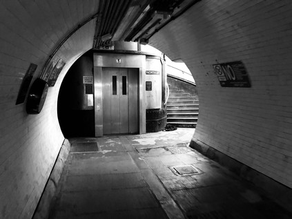
It was hard to classify my unease at passing under the Thames. The evidence told me that it was entirely safe, that generations had made the excursion on foot or bicycle since opening in 1912, and still did in their thousands. I also knew that I'd passed through tunnels in trains and cars without incident, even this very morning. But an anxiety which I've never truly conquered and which seems to retreat to some hidden cells like an inactive virus can be awakened by the most mundane of things. As I descended in the stinking lift-capsule to the subterranean level I was aware of dry-mouthed concern settling on me. A young woman ignored me carefully and deliberately, probably far more anxious than I but hiding it impeccably - and I was momentarily distracted by the sad thought that she had to do this every day perhaps: to pretend that it wasn't menacing to be the only other passenger in a lift with a nervous, shuffling and sweaty man. Experienced in tunnel-navigation she set off at a swift trot as soon as the doors opened. I paced myself carefully, the white tiles stretching ahead endlessly, descending to a mid-river nadir beyond which I couldn't see. I surprised myself by being less concerned with the weight of water above and more with the peloton of reckless cyclists who zapped by in both directions, in contravention of the signs but anticipating TfL's review of the no cycling rule which was imminently to deliver a verdict. My fellow lift passenger had stomped ahead, heels clacking loudly along the floor, staying resolutely to the left of the white line while others walked by in the opposite direction, equally unconcerned and apparently mostly bored by the need to walk rather than chug over in the ferry. The tunnel turned upwards and in the distance, a dark smudge, growing by the step, indicated the dark wood panels of the headwall and staircase on the northern side. I picked up the pace, carefully managing my steps to miss a rather full lift going up and to wait for its next trip. If possible, the northern liftshaft was more nauseatingly smelly than the southern and accompanied by a couple of cyclists, I made the ascent without breathing any more than was necessary. The doors opened and I whirled out of the rotunda into reliably grubby and desolate North Woolwich. I looked around at the few people lingering near the entrance waiting for the lift and realised that none of them would congratulate me for making this utterly unremarkable, everyday passage. I headed up the dusty road towards Pier Road, feeling somewhat energised by my passage under the river after finding excuses to avoid it for so long. I was now in environs I knew fairly well and it felt reassuring to be back on the long road which stretched west along this sometimes ill-starred and isolated peninsula.
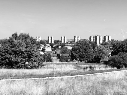
I often write of territory which is shifting, contested or liminal - but North Woolwich is perhaps a defining example of this kind of place. Its ownership and fate have been eternally unsettled - an early hamlet here was destroyed by medieval flooding, and a long mess of administrative change resulted in the parish becoming an outpost of Kent in Essex. This confusion was largely fuelled by Hamo de Crevequer, appointed Sheriff of Kent after the Norman Conquest and also gifted lands in Essex and Surrey. To facilitate more efficient taxation and control of the ferry across the Thames, he established an extenstion of his manor to the north bank. When the parish boundary was drawn based on the old manorial lands the anomaly persisted. The creation of the London County Council did little to resolve things - the Metropolitan Borough of Woolwich was absorbed by the new County, while the Boroughs of West and East Ham which surrounded North Woolwich remained in Essex. The ancient anomaly was finally tidied up by the creation of the London Borough of Newham in 1965, around nine centuries after it had originally arisen. With the old settlement long washed away, for many of these hundreds of years the territory north of the river had been a wild and mostly uninhabited waste, unimportant and easily ignored - not until the 19th century did the population here start to increase, as industry and dock construction processed east along the river. Cable-making and shipbuilding brought a new working-class population to the area, and North Woolwich became briefly prosperous. The presence of Harland and Wolff's works at Gallions Point and the proximity to the docks made the area a prime target for bombing in the second world war, and the population declined rapidly due to the destruction of homes and the displacement of industry. The factories didn't return, and the wharves became scrapyards, refuse transfer sites and waste lots. Only the mighty Tate and Lyle works at Silvertown remained, engulfing the area in sweet, earthy and rather sickly clouds of fume. The road through what remained of North Woolwich was drab, quiet and mildly threatening in its weekend desertion. The southern edge of the road was marked by a long, concrete wall erected to screen homes from the noise of Crossrail trains should they one-day start to emerge from the earth nearby. It was a depressing structure, blank and oppressive with only occasional pavements to accommodate bus stops. The narrow tongue of land tapered between river and dock, the DLR forming a spine from which the low-rise housing and closed pubs dangled precariously towards the riverfront. The sugar works were silent today, a massive banner depicting a Golden Syrup can flapping unsettlingly above. It sounds odd perhaps, but I rather like the feel of this place and decided to settle on a bench to eat a late lunch and think about the route ahead of me a little.
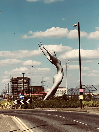
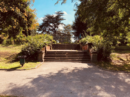
North Woolwich slipped into Silvertown without any sense of change in status, the concrete wall finally turning aside in the Travelodge carpark where the railway tracks dip into the revitalised Connaught Tunnel under the Royal Docks. The hotel itself is a unusual building: a squat, rectangular block with gently curved corners apparently modelled on a vintage transistor radio. The service entrance to London City Airport former a third spur from the junction was silent, the staff idly but suspiciously watching me walk by as I turned towards Nasser Azam's 12-metre tall bronze statue of Athena which graces the entrance to Connaught Bridge. The elegant figure throws her hands back and pushes her body forwards, apparently caught before an elaborate act of bowing down towards the east. This isn't insignificant - the artist wanted to honour the community which had raised and supported him. Athena acknowledges that the city towards which I was slowly trudging had built much of its prosperity on the foundations and the sweated labour of these communities. The statue changes in aspect as I make my way around the roundabout on which it stands: from the front a striking statement of intent, from the side the beginning of a supplication, from the rear a muscular statement of feminine strength. From the bridge, I had a fine view across familiar terrain: the wasteland stretching west towards Millenium Mills, the wind-rippled expanse of the Royal Victoria Dock and the distant towers of the Emirates Airline climbing to cross the river. I turned south and then west, towards Pontoon Dock. In contrast to North Woolwich, much had changed here. The numerous building projects which I've spotted languishing over the years have slowly cranked back into action, the financial crisis finally unpaused for these apartments as far-eastern buyers speculate on the crazy zig-zagging pre-Brexit pound. They still jostled with scrapyards and warehouses, some in use and some abandoned, but people were returning to the penninsula it seemed. The ghost of George's Diner and the Graving Dock Tavern still haunted the northern side of the road, surrounded by a forest of buddleia, but they were overshadowed now by the mighty, ship-like lines of Barrier Point and the sturdy piers of the DLR viaduct. At the entrance to this new development, apparently providing accommodation for students and their visiting family, a gleaming new Starbucks store traded remarkably busily. I slipped in for a much-needed coffee and to plan how far to walk today. The airconditioning was welcome - a chance to reapply sunblock to my sweaty forehead to the apparent disgust of an elegant Spanish family who accompanied their student daughter as she showed them around her temporary home. They looked unimpressed, and a little concerned perhaps? This place felt incongruous - I could see the desolation of undeveloped, struggling Silvertown across the street beyond a coffee shop diorama of MacBook screens and complicated looking iced drinks. Inequality is a strange concept to convey: easy to intellectualise but hard to illustrate without invoking a patronising pathos. But it was here at Barrier Point, and it felt deeply uncomfortable. Aware I was lucky to regard passing through this place as leisure rather than necessity, I swallowed my coffee and moved on to find some good old-fashioned public-spirited philanthropy to ease the middle-class guilt a little. I found it very close by at Lyle Park. This place was an unexpected gem - accessed by a long, leafy path beside public tennis courts, the almost hidden entrance opening into a lush, green square of open space big enough to house a football pitch. A line of trees divided the park, with an impressive brick and stone stair leading up to a terrace on the riverbank. On this terrace, the gates of the Harland and Wolff works which employed locals until 1972 were placed ceremonially between rose beds exploding with colour and scent. The park appeared utterly deserted. Sir Leonard Lyle donated this sliver of land to the local public of West Ham in 1924. It would have been a very significant open space in the crowded, factory-choked confusion of Silvertown in the early 20th century, and a welcome escape for families who lived in relatively cramped conditions. Few lived nearby now, except for those who occupied the new developments and likely hadn't dared explore this far from their front doors yet and the park was unused but beautifully kept. The grass was green despite the long, hot summer and the foliage was carefully tended. Finally, on the range of benches beside the Thames, I spotted another human being - a young mother rocking a pram with her foot while she carried on one-half of an impassioned, frustrated 'phonecall. I quietly took photographs of the river before slipping away and leaving her to her call - Lyle Park was still a haven for the locals of Silvertown it seemed, and it felt right to leave it that way today. Tate might have sponsored the temples of art which graced the banks of the river further west, but Lyle's more modest bequest was still an oasis of calm in a conflicted spot.
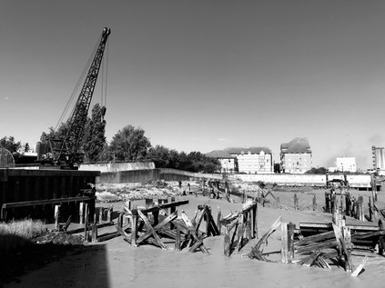
I turned west again, and almost immediately began to climb as the road rose onto the Silvertown Viaduct. Below, a mess of industry - some dead, some clinging barely to life - filled the narrowing isthmus between the river and the dock. By the early years of the 20th century, the approach to the Royal Docks from London was beset by delays and queues which were beginning to hamper trade. The narrow, tight elbow in the road after the Barking Road bridge over the River Lea fed a slow line of traffic onto the long approach road to the docks with an often-opened swing-bridge over the Tidal Basin entrance. Finally in 1929 the Dock Approaches (Improvement) Act passed through parliament authorising historically massive sums of money to resolve the issue. The solutions were elegant and surprisingly long-standing, with the original spans of the replacement Lea Bridge still doing duty among a tangle of new carriageways and slip-roads, and this three-quarter mile long Viaduct over the dock entrance still reflecting the sun back at me from impressive and graceful concrete flanks. At the time of its completion in 1934, there was no other similar road scheme in Britain, and the starkly modern design signified an optimism in the future of the docks which was to be largely misplaced. The Tidal Basin entrance was dry now, one of the towers holding the cables for the Airline occupying space on the former waterway. The cablecars moved slowly overhead in the startling blue sky, new towers of dockland housing rising to meet them as the area to the north of the crossing was gradually gentrified. The view was surprisingly open from the top of the viaduct - over the Thames to the white nodule of the O2 with its own forest of new towers growing around it, and north to the sprouting patch of similarly gleaming new buildings in Stratford. Setting aside any concern over how London could survive these transformations, the effect was exhilarating. It felt like surveying a city-building computer game from inside the screen. Buildings grew almost as I watched, the vista changing with every rotation of the lens. I descended from the viaduct to take the Lower Lea Crossing. It was a walk across this bridge which had, in some ways, rekindled my series of London walks some years back, and reversing the direction felt fitting. I was re-entering a different city now: an unplanned, opportunistic mix of new buildings and new communities, lost history and missed chances. I navigated around the mess of fly-tipping and broken glass which stood as a gateway to the bridge, passing the site where I'd spied people camping in the bushes beside the road on my prior visit. The carriageway leapt forward, over the sluggish, muddy estuary of Bow Creek which curled and writhed below, resisting its confluence with the Thames. On the little headland of Goodluck Hope where the lighthouse at Trinity Buoy Wharf kept a now lightless guard, the warehouses and workshops had been painted with historic mock-ghost signs for businesses long since closed. I spotted one for Samuda Brothers - painted in bold black letters on white, suitably distressed for purposes of false provenance. The connection of Bow Creek with Samuda Brothers - a relatively shortlived shipbuilding firm which was opened in 1843 by Jacob and Joseph d'Aguilar Samuda - was a little obscure. They are much better known for their larger premises on the Isle of Dogs, now the site of the Samuda Estate - but their origins lie here at Leamouth where they leased a yard until 1852 when it proved too small for their ambitions. The company's time here wasn't entirely happy or successful: their first ship, the Gypsy Queen exploded during testing, killing Jacob and nine other employees. A further explosion in 1845 claimed three more lives. By the 1860s, established in new premises, Joseph rode out the financial crisis by securing orders for iron and steel warships from Russia and Japan who were then escalating towards an inevitable war. He died in 1885 and the company failed to sell as a going concern. Shipbuilding would continue here at Creekmouth until 1912 when the Thames Ironworks and Shipbuilding Company closed its gates.
The Lower Lea Crossing touched down at the dusty, windswept roundabout nestled in the corner created by a contortion of Bow Creek and the remains of the East India Dock Basin. I eyed the clock with concern here, trying to decide how far I should press on. I decided to head for Blackwall where I knew I could get a bus back along Commercial Road into the City. This felt like a particularly fitting ending to a largely unplanned walk: to unravel the route I'd just spent weeks reliving as I tried to turn some entries on this blog into a small book. The windshield concrete blocks of Robin Hood Gardens had gone and dust and litter whipped across the path, while the hot afternoon sun beat down on a modern, glass and metal Blackwall. The past was now all but erased here - reminders revealed only to those who knew their locations in privatised walkways and residents-only gardens. I edged through the hinterland of the Virginia Quay development and crossed the broad dual-carriageways of Aspen Way via the footbridge extending from the platforms of East India DLR station. The view from the perspex tunnel was uncanny and arresting - a Ballardian sweep of new, sparkling buildings to the east and west, the road rising from a tunnel and sweeping in a curve towards the city. It felt quiet and abandoned today, waiting time for the next week of business when the road and rails would twang with the tension of a new week, commuters debating market conditions, speculating about a post-European future. A sticker on the plastic window interrupted my photograph: "A Peoples' Vote". Somehow, despite the sense of desperation and disconnection I'd found in Erith, it felt more equipped to weather the storms which were coming - less divided and surprisingly not reliant on the fortunes of London. The city was bleached by light, decontaminated and refreshed for another week of business to come. I headed for the bus station, nursing a headache from the glare of the shimmering towers of Blackwall.
You can find a gallery of pictures from the walk here.
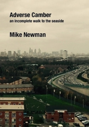
UPDATE: You can now buy Adverse Camber on Amazon UK and Amazon USA.
Over the past couple of months, I've revisited the posts I wrote here about the incomplete A13 walk which I took back in 2015/16. They felt a little self-indulgent, but were in places interesting enough that I thought I'd like to do something a little different with them. Since those walks, I've tended to write in a little more detail about the history of places I visit, and it felt like revising them a little in that light might also help. I'd also recently dug out a copy of Remapping High Wycombe by John Rogers, a project he'd self-published a long while back via Lulu.com. Flicking through that fascinating little book, I thought perhaps that this might be a good home for the A13 posts. And so, Adverse Camber was born...

I've never tried anything like this before: on one hand it feels supremely pompous to present what were essentially lengthy field notes in this way, on another it feels like a fitting home for some of the words which were spinning around me at a challenging and complex time in my life. One thing is certain: these walks set a pattern for me which has endured and sustains me to this day. The opportunity to put some of these thoughts alongside some of the images I captured along the way has helped me to reconnect with why I write, where I could improve and how these walks impact on my thoughts.
I don't think this will become a huge seller, particularly given the sometimes pricy shipping costs - but if you've enjoyed the posts here over the years and want to offer some support, this might be an interesting way to help out a little. You can click the button above to get to the store - and the discount code LULU10 at the checkout might help a little too!
Here on this Middlesex Turf: The Yeading Brook
Posted in London on Saturday 11th August 2018 at 8:08pm
I'm fairly often asked 'Why London?' when I speak about my wandering. Living in the West Country, a comfortable distance from the zone of poor air quality that sheaths the city is, to most, a huge positive and the question appears to assume a deficiency. Why not walk the countryside and the beaches on my doorstep? In truth, the origin of the walks I take can be traced to a very specific event in my life which thanks to the internet I can date fairly exactly - a purchase one gloomy November evening in 2002 of 'The Lost Rivers of London' by Nicholas Barton. I'd felt my interests converging before then of course: a fascination with London in literature had seen me gradually explore eastward from the comfort-zone of arrival at Paddington, and an equally abiding interest in railways had seen me exploring the subterranean byways of the city too. As I began to delve into the curious valley of the Fleet and its history, Barton's book was recommended. It opened a new door: the idea that the history of London was hidden in plain sight, never far from the surface and detectable in the lie of the land and the curves of the streets. Of course, not all rivers are 'lost' in the sense Barton suggests. Some have not been buried, culverted or stopped up, but have simply drifted out of the everyday experience of most Londoners. They slip forgotten between backstreets, appear briefly beyond anonymous railings, then disappear again around an inaccessible corner, or beneath a railway line. When I realised I could find these not-quite-lost rivers with a map, a bit of research and a decent pair of boots it started a habit of walking which persists to this day.
So, it was because of that fateful purchase I found myself heading west today. It felt a little counterintuitive, having spent a rare night on the eastern edge of the City, to be heading this way - but I'd had little time to plan for this weekend and was determined to do something which would take advantage of a more relaxed schedule. After an unexpected dash across the platform at Baker Street, the Metropolitan Line deposited me at North Harrow, a station I'd passed through but never alighted at. I knew very little of this area, indeed I suspected I'd only ever set foot in the Borough once before, even then only just passing over the border to spend a fitful night in a Premier Inn before a rail excursion. On that occasion I hadn't even detected the shift into Harrow - it just felt like the suburban strips I'd seen from passing trains: post office, hairdresser, modern flats filling in the gaps between the classic North London shopping parade and the massive new supermarket. At first sight, the station at North Harrow appeared to represent the boundary between the little town centre, mostly clustered along the nearby crossroads with the A404 and sleepy suburbia. This wasn't the Harrow of the public school and quaint hilltop village which harked back to Betjeman. North Harrow was the sea of rooftops which his 'rocky island' looked out upon. It was still relatively early, and few people stirred as I headed out of the station and doubled back into Northumberland Road. Here and there, people were leashing dogs for their morning walk or loading the car with luggage for a holiday. It was already remarkably warm out here and I felt privileged to be out walking rather than stuck in traffic on a Motorway today. A little way along the street I spied a low metal railing on each side which indicated the spot where the Yeading Brook passed under the road, and where my walk would begin in earnest. This modest but surprisingly long stream falls definitely into the 'mislaid river' category. Flowing almost entirely above ground and through some remarkably accessible open land, the brook is largely ignored. It rises a short way to the northeast of my starting point, near Headstone Manor - and while I could have begun walking somewhat closer to the source, a fairly substantial stretch of this first part of the waterway is inaccessible. A visit to the moated manor house and Museum of Harrow would have to wait this time. Instead, I turned west on a path which snaked alongside the brook, through pleasant if somewhat parched and tired looking greenery. The first part of my walk would be typified by these spaces: valued local segments of parkland which were left over from the suburban sprawl which had created these places. These were the awkward corners, easily flooded valleys and scrappy boundary lands where another house couldn't quite be squeezed in. Some of them had been adopted and transformed into more formal linear parks - and it was one of these which marked my first encounter with the Yeading Brook. Busy and fast-moving despite the dry conditions, it was reasonably clean and free of algae too. I nodded to passing dog-walkers, papers tucked under their arms as they headed home or off to breakfast, and let my legs find their stride. It felt good to be walking.
The brief parkland path soon deposited me near a five-armed roundabout, where I was forced back onto pavements for a while, striding out along the sleepy Church Lane which returned me to the brook at the entrance to the Streamside Open Space. This was a pleasant and quiet, though altogether wilder park which ran for a short distance along the Yeading Brook, again taking advantage of the strips of useless land which fringed the waterway. I was temporarily enclosed by trees and walking a scrappy trackway which reminded me of my recent forest walks. All too soon it was over, and this patch of reclaimed territory in the midst of Metroland gave way to another suburban street and the impassible barrier of the Metropolitan and Piccadilly Line branch to Uxbridge. I suddenly felt very far away from London in a sense which I've generally only experienced in the furthest eastern reaches. The mild thrill of feeling almost-lost in new territory spurred me on, and I headed along the street to find the bridge at Cannon Lane. Here the road occupied the entire width of the original bridge and pedestrians were filtered off onto a footbridge which paralleled the road - a fortified tunnel of spikes and wire cladding which purposefully spanned the tracks. Rejoining the lane, I descended at the first possible opportunity into Roxbourne Park and crossed it to find the brook at its eastern edge. The park is oddly named, given that the Yeading Brook runs alongside its entire length while the Roxbourne, one of the Yeading's tributaries which emanates from the same high ground, runs some way to the south of the park. I crossed the brook, eschewing a more formal tarmac path and disappeared into another run of fairly wild, wooded territory which ran along the eastern bank. It was gloriously tricky going here, the path winding between trees and sometimes appearing to give up entirely before unexpectedly switching direction back towards the water. A rather makeshift looking brick bridge crossed a currently dry stream branching to the south, while I picked my way through earthbound loops of tough branch and piles of windswept fly-tipping. Over the brook, the rather tamer environs of the park tapered into some playing fields, and my path soon opened onto a wide grassy field too, well-kept but largely abandoned. I crossed the brook again and walked its western bank through the remainder of the Roxbourne Park. This section was reclaimed from a landfill site in the 1970s and was just the spot for the Harrow & Wembley Society of Model Engineers to relocate their operations. The society is comparatively venerable and an early comer to the operation of outdoor miniature railways, having begun in 1937. By 1973, having experienced difficulties at their home at the British Railways Sports Association site at Headstone Lane they were looking for a site where a ground level track would let them haul passengers. The Roxbourne Railway is still operating in the park today - a kidney-shaped loop of track embedded in the sun-bleached grass, and a fan of concrete where elevated tracks facilitate the unloading of the tiny works of engineering magic which haul children and surprising numbers of self-conscious adult men. The track was silent today, the station closed for business until Sunday afternoon when trains would again process around the park.
I exited Roxbourne Park by a creaking gate with notices imploring me to close it carefully behind me. The path continued rather provisionally on the western side of Field End Road, disappearing between metal railings into a tangle of bushes. For a while it was just me and the Yeading Brook, the track sticking close to the tree-shaded water as it wound westwards towards Ruislip. I saw few other humans on this section of path, despite it providing a sensibly direct route through the densely packed inter-war estates of Ruislip Manor - something that very few other footpaths or streets managed as they meandered into crescents and dead-ends. All around me were avenues and cul-de-sacs of good, solid semi-detached homes. There were driveways where cars crouched in the heat, their bodywork reflecting intense beams of sunlight through the foliage, and there were endless faded English flags proudly hung for the World Cup and absent-mindedly abandoned when the nation's gaze once again turned inward. My path was a channel of green through all of this, opening out into the wide plain of Mount Pleasant Park. The grass was cropped tightly here, revealing a crumbling concrete road serving the garages behind homes in Torcross Road. I stomped along the rough path, realising I needed to find water pretty soon and deciding on a detour along Victoria Road to a large, modern complex featuring a supermarket, cinema and other amenities.
Little did I realise the notoriety of the apparently sleepy zone into which I was stepping. I was alerted first by a recent crime - the stabbing of Osman Shidane in May 2018, apparently by a 16-year-old boy who was subsequently arrested and charged. While I rested briefly and idly scrolled through the various sad and horrifying reports of this crime - which appeared altogether unexpected in this generally unremarkable part of London - I realised that this was not the first crime to take place on almost the same spot. On 14th September 1954, Jean Townsend was walking home from South Ruislip station having taken the last train home from a social gathering in the West End. She was last seen walking alone on Victoria Road, her body discovered on waste ground near Angus Drive the following morning, Jean having apparently been strangled with her own scarf. Despite the removal of her underwear, there appeared to be no theft, assault or sexual motive for the crime, and the Coroner expressed perplexity about why Jean had been targeted at all. In the following months the Police discovered few leads. Much was made of the presence of US servicemen at nearby South Ruislip Air Station and a report that a voice with an American accent was heard prior to a scream on the night of the murder, but this lead amounted to nothing. Rumours of uncooperative US authorities compounded the circulating view that an airman was responsible but that it was all being hushed up, and further reports surfaced of women being approached by sinister men with Amercian voices or driving unfamiliar 'American type' cars. Parallels were drawn too with killings in West Germany where bodies had been left beside the Autobahn near the bases where US and British troops were stationed. The Metropolitan Police took this seriously enough to make contact with their German counterparts, but the line of enquiry soon petered out. This may have remained an isolated and tragic suburban murder story had further events not occurred nearby: three weeks later Doris Vennell was pursued home from North Harrow station and grabbed by a man with 'a large forehead'. In the struggle, she tore buttons from her attacker's coat - but again, no conclusions could be drawn. Concern grew locally, with voluntary patrols walking women home from Underground stations in the evening, and a general unease growing around the servicemen stationed in the area. As time passed, the case faded sadly into the background of everyday life as these personal tragedies often do. Then, on 30th April 1957 Muriel Maitland, a young mother of two children failed to turn up for work. The alarm was raised and her body was soon discovered in Cranford Woods close to Heathrow Airport, a little further downstream on the course of the Brook. The assault on Muriel was far more savage - she had been raped and punched repeatedly - but no clues to the identity of her attacker were found. Her bicycle and coat were later found near the Grand Union Canal, but her murder remains unsolved. The Police briefly considered a link with the murder of June Townsend, but swiftly discounted this possibility given the different characteristics of the assault. Again, the suburbs returned to their uneasy sleep. Ruislip was by now the butt of jokes about mundanity: Neasden, Surbiton, Ruislip - the playbook of the TV comic. Everyone had heard of them, but no-one aside from their residents knew these places well enough to challenge the assertion that they were dull, unremarkable and bound to an era of the Empire and the King.
Ruislip awoke from its conservative, suburban repose with a violent jolt on 13th June 1971, when the body of 29-year-old Gloria Booth was found naked and mutilated in Stonefield Park, a short distance to the south of Victoria Road. It seems likely that she was snatched from a bus stop and taken to a nearby lock-up by her killer who tortured and mutilated her, though again did not sexually assault her. At her inquest the Coroner noted that the crime had 'unusual features' and 'aspects of a disturbing nature' which would not be revealed until an arrest was made. No-one has ever been arrested and the true horror of the crime remained, perhaps mercifully, sealed in police files. However, this unexplained pattern of attacks - likely unrelated, but curiously site-specific, hugging the course of the Yeading Brook and the River Crane into which it flows - continued to agonise the families affected. In 1982 the Metropolitan Police re-examined the files on Jean Townsend's murder after a number of anonymous telephone calls. The content of the calls was never divulged but it appeared to satisfy officers that no USAF servicemen had been involved, and also convinced them that the crime was not linked to others. Later, a schoolfriend of Jean lodged a Freedom of Information request to open the files, but was denied access. The case was heard at an Information Tribunal in 2007 which upheld the decision not to disclose the papers, sealing them until 2031. During the hearing, a detective informed the panel that while there was no imminent opportunity that the murderer might be identified, such a possibility could not be discounted. Evidence from the crime scene had been re-tested by the Forensic Service in the 1990s in the hope that advancing DNA technology might provide further clues, but this had not produced any leads. In a somewhat stranger twist, the tribunal allowed a theory to be advanced which had developed via a segment on John Peel's otherwise rather gentle Saturday morning 'Home Truths' show on Radio 4: that an Italian-English noble named Count Francesco 'Frank' Carlodalatri had taken to the habit of travelling the Central Line late at night, staring intently at people, and had indicated that he would pay a sum of money to someone 'to kill a woman'. An interview with Frank's landlady who had been warned against him but still drove him to Dover en route to Italy, never to return, suggested he may have been the attacker. In the ensuing years, the embers of these murders have occasionally been stoked by journalists who, desperate for copy, walk again what they have dubbed 'Ruislip's Murder Mile'. This invariably attributes the murders to established Serial Killers who can be linked to the area, however tenuously. Independent researchers believe they can locate Scottish murder Peter Manuel in South Ruislip in 1954, but the dates are vague and his presence largely unproven. Gloria Booth's relatives have also pressed for new consideration of her case, believing that the killing can be linked to Peter Sutcliffe who regularly visited his future wife Sonia in Alperton during her teacher training. Again, newspapers have been quick to capitalise on their search for answers but invariably turn the article over to a lurid re-cataloguing of the Yorkshire Ripper's depraved exploits.
As I retraced my steps towards Victoria Road, my bag full of water supplies for the walk ahead, I saw the area a little differently. Ruislip was as quiet as ever, its suburban character inviolate - but like all suburbs, there was the hint of Ballardian frisson here. The twitching closed of net curtains could hide a great deal, and the streets which hedged around the narrow valley of the Yeading Brook hid dark secrets. Ruislip is no different to many suburbs of London which, in the century or so in which the city has sprawled out of control, have inherited the tribulations which smaller cities confine to their central zones. But a crime out here creates deeper, if highly localised, ripples in the pond. Areas are left unwalked through fear or superstition, and stay that way as urgent news becomes a sad history and then much-distorted legend. Modern media treats all outrage equally, and they'll interview the nearest person prepared to say "You just don't expect it here, do you?" - when perhaps here is exactly where we should expect it? On almost the same spot as Jean Townsend was found 34 years earlier, a young man was brutally killed in 2018. Ruislip felt forlorn and far less inert than it had seemed when I emerged from Roxbourne Park just a short while earlier.
I crossed a windswept and deserted playing field to emerge near Ruislip Gardens station, crossing the busy street at a point directly above the Yeading Brook which emerged from under the railway and disappeared into a wooded gully beside the high-security fences and CCTV cameras which surrounded RAF Northolt. This base has a long and distinguished history, having opened on 3rd May 1915 as RFC Military School Ruislip, initially flying sorties to protect London from Zeppelin raids. By the end of the First World War, daring early missions over France were being flown from the base. During World War II, Northolt hosted Squadrons of Hawker Hurricanes crewed by both RAF and Polish Air Force pilots, with distinguished records established by both forces. During the Battle of Britain, thirty Northolt based pilots were killed - ten of whom were Polish and thus their national War Memorial stands nearby. The base became a target for the Luftwaffe and a plan to camouflage it took advantage of its suburban location. A stream was painted onto the runway, and the hangars and administrative blocks were decorated to appear like the suburban housing which surrounded the site. So convincing was the disguise that pilots directed to land at Northolt for the first time would struggle to find the runway. In peacetime, following the development of Heathrow Airport nearby, the opposite problem became a bigger issue as pilots mistook Northolt's runway for that of the major civilian airport on a number of occasions. Indeed, as the military role of the RAF base has declined there have been suggestions that it could operate as a satellite of the Airport, but these have come to nothing. Partly perhaps, because despite benefitting from the anonymity and uniformity of the suburbs, the Base has not always been a good neighbour. The first incident occurred in December 1946 when Douglas Dakota, G-AGZA operated by Railway Air Services took off following heavy snow and failed to gain height. The aircraft came down squarely on the roof of 46 Angus Drive, with the unharmed aircrew climbing through the loft and leaving via the front door. The house was uninhabited at the time, a couple waiting to be married before moving in soon after. In 1960 the engines of an Avro Anson failed on take-off, the plane limping over the railway line and descending onto the Express Dairies depot, now the site of the supermarket I'd visited earlier. Various safety improvements were made over the years as the drawbacks of the suburban site became clear - not least over-run pits following a 1996 incident where a Spanish Learjet crashed into a van travelling along the A40 Western Avenue while flying an actress to work at Pinewood Studios. Lisa Hogan, the passenger on the flight, who told investigators that the Spanish pilots couldn't understand English Air Traffic Controllers and bickered physically prior to the incident, considers herself to have had a lucky escape. She is however, now the long-term girlfriend of Jeremy Clarkson.
The base is quiet now, home to a range of support and storage functions, but an active runway is still maintained. In recent years this has been a place of reluctant return: the remains of the Princess of Wales were repatriated from Paris in 1997 via Northolt, the Queen's Colour Squadron ceremonially meeting the flight. Short years later, the fugitive Great Train Robber Ronnie Biggs, by then gravely ill, returned to Northolt to an equally formal welcome, being immediately arrested and returned to jail in Belmarsh Prison. He had been a tabloid presence throughout my 1970s childhood: a mahogany tan and coils of gold chain grinning amiably but smugly from the front pages as he basked in his Mediterranean exile and notoriety. But on an overcast May morning, 35 years after he escaped from Wandsworth Prison he was helped, frail and ashen-faced from the aircraft into a waiting Police vehicle. A magistrate heard his case swiftly and committed him to Prison again - essentially requiring him to complete the thirty-year sentence of which he had served just fifteen months. As I edged around the perimeter of the airfield, these notorious inbound flights seemed distant from its current purpose. Vast prefabricated sheds stored archived documents or housed the administrative staff who kept the RAF running behind the scenes. During the London Olympics, Eurofighter Typhoons had been based here, the first fighter aircraft at Northolt since the Second World War, poised to take to the air should the Games be threatened by terrorism. Even now, with the Olympics a distant memory, security was tight: an RAF Police truck appeared to track me around the edge of the site - but I was confidently on publicly accessible ground here, the path well-used by joggers and dog walkers too - at least until I reached the edge of the Ruislip Gardens estate where the path passed between metal barriers and into the unknown.
This large area of empty scrubland on the map had troubled me. It was unclear if there were paths across it, and the presence of the RAF base felt much more sinister when beyond its perimeter fence was, well - nothing much at all! This was one of those strange spots where London gives up. The last house turned inward towards the city for safety, and the cul-de-sac ended near a scrubby path into the grass. After a morning spent passing along a narrow green channel through seemingly endless suburbia, it felt both exciting and worrying to be heading into wilder terrain. The jogger who had passed me a few minutes earlier returned, his circuit complete. I was perturbed by this: if he'd circled back on his daily run, perhaps there was no way out of here after all. Was I walking into a cul-de-sac of my own? Undeterred, I snapped a picture of the back gate of RAF Northolt, obstructing a rural lane that didn't even trouble the official map and defended by cameras and dire warnings against trespass. I pressed onward into the marshy scrub on the western edge of London. The tree-lined brook skirted the security fence. There was little evidence the path was used well at all, and it often became almost impassably overgrown. I waded through shoulder-deep brambles and nettles at some points, realising I had little option but to press on, arms above my head. I felt utterly remote from the city at this point, a feeling compounded once I passed a low wooden gate into Ickenham Marsh. This clearing of wetland grasses, tumps of stubborn brush and venerable trees is ancient common land, and cattle still graze there today in a nature reserve. Given my abiding discomfort around cows, this was a problem as two huge examples of the species lurked lazily near the fence beside the path I aimed to head for. I tried to outsmart them by heading across the marsh, stumbling and tripping over the clumps of tough, reedy grass and making myself far more conspicuous than if I'd simply walked across their lazy, apparently unconcerned eye-line. It didn't work - the route took me to the edge of the fence but I'd need to walk even closer to what I now suspected were in fact bulls to get out. I retraced my steps and decided to brave the direct route. Sweating with horror and with a white-knuckle grip on the straps of my rucksack, I strode purposefully forward. The cattle, inert in the midday heat and barely inclined to move an inch, completely ignored me. I ran the final few steps through the gate, emerging triumphantly on the Hillingdon Trail, a route which would shadow the brook for much of the remainder of my walk. I felt like I'd completed some sort of trial and began walking again with renewed zeal.
The Hillingdon Trail boats a 20-mile route through some fine woodland and countryside, but my first experience of it was a rather gloomy underpass which took me beneath the A40. The path and the brook met in a concrete culvert which dipped under the bank on which traffic flashed by. The walls of the passage had been decorated in a yellow and green tiled motif sometime presumably in the late 1970s. It felt tired and abandoned down here - if it wasn't busy with walkers in high summer, when did people ever use this trail? The path turned and twisted to pass under another road - the A437 - which leaves the A40 here at a very strangely arranged junction serving Hillingdon. After surfacing, a brief walk alongside this road deposited me in a suburban park where dogs were being exercised. I paused to eat oranges and reapply sunblock before surveying the route onwards. I had foolishly assumed I'd be able to walk the Yeading Brook and then much of the River Crane today, but I hadn't reckoned on the day being quite so hot or some of the walk feeling quite so challenging. A little rested I set off again, following the signs for the trail around the back of an abandoned changing block beside the football pitches and into a narrow, litter-strewn gully at the rear of a crescent of homes. The path emerged into a broad green field which led to the entrance of Gutteridge Wood, and I was soon back on the bank of the Brook, a much broader and more impressive waterway now than the one I'd first spied in North Harrow. The woodland here was surprisingly tidy and free of litter, its decent paths accessible and well-walked. I occasionally found myself catching up with an older gent, striding along with walking poles and steadfastly ignoring my polite 'good morning' as he relentelessly pressed on, determined to tick off another designated footpath no doubt. I took a more leisurely amble through the woods, realising I was now due south of the Airfield having walked a huge loop out to the west. My path was sandwiched between the Brook and a man-made Feeder channel which carried water from the River Pinn towards the Grand Union Canal via a convoluted zig-zag of ninety-degree turns. The path twisted south, then east towards Ten Acre Wood running along the edge of a farm with tall, swaying wheat stalks basking in the sunshine. I spotted the elderly but intrepid walker heading through a gap in the hedge and striking out along the edge of the field rather than tackling the sometimes bramble-choked official path. I stuck to my route, enjoying the challenge and battering my way gleefully through the obstacles. The hum and shudder of the A40 was close by, the rumble of aircraft approaching Heathrow overhead - I was in my favourite terrain, where urban and rural meet in an uneasy boundary-strip. At the corner where a series of stiles took the path southwards, I gained a companion - an eager but overheated German Shepherd which seemed happy to join me, tongue lolling in the heat. I was sure I'd shake him off at the stiles, but he ingeniously found a way of squeezing over, under or through each of them. I paused - unsure how to proceed: I wasn't particularly confident with dogs, and couldn't figure how I'd prevent him following me wherever I headed. Eventually I heard the exasperated cries of his owner approaching. He looked at me expectantly, to see if we were going to continue our adventure. I waited. Finally he decided that I wasn't going anywhere interesting and bounded off to find his owner. I turned south, back into the woods - noting as I left the edge of the farm that the pole-toting walker was scratching his head in the corner of a nearby field which had no obvious exit onto the footpath. I was keen to get back to the Brook which the path had parted from a little further north where the Roxbourne finally joined it at an inaccessible confluence. The path emerged on Charville Lane, a road to nowhere - besides a car breakers' yard and a clay shooting club - which was littered with the evidence of late-night use. A couple of cars passed at speed, clearly not expecting to meet pedestrians and kicking up clouds of dust. Immediately opposite the path I emerged from was Golden Bridge, an impressive arc of textured concrete opened in 1986. There has however been a crossing of the Yeading Brook here since around 1500. The modern bridge was opened by Lord Bernard Miles, only the second British actor to be elevated to the Peerage and a man of Middlesex who had taken part in an early 'right to roam' demonstration near the site in 1929. Such protests soon multiplied, and a later 'mass trespass' at Kinder Scout which saw several arrests for 'Riotous Assembly' led in part to the creation of National Parks in 1949, and finally to the Countryside and Rights of Way Act 2000 which finally gave clarity on public access to open land. I passed over the bridge before realising that I was heading in entirely the wrong direction - perhaps no bad thing as the path ahead was in poor repair and seemed impassible. Instead, I doubled back along Charville Lane, finding a poorly marked turning to the south where the Hillingdon Trail, now accompanied by a local route called The Dog Rose Ramble plunged back into the trees.
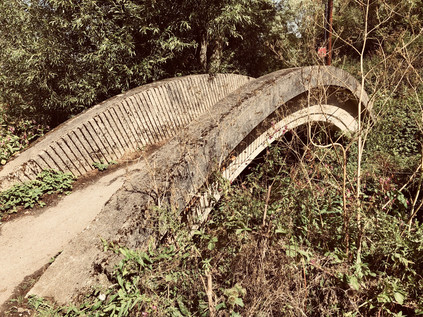
I stumbled out onto the pavement near AFC Hayes football ground, the path a mess of fly-tipped junk and rutted dry earth. The Brook passed under the road via a bridge with a satisfyingly solid, municipal concrete parapet of dubious ownership: one side of the Brook claimed to be Hillingdon, while the other welcomed me to Ealing. As ever, these often ignored waterways are boundary zones - and while they exercise apparently little effect on the locals, they might well be deciding how much Council Tax is levied, or on what day the recycling truck arrives. I took the Ealing bank now, a broadening and well mown strip of grassland which shimmered in the heat. I had sore feet and I was tiring, but I couldn't quite figure how to process this walk yet - so I continued through the grass which was, at least, easier on my feet than the rutted woodland floor or the hard pavement had felt. This part of the walk was comfortably uneventful - planes climbed or descended into my eyeline, while blackberry pickers stalked the hedges beside the brook and dogs scampered across the grass. Ealing was hot and sleepy, the locals who were foolish enough to brave the sun seemed to be moving slowly, cowed by the intense heat. I schlepped onwards, deftly avoiding a careering young trainee cyclist who was being coached by her big sister and proud father, and skirting a communion of dog owners who held court in Belmore Playing Fields while their charges play-fought and panted around them. Eventually, the path reached Yeading Lane where cars were lining up to disgorge the beautifully-dressed participants and guests for an Indian wedding at the nearby banqueting facility. An impatient driver grew tired of waiting for the merry parade to cross the street, spun his wheels and tried to overtake the queue of cars while yelling a racist epithet - only to find a further huge crowd of friends and relatives crossing the street and blocking his way. He was forced to bask in the glow of his own impatience for a while as they politely shuffled by, ignoring his rudeness. The path continued into less well-kept parkland which still hugged both the Brook and the borough boundary, before passing under the Hayes Bypass. This surprisingly major road was finally built in 1991, providing a long-mooted link between the M4 and the A40 and decanting traffic away from the Motorway at the point where it loses two lanes and becomes a sluggish, urban expressway delivering traffic from Heathrow into the centre of London. Thus, the A312 has become a congested thoroughfare in its own right. The Yeading Brook effectively divides around it, one arm swinging south in culvert and channels beside the embankment of the modern road, while an older alignment continues under the road, heading east towards the Grand Union Canal. I misread the map here and pressed on beyond the bypass, following the Hillingdon Trail waymarks and into a confusing tangle of paths around the scrappy wedge of parkland beyond the road. Eventually, I found a way out, climbing the steps of a filthy, waste-clogged footbridge over the canal and descending onto the towpath. The Brook was now some way to the west of my path and hemmed in between the backs of houses. Since the canal used its valley here, it felt sensible to proceed along the towpath for now. It would have been a quiet walk too, had it not been for a couple on bicycles who had attached speakers to their machinery and passed me blasting out 1970s disco classics. Uncertain of their route, they stopped frequently meaning I would pass them while they argued over whether they should have left the path, before they would cycle on, catching me up and impatiently trying to pass me to the strains of 'Stayin' Alive' peppered with furiously rung bells. Finally the argument was won by one of the pair and they left the path. I walked on in silence, passing under Southall Road near the mock-lighthouse at the entrance to Shurgard's storage facility.
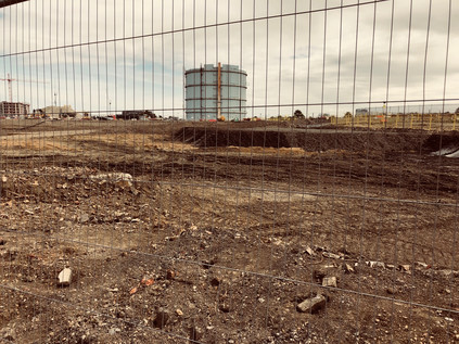
The Yeading Brook closes in on the canal here as they both turn to the southwest to pass under the Great Western Railway. This wasn't a picturesque stretch of waterway in any sense. To the east, a large triangle of land was being remediated prior to re-development, and the dry dusty contaminated earth was blustering around the site as tarpaulins flapped listless free of their moorings. The makeshift metal fence narrowed the towpath making an already rough and fairly treacherous path even trickier to navigate. As the railway approached, signalled by the regular thud and clatter of trains in the near distance, I experienced the sudden shock of recognition: I had passed this way on the train countless times and the expanse of empty land I could see was, until recently a vast carpark offering cheap stays for Heathrow passengers. At the eastern end of the site the familiar shape of the tall, pale blue Gasholder No.5 still stood. It had, for years, been a signal that London was near. I'd used it as mental punctuation - time to close the book, take out the headphones and pack my bag. Now the cars were gone, and the area was finally being redeveloped after a six-year-long wrangle with the planning process. 3750 new homes would occupy the triangle of land hemmed in by railway and canal - formerly Southall Gasworks. The remediation would be a challenge: the Brentford Gas Company had expanded west to this site in 1869 having outgrown their original plant. In the following century they had installed plants to manufacture creosote, road tar and ammonium sulphate, slowly taking over former chemical plants and brickworks nearby. As North Sea Gas became available, the plant entered a decline, broken by a brief stint as a set for a Space Refuelling station in "The Ambassadors of Death" a Pertwee-era Dr Who episode filmed in 1970. In 1973 gas production ceased, while gas storage continued in three of the five huge gasholders. Now just one remained - the iconic blue monster beside the railway - while all around it the earth was relieved of a century of pollution. The air reeked of chemical filth and I gladly pressed on under the railway towards Bull's Bridge. At the narrow, hump-backed bridge ahead, the towpath of the mainline of the Grand Union Canal crossed the junction between the Paddington Arm and the route to Birmingham. I'd read often about this spot, but it always seemed impossibly far west and out of my usual zones. The canal narrowed to the width of a boat to pass under the whitewashed bridge which arched steeply over it. A couple of cyclists paused at the peak to survey the route ahead. Beneath a sign pointed north to Paddington, east to Brentford and west to Braunston. I felt impossibly far from everywhere I knew, despite being in eerily familiar surroundings from frequent trips by rail through the area. A little way along the canal, the bulk of the abandoned Nestlé plant appeared to tremble in the heat haze. The earth sweated, a dull and sickly aroma of burnt rubber still drifting on the wind. A ghost of the unwelcome aroma of Nescafé lingering in the air. The thrill of being lost spurred me onwards, and I turned west again, passing under the A312 on its long viaduct over canal and railway to find the zig-zagging staircase which led up to the road. Deep beneath the steps, passing under the canal in a channel of greenery and undergrowth, the River Crane flowed - a little to the north, near the railway the Yeading Brook had finally yielded to this river - much shorter than the brook which fed it, but claiming the credit for the waters which finally reach the Thames. I was passing into a new territory and it felt like time to find an ending for this walk.
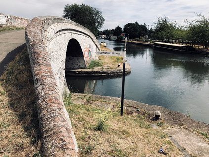
The Parkway, as the A312 is known for much of its length, was a dusty and grimy road even by London's standards and felt unpleasant to walk beside. Elevated to pass over the obstacles beneath, it was exposed and surprisingly windy atop the viaduct, with whirls of dust and litter spinning across the carriageway between cars. Behind me, as I headed south were the huge advertising hoardings visible from passing trains, ahead was a large roundabout where I intended to take any path which led away from the road in roughly the correct direction. The area was blighted by Heathrow, the ever-expanding airport causing a glacially-paced shockwave which had pushed civilisation further and further from its perimeter, a vanguard of storage depots, car parks, hotels and freight forwarding facilities leading the airport's inexorable advance. I had a choice of routes here - to follow the road towards the junction with the M4, or to cross the Crane and head along Watersplash Lane and into a pocket of woodland which ran alongside the river. I opted for the latter, and after negotiating the carpark of a closed and boarded-up Public House called The Crane, found myself walking the perimeter of what appeared to be an illegal traveller encampment. I skirted the site on a scrappy wooded pathway, picking my way over dumped furniture and decaying mattresses. At one point I stumbled upon the edge of a clearing where a couple of men from the camp sat drinking cheap lager in a pick-up truck. They called over to me as I crashed out of the woods, and fearing trouble I drew myself up to my full height and stood still on the edge of the path. Confronted with a bulky, overheated and somewhat wild-haired character rather than the local dog-walker they'd expected to annoy, they returned to their cans and ignored me. I tramped back into the woods walking a little faster, however, keen to get away from this weirdly gloomy and forsaken spot. This was variously known as Dog Kennel Covert or Moat House Covert, and had been the location of an ancient moated manor house known as Cranford Le Motte. The coming of the motorway in 1964 destroyed a dovecote, orchards and ornamental lake, though the remains of the moat are buried in the deep bushes here. Soon the ragged path through the rather forlorn woods became a little more formal if no less filthy in order to pass beneath the motorway and the slip-roads for Junction 3. Traffic was sluggishly stop-starting above me as I descended into the underpass.
I emerged from the gloom to find a pleasant driveway leading to a brick arch in what appeared to be a sort of gatehouse. I passed through to find this was one wing of a larger, rather fine brick building - in fact the stable block, and most complete remains of Cranford House. Here, tucked into an obscure corner of Old Middlesex had stood a fine three-storey brick house and a large estate, latterly in the hands of the Berkeley family having been purchased by Elizabeth Carey, Lady Berkeley from the heirs of Sir Richard Aston in 1618. The estate has a distinguished history far beyond that however, having been seized from the Knights Templar by King Edward II in 1308. Used largely as an occasional holiday home by the Berkeley's over their 300 years of ownership, by 1945 the house was in a poor state and was demolished. It's hard to imagine such a significant building being lost in modern times, but post-war progress was sometimes relentless and the coming of the motorway and the airport heralded - but had yet to deliver - a brave new future for the little village of Cranford which had declined in importance since the railway had taken away the coach traffic on the Bath Road. The park surrounding the estate is surprisingly large and rather quiet, the little church of St. Dunstan having sat amidst the fields since at least the 15th century - though records indicate ecclesiastical activity as far back as 1086. The River Crane flows along the eastern edge of the park, emerging from a culvert under the M4 and progressing along the route of The Parkway towards Cranford, where a the river has been bridged by the Bath Road since at least 1274. I lingered near the church for a while, rather amazed that I hadn't expected to find myself in this spot from the cursory research I'd done. There simply isn't much easily accessible record of this once important estate, swallowed by the effects of the 20th century and the ever-expanding infrastructure of the city. I crossed the bridge carrying the road to the church, wondering if the rumours of a long-sealed tunnel leading out of the gardens towards the road were indeed true? Cranford Park retains a strange melancholy and a sense of the ancient which rested uncomfortably with me. I felt I owed it a better appraisal and a great understanding - few people other than knowing locals seemed to make it out here, save for a few National Trust fleece-wearing older folk who I met as I exited the park and found myself once again by the A312.
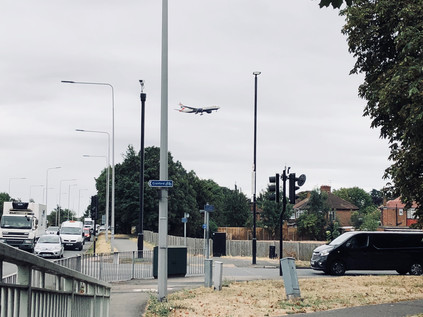
I could have continued my walk beside the River Crane towards Cranford, but I was troubled by my encounter with the park. Emerging from under the motorway, that resolutely modern horror, into a world of Elizabethan hunting parks, moated manors and tiny rural churches was an odd and jarring shift. I had transitioned from Brook to River too, and this felt like a sensible place to stop walking for now. The Crane - originally, and rather naïvely my target for today - could wait. It needed to be tackled on its own terms, a divided course through the southern reaches of Middlesex charted to the Thames. But Cranford wasn't entirely easy to escape: I headed out of the park and found the southern continuation of The Parkway. Aircraft hung heavily above me, wheels down and about to land. They felt impossibly close to the tops of the white vans and articulated trailers which queued for access to the motorway. Eventually, I turned aside, along a road named High Street which appeared to be little more than a suburban lane. At the next bus stop, I paused, a service from Heathrow to Southall was due. I forced my way on to the packed bus, uniformed flight attendants, cleaners and security guards filled every spare inch of space. The bus made slow progress towards the station and my train back east to our digs for the weekend. I felt like the Yeading Brook had got the better of me - its long, sometimes confusing course had taken me on a wide, western loop into genuinely unknown terrain, before depositing me in the no-mans land of Heathrow's footprint. Blighted by noise and vibration, the tiny village of Cranford had once given its name to the agreement reached with the Civil Aviation Authority about aircraft noise. Now it was disregarded, slowly going the way of the tiny villages which had been more dramatically erased by the expanding airport: Perry Oaks, Sipson, Heath Row. If a third runway was permitted other's would fall under it too, not least bucolic little Harmondsworth. But Cranford's demise was slower and in some ways more painful to watch as it struggled on the edge of the secure zone, ringed by hangars and storage sheds and punctuated by hotels to which passengers were freighted in by shuttle buses, rarely touching the ground outside the Reception. The bus nosed across the traffic on The Parkway and into the orbit of Southall, and I reflected on how this corner of Middlesex which had seemed so unpromising and inert at first had resonated with strange stories and hidden history. I both anticipated and dreaded my return here in equal measure, knowing I'd be snared by another new district.
You can find a gallery of images from the walk here.
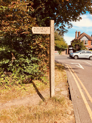
Timber and Fire: Epping Forest from Gate to Gate
Posted in London on Saturday 4th August 2018 at 10:08pm
The last few moments of my long tube journey to the furthest reaches of the Central Line were occupied by slathering sunblock onto my exposed temples, musing that when I was last here there was probably more natural coverage. The last time I'd arrived at Epping was in a post-viral haze, stumbling about the station and feeling sorry for myself, doubting the wisdom of travelling after a week of confinement with a case of H1N1. I recalled sitting on a bench on the silent platform, lacking the energy to head into town and wondering at how unusually rural and quiet it felt, and pondering the range anxiety I'd experienced as the train sped past large tracts of green, rural, definitely not metropolitan-looking scenery. Given that I was the only passenger in the carriage I expected much the same from my arrival today - albeit in far better fettle this time. I couldn't have been more wrong - once I passed through the ticket barrier I was caught up in a tide of people. The bright summer day had bought competing crowds to the station: some waited impatiently for the bus into town to manouvre around the busy car park while others jostled to get onto the train into London. The next wave of passengers trotted down the hill or scrambled out of taxis and parents' cars to make the long ride back into the city. It was a Saturday morning full of promise and possibility: over made-up teenagers gossipped in an awkward spot on the pavement, their cheeks burnished to an alien chrome. A taxi set off before its occupant had retrieved their bag, the casually suited former occupant rapping on the roof and swearing generously at the top of his voice to stop the driver in his tracks. The bus lumbered around in an attempt to reverse, lurching to a stop behind the taxi. All was good-naturedly, loudly chaotic in Essex today. I made swift work of the hill out of the station and found the road to town a little less hectic. It was good to be back, despite the fury of the welcome!
My memories of Epping beyond the platform were vague at best, but I soon found the supermarket and filled my bag with water and drinks. The temperature was already touching thirty degrees and was forecast to get warmer. There was coffee to be had here too, but my instinct was to head straight out of town. Epping is a long, drawn-out kind of place sprawling along a ridge of high ground which threads lazily into Essex, dividing the valleys of Cobbins Brook and the River Roding. My route - the aptly-named High Road - headed south, passing the Victorian mock-gothic water tower, now marooned in the middle of a used car lot. As the busy shops of the High Street begin to peter out, the houses became larger and were set a little further back from the busy road. Stocky Georgian brick piles sat beyond tall hedges which shade convertible BMWs. This was all undeniably a little less gauche than the Essex of popular perception. It was more conservative, very new-monied, a little brash. A broad stripe of grass, once green and now burned amber by the weeks of sunshine, broke away from the road and I gladly plunged between the trees noting an impressive and moss-covered concrete fingerpost indicating the public footpath across Bell Common. The sun beat relentlessly down on the sleepy village-end while a taxi waited outside one of the cottages beside the path, a heat haze shimmering over its roof. The string of houses ended abruptly where the road forked - the branch I now needed to cross headed south to Theydon Bois, while the main road to London turned further west. A high concrete wall and a shuddering equipment room were screened by a scrubby line of bushes. From beneath this parapet, traffic pulses along the M25 and began to slow for the whirl of sliproads onto the M11. Under my feet here is Bell Common Tunnel, an unusually environmentally aware attempt to hide the churn of the Orbital road from view at a pinch point where the important forest habitat and the peaceful community squeeze the road into a tight bend. Built between 1982 and 1984, and some considerable time before the high-profile road protests of the 1990s, the cut and cover tunnel is an unexpectedly sensitive response to the problem of completing the ring of tarmac around London. I've written elsewhere about the various Ringway plans which spun out over the post-war decades following Patrick Abercrombie's vision of a city encircled by roads which took the strain away from the mediaeval street pattern. Little of this materialised as the inner segments of the plan, which would have destroyed many homes and businesses, became entangled in long planning disputes. However, out here on the margins there was less heat in the argument. Perhaps, even by the early 1980s we had not quite grasped the impact of the loss of green and pleasant land in the same way we do now? The final shape of the M25 is a compromise: a lopsided and off-centre mash-up of Ringways 3 and 4. The motorway which was finally built and which squeezes through this future bottle-neck under Bell Common is never quite wide enough, never quite fast enough - and as a result, it creeps quietly out of its original footprint. Elsewhere lanes are added to patch up the broken circle with depressing regularity. But here, the landscape corrals the traffic and Bell Common with its cricket pitch and a dusty forest-edge car park is troubled only by the hiss and shudder behind the high brown wall.
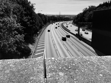
As I turned aside from the motorway, unable to get a panoramic view due to the height of the barricade erected to protect Epping from the noise of traffic, I found myself facing the forest for the first time. The small car park was busy with dog walkers loading and unloading their charges. A couple of early cyclists paused to check maps and adjust equipment. I made my own preparations, realising that I'll be leaving civilisation behind for a little while, and strode out between the trees onto a well-made path with a dry and cracked surface. The recent heat had penetrated even the deepest corners of the forest it seemed: the perma-mulch of the floor is littered with brown, sun-crisped fronds of foliage. The earth was splitting and opening, deep crevasses revealing loam which hasn't been exposed for what might be centuries. It felt like the forest was protesting against the indignity of the heatwave, and blaming us for our negligence in letting the climate interfere with its finely balanced ecosystem. But the woodland is resilient too, and only a few yards into the woods I'm covered by a cool canopy of leaves which keeps out even the most penetrating rays of sunlight. Occasional clearings fill the forest with light, like a zirconium flashbulb detonating overhead, and I took to wearing sunglasses to reduce the weirdly hypnotic effect as the sunlight strobes between limbs of the trees. It was good to be back, and once I'd passed sufficiently far into the woodland for the casual visitors' range anxiety to have them backtracking to the carpark, I was entirely alone in the ancient forest. The crunch of dry, friable earth underfoot echoed, occasionally startling creatures which skittered and crashed into the undergrowth. Aside from a few gentle dips and ascents into the valleys of currently dry streambeds, the walking was pleasantly gentle. Striking out to the south-west, I felt entirely enclosed by the woodlands, despite in fact walking a fairly narrow strip of the forest at this northern tip. Epping Forest once covered much of Essex and during the reign of King John still covered much of the ground between London and the coast. Curiously, it was John's signature of the Forest Charter, a lesser known counterpart of the more influential Magna Carta, which led to the preservation of the forest for future generations. This charter addressed deepening disquiet and economic strife arising from the designation of 'Royal Forests' - a status originally given to Epping Forest by Henry II. The Norman ideal of a forest was an enclosed area of woodland, grassland and marsh reserved for the monarch's use and inaccessible to commoners. For many, not least those living in Western Essex, the forest meant survival: in the form of fuel, grazing the land and foraged food. Increasing designation of Royal Forests, especially by King Richard, had resulted in around a third of Southern England being restricted, with rural populations struggling as a result. The Carta Foresta of 1217 restored the right of free men to gather wood and forage in the woodland, while allowing only the King and his appointees to hunt. Despite being somewhat less celebrated than the Magna Carta, the Carta Foresta enjoyed a greater longevity, with large parts remaining in force until the Wild Creatures and Forest Laws Act 1971 repealed and replaced its provisions. I was reminded that the forest is a strange place, and things seem to move far more slowly under the trees - including it seems the machinery of government.
I realised as I tramped along the path, that I knew very little of the interior geography of the forest. This was brought rather surprisingly home to me as I spied through the trees a smooth bank of earth, curving out of sight to the west. I had stumbled across Ambresbury Banks - now a haven for tall, slender beech trees but once a securely fenced Iron Age stronghold surrounded by forest. Much archaeological investigation has taken place here since the site was first systematically excavated by Augustus Pitt Rivers in 1881, but nothing has been discovered to corroborate perhaps the most enticing myth about the place: that Boudicca fought her last here in 61CE, before finally being slain by the Romans. Several other places, from Kings Cross station to Mancetter in Warwickshire claim the same honour - but there is a stately calm about Ambresbury Banks which makes it feel a fitting monument to a warrior queen. I stepped away from the path and scaled the bank, descending into the broad bowl. The floor of the forest was a tangle of sun-scorched bracken and surprisingly tenacious holly, and it was hard to imagine this place a hive of activity. It's likely that Ambresbury was a defensive position rather than a fortress - a secure place to gather the people and to remain safe from attack. The camp lies along a line of forts which roughly delineated the boundaries of the Trinovantes and Catuvellauni peoples who skirmished and bickered over territory in Essex until the Roman invasion. Even now it feels remote from the surrounding paths and roads, and as I crashed back out onto the trail, I startled a young couple and their dog who were distinctly displeased to see me. The forest retains its sense of risk and danger - but I suspect that a middle-aged man emerging from the bushes is regarded more likely as a moral than physical threat nowadays. Back on the path, I noted a few other walkers and occasional mountain-bikers, including a group of Spanish students who walked six-abreast and yelled up into the trees as they wandered. I wasn't sorry to get past them, leaving them checking their 'phones and gabbling with excited relief as they congregated in a small car park beside the B172 which meandered through the forest nearby. While they were clearly pleased to be back in some sort of civilisation, to me the road felt like a strange imposition - and a sudden need to be aware of my surroundings in a more acute way than I had been for the last hour or so of walking in the woods felt alien and uncomfortable. I wasn't sorry to disappear into the woods again on the other side of the busy route, wondering why my walks on the fringes of London were so often dogged by small bands of loud European tourists?
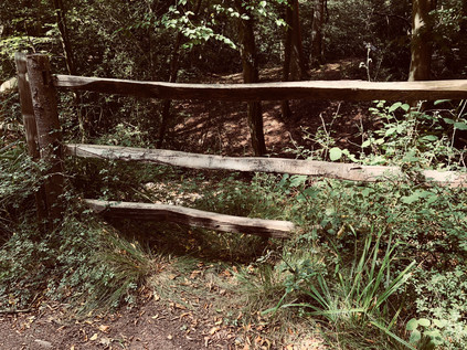
Walking again, I tried to identify my location more accurately but largely failed. There are few very good maps of Epping Forest and certainly, none which exceed the detail and care of that produced by Edward North Buxton for his 1884 guide. Buxton was a partner in the family brewing firm of Truman, Hanbury & Buxton of Brick Lane, and was also MP for Walthamstow. A lifelong conservationist, Buxton purchased Hatfield Forest and gifted it to the National Trust from his deathbed, thus saving it from a timber merchant who had already begun to fell ancient trees until scuppered by Buxton's purchase. His book on Epping Forest remains perhaps the most useful guide to the hidden corners of the woodland and is a testament to how largely unspoiled the forest has remained since it was protected by Act of Parliament in 1878. It could so easily have been different here. In 1851 much of nearby Hainault Forest was destroyed having been 'disafforested' by the Crown and offered for sale. Steam tractors dragged anchors through the soil, uprooting ancient trees and clearing around 3000 acres within six weeks. While Epping Forest had largely been unenclosed by that point in part due use as a deer park, it was clear that the Commissioners of Woods and Forests were keen to turn their attention to the plains and woodland which stretched tantalisingly close to the growing suburbs of East London. However, it was this very proximity which had apparently increased the use of the forest by commoners, with William Cowper-Temple MP noting during debate in the commons in 1871 that "It was most gratifying to witness multitudes of the working classes, who had escaped for a day from the smoky atmosphere and the dreary expanse of bricks and dust and dirt called the eastend of London with parties of children, imbibing health and enjoying themselves intensely in innocent and health-giving pastimes." Visitor numbers grew during the 1860s and consequently, the Lords of the various Manors which included forest land began to enclose the woodland, protecting their asset and preparing for a profitable sell-off. This enclosure was not without resistance, with Thomas Willingale of Loughton persisting in the practice of the common right to 'lop' trees. Willingale was prosecuted at Waltham Abbey, and members of his family imprisoned as a result - a cruel punishment which sounds oddly antediluvian to modern ears. It was his action though, which brought the situation to the attention of Edward North Buxton, his brother Sir Thomas, and to John T Bedford of the Corporation of London. Thus, the political movement to conserve the forest began with the Corporation buying parcels of land throughout the 1870s prior to becoming custodians of the forest on the passage of the act. So, Epping too was disafforested - but with the Corporation as both landlord and conservator, its future was largely assured:
Epping Forest is hereby disafforested; and Her Majesty's rights of vert and venison within the same, and the several forest courts, and all letters patent, grants, appointments, and warrants of any offices, bailiwicks, walks, and lodges, and all salaries, allowances, gratuities, and fees payable or allowed in respect of the same, and all burdens and restrictions arising out of the forest laws or customs, shall, as regards Epping Forest, on and by virtue of the disafforestation thereof by this Act, cease; and the deer therein are hereby transferred to and shall belong to the Conservators, to be preserved as objects of ornament in the Forest.Epping Forest Act 1878
The path continued south, skirting the broad, open scrublands of Furze Ground and Copley Plain. These spaces, often appearing suddenly between the trees, are a striking feature of the forest and a reminder that this is wild and ancient land. Some of these areas have been cleared for centuries, not least those nearer to Chingford which were denuded of trees as early as 1543 when Henry VIII built his hunting lodge 'The Great Standing' nearby. But there have always been swathes of rough scrub, marsh and grassland at the heart of the forest, and it's perhaps a little surprising that they make for some of the most dramatic views during the long walk under the trees. The path also descended here, delving deep into the valley of one of the streams which combine nearby to form the Debden Brook. Today though it was a ghost waterway, and at the floor of the valley the path crosses only the dry streambed. The largely redundant bridge and only a damp layer of rotting foliage indicating the presently absent waters. For a relatively minor waterway which is largely unnamed on maps, the Debden Brook has a marked effect on the area. As it curves east towards the River Roding the arc of the stream describes the extent of human habitation - the edge of the suburbs. This currently moribund little rivulet is the last defence of rural Essex against burgeoning London. My descent into the valley was followed by a steep, lung-busting ascent towards Goldings Hill where the busy A121 crossed the forest, providing a link between the eastern suburbs and the main road into London. Crossing the road was a challenge, necessitating a swift and careful totter along its narrow margin to reach the staggered continuation of the path. This fast-flowing rat-run beneath the trees is a sobering reminder that nowhere in Epping Forest is ever really far from arguably the world's busiest and most complex metropolis. But as I disappeared under the trees again, I felt like I could be a continent away from London.
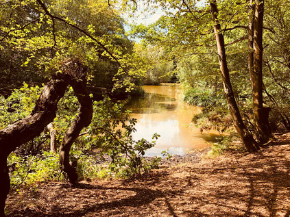
Beyond the road, the path dipped and bucked into a series of further, even steeper valleys which formed the various tributaries of the Loughton Brook, emanating mostly from sources on Broom Hill to the West, and again mostly running dry due to the recent weather. The ponds which form along the brooks were not yet dry, but they were green-tinged and algae-covered, insects flitting over their surfaces while fishermen fruitlessly dangled lines into the dead, still water. The walking was challenging but pleasant here, the tree cover making for humid but thankfully shady conditions. My boots were doing the job they were designed for at last and appeared to be responding to a rare reprieve from pounding asphalt and pavement by protecting my feet well from the trips and twists of the forest floor. For a while here, time became soft and pliable. I couldn't say how long I'd been in the forest or how far I'd travelled. The path ahead was my only focus, and studying the form and foliage of the woodland ahead is all the thinking that was required of me. It felt both liberating and terrifying to be released from caring about much beyond the immediate landscape and I felt my brain rebelling. My ever-active and somewhat disordered mind sought to fill my synapses with anxieties about work problems, my bank balance, politics - but they wouldn't stick. The huge, unknowable and ancient forest demanded all of my attention, and if I dared to let my mind wander into human concerns it reminded me with a misplaced branch or a knotty crag of earth that it had the power to trip me up in every sense. I've never been someone who talks about 'oneness with nature' - that always strikes me as an artificial state, sought by those who seek a sort of environmental superiority over the rest of us with our petty worries about everyday things. For a little while though, and I'm not entirely clear how long, in fact, it made an odd sort of sense. It wasn't a spiritual or even a particularly esoteric experience: it was simply the strangeness for an urbanite of being entirely consumed by a living thing bigger than oneself.
I was returned to my normal, sceptical self by taking a wrong turning. Consulting the map I noted I was still east of the A104 which forms a spine through the forest. My aim was to cross the road and stay for as long as possible in the broader and denser areas of the forest, in the angle between the encroaching suburbs of Chingford and Loughton. As the forest continues to the south it becomes more sporadic and disconnected, though no less dense and remote in places. I retraced my steps to a crossroads where a group of older tourists, distinctly unprepared for the terrain ahead, appeared to be wandering aimlessly too, and I headed west towards the road. Like the other road crossings in the forest it felt like a traumatic imposition on the peace and calm, but perhaps in the case of this main route out to the M25, even louder, faster and much harder to cross. When I finally made the dash, I found myself on a somewhat indistinct trail which runs parallel to the road through a broad plain of dry, yellowing grassland. A warning on the gate indicated that cattle may be nearby, and they have left their own special evidence too, necessitating careful walking. My route converged on a more established path at Palmers Bridge, though it was currently an unnecessary structure, with the long straight ditch beneath the wooden footbridge entirely dry. I followed the ditch towards Connaught Water, an ornamental lake built around 1882 by flooding a formerly swampy area of the forest where many streams converged. The lake was named for Prince Arthur, The Duke of Connaught who had accompanied his mother Queen Victoria on her visit to Chingford when she dedicated the forest to the people. Arthur went on to become the first Forest Ranger alongside other honours, including becoming the tenth Governor General of Canada. The lake was extended in the 1890s with large, wooded islands established to create impressive views from the lakeside path. More recent innovations included a wooden boardwalk which snaked around the western edge of the lake, allowing a generous throng of visitors to get closer to the waterfowl which strut and wade in the lake, occasionally flapping away from more enthusiastic children as they approach. Connaught Water is also the source of the Ching - fed by the dried-up brooks and streams which arrive from further north in the forest, a twin-bored concrete culvert at the southern end of the lake allows water to run down a cascade into the muddy beginnings of the river. When I walked the Ching, I started to the south of this point - so a pilgrimage to the source was long overdue. However, there really was no source to speak of: the pipes were dry and the bed of the river had clearly not been damp for some time. I crashed along through the bracken which was, prior to the long spell of dry weather, a deep reedbed beside the water. Eventually, I was forced to surface at the crossing of Rangers Road. Beside me was the 'Essex' sign which had signified the start of my previous walk and to the west was Chingford Plain. Queen Elizabeth renovated Henry VIIIs original 'Great Standing' here as her hunting lodge and it still stands today, an isolated and rather plain timber-framed building next door to the much more elaborately mock-Tudor former Royal Forest Hotel. The hotel is now a Premier Inn - a singularly ostentatious one too, with many rather unusual features to accommodate the old building which houses it. The two buildings sit in curious harmony - the genuine heritage piece and the plausible Victorian fake - while a modern visitor centre commands a view over the plain towards the forest. My business didn't take me this far west today though, and after crossing Rangers Road, busy with school holiday traffic, I plunged back into the woods to repeat a section of the walk beside the Ching which I'd last done in freezing temperatures. I'd slipped and slithered over the muddy ruts back then, but today I was more at risk of tripping over the cracks in the parched ground.
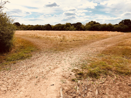
The route south soon became much more familiar via a reunion with the Ching at the edge of Whitehall Plain where a tiny bridge crossed a rather pathetic trickle of muddy water. But it was at least now a stream of sorts, showing that even an unprecedented dry spell couldn't quite quash this little waterway's aspirations. The walk across the plain, entirely alone and largely free from any hint of the surrounding city was a rather special moment, which I perhaps hadn't fully appreciated on my last visit because staying vertical was more of a concern in the icy horseshoe ruts. Today, the baked earth and dry grass crackled underfoot and the sun beat down on me relentlessly. I ambled along slowly, pacing myself - there was some way to go, and the weather was exhaustingly hot now. As the river and the path converged again at the crossing of Whitehall Road, I had three choices. On my winter visit, I'd taken the path to the west of the little concrete bridge parapet which seemed a fairly sensible option in those conditions. There was also a seemingly more official path further to the east which would likely have been a lot safer too, but in my concern to find a route that day, I'd entirely missed it. That didn't seem appropriate for today either - instead I wanted to disappear into the tiny gap to the immediate east of the bridge, where a less well-used but clearly evident pathway descended steeply to the bank of the river. I reasoned that I knew this area well enough to find a way out of any scrapes I got into, and plunged into the tangle of woods. This part of the walk was actually ridiculously good fun - tiny paths, little more than faint desire lines cut by dog walkers, criss-crossed the land along the edge of the river. Despite being in a narrow flank of the forest between two densely-populated areas, I was absorbed into the woodland entirely. I tramped around, relying mostly on my sense of direction and carefully dodging the gnarled roots and banks of tall holly. Occasionally the detritus of late-night couplings was evident in wet-wipes and condom wrappers, and I marvelled at the resilience of these folks who would be exposing bare flesh around some seriously robust holly bushes and nettles! Realising I was drifting to the east I took a very minor path which wound back towards the river and found myself on the edge of a very clearly marked PRIVATE field with no obvious exit beyond the swaying, reedy grass which had grown to near shoulder height over the course of the summer. Above the sea of yellowing stalks I could see suburbia encroaching on the forest, closer than seemed possible just moments ago while I was plodding along the barely-evident forest tracks. I retraced my steps and set off into the dense knot of trees again, more aware than ever of how quickly this familiar landscape of streets and houses could return to nature given the opportunity.
The ornamental boating lake in The Highams Park was busy with visitors on this hot afternoon - a far cry from the ice-bound edges of the water which I'd found on my previous visit. I took a path which hugged the lake rather than the route I'd taken on my last visit, surprising a group of youngsters daring each other to skinny-dip from the opposite shore. They continued egging each other into diving into the water, little bothered as I passed by. Dogs and birds both enjoyed the water too, splashing and flapping their way into the deeper parts of the lake while their owners lazily ambled, too hot to walk faster around the perimeter. The whole concept of 'Highams Park' appeared to be a contested one: the park itself, created in the 1930s was named very specifically with the definite article which differentiated it from the name commonly applied to the neighbouring district. This drift west into newly laid suburbs largely followed the rechristening of the railway station as 'Highams Park and Hale End' in 1894, two decades after opening to serve the latter of that pair of then distinct settlements. Some it seems, believe that there is, in fact, no differentiation to be made between the two former villages - while others resolutely disagree. Confounding local historians further, the manor of Highams - sometimes known as Higham House or Hall - lies further east, beyond the forest's edge facing Woodford Green. Built for Anthony Bacon MP in 1764 on his purchase of the ancient manor of Higham Bensted, the hall briefly served as a military hospital and is now a private school for girls. The Ching snakes around the western shore of the lake, deceptively appearing to feed it but remaining in fact an entirely separate waterway aside from an overflow at the southern end. The parkland here were formerly part of the extensive grounds belonging to the Highams Hall, landscaped by Humphry Repton and eventually purchased by the Corporation of London when it moved to preserve the forest.
I was now entering a part of the forest which I knew well and also one where a previous walk had faltered - and I'd found myself anticipating this part of the walk perhaps most of all. After negotiating around the striking modernist blocks of the Best Western hotel which now looked tired and somewhat dated, I headed back into the forest along a familiar track. The A104 was still close by on my left, revealed as I passed an open grassy space between houses. Traffic was already braking, slowing for the congestion of Waterworks Corner up ahead. The trees closed in above me again as I passed the clearing where the memorial to preacher Rodney 'Gypsy' Smith stood, before taking the path that led onto the North Circular footbridge and crossed the route I'd taken along the edge of the forest when I walked the length of that road. Suddenly, I was beyond the edge of the trees, above the carriageways and surrounded by a clamour of traffic noise. To the west, the Lea Valley shimmered under the bright sun, and the towers and chimneys of Tottenham and Edmonton swam in a distorting heat haze. To the east, the traffic banked and peeled away to the south, the brief knot of Saturday traffic around the slip roads to Waterworks Corner slowly negotiating the exit. There was something about this spot - distinctly of the forest, but out of the trees - which somehow amplified the experience of walking in the woods: a green, moist silence becomes an immediate sensory overload of white noise, bright light and unforgiving heat. The road remained impressive and daunting, despite being part of a well-walked circle now. I fought an overwhelming urge to retrace my steps along its forlorn, ragged edge. Instead, though I continued southwards, navigating the narrow strip of raised ground between the A406 and Forest Road which is crossed by another, quieter footbridge. Beyond this was the raised field of tall grass where my last attempt to cross the forest had come to grief: at the end of the path was a steep downward slope which had become a wintry, wet mudslide. Today though, it was a sheer but navigable scramble of smooth, dusty earth. I half walked and half slid to the bottom, a sense of almost ridiculous personal pride achieved in this simple task. Perhaps I'd become more adventurous since my last visit, or perhaps I just felt more at ease in these woodland perambulations now? In any case I was safely down and could once again emerge briefly to cross the road and enter the last, straggling edges of the remaining forest.
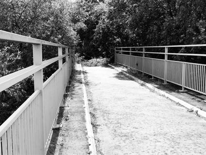
Pride is never advisable on these excursions, it's fair to say, and immediately on re-entering the forest on the eastern side of the road, I lost my bearings. The paths were not easy to follow in this area, and I found myself circling the same spots while looking for what should have been a well-worn route to the east of the Forest School. I'd walked a dog near here before with a former pupil of the school who had shown me around the impressive facilities after hours, and I foolishly thought I could follow my instincts to get out of the bind. Instead, I found myself retracing my steps more than once and feeling none the wiser. I finally found the right route, taking me close to the perimeter of the school buildings and across Snaresbrook Road near the point that a tangle of drainage ditches split away to feed the Hollow Pond and the Eagle Pond. Hollow Pond started life as a series of pits left after gravel was extracted for road building. Quarrying ceased in 1878 and the pits filled with water and were abandoned to gradually return to nature, until 1905 when unemployed labourers were drafted into the forest by Leyton District Council and the Forest Conservators to landscape and extend the pits into a large lake. Soon becoming a popular resort close to the growing suburban districts of East London, a well-used but muddy bathing lake was converted into Whipps Cross Lido during the 1930s with costs shared by Leyton and Walthamstow's councils. The Hollow Pond, on a blistering summer afternoon, was still busy with locals lazing around its banks and it was easy to imagine that if the Lido had survived the 1980s it would have been much used today. Meanwhile the quieter Eagle Pond teemed with waterfowl which skidded onto its surface and lurked in the shade of its wooded edges. For some years now, the Surrey-based Swan Sanctuary has used the pond as a point for releasing birds back into the wild after recovery from sickness or injury, and with fishing now banned the pond was an oasis of calm in the busy afternoon. The incongruous bulk of Snaresbrook Crown Court reflected in the water - a huge and imposing but slightly gloomy building by George Gilbert Scott and William Bonython Moffatt which was originally built as Wanstead Infant Orphan Asylum and became a court only in 1974. My path took me between the ponds, well away from the crowds and onto a long, dry pathway of dead grass and baked earth which cut across the flats towards The Green Man roundabout. To the south, I could see the impressive villas which fronted Whipps Cross Road closing in, marooned between the busy road and the open ground. My path climbed to cross the Central Line before delving into the centre of the vast road junction. Somewhere on the fringe of this junction the mood switched - all day I'd felt connected to the forest, even when it had been little more than a narrow strip of land between busy suburbs. This terriroty was now of the city. A constant, low-level drone hummed in the air: traffic, conversation, aircraft. In the forest I had been insulated. I felt disorientated, and uncharacteristically, weirdly unnerved. The temperature was well into the mid-thirties now and I'd begun to feel tired and thirsty as the last of my supplies from Epping were used up. In some ways, it felt like entirely the right conditions in which to approach London: activated, edgy and a little distracted - the natural traits of the city. Beneath me, the A12 contorted under the junction in a tunnel: the road was yet another planning compromise, a testament to further abandoned grand plans and a legacy of road-building policy which just wouldn't cut in it these days of environmental impact assessments and consultation.
One last patch of woodland took me further south, along the aptly named Bushwood, a curving street of solid Victorian homes which faced the last vestige of the forest as it dwindled into the edge of Wanstead Flats. As soon as I could break away from the road, I took a path along the edge of the woods, eager to spend the last mile of my walk as close to the forest as I could. The path crossed the head of an avenue of trees, partly replanted and under restoration, before heading across the northern edge of the Flats. My view to the south was striking: Fred Wigg and John Walsh, two tower blocks dating from 1966 backlit by the strong afternoon sunlight. On 12th December 2011, a flat on the 13th floor of Fred Wigg caught fire. It took the London Fire Brigade five hours to control the blaze following a full evacuation of the block. A few residents were treated for smoke inhalation or hypothermia, many having left their houses quickly on a cold evening in their nightclothes. However, there were no casualties and the fire was contained in the flat where it broke out. It stands as a striking contrast to events years later in West London: here, the original construction of the tower - while considered ugly and tired - held fast and the evacuation ran smoothly. This unremarkable block should have returned to obscurity after attaining a briefly newsworthy status, but in 2012 it hit the front pages again when residents sought permission to begin a Judicial Review of the decision to site air defence missiles on the roof of the building during the Olympic Games. Permission for the review was denied - legally correctly given the government's prerogative powers in defending the realm, but this was just another instance where the Games, unstoppable and somehow beyond criticism, rode roughshod over the lives of ordinary people in East London. Thinking back to that year as I passed the towers, a landmark one in my life in many ways, I remembered well the mood of tension and frustration: no less-than-positive comment on the Games could be passed without summoning the wrath of the part-time patriots who couldn't see past the TV coverage. It was going to be good for London - good for people who lived in places like Fred Wigg. We ought to shut up and stop moaning. The jury is still out on the economic benefits of the London Olympics, particularly in these areas outside the immediate environs of the Queen Elizabeth Olympic Park and its hinterland of newbuild residential towers. Today the blocks named for esteemed local councillors Fred Wigg and John Walsh await refurbishment, the work delayed awaiting the outcome of the Grenfell Enquiry and a ruling on whether the borough should pay for any resulting cost implications. The sun beamed momentarily through the open ground floor spaces of the two blocks, lighting up my path ahead. Beyond, the towers of the Isle of Dogs shimmered in the middle distance while out on the flats people sunbathed and picnicked. On afternoons like this, being in London felt like a privilege - and even the noisome aroma of the overheating, overtaxed sewers and the thrum of traffic nearby didn't make it seem any less attractive.
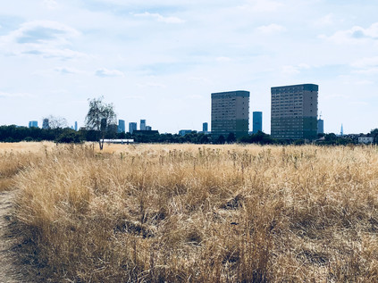
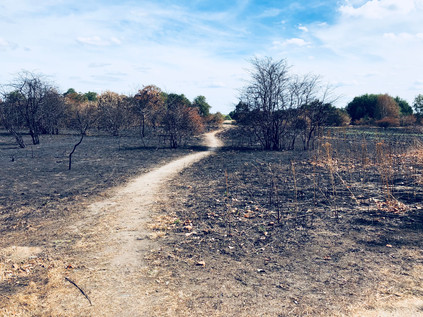
Stumbling wearily onto the pavement, I turned south onto Woodford Road and passed the sign which welcomed me to Forest Gate. I thought back to the start of my walk, and the faded sign hanging in the trees outside the Forest Gate Inn near Bell Common. As I headed south, the last tapering tail of Wanstead Flats became the final edge of the forest. Beyond this point, all was London. The city takes over in earnest here, and any sense of the ancient, loamy depths of the woods very swiftly fades. A tall housing block, Capel Point, stands sentinel over the edges of the Forest. The pulse of the city returns, and I'm swept along into the rhythm of other walkers again - a strange feeling after being largely alone since leaving Epping. I pass the quiet station at Wanstead Park, trains shuttling overhead under new electric wires, and press on south to Forest Gate station. The area is vibrant and diverse, the businesses reflecting this. There is noise and colour, endless diversion - a strange experience after a day dominated by the green of the forest and the sun-bleached yellow of the heath. As I collapse onto a bench to await the new, sleek purple train which will in time, become a Crossrail service, I contemplate the walk I've undertaken. Since I first stumbled into the forest, almost by accident, I've been captivated by its history and its strange otherness. I always considered myself capable only of urban walking, but some of my first forays into more adventurous exploits on less established paths began walking the trails and tracks in the forest. It may seem like a tame, unwilded place to many - and may seem like a dull and commonplace spot to those who live locally, but Epping Forest is a magical and strange place. A place where people live uncommonly close to genuinely ancient woodland, and where reservoirs and road junctions are hidden under the boughs of truly venerable Oaks, Planes and Hornbeams. I'm more convinced than ever after walking its length that there is really nowhere quite like the forest. I'm also very aware that I've only explore a tiny fraction of its vastness, and as the train pulls away from Forest Gate for Liverpool Street, I know I'll need to return.
You can find a gallery of images from the walk here.
Lost::MikeGTN
I've had a home on the web for more years than I care to remember, and a few kind souls persuade me it's worth persisting with keeping it updated. This current incarnation of the site is centred around the blog posts which began back in 1999 as 'the daylog' and continued through my travels and tribulations during the following years.
I don't get out and about nearly as much these days, but I do try to record significant events and trips for posterity. You may also have arrived here by following the trail to my former music blog Songs Heard On Fast Trains. That content is preserved here too.
