Despite heading into London by train on a fairly regular basis these days, I'm much less likely to find myself patrolling the network with anything like my former frequency. In particular, trips to points north are far less common and my familiarity with some places where I'd once have popped-up frequently has long since diminished. Some things though, never change - and so my first port of call on arriving at Bristol Temple Meads on the first leg of our journey to Manchester was the Customer Services desk. We'd been sold an empty promise - an 09:41 to Gloucester which simply didn't exist. The Filton Four-Tracking works were clearly going to cause us to have a long and fairly convoluted trip today - but I was surprised that it was going to be quite this tricky. As it happened, Great Western's staff sorted things swiftly by passing us on the 09:45 Crosscountry service to Birmingham New Street which took a long, lazy wander out to Swindon then reversed to amble up the Golden Valley Line via Kemble and Stroud before regaining its regular route at Standish Junction. At New Street of course we were left at the mercy of the Train Manager on the next service north - but a friendly and understanding railwayman let us travel in First Class for our troubles. I lazily dozed as we sped north on a route which I'd not travelled for a good few years. We arrived in Manchester a little late but relaxed and relieved to not have been too troubled by the awkward beginning to our trip. A swift tram ride through the busy city centre, basking in unusual bright sunshine, and we were at our hotel for the next two nights. It was good to be back.
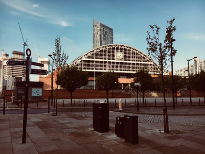
Our last visit to Manchester had been on the hottest day of the summer, in a hotel which decided not to air-condition its upper floors. Predictably it hadn't created positive memories and much of the visit passed in a frustrating haze of heat. This weekend was predicted to be warm too but less intensely so, and we were able to get out and explore the city a little. During our stay I took my customary, early morning strolls and found myself approaching familiar streets from a different angle. All of my previous visits had focused on the narrow, north-south axis between Piccadilly and Victoria. This time I found myself crossing my own path and happening upon corners which I'd passed often but never turned. Manchester now, of course is a much changed city - vibrant, busy and cosmopolitan in comparison to my earliest visits. I negotiated the relatively recent Second City Crossing with some confusion, finding trams where I didn't expect them. Finally, and rather remarkably on the anniversary of the last time I stayed, I happened upon the Merchant's Hotel - a grim reminder that things had changed for me, if not for this forsaken hovel which was remarakbly still in business! On Sunday afternoon we wandered the Northern Quarter's busy market which I confess to finding a little dizzyingly busy, but the walk was rewarded with good coffee - first with indifferent service in Foundation Coffee and then in the much more welcoming Takk. We zig-zagged back to the hotel via Piccadilly Gardens, busy in the bright afternoon.
The main event though, and the reason for this trek up north, was the live My Favorite Murder. This has been a frequently heard podcast here for some time, and when tickets were announced earlier in the year, I knew I had to ensure they were secured! A VIP package meant some merchandise, priority entry and seating, and perhaps more nervewracking for both of us, a chance to meet Karen Kilgariff and Georgia Hardstark. I'm not great with celebrity - projecting my own thoughts onto them by imagining that they really just want us to leave them alone - but for others, it was the thrill of meeting people who've become heroes of a sort. Their irreverently funny but touching and sensitive forays into true crime have become a defence against homesickness - a little slice of the saner and calmer America delivered via the airwaves. We ate a swift dinner before heading to the Albert Hall - a former church turned concert hall which appeared to be crumbling from within, paint peeling and fixtures wobbling with little concern for modern health and safety rules. The bright sunshine illuminated the art-nouveau style stained glass from outside, giving the whole place a strange glow. While the performers found their 'daytime' show a little odd at first, the venue couldn't have been more perfect. I surveyed the crowd - predominantly female and a defiant mix of geeky types which it was a delight to be part of. I made conversation with a young gent sat next to me accompanying his girlfriend as a birthday gift. We speculated on the murders which might feature - what might be 'too soon' or 'too local' to land well. We played the reluctantly dragged spouses at first, but soon gave in to the admission we were looking forward to this too.
A couple of hours later we stumbled out into the dark of Peter Street, having met the perfectly delightful pair of presenters for a few short minutes. A little starstruck, still laughing at the show we stopped in for a beer before heading back to the hotel where yet again the ever declining Premier Inn brand let us down on customer service yet again. It wasn't going to spoil the day though - and consoled ourselves in knowing that the final night of our trip was being paid for by my talent for complaining. The next morning after a fine breakfast at Friska, a nearby eatery which appears to have made the leap from Bristol to Manchester, we headed for the station to cross the Pennines to York. On our last trip, a genuinely bizarre performance by the staff of Hotel Indigo had resulted in a full refund, an apology and an offer of dinner, bed and breakfast on the hotel in order that we could experience their normal level of service. The trip from Piccadilly brought back memories of long-ago excursions: craning my neck to see what was lurking on Guide Bridge Yard, secretly wishing I could stop off at the fine Station Buffet at Stalybridge and marvelling at the sudden burst into Yorkshire at the end of Standedge Tunnel. We soon found ourselves approaching York in wonderful sunshine, the station gleaming golden in the afternoon light. It was good to be back in a favourite spot.
After checking in - a much less irritating experience this time I'm glad to say - we headed out to catch up with friends at the York Tap. It was good to meet old friends and new, and to see some happy faces too. All too soon it was time to head back for our complimentary dinner. It was - well, better than last time - but still a long, drawn out and rather odd experience. As the restaurant closed around us while we waited for our dessert we speculated that this would probably have generated a complaint if we were paying. After this, we were a little wary of breakfast - but were greeted by one of the best spreads I've ever enjoyed at a hotel. The service was swift and friendly, and the food was frankly amazing. If we'd booked just the excellent room and this wonderful breakfast we'd probably have happily skipped the weird dinner experience. As we boarded the slightly overheated 10:45 back to Bristol I composed my response to the manager of the hotel. We'd had a much better time and a great welcome - but the restaurant was still strange and slow.
We stepped off the train into the usual mess of afternoon delays at Bristol, but feeling remarkably relaxed after the warm trip home. I've known for a long time that travel is good for me - but I'd underestimated how much I needed to escape on the rails like this. The next months - indeed the next week - will be busy and challenging. It's unusual to think of Manchester as an oasis of calm, but that's certainly what it's been for us this weekend.

Via Antiqua: By Watling Street from Kent to London
Posted in London on Saturday 28th April 2018 at 11:04pm
Today's walk had crept upon me unexpectedly. The weeks had tumbled by unusually swiftly and a confused calendar thanks to rail works and changing plans meant I'd not prepared myself. In reality, the process of planning a walk isn't as onerous or complex as I often make it sound: usually, it's a germ of an idea followed by a cursory study of a map to ensure there is actually a path to follow. The research comes afterwards, reconstruction undertaken with feet smarting and imagination fired. There are numerous half-formed plans circling at any given time - and sometimes one leaps forward as an essential next step or perhaps just won't quite stop cropping up, coincidentally or otherwise. It was just one of these nagging presences which drew me south of the river again today... I felt like I'd been haunted by Watling Street for years now. I had a map of Roman Roads as a boy on which I'd been shown how close my home was to the confluence of Icknield Street and Fosse Way - but it was the improbably perfect diagonal trajectory of Watling Street which most intrigued me. After lying dormant in my imagination for years the road had resurfaced - first in print with Jon Higgs state-of-the-nation travelogue and Iain Sinclair and Alan Moore tramping Steve Moore's 'psychic circuit', then it began to assert a presence on the ground seemingly wherever I've walked in recent months. When I've looked at maps to plan future excursions the arrow-straight incision across the north of Kent has been impossible to ignore. The red slash of an A-road scythed across the map like a fresh, clean paper cut. Walking roads - ancient and often less so - has some precedent here, so it didn't feel strange to plot a course along the route as a potential future trip. Yet I still filed this one away, for an especially rainy day perhaps - because surely a straight line couldn't make for the kind of convoluted itinerary I'd prefer? But as I prepared hastily for this trip, I couldn't quite shift the idea that I needed to connect up previous walks via this old track.
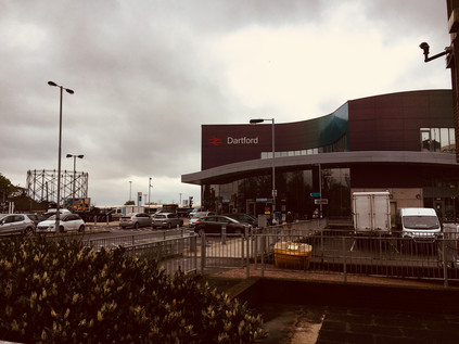
And so I made my way to Charing Cross to take my pick of the carriages on an empty train to Dartford. The rumble and shudder through the southern suburbs was becoming very familiar now but felt somewhat eerie as I appeared to be almost entirely alone onboard. The train snaked through the refurbished London Bridge station - grey plastic panelling and swooping escalators descending into the re-imagined undercroft - and left the gravity of the city. I let the greenery of the suburbs drift by the window while I pondered my changing relationship with Kent over the years. On my first excursion here I was entirely unimpressed: the ponderous amble through the middle of the county by train was dull and charmless, ultimately leading to desolate, unremarkable Ashford. I revised my view over subsequent visits - especially those involving the northern coast which had grown to fascinate me. Now, after a sequence of walks which had dallied along the border of the county, I was curious to exit by this most ancient of trackways. It felt like a fitting way to mark a re-evaluation. The train slowed after passing familiar ground at Crayford, and high above the marshes I could see the towers of the Dartford Crossing and the distant glower of Essex on the horizon. Lurching across the junctions where the splayed branches of the North Kent Lines finally reconstituted themselves into a single railway, the train slowly came to a halt at Dartford. Below the raised platforms of the station, I spotted the former millpond fed by the River Darrent which was busily being redeveloped as a waterfront living opportunity. The narrow platforms and dated, gloomy exit stairs led out to a modern but down-at-heel ticket hall tacked onto the rear of the Borough's grim civic centre. A bridge took me over the busy inner ring road, descending near the red brick flank of the Orchard Theatre. Dartford was a town which had willingly conceded its soul - and just a few miles along Watling Street the vast hole-in-the-chalk of Bluewater sucked the income out of the locals with alarming efficiency. Dartford mopped up the rest via a network of pound shops, chain pubs and gambling opportunities. I headed for the centre of town where Spital Street followed the ancient geometry of the Roman road, heading in from the settlement of Vagniacae at nearby Springhead. The site there had been a centre of worship before the coming of the Romans, with evidence of Iron Age rites near the pools where the River Ebbsfleet rises. The tradition of worship and offering continued, with the Romans turning the site into a major complex of temples - and now Bluewater stands close by, drawing its own pilgrims. Perhaps grim, inward-looking Dartford has always been the poor relation hereabouts? I turned west on Spital Street, suspecting that any hint of interesting shopping opportunity lay along the pedestrian zone to the east. The narrow road was lined with abandoned shops, proper old-fashioned independent cafés emitting tempting breakfast aromas and a brace of repurposed theatres deputising as evangelical churches. I felt uncomfortable, though there was nothing especially menacing about the place. Perhaps in fact a little edge would have helped. Dartford just felt tense and contracted: out of the gravity of London despite being (just) within the grand circle of the M25. I began to climb West Hill, finally falling into step with the historical route of Watling Street as it passed the Royal Mail sorting office and the crumbling remains of The Lock-up: Dartford's first police station and latter-day dosshouse for itinerants. It was good to be walking, and a relief to be leaving this oppressive town.
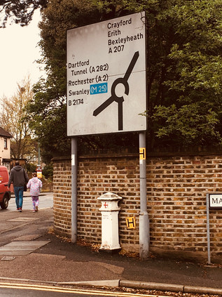
The last stretch of Watling Street within the boundaries of modern Kent was a drab channel through suburbia, with occasional bursts of local shops which were invariably closed for business. The land rose gently ahead of me as I crested the narrow tongue of high ground which separated the Cray and the Darrent. It struck me that only a few weeks ago I'd been further north on the bleak marshland which sat between this road and the Thames. Up ahead was a junction with the B2174 - an inauspicious number for what was an early incarnation of that most British of institutions, the bypass. The road arcing south around Dartford and avoiding the narrow progress of Watling Street through the town was opened by the Prince of Wales in 1924 - or perhaps by an overzealous worker who severed the ribbon in advance of the royal scissors. The press of the time dubbed this the 'New Watling Street'. The road meets its much older counterpart at this rather inconsequential roundabout which, since 1965 at least, has formed the border between London and Kent. Looking west there a proud sign advised motorists that they were about to enter the London Borough of Bexley, while to the east Kent offered no such welcome. There was however a marker here - squarely between the poles of the sign advertising the roundabout an 1861 Coal Duty post remained in place and in good shape. As my excursions have taken me further out into the suburbs of London, these administrative obelisks have become welcome markers of my progress back towards the City. Finding one here today felt like a first indication that this might be a more interesting walk than perhaps I'd expected. There were few other signs that I'd passed into London - the line of former council houses didn't break step, even when the insignia on the wheelie bins changed. Beyond the junction, the road led downhill once again, into the valley of the Cray. There was a brief thrill of familiarity as I noted the retail parks which had greeted me when I'd entered Crayford from the south. I braved a pair of scornful, braying locals concealing cans of Special Brew to snap a picture of the clock tower before heading across the river. Crayford was much as I'd left it a few short weeks ago - a busy churn of suburban life shot through with traffic heading for Bluewater or Lakeside. It was only after a few minutes of brisk uphill walking that I realised my plan to attempt this walk largely without a map had failed me. The road had turned slightly north to cross the river and I'd blithely headed straight on. The High Street began to dwindle as I climbed, the local shops being replaced by a string of takeaways and abandoned vape shops. I knew this wasn't where I should be and instinctively stopped to consult the map. I had indeed gone straight ahead - but the kink in the route over the river had thrown me off course by about 45 degrees. I trudged back downhill, acutely aware I was passing people I'd just moments ago huffed past on my ascent. I adopted a facial expression which I hope conveyed that of course I'd meant to walk up the hill and back again so soon. Back at the bridge I turned southwest, immediately recognising the route I'd taken in reverse along London Road while walking along the Cray. I was back on track.
Watling Street was dominated for a few miles now by suburban encroachment. The green spaces of Shenstone Park and Bigs Hill Wood gave some relief from the parade of recycling boxes and wheelie bins as the road made a steady climb away from the Cray valley. I'd been intrigued by the near life-size silhouette bronze sculptures of cows in Shenstone Park on my last passing, and getting closer enabled me to read more of the story: David Evans & Co. made silks nearby, using the Rubia Tinctorum or Common Madder plant to create a vivid red dye and maintaining a herd of cattle on the site to provide manure to fix the colour in the cloth. Beyond the park, the road returned to suburbia, still climbing as I faced down a cold, persistent drizzle of rain. The rise reached a plateau at Pinnacle Hill - a rather overstated name perhaps - and the view ahead opened before me. This was Bexleyheath, as announced by the strange tumble of gables and brick of the new Civic Centre. For many years the busy corner of Watling Street and Erith Road was occupied by the computer centre of The Woolwich Equitable Benefit Building and Investment Association which those of a certain age will recall being advertised in a chummy inclusive fashion: "I'm with The Woolwich". In the heady days of 1989 they made a bold move to relocate their HQ into a purpose-built block on this corner. The heady days of demutualization and acquisiton that followed were a small part of the build up to the crashes of 2007, and by 2006 the Woolwich was part of Barclays PLC and the HQ was closed. The Borough stepped in, selling the site of their civic offices to Tesco and snapping up the Woolwich site as a bargain. The redeveloped area was disarmingly quiet at the weekend - built in part as a plaza to cap the busy High Street, there's little need for people to press on this far beyond the shopping centre. The Civic Centre towers and tumbles above the crossroads, facing London defiantly, the exterior only hinting at the impressively refurbished, modern facilities within. I waited at the crossing for what seemed like long minutes, sharing my wait with a couple off to a wedding who were impatient to get out of the rain - there was a concern that suede would matt and hair would frizz. I considered my own appearance, bedraggled and damp, red-faced from stomping the hill from Crayford, and figured that the well-turned-out pair had little to worry about yet.
After crossing Erith Road, Watling Street becomes Broadway, the main drag of Bexleyheath - and a relative newcomer to the area. In the early 19th century the wild heathland pressed directly against Watling Street and there were few houses in the area save for the hamlet of Upton where William Morris decided to locate his 'palace of art' - The Red House in 1859. The construction of the house, which was swiftly absorbed into the suburbs as the commercial centre of Bexley shifted onto the heath and Upton was swallowed, largely bankrupted Morris. He was forced to sell up in 1865 vowing never to return to the house or to Upton. Now, two broad bypasses sweep traffic north and south of the centre, leaving Broadway to continue as a pedestrianised walkway on the line of Watling Street. This largely featureless, pavement, part-covered by an inaqequate awning, delved between a carpark and an extension to the 1984 shopping centre including a huge Sainsbury's and a multi-screen cinema. As ever I was walking against a tide of shoppers heading for their cars or buses home. Across the expanse of parked vehicles, the white chequerboard flank of the utilitarian Magistrates Court gleamed, all the better for a soaking of rain to slough away the traffic grime which still streaked the less exposed rear of the building. This wasn't, I'm sure, how Bexleyheath wanted to be introduced to newcomers - and it seems that the ceremonial march along Watling Street didn't do the place justice at all. As the enclosed alleyway which I'd been walking burst out into surprising sunshine, the street opened out into a much redeveloped and bustling market square. At the centre was the Clock Tower erected in 1912 to commemorate the coronation of King George V. The architect, Walter Epps, designed the tower with niches which he hoped would in time be filled by busts of the Royal Family which has largely been the case - though in 1996 a bust of William Morris was allowed into the hallowed company to celebrate the centenary of his passing. The tower was a focal point in a pleasing pedestrianised area which stretched along Broadway, taking full advantage of the straight-line of the Roman Road to create a promenade between the modern shopping centre and the more traditional street scene to the north. In 2000, to celebrate the millennium, the bells in the Clock Tower rang for the first time since they were silenced by the Defence of the Realm Act in 1914. I was surprised how much I liked Bexleyheath - in essence just another fringe centre which ought to feel as oppressive as the hugely redeveloped Wood Green. But here, just enough of the town had survived, and just enough of the character of a place which was not ancient but remained proud seemed to linger. I decided to stop for refreshments and watch Bexleyheath pass by for a while.
A consequence of the long, straight course of Watling Street is the tendency of settlements to become drawn-out, straggling places - and Bexleyheath appeared reluctant to give up just yet. The twin bypasses rejoined Broadway to the west of town, and traffic was once more permitted to flow along the ancient road - though it was relatively sparse given the swifter route of the A2 carving through Kent a little way to the south. I crossed the junction of Upton Road, practically all that remains of the now subsumed hamlet, and where I'd turn south if I wanted to visit Morris' home - today though I pushed onward as Watling Street became the curiously named Crook Log. Opposite the apparently well-used leisure centre of the same name, the Morris Wheeler Gates of Danson Park proudly bore the insignia of Kent and its motto Invicta. This impressive green space was gifted to the Borough in 1925 having previously been part of the lands surrounding Danson House which remains at the heart of the park, with views over the ornamental boating lake. The house was built in the 1760s for Sir John Boyd, a prominent figure in the British East India Company, and there is debate about whether it was Capability Brown himself or his assistant and scholar a 'Mr. Richmond' who laid out the lake and parkland surrounding it. Little appears to be known of this mysteriously acolyte save for the plans for Danson Park which survive in Bexley's archives. By the time of Boyd's death, the area was already in use as pleasure gardens, and the association with recreation continued despite being threatened by its acquisition by Alfred Bean, a railway engineer and prime mover behind the Bexleyheath Railway Company who envisioned the area becoming a vast residential estate. On Bean's death in 1890 some areas were indeed auctioned for building plots, but by 1921 on his widow's demise, the Urban District Council acquired the land at auction. In 1937, Lord Cornwallis presented the council with the status of a municipal borough under an ancient oak tree in the park - and the Charter Oak remains enclosed within the park, and indeed in the arms of the Borough of Bexley. The park and house have benefited from much restoration in recent times, and it seemed busy with locals despite the rather gloomy beginning to the morning.
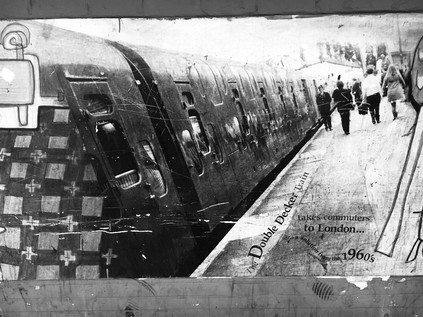
Danson Park marks a passing which would otherwise be hard to detect - from Bexleyheath into Welling, another long and drawn-out settlement which hugs the line of Watling Street. Welling, while perhaps not as significant in the borough's recent past, has a longer history. Evidence of neolithic occupation has been unearthed at East Wichkam, now wholly absorbed into modern Welling, but once a distinct village which once housed a temporary village of workers huts serving the Royal Arsenal at Woolwich. This link is celebrated with the loan of a 36lb Russian cannon which sits at Welling Corner, now largely ignored by passing shoppers but favoured by clambering children. The railway reached Welling in 1895, crossing the western end of the long High Street via a high brick bridge, and opening up lands north of the area for development by way of a station a short walk from the main street. The long stretch of shops leading to the bridge still maintained a prosperous and pleasant air, with a surprising diversity of stores - the usual suburban mix of chicken shops and cafés supplemented by craft stores and the like. Welling also benefitted from several major supermarkets setting-up shop in premises along the line of the main street rather than at some spot on the outskirts, thus ensuring a constant stream of pedestrians along the pavements. I was acutely aware that London was just over the next hill - at least the London which most would recognise as such - but this place felt full of provincial bustle. Perhaps Welling really was the last outpost of Kent - and the insignia on the gates of Danson Park referred to its triumph over the creeping suburbanisation of the borough? It might seem that London was close by, its inevitable gravity already pulling in road and rail, but ahead of me was a mighty barrier, and rising above the line of the railway bridge a distant green smudge against the grey skies signified Shooters' Hill. Rearing above the road, this formidable barrier had been easy to ignore until now. I tightened the straps of my rucksack and marched onwards, under the railway bridge with its rather impressive murals of Bexley life, including an image of the ill-fated and short-lived double deck trains of the Southern Railway. It was time to head back into the city...
Despite the grey skies and general gloom, the day was becoming warm and humid, and as I passed the last possible place I could rest before my ascent at the appropriately named 'We Anchor in Hope' public house, I decided that my best chance for an assault on the hill was to tackle it in one lung-busting push. Detours into the temptingly dark and cool Oxleas Wood to the south could await another walk, and the opportunity to stray into Woodlands Farm to see gambolling baby lambs needed to wait too. Instead I looked ahead at the straight, steep road disappearing into the tunnel of overhanging trees. At the foot of the hill a burned out car had collapsed onto the driveway of Thompson's Plant and Garden Centre, notices explaining that there was currently no parking or vehicle access. The air nearby had a taint of melted electronics and charred fabric. I edged uneasily around the stricken vehicle and began my climb. At first it felt surprisingly easy - the hill, though 433ft high was not steep on its eastern flank, and the walking was challenging but manageable. After a steeper and sharper rise near the summit which was more taxing, the road levelled a little near Eaglesfield Road. I turned north, puffing into the quiet park which sat on the brow of the hill here, and found a seat to survey the view back east. The description of the prospect from the top of Shooter's Hill written by Celia Fiennes has perhaps never been bettered - and remains remarkably accurate today. Fiennes was born in 1662 and never married, instead embarking on a series of tours of England which she undertook "to regain my health by variety and change of aire and exercise". Her memoir, largely intended for friends and family, was never published in her lifetime but has since seen the light of day, providing a remarkable contemporary account of the country as it thundered haplessly towards industrial revolution.
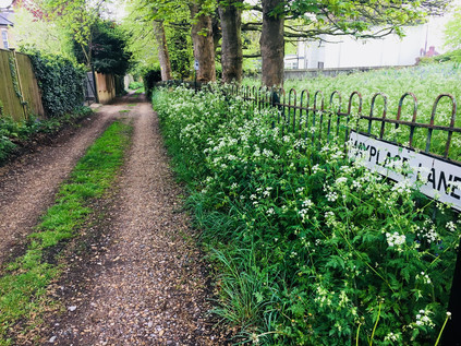
Shuttershill, on top of which hill you see a vast prospect ...some lands clothed with trees, others with grass and flowers, gardens, orchards, with all sorts of herbage and tillage, with severall little towns all by the river, Erith, Leigh, Woolwich etc., quite up to London, Greenwich, Deptford, Black Wall, the Thames twisting and turning it self up and down bearing severall vessells and men of warre on itIn the distant haze I could see the Dartford Crossing, close to where I'd set out earlier this morning. The suburban settlements along the railway and on Watling Street formed a continuous chain of red-brick smudges stretching from the horizon and ending near my feet. There was a surprising presence of green spaces too - not always evident from the ground, but nestled between developments and in the useless triangles abandoned where estates adjoined each other there were clumps of trees, patches of suburban parkland and expanses of municipal playing field. Kent shimmered in the distance, the Thames visible mostly as an absence from this vantage point. I pondered the walk to this point, and planned my next move. Since I was here on the slopes of this hill with its neolithic history it felt only right to seek out the Shrewsbury Tumulus where Steve Moore had anchored his esoteric visions of this neighbourhood. I would be treading in the recent steps of better writers and deeper thinkers once again, but it felt wrong not to make the short walk over the ridge to the mound. A meander through the quiet streets brought me to the mound, tall grasses and a bright swathe of wild flowers almost concealing its form. The corner site, fenced in and protected, was a quiet place in an already sleepy residential suburb. A curious peace lay across the Shrewsbury Park Estate with its fine 1930s homes glowing in the afternoon sunshine which had finally made an appearance. The parkland here was associated with Shrewsbury House which stood nearby and was rebuilt as recently in 1923, and was later purchased by the London County Council for new housing. The archaeological significance of the area was already reasonably well-known - but only one of the Iron Age tumuli survived even then. Watling Street likely long pre-dated the Roman road, an ancient track to a place of burial and reverence atop the highest point for miles around. I paused a while, intrigued by the apparently ancient route of Mayplace Lane which wound downhill towards the Thames. This narrow track had been paralleled by more modern routes, but still found its own meandering course down towards the shore. I noted its route for further investigation - intrigued by the suggestion of a route to causeways over the marshes. I'd been a little sceptical about the lure of this place which appeared to completely ensnare Steve Moore, working its way into his writing - even indirectly influencing the work of (the unrelated) Alan Moore with whom he frequently collaborated. In the work of both Moores there was a deep historical significance to place, and Steve had anchored his visions deeply here on Shooter's Hill. Considered alongside distant Shepperton in the west, the houses provided a fitting counterbalance of mid-century modernity. In these geographically distinct suburbs Moore and Ballard worked to redefine their environs in dark fantasies. Somehow their visions grounded London, pinning down its sometimes hazy character under a near-perpetual dome of cloud and drizzle, and providing a dream life for its suburbs.Diary of Celia Fiennes - 1697
I returned to Shooter's Hill near The Bull, a long established refreshment stop those who had tackled the ascent of the hill by coach and presumably wished to celebrate doing so unmolested. Now it promised suburban taproom character at London prices. The famous water tower leered above the hostelry, now a private home with unparalleled views across Eltham Common towards Severdroog Castle, or over the Thames to the aspirational environs of Galleon's Reach.
The western side of Shooter's Hill had seen work to flatten the climb during the 1950s when lower powered motor vehicles didn't always make the crest, and now the road dipped into a man-made chasm between the pavements. Walkers were consigned to the original gradient, steep enough to give me the uneasy sense of tumbling forwards and to conjure a dull ache in my shins. Much of the southern side of the road was occupied with the Memorial Hospital, now largely providing mental day health services, the grand gateway advised those with more pressing issues or injuries to head for the Queen Elizabeth Hospital in Lewisham. Opposite the hospital and set back from the road, the Red Lion was preferred over The Bull for staging Mail Coaches on the route to Dover and remained an inn of a fairly unreconstructed nature - offering a special on pies and pints, and a full range of Sky Sports channels. Beside the pub, a terrace of five cottages stepped down the hill and it struck me how isolated a spot this must once have been. Shooter's Hill was, for centuries, synonymous with utter lawlessness. The slow climb and the wooded areas around the hill made the work of highwaymen all too easy - more visceral and far less romantic than stories suggest. During the reign of Henry IV the crown ordered clearance of trees along the edge of the road to prevent 'violent practices' yet these persisted - and indeed increased in frequency - for centuries to come. Even the practice of hanging the corpses of executed thieves over the road as a warning seems not to have deterred attacks, with Samuel Pepys describing in his diary for 1661 passing by "the man that hangs upon Shooters Hill". By the 19th century a substantial village had begun to grow on the slopes north of the road, while Eltham Common had been partly cleared to the south. The presence of a range of larger houses and follies such as Severdroog Castle had also altered the character of the area considerably. It was no longer necessary for Eltham to maintain two Police stations to manage the disorder in the area, as was the legend. My own nod to this history of malfeasance was to disobey signs ordering pedestrians to cross the busy street to avoid some apparently abandoned roadworks, and feeling justly proud for maintaining tradition, I came upon the crossing of the South Circular. I recalled standing at this spot while stormclouds massed over the city, pondering the walk ahead of me. Today I continued westwards into Blackheath, passing the former Royal Herbert Hospital which had, for over a century, housed veterans of British military expeditions overseas. Built initially to house those returning from the Crimean War, the facility opened in 1865 and many of the then-innovative design features arise from the input of Florence Nightingale who had been sent to the Crimea by Sidney Herbert, Minister of War and had formed very clear views on how casualties should be managed both on the field and back at home. Royal Patronage came in 1900 when Queen Victoria visited veterans of the Boer War at the hospital, then noted for its fine buildings and health-giving proximity to the open spaces of Oxleas Wood. The hospital remained in use as an Army teaching hospital, admitting civillians injured in the wartime bombing of the Royal Arsenal and caring for injured prisoners of war during the World Wars. The site finally closed in 1977 and the fine buildings appeared doomed until the designation of the Woolwich Common Conservation Area and a Grade II listing. Now, predictably, the buildings have been converted to luxury accommodation with pools, bars and tennis courts on site. A little further west, near Hornfair Park was another location dedicated to the relief of wartime suffering - this time for the animals innocently caught up in human conflict. The Old Blue Cross Cemetery was founded by the curiously anachronistically named Our Dumb Friends League in 1897. The site once also housed a bustling kennel and quarantine point for animals returning from war overseas, but this was closed by 1958 - surviving longer than the cemetery which was flattened in 1947 due to the cost of repairs. The site has recently been restored, a walled garden of surprising quiet in the midst of a busy housing estate, and work continues to uncover and interpret the memorials. The long tongue of green space leading north from here towards the Thames was once Hanging Wood, reputed to be the favoured hiding place of the highwaymen and brigands of Shooter's Hill. Today, the quiet park stretched away from my route inviting a future walk but offering no challenge as I continued on my way.
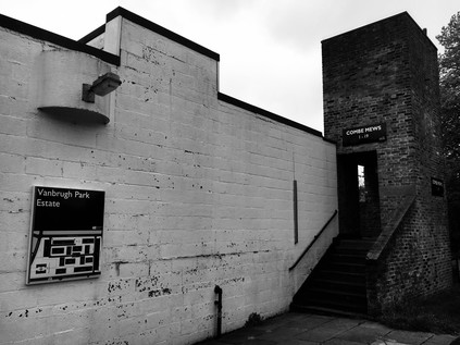
The road divided in Blackheath, the route of Watling Street contested from here on. Certainly, the southern fork, towards the Sun in the Sands then continuing as the A2 into London was a straight, direct route which resembled the traditional course of a Roman road - but the northern fork towards Greenwich seemed a more likely candidate for my walk. Driving directly ahead onto the scrubby and attractive fringes of Blackheath, the road passed over the seething concrete gully containing the Blackwall Tunnel Southern Approach Road and abruptly entered the charming village centre of Blackheath. Pleasant local shops lined the walk up to the busy junction beside the Royal Standard pub, and it was easy to see why this had become such a desirable address in recent times. I continued heading west into Vanbrugh Park, named for architect and bawdy playwright Sir John Vanbrugh who built his home, Vanbrugh Castle, nearby on Maze Hill. Initially, the streets were lined with imposing townhouses as I'd expected from an area bearing this distinguished name, but as I approached the Heath I noticed a block of low-rise, modern dwellings presenting their rather stark rear aspect to the road. Vanbrugh Park Estate was designed by Chamberlain, Powell and Bon - perhaps better known for their work at The Barbican and Golden Lane Estate in the City of London - and it was possible to see the germ of these later developments in this mix of housing types and dedication to vigorous modernism. The two-story houses which abut the Heath formed a square, looking inwards to narrow streets and walkways along the blocks. Behind these, a taller block of four distinct towers interlinked with decks and stairways rose over the houses, with distinctive corner windows giving the building the appearance of hanging from an external skeleton of concrete. Everything was separated by well-cared-for green space, and the area felt quiet and serene. Most of the homes were now privately owned - and given their heritage, much sought-after nowadays. It seemed surprising and brave to locate something so modern and incongruous on the edge of ancient Greenwich and so close to the open, and in parts still rather wild Blackheath. It seemed stranger still to cross the street and delve into an opening in the wall of Greenwich Park...
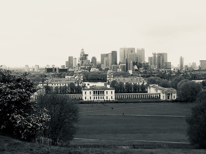
There have been recent reconsiderations of how Watling Street entered London, and the route around Greenwich in particular has been disputed. A Romano-celtic temple was discovered in Greenwich Park in 1902 and has been re-excavated in recent times to suggest it was of considerable importance. In use from around CE100 the site was very close indeed to the straight line I was attempting to strike through the park, roughly continuing the course of Watling Street which I'd walked in from Dartford. Distracted by the beautiful rose gardens and the impressive old trees, I continued uphill towards the Observatory with a growing admiration for the area. I felt like a fool in fact - I'd assiduously avoided Greenwich Park for years, once staying close to its gates but refusing to walk uphill for fear of the throng of tourists I'd seen pouring out of the gates. I'd fallen victim to an inverted snobbery which I now realised was foolish. The park was busy, the queue to visit the Observatory certainly long and tedious, but the view to the south was utterly spectacular - and entirely free of charge. Up here, gazing across the hazy and sombre shadows of the Isle of Dogs and regarding the silvery curve of the Thames I was reminded of Joseph Conrad and 'The Secret Agent' and the tale of a 'dynamiter anarchist' attempting to stop time which inspired it. The park had always been busy, always a focus of London life - of world attention no less. It made sense that Watling Street - or at least a significant branch from the road - would have passed into the park and towards the river at this near-perfect strategic viewpoint over the Thames Valley. Below me, the buildings of the Royal Naval College spread out in formal squares and courts, the sun gleaming from the Portland Stone and shimmering over the lead domes. My walk had begun in inauspicious Dartford, a place seemingly devoid of promise, and had ended here in a picture-book view of London spread out before me. I carefully picked my way down the steep path and out of the gateway into Greenwich. The sudden burst of activity felt disorienting and strange. People swirled around the tiny pattern of streets, dodging between beer gardens and street food vendors. Traffic nudged impatiently through the crowds, attempting to assert its right to dominate the old thoroughfares. Tourists ambled without apparent targets, gazing at guidebooks rather than the road at their feet. In the midst of this, the cool, dark churchyard of St. Alfege called me - Hawksmoor's most understated design perhaps, but still austere and impressive despite the lack of the octagonal west tower he planned which would have made it a southern cousin of St. George in the East. The garden felt damp, ancient and distinctly riverine under the tree canopy. It was also oddly silent despite the nearby thrum of traffic and people. This felt like the right place to end my walk.
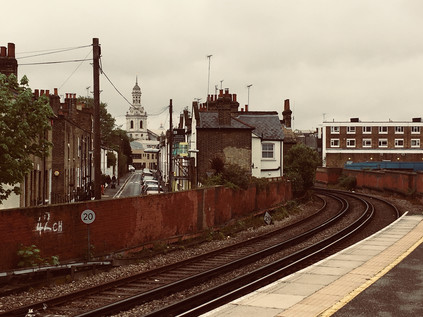
From the platforms of Greenwich station I looked back east, the curve of tracks framing the church and the tumble of buildings which fell towards the bank of the Thames. I'd found myself here twice in recent times, and realised that during my one brief stay here I'd barely done the place justice. Despite a liking for the place, I'd often skirted around Greenwich like it was an inconvenience, ignoring the history which seeped from the ground and preferring to look north, away from the park on the hill. It had taken an ancient road to bring me here, a road walked long before the Romans and one which was almost ingrained into the land by continuous use. Somewhere between the ascent of Shooter's Hill and the descent from Greenwich Park I'd made sense of the walk and found a way to begin to read the southern geography at last. I boarded a train bound for Cannon Street where London Stone should be, but currently wasn't. I was still following the most ancient of ways...
You can find a gallery of images from the walk here.
From Source to Creek: Walking the River Ravensbourne
Posted in London on Saturday 7th April 2018 at 11:04pm
Anyone who regularly tolerates these missives which emerge from wanders along dusty roads or trickling minor rivers will know how quickly I can turn a pattern of walks into an altogether grander project. As a consequence, I try consciously to vary these itineraries, scattering my trips around the edges of the city in an effort to release myself from any sense of duty. Given a project, I usually collapse under the anxiety of sticking to its rules, and I vowed somewhere on the edge of Tottenham last year that I wasn't going to let that happen again. But somehow, during my last walk, I was utterly gripped by a desire to better understand the rivers which tumble out of the hills on the south-easternmost corner of London. These rivers are familiar in name, their creeks and estuaries crossed when walking the Thames Path, but I don't know them well beyond that. I lack any great knowledge of the areas where they rise, run and combine, and something of this sense of the unknown drew me back to the edge of Kent today. I'd broken my own rules before I'd walked a single step, setting out on a grey but dry morning for Bromley South via a routine familiar from my recent trip. Like last time, I managed to swiftly acquire coffee on my route through Victoria Station and stepped onto a late-arriving train which was almost immediately due to depart again for the suburbs. Soon I was curving through Brixton and Penge, weaving through the rising uplands and watching the view shift from yellow London brick to swathes of green dotted with suburban streets. It was something of a surprise to ascend from the platform at Bromley to find myself on an unexpectedly busy high street curving and falling away to the south-east. There was little time to waste exploring though, a 320 bus bound for Biggin Hill Valley was approaching the stop. This would take me to the edge of London, and to the start of my walk...
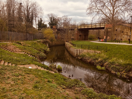
I'd never heard of Keston. This wasn't entirely surprising - it doesn't register on the rail network which is my master reference for the suburbs. It was still surprising to find a name which hasn't cropped up at all in some prior perusal of the map though, and I was curious about what I'd find out here. The bus set off south from Bromley along the A21, stopping regularly outside the pleasant villas which lined the busy arterial route out of town. Slowly, the houses dwindled on the western side of the road - Bromley Common was out there beyond the railings. I'd need to cross the common on my route back to London, and just now it felt like striking out into the unknown. It also seemed surprisingly vast from the window of the bus, with long stretches of woodland concealed by the railings and walls. After navigating the tiny knot of a village centre where the road to Croydon crossed our path we were largely out in the country. I disembarked soon after at Fishponds Road, the carriageway overhung by tall, mature trees under which blasts of traffic shuddered by, buffeting my tiny island of safety beside the Transport for London bus stop. The familiar red signpost felt distinctly odd out here - was the frequent service of near-empty double-deckers perhaps an administrative oversight? I picked my moment and carefully scuttled across the road to follow the more generous path on the other side as far as the corner where a sign indicated the entrance to Keston Common. An unmarked but well-trodden trail of crisp, yellow leaves plunged behind an abandoned block of municipal public conveniences and into the trees. I shouldered my bag and headed into the woods, grateful that the track was dry here at least. The sounds of the road were soon muffled by the foliage, and surprisingly quickly the splash of moving water replaced them entirely. A little way into the common, between the trees I saw the clouds reflected in the surface of a sizeable pond. The path wound around the outside of this pair of broad and shallow lakes, first dipping into sudden sumps of mud where the water had overtopped the bank, then climbing towards the source of the river. At the top of a short muddy clamber, in a narrow culvert, the River Ravensbourne rushed by on its journey downhill to the ponds. Up ahead a neat brick circle in a clearing was revealed, clear water bubbling busily into its centre. A father led his wellington-boot clad child stomping through the torrent, the boy squealing with delight and splashing the nascent Ravensbourne across the path. I watched this simple gleeful act of rebellion, waiting for them to return to the path to paddle through the same mud-puddles I'd encountered, before gingerly dipping a toe into the waters myself.
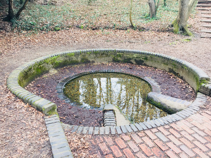
Almost all of the rivers I walk begin a little too far outside the urban boundary for me to track them to their sources and I'm often forced to pick them up from some convenient spot on their upper reaches where they intersect with the transport network. Today though was different, and there was a somewhat magical feeling about this spot known as Caesar's Well. Legend - at least as dictated by R.C.Hope in his 'Legendary Lore of the Holy Wells of England' - has it that a swooping raven directed Julius Caesar to halt his troops on their long march from their landing point in Kent to London and that here he discovered a fresh spring of healing waters. The waters became the Ravensbourne in remembrance of this fortuitous event, and the well bears the Emperor's name to this day however dubious the tale's provenance - certainly there is no record of the Roman Legions reaching this spot during Caesar's expeditions of 55-54BC. Indeed there is recent evidence that the route which the invaders took may have been further to the north, from Pegwell Bay on Thanet. This has also challenged the view that the venture was unsuccessful as Caesar left Britain with the loyalty of several Cantiaci leaders and regarded them in De Bello Gallico as the most civilised of the British tribes. To reinforce how unlikely this tale is, there is another identically named well near Wimbledon with a similar backstory but even less proximity to the invaders' trajectory. But the optimistic nomenclature is not entirely without some foundation: both of Caesar's unlikely South London watering holes occupy locations near ancient camps which were excavated in the flourishing early days of British archaeology, and the temptation to link them to the established Roman narrative would have been strong. It appears that much was inferred on the basis of legend and oral history, and in the case of the spring which lapped at my feet here on the very edge of London, it was it's proximity to the long-presumed location of Noviomagus Cantiacorum which supported the claim. The site of this bustling Roman trading town had long been sought - with speculative attempts to fix its location near Keston dating back to the 16th century. Thomas Crofton Crocker's discovery of a burial site near Keston had all but fixed the location of this much-sought-after settlement in the historical record, with the Society of Antiquaries of London convinced enough to support him in founding a dining club known as the Noviomagians in honour of his discovery. However, during the excavations prior to the construction of the abortive Ringway 3 around London in 1966, Brian Philp discovered compelling evidence of Noviomagus Cantiacorum near West Wickham. Thus there is now a far more likely location for the elusive settlement, and Keston's time in the spotlight is largely over. But Caesar's Well still bubbles with clear water, which some have been brave enough to drink. Having found the source of the River Ravensbourne though, it was time for me to set off across new territory...
Keston Common is a narrow strip of woodland, sandwiched between the widely spread arms of Keston village with the Ravensbourne forming an eastern boundary. I wasn't far from civilisation at all here, but I felt strangely isolated in the forest of bare trees. Spring hadn't reached the common yet, but the morning was warming and there was a slight haze of mist. Navigating was surprisingly tricky - when these trees were green and fulsome it would be easier to discern the pathways through the woods, but just now every gap appeared to be a potential footpath and it was necessary to follow the churned line of hoof-prints and last autumn's mulched leaf-fall to find a way through. I soon adjusted to the conditions, adopting a careful but quick trudge which allowed me to manage even the muddiest sections without slipping or sinking. A mixture of instinct and map reading kept me heading roughly north while trying wherever possible to push to the east of the common, nearer to the river's course. Occasionally, open grassy fields opened on the path and finding a suitable exit was a challenge. This was surprisingly satisfying walking - physically tougher than I'm used to out in the suburbs and mentally challenging too. The river was present but unseen - sometimes heard between the trees through an unexpected splash or the flap of a wing on water. I took a looping route, inadvertently turning back on myself to get closer to the water and crossing a minor tributary of the Ravensbourne which joined it in a deeply eroded gully, both streams still tiny but fast flowing in their natural culvert. Eventually back on route, I emerged onto the busy Croydon Road at a point where Hayes Common, Bromley Common and Keston Common met. The road disappeared into the trees in both directions, a narrow path on both sides - but just visible ahead my route continued between the trees, a narrow path heading into Padmall Wood, a more substantial tract of woodland which stretched north alongside the river. The woodland felt surprisingly wild and solitary, despite the presence of schools and impressively large homes just yards from the path. The air beneath the trees was still and beginning to get humid as the first real springlike morning of the year unfolded around the Common. I thrashed along, picking up a large stick to use as a walking aid, thrusting it into some of the muddier spots to test their viscosity and depth. In the swing of my walk now, I emerged at Barnet Wood Road, a surprisingly fast-flowing east-west rat run across the common. Thankful I didn't have to walk along this pathless channel of traffic I noted that my track was marked by seemingly pointless metal five-bar gates on each side of the road. The gates were overgrown with foliage and hadn't needed to be operated for years. Instead, the path was worn into the ground around the gates. I headed into Barnet Wood, carefully laying my large stave against the gate - I wasn't going to need that now, was I?
Barnet Wood was a little denser than the woodland I'd covered so far, extending in a narrow tongue along the course of the river while broad grassy plains opened up on the western side of the common. I decided to stick to the woods in the hope of coming upon the river again after what seemed like a long, hot walk since it last appeared. Most of the regular dog walkers and traffic clearly diverted into the open spaces here, leaving the wooded tracks less well walked and surprisingly wet and muddy - I developed a technique of anticipating these patches of deep standing water and skirting off the path via the deep mat of fallen leaves which remained dry and navigable under the trees. The persistent hazard here though was buried roots and creepers which snagged underfoot and dragged along - and it's perhaps fair to say that the large stick I'd left back at the road would have been a useful aid here. It was hard going, but the knowledge that I was closing on the river was encouraging. Then, as I was checking my direction in the anticipation that I'd soon cross paths with the elusive Ravensbourne again up ahead, I let my concentration slip. My foot snagged under a solid root anchored at each end, creating the perfect man-trap. I tumbled forward into a pile of soft leaves with a grunt of expelled breath and a very quick flush of embarrassment at my hubris. I wasn't a proper walker at all, as this entirely proved. A quick inventory of my injuries: nothing major, a scratch on the hand and a little mud on the jeans - the leaf carpet had kept me mostly clean and safe. My right big toe throbbed painfully though - driven into the end of my very solid proper walking boot and subsequently jammed hard against the branch, it had taken quite a battering. I scrambled up and tested it. I'd walk it off, like always. It hurt less when I walked in fact, and so I set off again, finally finding the busy and widening river up ahead crossing under a deeply rutted farm track. I had a choice to make here - the river ran almost equidistantly between the main road to the east, or a woodland track to the west. Following the river directly north was impossible as it disappeared into very specifically marked 'PRIVATE LAND' in Mazzard's Wood. Feeling the need to redeem my credentials after the completely unwitnessed but still somehow shameful tumble, I headed west along the track between barbed wire and electric fences. It was possible to walk in the deep, dried ruts and only encounter occasional puddles of muddy water. I skirted these carefully, often meeting the gaze of horses grazing lazily in the sunshine behind the fences. The track curved north and west, and seemed endless. Despite being alone on the path, I felt uncomfortably exposed walking this narrow strip between carefully enclosed and defended land, particularly after a long solitary trek in the woods seeing barely another soul. Finally I noted someone walking towards me up ahead and I stiffened for conflict, expecting a farmer or horseman to challenge my presence. I summoned the OS map on my 'phone, ready to defend my right to be here and desperate not to be pushed back towards the main road. In the event, the fellow-traveller nodded a brief 'good morning' and strode past me. He was no walker - dressed in white jeans with an expensive designer hoodie, a pale and pristine looking mock-fur collared parka and lots of jewellery, he seemed an unlikely character to meet on this muddy track. I was particularly amazed that he'd navigated the swampy junction I encountered a few yards ahead without incident, as I carefully picked my way along a nearly submerged plank, using the decaying and precarious uprights of a barbed-wire fence for support. Crossing slowly but safely, I turned east here to head for the Rookery Pond where the river fed a long, slender lake hidden in the woods. Now a noted Carp Fishery, this pond belonged to The Rookery, a fine house built on the fringe of the common early in the 18th century by the Chase family, and occupied from 1755 by James Norman. When Philip Norman wrote of the area in Archaeologia Cantiana in 1900, he recalled seeing the Chase Family arms above the staircase of his great-grandfather's home. The Norman family occupied The Rookery until the Second World War, when it was required for military use - finally burning down in 1946 while still in the hands of the Ministry of Defence. The land then remained open due to the newly passed Green Belt legislation until 1965, when the development of the sizeable Bromley College campus was permitted on the site. The fate of Oakley House, the other substantial nearby house on the common from the same era has been a little less dramatic, now serving as an expensive wedding venue. The Ravensbourne still marks the western boundaries of these properties, and my walk finally found it again, a fast-flowing and much larger stream now. Better yet, there was an unmapped path running alongside the river into the edge of Scrogginhall Wood - and on the basis that paths worn down by feet must go somewhere I turned north alongside the river. This was a welcome diversion - I didn't yet feel ready to head out to the busy A21 to slog into Bromley Town Centre, and this path beside the deep gully through which the river flowed was cool and quiet. My spirits lifted, I savoured this stretch of water - perhaps the last time I'd see the river outside an urban setting - even enjoying the odd experience of scrambling down a bank to splash through a stream joining the river from the west. All too soon a weed and litter choked pipe swallowed the river as it disappeared into an earth bank running along the edge of Norman Park. I crashed rather suddenly out of the bushes, a sweaty and muddy creature with a red face and wild hair, surprising dog walkers and skateboarders on the busy path nearby. Traversing the common - just a few short miles of this long walk - had felt like a trial, but was of course a less dangerous experience that in the days when Highwaymen and robbers frequently the paths and lanes hereabouts. Among the dark and often dubious tales of legend, the generally more reliable diarist John Evelyn recorded being robbed here in 1652 when assailants jumped from behind a great oak tree. It was easy to see why these strange, contested lands with their contorted paths and sudden streams blocking the way would have provided perfect cover for those who with knowledge of the ways who wanted to lose themselves. Today, for just a short time at least, I'd become one of them. But now, despite my aching toe, I was eager to continue walking.
I sat on a bench in the sunlit Church House Gardens, feeling like I was dangling my legs over a precipice onto the playground below. I'd arrived suddenly in the centre of Bromley, having trudged up the almost pristine suburbia of Hayes Road and stumbled unexpectedly on Bromley South station where my day had started just a few hours before. Suitably equipped with refreshments, I climbed the steep curve of the High Street as it led away from the valley of the Ravensbourne. I stopped briefly to admire the striking Churchill Theatre. Designed by the Borough Architect, this 1977 built block emerges from the steep wall of the valley, with lower floors being effectively underground when considered from High Street level. It felt like a building out of time, one which should probably have surfaced ten years earlier. However, it remains busy and popular, housing the main library and a range of performance spaces. It also sits in the midst of the town, pushing its sizeable concrete frontage into the flow of pedestrians scuttling between shops. Now behind me, its lower levels were reflected in a pool busy with ducks, while I gazed down into the deep gully where the Ravensbourne ran concealed beyond the margins of the park. I reflected on the changing nature of the river - from now it would mostly be snatched views from crossings and occasional bursts of foliage on littered banks. Having seen the river develop from its spring, I felt unexpectedly angry at its containment. I was surprised by Bromley though - my brief encounter with its bustling centre was unexpectedly pleasant. In trying to discover notable residents I'd noted H.G. Wells was born and educated here and expected to find a memorial of some sort, but I was disappointed to hear that the only mural had been painted out some time back. Perhaps it was his assertion that Bromley, rapidly growing towards its status as the largest London Borough during the early 20th century as a "morbid sprawl of population?" Wells later noted in a letter rejecting the Freedom of the Borough that "Bromley has not been particularly gracious to me nor I to Bromley". The list of luminaries who have lived and worked here - from Charles Darwin to David Bowie is variously celebrated throughout the town, but Wells is relegated to a blue plaque high on the wall of Primark. Few eyes drift up from the unbeatable bargains to see what it has to say about Bromley's literary son... It was tempting to linger a while longer in the warm park, especially given the dull ache which had settled into my injured foot. But time was pressing, and the walk felt somewhat longer than I'd bargained for. I set off, leaving the gardens and navigating by way of the tall Kentish Ragstone chimney of the former pumping station which towered over the low roofline of the suburbs. Nearby, at the foot of the steep slope up to town, the Ravensbourne reappeared in a deep trench surrounded by solid looking railings. I trailed it through the recreation ground which it bisected before again slipping away underground. The course though, was clear - up ahead an alleyway between the back gardens took an almost perfectly straight course alongside a raised concrete slab which concealed the waters of the Ravensbourne. In 1863, the map showed the river meandering about open fields, here - but just three decades later it had been channelled into a straight canal. Now it disappeared entirely, despite the effort to commemorate its presence in Shortlands by way of a reconstructed bridge parapet near the railway station. I leaned on the railing pondering the flowerbed below and noting that the Prime Meridian passed through this spot on its inexorable journey to the southern hemisphere. Passing motorists stared at me in a mix of curiosity and barely disguised disgust, attempting to discern what I was looking at on the other side of the structure. Perhaps it's not just H.G Wells which Bromley has chosen not to acknowledge, given the way its once proud river is mistreated by the borough just now?
Beyond Shortlands, the river resurfaces in private land. The golf course is fringed by dire warnings about trespass, so I tramped the long, straight track of the teasingly named Ravensbourne Avenue as it shadowed the railway embankment high above. At the end of the road, I pressed onward into Summerhouse Playing Fields, passing manholes with the tantalising sound of gushing water beneath them. Finally, as the swathe of green opened out ahead, the river was revealed, speedily gurgling north along the eastern edge of Beckenham Place Park. This huge park is effectively divided into two by the railway running approximately north-south, with few crossing points available. As I followed the curving course of the river, trains slowly crept between Ravensbourne and Beckenham Hill stations, pausing in the park before making their final approach. The larger, western section of the park is home to Beckenham Place, a fine manor house built on a site with a history stretching back to ownership by the Bishop of Bayeux immediately after the Norman invasion. Later, the lands appear to have been contested and divided between neighbouring manors before being united again as the estate of John Cator MP who built the current mansion. The building was inhabited by tenants for much of the 19th century, the house and land finally passing into the ownership of the London County Council, and nowadays - with boundary disputes finally settled in 1995 - the Borough of Lewisham. In the grounds the first municipal golf course in the country remains operational having served the locals since 1907. All too soon, I found myself in the north-eastern corner of the park, watching the river disappear between houses, guarded by palisade fencing. I was pushed back onto the road, and finally out onto the endless churn of the A21. Freed from the sluggish traversal of central Bromley, the traffic gained speed and thundered through the one apparently 'picturesque' hamlet of Southend. The river briefly resurfaced from its enclosed, suburban meander here, filling a sluggish, green-tinged pond which fronted a dramatically situated branch of Homebase which leaned out over the water towards an island populated with well-intentioned but odd artworks. A few brave waterfowl swam nonchalantly around the island, looking a little lost and confused. As I tried to make sense of the scene a passing drunk pushing a bike began to tell me about his shock at the sudden explosion of a recently replaced inner tube. I couldn't avoid noting his dismay, even over the relentless traffic noise. It was time to make the long march into Catford, with the river flowing just feet away between the industrial buildings of Bellingham.
Bromley Road was beginning to feel endless - a long, straight run of impressive villas giving way to parades of shops which had likely once been rather important and salubrious, but now housed decommissioned chicken takeaways and makeshift tyre and body-shops. Up ahead I could see the taller buildings of Catford approaching, not least the impressive municipal block which I'd been taken with on my walk around the South Circular. I was torn here - the river ran a little way to the west where it joined the River Pool, one of its more significant tributaries. A well-signposted 'green walk' along the Pool has been completed in recent years, which takes in the point of confluence, and it felt like an attractive idea to cut across to walk this section of river given the challenge of getting near the Ravensbourne otherwise. However, the scissor-like arrangement of railway lines which converged nearby wasn't easy to cross, and instead, I stuck with my plan to pick up the Ravensbourne again near Catford. I'd seen it on disembarking from a train here, flowing in a deep channel between the two distinct stations which sit just yards - and a few vertical feet - apart, and I was curious to encounter it again at this spot where river and rails tangled together. Beginning to feel the effects of walking in the surprisingly warm weather, I felt myself flagging as I edged around the centre of Catford and arrived at the foot of the rise where the South Circular climbs to cross the railways and the river. The road pulsed traffic from the gyratory, flowing sluggishly west towards Forest Hill - since my walk I was more aware of its tortured geography, and I was impressed that it still functioned at all under the strain. After some initial missteps I finally found the tiny roadway which snuck between the stations, passing an abandoned and decaying ground-level entrance to the elevated Catford Bridge station above, and once again crossed the Ravensbourne. The river was now a surprisingly wide and fast flowing churn of silt-brown water which emerged from under the main road and a cluster of ancient looking sewerage pipes to flow alongside the railway viaduct. Enjoying the cool and shade which the brick arches offered I headed off along the route, diverting into the recreation grounds which fringed the eastern edge of Ladywell Fields. The riverside path was busy with cyclists and dog-walkers here, the river gradually transitioning from suburb to city. Up ahead, glassy towers indicated the looming presence of Lewisham, with the ubiquitous cluster of cranes indicating the locations of ever more redevelopment. I decided to savour this part of the walk alongside the river as it passed over the railway once again by way of a spiralling bridge. I was acutely aware that there may not be much more greenery to see for a while. Across the water, the sinuous curve of the Riverside Building of University Hospital Lewisham echoed the course of the river. There is a long history of caring for the sick and unfortunate on this site, with a workhouse founded here as early as 1612. By the 19th century it was noted by The Lancet that the workhouse had essentially begun to function as a general infirmary, a role it officially gained with building on a neighbouring site in 1894. The gradual consolidation of smaller NHS units and hospitals onto the site enlarged and complicated the hospital until it was comprehensively redeveloped during the early years of this century. The hospital has struggled financially in recent years, hitting the headlines for an anticipated closure of Accident and Emergency services which resulted in protests and court injunctions. For now though, it soldiers on with its modern new buildings shimmering over the Ravensbourne, and not feeling entirely out of place.
The path rose and turned aside from the river, leaving it to head under the tangle of railway lines which converge on Lewisham. Ladywell fields had been purchased by the London County Council from the Manor in 1889, but the flooding from the Ravensbourne rendered it useless for building, leaving vacant the string of three distinct fields which make up the ragged outline of the park today. At the western edge of the park, the almost quaint buildings and covered footbridge of Ladywell station occupied the site of one of the numerous wells which gave the area its name. In 1648 a miraculous cure for a local woman's 'loathsome disease' was attributed to the waters here and the well was soon celebrated as a holy site. The site became a place of local pilgrimage with its waters offered freely to the poor and infirm: "as God hath freely bestowed His favours upon this water, so it is now dispensed gratis to any that desire it". By 1850, the well was partially covered to accommodate the coming of the railway which changed the fortunes of Ladywell considerably. Descending from the bridge into a knot of pleasant, Victorian shopfronts now occupied by delicatessens, restaurants and artisanal food stores I was struck that this was a place which was once described by a former local I was travelling with as 'a dump'. In fairness, I'd had my doubts as from the passing train it was clear that Ladywell's gentrification was well underway even then, and now the transformation appeared complete. I inadvertently shadowed a couple who were walking from café to delicatessen, gurgling infants strapped helplessly to their fronts as they meandered across the road ogling handcrafted baked goods in the store window. Inviting though Ladywell was, my business lay elsewhere and I marched steadily onward along Marsala Road and into a hinterland of fine terraced houses and oversubscribed on-street parking. This was as close as I could get to the Ravensbourne for some distance as there were few means of passing under the web of railways which flanked the western edge of Lewisham Town Centre. The cranes I had spied earlier occupied the slivers and diamonds of land between the tracks - these rough scraps of space once deemed too expensive to seriously consider as development opportunities now sprouted towers of glass and plastic cladding. I zig-zagged under railway bridges and into a development of low-rise social housing finding the river running sluggish and copper-brown at the end of the street. The regeneration had spread south along the river here to form Cornmill Gardens. This was a unusually well-used open space, part of the Rensaissance SE13 project which had seen the tired but diverse and busy Sundermead Estate unceremoniously demolished to make way for new towers of housing. The river trickled between remediated and carefully sloped green banks, a far cry from the mill stream which would have thundered through this site in times gone by. I picked my way around carefully designed benches - comfortable to perch on, but useless for a prolonged rest - and dodged wandering students with their eyes locked onto their 'phone screens. I realised that while the area felt busy with passing people, it was a purposeless zone. The locals had been tempted out by the first genuine springlike afternoon of the year, but there was little out here in the way of spectacle. Lewisham's real business took place away to the east in its complicated palimpsest of a shopping centre - built and overbuilt to suit the needs of the growing town. People here flitted aimlessly around the atrium of the new Glass Mill Leisure Centre with its Tetris-like curved flank dazzling drivers on the A20. I took a wrong turn here, accidentally heading for the station while trying to navigate by railway and river in a landscape in flux which wasn't yet fully fixed on the ground. After retracing my steps onto Loampit Vale, hemmed in between new towers and older retail parks, I was glad to turn aside leaving the centre of Lewisham and passing under the railway and into the suburbs once again. Near Elverson Road DLR station I found myself on more familiar inner-London territory: decaying but proud terraces being left until the value of their footprint increased, flytipping and out-of-date advertising campaigns on billboards. It was a welcome relief after the forced pace and painted-on smiles of Rennaisance SE13. My feet hurt - especially the one I'd damaged back on Bromley Common - and I began to wonder about successfully making it to the end of my journey. However, I was able to find the river again in Brookmill Park which provided something of an impetus. This long, slender green space slinks alongside the concrete culvert which carries the Ravensbourne, culminating in a formal garden at the rear of the Stephen Lawrence Centre. Here, a trust named for Stephen - the victim of a brutal racially motivated murder in Eltham during 1993, provides opportunities for young people. It shouldn't be a shock to see his name attached to something so absolutely positive given the efforts of his family to find justice and progress over the past twenty-five years. Even so, it was good to see it mentioned aside from the depressingly familiar context of the terrible corruption which likely still afflicts South London policing, and the racism and violence of the drug trade steered by Kentish gangsters. A name becomes a 'case' or a 'scandal' all too easily and as a result is much too easy to pass over without considering the humanity. But in this little corner near the river and the park new enterprises and young local entrepreneurs are afforded space and support from the Trust, and it felt after all that perhaps this untimely, violent death - one of too many in London's suburbs - had resulted in something positive occurring?
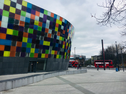
The Ravensbourne buckled and writhed to pass under Deptford Bridge, with the DLR viaduct sloping into the frame and closely shadowing its curves as it transitioned to become tidal Deptford Creek. The incoming tide obscured the wide expanses of muddy embankment shoring up the concrete flood barriers which enclosed the river. I crossed Deptford High Street, looking west along a range of proud facades which had once been a fine street of shops but were now largely shuttered against the relentless London-bound traffic. This was the disputed continuation of Watling Street towards the city, the true route lost under the layers of urban development, but not to the imagination it seems. I didn't linger at this rather gloomy spot, heading instead into the quiet industrial backstreet of Creekside. The river was implicit here, its course could be inferred behind yards and buildings largely via the flashes of foliage or ironwork glimpsed through gateways and between fences. The low warehouses which fringed the western edge of the street overlooked the former wharves which had lined the tidal creek, and I felt suddenly much more comfortable. This kind of interstitial zone between river and industry felt benign and familiar, and despite my growing physical discomfort I stepped up the pace, keen now to make it to the end of the Creek if possible. As I walked I considered Deptford - once a notable place in its own right, now largely an erasure between Greenwich and London. Deptford was the location of a royal dockyard opened by Henry VIII in 1513, was home for a time to John Evelyn and saw the tragic end of Christopher Marlowe - in short, a veritable Tudor-era soap opera of a location. But the recent history here is wholly of decline and obsolescence. The maritime heritage business is saturated by nearby Greenwich and the former Navy Victualling Yard can't compete with a remediated tall ship and a pop-up food market for glamour and Instagram potential. Deptford slumbered, the industrial units silent on a weekend afternoon. At the end of Creekside I took a shortcut through the misnamed Greenwich Creekside development - a jagged insertion of homes and businesses which was not yet fully operational - and not really in Greenwich. The silence between the slivers of glass and steel was interrupted only by the flapping of builders' tarpaulins and the slow grind of metal on concrete as the wind shifted the decaying gates of the only remaining warehouse on the edge of the creek. The quiet was oppressive, accompanied by a sense that permission was required to be here. I wasn't sorry to emerge on Creek Road where the Ravensbourne has been bridged since 1804. Before that time, it's likely that travellers faced a tricky crossing of the 'deep ford' which named the growing settlement, and there are speculative suggestions that a causeway is buried under the sucking mud of the banks for this purpose. Now the Creek is a boundary - both between the Boroughs of Lewisham and Greenwich and between quiet hinterland and tourist mecca. But beside the bridge, on the Greenwich bank, are reminders of the Ravensbourne's role in the development of the city. To the south, a single crane serves the last remaining on the creek, Brewer's Wharf. Operated by the Prior family since 1870, the wharf still receives aggregate deliveries from Essex for concrete production - relieving the choked roads of South London of at least a few heavy vehicles. To the north, a repurposed dock inlet hosts the banal development of New Capital Quay, which manages to look even more unreal at close quarters than the computer generated images which advertise apartments and a recently opened Waitrose. However, the ranks of identikit blocks are almost without value thanks to the discovery that they are clad in the same unsuitable material which exacerbated and expedited the spread of fire at Grenfell Tower. They stand in limbo, sold but now unsaleable - unable to undertake their role in the chain of capital and useless to those who bought them as rungs on the investment ladder. But for many, they are still home - and what a strange, liminal existence it must be. The blocks are under 24-hour guard, their future to be determined not by architects or planners, but by lawyers who argue the responsibility of mitigating the risk. Standing at the centre of the bridge over muddy Deptford Creek, looking up at the dull and somewhat benign looking buildings, it's hard to imagine an easier place to sell: Thames views, on the fringe of Historic Greenwich, near the DLR... Will the tenacious Brewers Wharf or these blighted blocks survive longest?
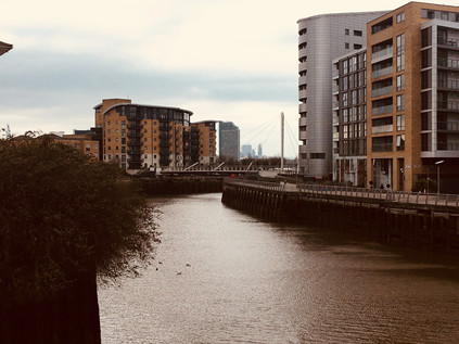
I padded slowly along Creek Road which gradually descended into the churn and haze of Greenwich, imagining this now quiet street lined with spectators for the London Marathon in just a few days time. Up ahead, the cluster of buildings around St. Alphege's Church shone in the unexpected late-afternoon sunshine and the ancient pattern of streets seethed with tourists. There are many points in London where transitions are made - where it is very clear that one has walked into a different zone - but few were as jarringly obvious as this one. Modern shopfronts lined the last stretch of the street as I headed for the mass of people pushing through the narrow thoroughfares of this old town. They walked, heads down, pursuing the next pre-determined point of interest and were never likely to detour towards the sluggish mouth of the Ravensbourne which ended its journey just a few yards away. I was briefly caught up in the throng, trying to find my way to the entrance of the DLR station - even that was carefully named to convince the tourists they were in the right spot: Cutty Sark for Maritime Greenwich. Missing the entrance due to the crush of bodies attempting to exit, I completed a full circuit of the busy corner glimpsing the tide of people heading for the old marooned tea clipper in its dry-dock and leading away towards the fine buildings of the Naval College. Greenwich on a sunny afternoon had its attractions, but the shuffling, jostling and impatient tourists definitely weren't part of the package. Finally finding a way into the station I descended to the platform via the stairs, cool concrete in never-ending flights which folded back on themselves relentlessly. Soon the driverless train arrived to whisk me under the Thames and into more familiar territory. Surfacing on Bow Road, the gritty and fume-filled chasm which has launched or ended so many of my ventures, it felt impossibly distant from leafy Keston, the bubbling well in the woods, and from my clumsy thrashing through Bromley Common. It had been a day marked by sudden shifts and curious comparisons. My damaged toe pulsed uncomfortably in my boot, reminding me that these tiny but revelatory excursions came at a price.
You can find a gallery of images from the walk here.
As my train lumbered across the junction and into the terminus platforms at Orpington station, I pondered the journey here. I should have been here a week ago, a long-planned and much anticipated weekend trip which combined a range of events and - for me at least - culminated in a long day of walking. Then it snowed - quite a bit in fact. Perhaps the most significant period of snow for eight years - and it was hard not to reflect back on that last period: a long, dark week of slithering to the station along ice-slick pavements and worrying about how I'd escape at the weekend. This time around, the weather reports and growing panic in the media had sparked my remembered anxieties again and I'd suffered through a week of doubt and concern - by turns feeling stupidly angry and utterly and childishly selfish. When the day came, we made a supreme effort to get to London - which it seems was by then recovering from its deluge - but the mixture of rather poorer local conditions and a train operator which is always keen to find an excuse to reduce or remove services left us stranded. We returned home for an extended weekend of staying indoors and watching the locals descend into feral, panic-buying lunacy. I filled my time with persistent bickering with customer service teams in a - mostly successful - attempt to gain refunds on our lost trip. We regrouped and replanned - there was no reason we couldn't try for next week... And so I found myself once again at the edge of London - this time in the far, largely uncharted south-eastern quadrant. The city felt distant and remote - this corner of London was almost squeezed out of the boundary, a hazy margin where bus routes terminate and Oyster zones evaporate.
Outside the station, all was quiet. I had to remind myself that it was Sunday morning and also somewhat earlier than I'd normally be setting out. A cab driver quietly smoked beside his car, eyeing me expectantly as I left the station and turning away in disgust as I shouldered my bag and set off down the hill to the main road below. Despite the long genesis of this walk, my planning had been minimal - and had mostly focused on the later part of the route as the River Cray navigated broad open spaces on the edge of London. This, though, was just how I'd expected these commuter-fringes of the city to feel - sleepy, safe and strangely calming. As I turned north at a roundabout which encircled a war memorial obelisk, I began a long trudge up the broad and surprisingly substantial High Street. Most of the stores were still behind their protective shutters, but the tiny branch of Starbucks was preparing to open. I half contemplated lingering until I'd had more coffee - but I decided against it. It was a rare pleasure to have an entire day free for walking like this, and there would be time later for refreshments. So I passed by the inexplicably named 'Walnuts Shopping Centre' and progressed along the long, low stretch of mostly twentieth-century shops towards the northern edge of town. Orpington is easily imagined as a creation of the heady days of the last century - and indeed for a while in the 1960s 'Orpington Man' was the yardstick for the normal, suburban lower-middle classes who elected Liberal MP Eric Lubbock in a shock revival for the ailing party. However the town has a much longer and deeper history, first entering the record in 1038 when Eadsy, chaplain to King Cnut, gifted his estate here as a priory attached to Canterbury. Turning into a side-street which unexpectedly became a rural lane between weatherboarded cottages, I entered Priory Gardens via a side-gate. This unlikely mix of public park and formal gardens was added to the grounds of the largely still extant priory buildings by their last owners, Cecil and Lilian Hughes, before the site transferred to the ownership of Orpington Urban District Council in 1947. I took a slow circuit around the greenery, finally finding myself beside a broad and shallow pond with a stony bed visible beneath its clear waters. Here, where the clay of the Thames basin meets the wide swathe of chalk which stretches south-east to Dover, rainwater reaches the surface and the River Cray rises...
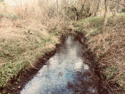
Once I'd located the source of the river I was keen to begin walking its route - however the London Borough of Bromley had other ideas. I'd noted a gang of workmen idly waiting for the clock to tick past 9am when presumably it becomes decent to raise a racket on the sabbath, but hadn't reckoned on their barriers blocking a small wooden bridge crossing the pond. I doubled back and circled the eastern bank while tame wildfowl clucked and fluttered around the edge, expecting food from any passing human. I finally regained my route at the end of the High Street where with traffic avoiding the notoriously sluggish section of the M25 scurried by on the A224. I crossed at the lights, cars screeching unwillingly to a halt at the signal, and headed north along the optimistically well-named Cray Avenue. I hadn't reckoned on much road walking today, and I wasn't sorry when at the end of a blue fence adorned with 'Jewson' signs, a gap in the hedge gave way onto a muddy path between three wooden stakes. I squelched between them, slithering along rather carefully, ready to retreat if needed until an emerging dog walker proved beyond doubt that there was a means of passing through. A muddy but reasonably firm path emerged and I plunged into the trees, emerging near a low brick wall around the head of a culvert. The Cray tumbled over a sluice and curved through the grassy strip beside the road. Faced with a choice between a more formal path and the continuation of the muddy riverside route, I took the later and splashed happily along beside the narrow but busy stream before emerging at a gate on Kent Road. Across the street the better surfaced path continued beside a low railing over the Cray, and I headed back under the trees towards the hard-to-pin-down village of St. Mary Cray. Until the coming of the railway, this village had been the heart a collection of small communities - The Crays - providing their market and mother church among other things. When it arrived, the railway crossed the valley via a nine-arched brick viaduct which swept it over the High Street of St. Mary Cray on its route out into Kent. This structure meant the station was constructed to the west of the village, to solid ground nearer to the curiously named environs of Poverest - a corrupted attempt to honour Margaret de Pouery, a landowner here in 14th century. Thus the modern village struggles to settle on a single centre. Near the viaduct a pleasant village green with a quaint wooden sign is surrounded by ancient shops largely now converted into dwellings, while the broad valley floor between the river and the A224 is filled with commercial and industrial premises including the carbon-copy units of the Nugent Retail Park. Even the vast Allied Bakeries site emitted no aromatic evidence of its craft this sleepy morning, while disgruntled punters struggled to leave the Mary Rose - a 16th century coaching inn turned motel which has frankly terrifying reviews online. The river emerged in a narrow channel beside the High Street as it passed under the high brick arches of the viaduct. A brace of guests wrestled their wheeled suitcases along the narrow walkway between the river and the rather gloomy looking extension of the hotel. Their faces betrayed a mixture of relief and disappointment. This is where London washes up against Kent - not far beyond the edge of St. Mary Cray there are open fields which stretch out to the nearby M25. Drained of life by the motorway, the commuter railway, the irresistible draw of Bluewater and the local retail sheds, this place feels dogged and depressing and quite different from the way I imagined it when scudding overhead on the rails. I decide to treat the viaduct as a point of transition and head north into what I hope will be less unnerving territory.
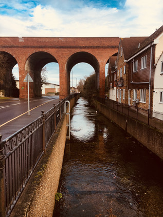
After passing the squat but solid church of St. Mary which was has been variously extended since the 13th century, I set off along Main Road - a long stretch of small millworkers' cottages mixed with more recent social housing, which led to a green space where the river broadened into a former millpond. The main course of the river and a sizeable part of the pond was tucked behind the back gardens of Main Road, but a bridge led over the river and ran alongside a busily burbling flood relief channel cut through the gardens on the course of a former millrace, to a tumbling sluice. The Cray disappeared under the road here, and into the former site of Nash's Paper Mill. Much of this site is now the rather anonymous Crayfields Business Park, but on a whitewashed wall a war memorial records those employees of the company who fought in the First World War, six of whom did not return. Poignantly enough, a much younger W.Nash is featured in the list. The mill survived to see a unique diary kept and published in a short history of the site, recording the efforts papermakers went to in order to ensure a supply during the bombardment of South East England in the Second World War. On the night of 2nd August 1944, the author casually records:
Papermaking under shell fire, but we kept going. Complaints about quality are receiving scant courtesy. People outside the south-east area have no conception of what we are undergoing.Extract from 'William Nash of St. Paul's Cray, Papermakers' - W.S Shears, 1950
The mill appears to have struggled on until around 1980, as Nash focused its operations on other equally venerable sites in Hertfordshire and Kent which subsequently closed too. Now the family business continues largely as a property company, the land around the river which drove the mills now their stock in trade. It was hard to conceive of vast quantities of fine paper, some destined for banknote manufacture leaving this quiet corner near the weatherboarded Bull Inn for well over two centuries.
At Pauls Cross, near The Bull I crossed Sandy Lane and began to head north and out into the countryside. The Cray ran below in inaccessible privately-owned meadows, the map showing tantalisingly broad lakes and grassy scrub which would have made for muddy but interesting walking. Instead I began a long, slow climb alongside a country lane which thundered with surprisingly fast traffic. Eventually, the narrow footpath rose away from the roadside and disappeared into a long, damp tunnel beneath the trees. The road could occasionally be glimpsed below, cars flashing by - slowing for the infrequent speed humps before accelerating crazily away again. The path was silent and empty, and I began to doubt this was a sensible way forward - a fear confirmed when I reached the Bannatyne Health Club driveway and the path disappeared entirely. Looking ahead, the road curved to pass under the A20 with little hint of a pathway reappearing. The traffic swished by my elbow, freed of speed controls and taking full advantage of this rural rat-run between the communities on the edge of London. A public footpath struck out towards Ruxley Wood, but that would take me much further east than I wanted to head. Reluctantly and rather dejectedly I retraced my steps to The Bull and crossed the river once again near the site of Nash Mill. I soon found myself back on the busy A224 at Sevenoaks Way - a broad arterial route built in the mid 1920s to bypass Orpington and the Crays. At Crittall's Corner it met the A20 at a bleak and busy roundabout. A damp underpass curled under the road, tiled with childlike images of the traffic above, emerging in the centre of the roundabout with the major road passing unnervingly close by overhead - apparently on a budget-saving flyover that wasn't built an inch higher than it needed to be. In the north-west nook of this junction, now occupied by a sizeable branch of B&Q, was the former Crittall Window factory. This southern outpost of a company more associated with Essex than Kent produced the simple but enduringly appreciated steel windows which graced many inter-war housing schemes and Art Deco masterpieces alike. The company enjoyed remarkable success in the USA too, and it felt cruelly ironic that this factory had disappeared as Coca Cola's European centre of operations arose across the street. It was here that the ill-fated Dasani mineral water was produced - essentially Sidcup tap-water treated with minerals to add 'healthy' properties. A little over a month after its February 2004 launch, the water was withdrawn when it was discovered that the mineralisation process produced harmful levels of Bromates in the otherwise completely safe-to-drink tap water.
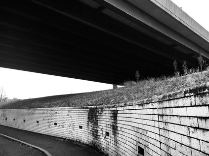
The sprawling site which opened in 1961 was decked out in the company's distinctive red and white livery and stretched east to the Cray, preventing access to the riverbank. Instead I walked the road towards the crossroads at the heart of Foots Cray, now an outpost of Sidcup - effectively a suburb of a suburb. Named for the local Saxon landowner Godwin Fot rather than any bodily appendage, until the early years of the twentieth century roles here were reversed with Foots Cray the dominant settlement in the area and the seat of the Urban District Council. A mix of industrial decline and improved transport into London propelled the comparatively lowly Sidcup into the spotlight, taking the municipal honours formally from 1921. Despite this, Sidcup suffers a troubled time in the spotlight - the butt of jibes at suburbia and the inevitable origin of the mythical '08:40 train' which every hapless middle-class stereotype needs to catch. By 2015, the ever-dull James Corden was discussing this 'armpit of England' on his US chat show. In truth, the sliver of Sidcup through which I passed was surprising busy and interesting, and as I crossed into Rectory Lane and passed the tiny War Memorial, things became near-idyllic. The lane narrowed towards overhanging trees, only the imposing tower of a Victorian school building standing above them. Established originally by Benjamin Harenc Esq. in 1816, these remaining and much improved buildings date from 1883 with the pyramid-topped tower proclaiming in an inscription 'While ye have light believe in the light that ye may be the children of light'. Harenc was the son of a recently-arrived Huguenot who swiftly made good being appointed High Sheriff of Kent in 1777. Dwelling at nearby Foots Cray Place, a fine house built by Bouchier Cleve, the Harenc family appear to have remained connected to the area until the house was sold in 1822 by Benjamin who sought a permanent home near Sevenoaks. Sadly, he soon became unwell and died as a result of the great excitement and anxiety he experienced in personally overseeing a new endeavour linking Kent to Ireland and the USA via steamship according to his obituary in The Gentlemans' Magazine. Foots Cray Place burned down during restoration work in October 1949, but the vast grounds of the house now form part of Foots Cray Meadow, which I soon encountered via a gap in the low wooden fence and a damp, muddy path trodden into the grass which led around the back of the Church. I slithered and slipped along, wondering if this was a wise choice of route - but then, after a particular muddy trough in the path, a low bridge appeared crossing the River Cray. I was back on track at last.
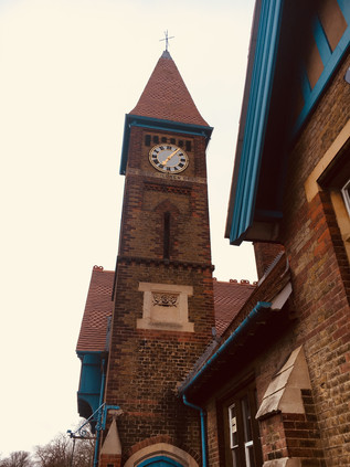
It seems that on a dry, cold morning when people have been a little stir-crazy indoors because of a week of poor weather, Foots Cray Meadow is a popular excursion. Especially so it seems for dog walkers, who stalked the muddy paths in clumps with their excitable hounds capering around them. As I slithered around one group, blocking the entire serviceable width of the pathway, I noted their dogs tussling and fighting in the river as they looked on, mute and apparently disinterested. It was a bizarre scene - a total abdication of responsibility for their pets which almost felt like an organised dogfight. I trudged on beside the reedy banks of the river as it swelled into a sinuous pond dividing the huge expanse of green space, an area that was once a mix of open land and formal garden belonging to Foots Cray Place and the neighbouring estate at North Cray. At the midst of the lake, the almost too picture-perfect Five Arch Bridge arced gracefully across the water - the centrepiece of the work which Thomas Coventry commissioned from Capability Brown. The works, completed around 1780, included taming the Cray into the serpentine lake and weir seen today along with strategic planting to create attractive walks and carriage drives around the estate. While this reshaping of the meadows seems a fairly unimpressive task today, the effort and ingenuity required to undertake this in the late 18th century - and indeed purely for cosmetic rather than commercial purposes - remains somewhat remarkable. It is perhaps even more remarkable still that this spacious sweep of green space remains on the edge of Bexley within the desirable commuter nexus of the M25 and just a short walk from a railway station. The suburbs had gradually enclosed Foots Cray Meadow, but not yet encroached upon it. After passing the Five Arch Bridge with its cargo of dog-walkers and visitors the paths multiplied, and following a frustrating altercation with yet another dog and its owner, I elected to take the less-trodden and largely canine-free walk along the water's edge. The river was wider and faster here, still flowing clear over the chalk and stone bed which had first surfaced back in Orpington. Near Water Lane, my path edged along a fenced sports grounds behind the impressive Loring Hall. This fine house was originally known as Woollet Hall, and was built in 1760 to replace a Tudor house known as 'Wallets'. Woollet Hall was for over a decade home to Robert Stewart, Lord Castlereagh who as Foreign Secretary, masterminded the diplomatic and financial alliances which led to the defeat of Napoléon Bonaparte at Waterloo. In later years, as Leader of the House of Commons his frequent need to defend the actions of Lord Liverpool's unpopular cabinet weighed heavily on him - particularly after the Peterloo Massacre and the passing of the Six Acts designed to repress future disturbances and ultimately to prevent a British revolution of the type which had occurred in France and the USA. The mood of the public was echoed, perhaps cruelly, in poetry:
I met Murder on the way -
He had a mask like Castlereagh -
Very smooth he looked, yet grim;
Seven bloodhounds followed him
All were fat; and well they might
Be in admirable plight,
For one by one, and two by two,
He tossed them human hearts to chew
Which from his wide cloak he drew.The Masque of Anarchy - Percy Bysshe Shelley, 1819
Torn between the need to remain in the Cabinet to advance his diplomatic causes and his growing distaste for parliamentary business, Castlereagh confined himself to Loring House in a state of increasing paranoia and mental disturbance. By August 1822 when visiting King George IV he was clearly disturbed and in turmoil, utterly convinced he was to be blackmailed as a homosexual. Finally, on 12th August while left alone for just a few minutes, Castlereagh cut his throat with a small knife he had concealed from concerned servants. Even in death he proved a controversial figure - with speculation by William Cobbett's Radicals that the elitist government had arranged a cover-up to ensure a grand public funeral and burial at Westminster Abbey despite Castlereagh's ignominious end at his own hand. The Radical press too, whipped up sentiment against him in scenes which would not seem out of place today, advocating attendance at his funeral to cheer and exalt his passing. The final insult was committed again in poetry which rather eerily echoes the Twitter threads of our own time:
Posterity will ne'er survey
A nobler grave than this:
Here lie the bones of Castlereagh:
Stop, traveller, and piss.Epigram - Lord Byron, 1822
It was difficult not to think of the desperate and paranoid Castlereagh as I trudged across the windswept plain which separated North Cray from Old Bexley, his home now settled as a private school for children with a learning disability after several similar uses in recent years. The riverbank was again off-limits and I was diverted across a bridge and into a forlorn spot where the tidy inter-war housing estate ran aground in a scrappy concrete hardstanding used primarily for fly-tipping. An unlikely looking footpath was signposted along the edge of a tilled field which seemed to be growing only a crop of large, fizzing electricity pylons. I trudged on, figuring that as this still formed part of the 'London LOOP' it must, surely, go somewhere... At the end of the field, a brief scramble onto a wide, grassy plateau revealed a view west across to Bexley and east to the high ground of Joyden's Wood on the other side of the Cray Valley. The sun had struggled briefly above the clouds and it was surprisingly warm despite the strong winds. I stomped onward, through the swaying yellow grass and down a somewhat slippery approach to a private road serving Bexley cricket ground. The gateposts fulminated with prohibitions and cautions, clearly barely tolerating walkers descending from the muddy path. Suddenly, and with something of a shock, civilisation surrounded me again. The footpath ran alongside the railway embankment, turned to pass under the station platforms via a narrow brick arch and arrived suddenly in the midst of Old Bexley. Announcements of trains to London echoed overhead as I tried to adjust to entering this rather self-consciously gentrified village. This corner of Bexley gained the 'Old' part of its name in the 19th century as the new town of Bexleyheath was developed to eventually somewhat overshadow this little Kentish stronghold. The draw of the latter settlement's improved town centre also rendered much of Old Bexley's High Street rather cramped, old fashioned and unwanted, but it appears that a revitalisation has occurred with the street now lined with bars, cafes and boutiques which gave it the air of a theme park or shopping village. At the junction of the roads to London and Dartford, still a busy roundabout today, fingerpost signs high on a building pointed back up the valley to 'The Crays'. I followed the road to Dartford instead, passing an impressive run of former almshouses and the old National School on route to the intriguingly named 'Black Prince' junction where the six wide lanes of the formidably improved A2 crossed my path. Named for a local legend that Edward, The Black Prince haunted the area, the name developed from the presence of a nearby hotel and inn on the route to London. This mock Tudor building, a famous music venue in the 1960s, was now a rather tired looking Holiday Inn occupying a wing of the swirling road junction which now shared its name.
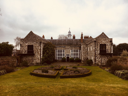
The Cray passed to the east here, running through the grounds of the improbably located Hall Place, a Tudor house nestled into a nook of the poorly designed road junction which send a bridge curving over the road between two tight, complicated roundabouts. Built in 1972 when the A2 was widened, this scheme dated from a time when concerns about the surrounding of a treasured historical site would have been less than paramount. Still less important was the tiny River Shuttle, a tributary of the Cray which had tumbled merrily from the higher ground of Bexleyheath before being unceremoniously dumped into a concrete channel under the road to finally reach its confluence with the Cray nearby. A junior football tournament was just finishing and I trailed over the bridge in the company of fathers counselling their young protégés on their performance while the mud was still wet on their boots. The striking contrast of Hall Place when it came into view was spellbinding - this house, built in 1537 by Sir John Champneys, Lord Mayor of the City of London seems an almost impossible survival. Much extended in the 16th and 19th centuries, the great hall looks west across the road while the later additions stand guard over impeccable formal gardens and celebrated topiary first planted in 1953 to celebrate the Coronation. Champneys was a son of Chew Magna in Somerset who lost his sight in later life, an event reported by London's chronicler John Stow as divine retribution for building a high brick tower onto his city home in Mincing Lane - as Stow's immortal quill put it "the first that I ever heard of in any private man's house, to overlook his neighbours in this city." During the Second World War, Hall Place became 'Santa Fe', a US Signal Corps station which intercepted coded Luftwaffe morse messages for decoding by the Enigma project. Following a spell as the headquarters of Bexley's library and museums service, Hall Place is now a thriving visitor attraction complete with shop and riverside café. The gardens certainly appeared busy, but it was hard to tell if the traffic into the site was heading here or for the carvery on offer at the Miller & Carter pub next door. I snapped a photograph of the front of the Great Hall, looking out onto what must once have been a far less urban aspect, noting the place for a possible future visit. For now though, I left the Sunday crowds to their roast lunches and football tournaments and struck out along the road to Crayford. The road followed the course of the river, which ran just out of sight beyond the carparks and sports fields - but I knew I'd soon be back alongside it.
Like many suburban satellites of London, Crayford was announced by the shining roofline of a retail park. A vast Sainsbury's store - once the largest in the UK - was the anchor for a sprawling development which dwarfed the Greyhound Stadium nearby. Once the dogs would have been the biggest draw in town, but now the supermarket pulled in the punters. Similar locations remain scattered across London - the sites of former stadia now given over to retail or housing developments. At Harringay, at Brent Cross and Clapton little remains except token nods to the long history of working class entertainment: speedway and greyhounds. Hives of night-time activity now reserved for late-night shopping or quiet suburban dwelling behind drawn curtains. Crayford's story at least, has a different outcome: when the site was redeveloped in the 1980s, the track remained central to Ladbroke's plans. Now hidden behind the fading red and grey facade it shares with the neighbouring Leisure Centre and which keeps it clearly anchored in its period, it still features regular races with restaurants and hospitality suites for the spectators. Crossing the reedy course of the river in a deep culvert, I entered the supermarket café in the hope that I'd find somewhere to recharge my 'phone and to get refreshments - I realised that I'd been steadily walking for hours now with no real break, and it was time to rest. I drew a blank in the massive store and headed instead for a coffee concession inside a branch of Next on the nearby Tower Retail Park. It's clear that Crayford has lost much of its centre to these vast ranks of stores and their associated car parks. As I sipped a cup in an ear-splittingly noisy branch of Costa Coffee tucked into the corner of the store I tried to imagine this as an industrial zone - the home of Hiram Maxim's factory which produced self-loading machine guns, supported by capital from Edward Vickers. Later, a complex merger which still sets legal precedent saw Maxim's operation take ownership of Nordenfeldt at nearby Erith, before itself being bought out wholly by Vickers, creating an enterprise which thrived during the Boer War supplying armaments to the British forces. The company endured lean times during peace, but a surge of War Ministry orders in 1914 ensured the factory's survival and the building of the nearby housing estate of Barnes Cray to cater for an expanding workforce. While the factory found many peacetime uses including manufacturing bottle-making plant, accounting machines and cars, its fortunes boomed during wartime, seeing considerable expansion in both 1939 and 1950 during the Korean War. By the early 1970s, with Ministry of Defence contracts largely drying up in the squeeze on public spending, the factory entered a terminal decline. By 1985, the small remaining plant was closed though some buildings lingered until 1998 when the site was cleared to become Next, KFC and Hobbycraft in due course. Crayford struggles on without this major employer, a town without a centre.
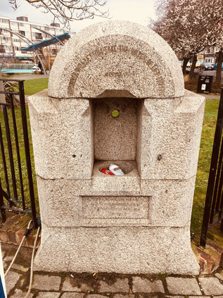
Leaving the coffee shop I realised that London Road was the route of Watling Street , the long straight road from Dover to London, and thence to Wales. The venerable route crossed the Cray near a little green between rows of local shops, empty benches lining its winding route. At the edge of the green a drinking fountain was inscribed 'Whosoever will let him take the water of life freely' and rather poignantly its now defunct-basin had been filled with empty Coca Cola and Stella Artois cans. I set off alongside the river, glad to be close by its banks again. The footpath here was better marked, and as I ventured onto a tree-lined pathway which left the road a large iron obelisk announced the Cray Riverway which shared the route of the London LOOP once again. Under the trees I was sheltered from the surprisingly strong wind which scoured the flat marshlands stretching toward the Thames, and I had a peaceful and pleasant walk between the backs of suburban homes and the water which still ran clear despite being heavily fly-tipped. I was briefly forced to detour into the streets of Barnes Cray, filled with sleepy Sunday afternoon dinner smells, before returning to the river as it ran through the scrubby marshlands hemmed in by the nearby Stanham River which formed the border of Kent. The river was suddenly a brackish, tidal brown - flowing sluggishly in a wider channel through the flat, empty landscape. A tell-tale waft of decay indicated the presence of the West Kent Main Sewer, taking a direct route towards Longreach Sewage Works on the Thames. The air was tainted with industry, a tang of metal and saltwater on the tongue as I navigated my way across the A206 where the Cray flowed beneath a low modern bridge. The brown water almost touched the parapet as it churned under the road, and I made a slight detour north to reach the west bank of the river's estuary. I soon found myself on a narrow, dusty and litter strewn lane which ran between a desolate, recently cleared site and a huge transport yard. The lane was quiet today, but I could imagine just how tight clearances would be on weekdays when the trucks thundered towards the waste disposal site up ahead. The railway from Dartford passed over a low brick bridge where a narrow carriageway had been lowered to allow taller vehicles to pass. In the recent rain and snow this had become a dirty sump of water which an unexpected passing car splashed into, almost grounding the low underside of the vehicle as it accelerated out of the filthy soup and sped back towards Crayford. I edged under the bridge on the elevated pavements, thankful that I didn't need to wade through the muck below. On the other side of the bridge, seagulls wheeled and cried as they flocked to the rich pickings of the waste disposal site. The sweet and cloying smell of rotting waste mixed with a strange reek of burning, and I noticed a somewhat professional looking camera operator framing the clouds of birds as they dispersed and reformed on the buildings and fences of the site. He politely let me pass, perhaps used to walkers interrupting his vigil - this was after all, somewhat surprisingly, still part of the sanctioned footpath circling London. The path turned a sudden corner between high concrete fences, twisting north again and climbing. The wind hit me at the top of the rise. Unexpectedly I found the view opened before me - smudges of clouds in a grey-brown sky echoing the wind-blasted grass and mud of Crayford Creek. The river was a sickly trickle at the foot of a deep, scoured channel. In the middle-distance, the Dartford Crossing arced over the Thames, beside it the towers of Littlebrook Power Station. On the opposite bank, a teenager throttled the engine of a scrambling bike to impress his bored girlfriend who stood by, idling flicking at a 'phone screen. The noise of the engine carried across the marshes, flat and empty - and seemingly endless. I drew the zip of my coat up to my chin to beat the cold wind, and set off along the final stretches of the River Cray. A little way ahead it flowed into the Darent at Dartford Creek, the two muddy channels combining in the midst of the marshes. The path was narrow but well-walked and had been scoured dry by the salt-laden winds. I fixed my eyes on the Dartford Creek Flood Barrier, and started walking.
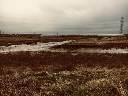
This lonely, windswept stretch of the Thames foreshore appeared entirely deserted now, but it had a long history of human use. The crack of gunshots marked the Dartford Clay Shooting club on the Kent bank of the creek, mocking the absence of the former Wells Fireworks factory which inhabited this spot from 1837 until driven out by cheap imported fireworks in the 1970s. The site had returned to nature, a scattering of decaying huts barely visible now indicating a works which had once created displays for Coronations, Jubilees and the Olympic Games. Beyond the factory was another absence - the site of a sprawling complex of hospitals which had been built out here, away from civilisation - and away from the opposition of local people who feared smallpox patients being treated near their homes. Land at Gore Farm in Dartford had been used for a camp for infectious patients since the 1890s, but the association with this site beside the Thames began with The Long Reach Hospital in 1901, hastily erected in temporary buildings by the Metropolitan Board of Asylums to deal with an especially virulent smallpox epidemic which was overwhelming the three hospital ships moored alongside the site, Atlas, Castalia and Endymion. A tramway was built out to the river, with patients arriving by river ambulance and being conveyed to the hospital by second-hand tramcars. Nearby, the much larger permanent Joyce Green Isolation Hospital was under construction in an effort to replace the ageing ships, but was not yet ready for use by patients. The Long Reach was soon struggling for space, and a further temporary site, The Orchard, opened in 1902. Finally in 1903, Joyce Green opened just as the epidemic of smallpox declined. The Orchard saw further use as a military hospital and convalescent home for Australian troops between 1914 and 1919 before being destroyed by incendiary bombs during the Second World War. The Long Reach meanwhile was rebuilt with more permanent facilities and maintained ready for future epidemics of smallpox, seeing a flurry of activity in the early 1930s and treating its final patients as late as 1973. Joyce Green Hospital survived much longer, admitting patients with a range of infectious diseases requiring isolation and housing over a thousand Russian refugees who arrived in 1918 having been exposed to smallpox on their journey. The hospital transferred to the London County Council before joining the newly-formed NHS as a general hospital in 1948 and remarkably remaining in use until 2000 when the newly built Darent Valley Hospital took over from a piecemeal range of facilities scattered around Dartford. Looking across the marshes towards the green smudge of Essex on the horizon it was easy to see the attraction of this wide, empty expanse of land to provide effective isolation. I thought about the staff, stationed here and subjected to daily rituals to remove and prevent infection - I tried to imagine the smell of carbolic scrubbed skin and burned uniforms. Even now as I trudged along the bank of the creek, the landscape challenged me to face its emptiness. Humanity seemed uncomfortably far away here, even to someone comfortable with solitude. The wind was loud in my ears, just the crack of gunfire and the buzz of the distant motorcycle engine joining the roar. Looking towards Kent, the reedy green land was empty now - but it had known suffering. Even the scars that the hospital wards had made on the land now fading under the reeds and scrub.
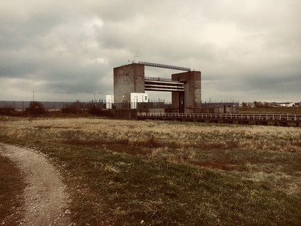
The creek curved and bucked, seeming to resist its final journey to the Thames, while the path struck directly for the tall concrete towers of the flood barrier. A warning light, erected on a spidery metal gantry explained that when it was lit the barrier was closed and there was no escape from the creek. It was hard to imagine boats navigating the deep muddy crevasse below, but Dartford Creek had once been used by Thames Lighters to access wharves in Crayford and Dartford, and there appears to be some effort afoot to restore the river to use by pleasure boats. As I headed for the barrier, the sun broke through the low clouds that had dogged my walk, and the marshes were suddenly illuminated. The distant bridge at Dartford shimmered in the spring sunlight, while the river rippled with bronze below, reflecting the yellow marsh grass. I was entirely alone now, the last dog walker miles away and the waste disposal plants which sheltered in the lee of the high bank deserted for the weekend. At the foot of the gigantic flood barrier I paused and looked back west: the broad thames turned south, Erith Reach twisting back towards Greenwich and the City. On the western bank of the Darent on the spit of land which protruded into the river the Thames Ammunition Works opened in 1879 in a seemingly ideal spot away from any great mass of population and with easy river access from the Royal Arsenal at Woolwich. During the Great War the site was taken into government control and briefly connected to the railway network, but by the early 1920s it was under the ownership of Messrs W.B Gilbert Ltd. On February 19th 1924, while the predominantly female workforce were disassembling shells to recover powder, a fire broke out on the site causing a number of large explosions. The remote and inaccessible site meant that help was slow to arrive, and eventually eleven women and a foreman lost their lives. The site is buried by new industry, its sad history largely unremarked now. Across the water, the mounds of detritus which had accumulated over a century at Rainham loomed large, the sun winking off passing trains speeding out to Europe as they emerged from behind the rubbish heaps. To the east, the little town of Purfleet was reassuringly familiar - the riverfront flats and hotel dwarfed by the arched hanger of the Royal Opera House Production Centre, while the low viaduct carrying the A13 strode across Wennington Marsh. I spent a while watching the scenery shift, the river changing from a deep olive to a surprising blue as the sky cleared. It was hard to imagine The Long Reach Tavern surviving near this spot - until damaged so severely in the infamous tidal surge of 1953 that it had to be demolished. In the 19th century the tavern had been infamous for cock-fighting and bare-knuckle boxing contests, and it had thrived on the presence of both the nearby hospitals and the aerodrome used by Vickers and Maxim for testing early aircraft prototypes, and later by Britain's nascent Air Force as RFC Joyce Green. There was no clear trace of the inn now, the flood defences built in response to the disaster which spelled its end having obliterated the ground on which it stood.
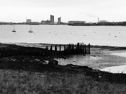
The temperature fell as the sun began to slide towards the western horizon, and it was time to head for civilisation again. As I turned to face west and begin my journey back to London, the sky was beginning to turn an ominous purple-grey. I joined the Thames Path and began walking towards Erith along a raised bank between the water and the ancient salt marshes. Decaying wooden structures strode out into the water - long forgotten piers and jetties which had been replaced by the modern yacht club I could see up ahead, a forest of masts clustering around the building. The path descended from the bank to skirt the yacht club, turning inland and onto the industrial roads leading towards Erith. I was tiring now, and the slog up a dusty hill while dodging puddles of suspiciously rainbow-tinted water outside waste management facilities felt like hard going. Erith was a genuinely strange place - once a resort described as a 'pretty little place' by Walter Bell in 1907, it had been relentlessly colonised by industry. The proximity to a calm stretch of river drew factories and railways towards the shore here, but they abandoned the town just as quickly as they'd arrived as industry on the river declined. At the end of Manor Road I spotted the disused parapet of a bridge which had once carried a branch of the railway to a riverside pier, now filled in and occupied by a flank of the huge Morrisons store which had, in turn, changed the face of the town's commercial zone. The centre of Erith was a down-at-heel shopping centre which used its ancient High Street as a service road. It was hard to know if the shuttered stores were closed because it was Sunday or if the centre was in more permanent decline. A few groups of young people hung around, and the last straggling shoppers shuffled home from the early Sunday closure of the supermarket. In some ways Erith's town centre felt less human and more helpless than the abandoned marshland of Crayford Ness. I pressed onward, under a slippery subway and towards the railway station. I wasn't sorry to be leaving Erith behind, though I had a nagging sense that this part of the world wouldn't let my imagination go now I'd walked the river. I'd expected little more than a decent, long walk today, but had found a surprisingly contested territory, continuously walking a knife-edge between being suburban London and semi-rural Kent. The Cray was a physical and emotional boundary, even if it didn't quite match the ceremonial boundaries, redrawn to enclose many of its once remote settlements within the growing sprawl of modern London. From the mannered and carefully primped park where it surfaced to the wild, sprawling, wind-blasted marsh where it gave up its waters to wider river, the River Cray inhabited a zone which was neither city nor country, neither town nor village. Watermills may have been replaced by retail parks and waste plants, but the river still seemed to drive a quiet and relentless industry. As I boarded a train back to the Sunday silence of a near-abandoned Cannon Street, I surprised myself by looking forward to being out here on the edge of Kent again.
You can find a gallery of pictures from the walk here.
Lost::MikeGTN
I've had a home on the web for more years than I care to remember, and a few kind souls persuade me it's worth persisting with keeping it updated. This current incarnation of the site is centred around the blog posts which began back in 1999 as 'the daylog' and continued through my travels and tribulations during the following years.
I don't get out and about nearly as much these days, but I do try to record significant events and trips for posterity. You may also have arrived here by following the trail to my former music blog Songs Heard On Fast Trains. That content is preserved here too.
