The Curse of the Curious: A Last Walk before Lockdown
Posted in London on Saturday 7th March 2020 at 10:03pm
Pre Amble
I began writing about this walk during mid-April 2020. The UK is heading into the fourth week of 'lockdown' - a precarious moment when a review of these conditions suggested it wasn't yet time to relax them. The mood hovers between unexpectedly good-natured compliance and the growing sense of a national tantrum about to burst. The economy is stuttering, but those least engaged with it struggle most. For them, the monotony of their normal is only broken by some of the things they've seen stolen by this unseen adversary: a precious moment of peace when everyone leaves the house, the belonging of school-gate gatherings, the conspiratorial break-room banter of work. For me, this period has been strange but relatively easily endured. Working for a local authority has exposed me to something of the growing horror, but also much of the remarkable response. I've been able to work largely from home, marshalling resources remotely and massaging decisions into shape like a nuclear scientist reaching into the mechanical arms which will manipulate dangerous isotopes. Any sense that this is easily achieved should be avoided - so many of us aren't ready for a virtual existence. The alluring ease of a virtual flounce with the click of the 'end call' button is always present. Who knows what is happening just off-camera? The outcomes are often tiny and trivial and feel remote from the reality of the situation. But, at the very least, I feel like I'm somehow useful in the margins.
When I walked this largely aimless excursion, the virus was a growing curiosity. A slow-burning 'other' thing, in another place. It had no form or substance yet, merely a rumour of contagion. Heading into London felt risky in the mildest sense. It seems impossible we knew so little, such a short time ago. But reflecting on that journey into a world which was largely functioning utterly normally, I can see how conspiracy theories have taken hold. Life, torn from its usual moorings, has left a tantalising but terrifying gap between us and the shore. The gap swirls with information - the very channels which keep us connected carrying a ghost signal of what-iffery and nudging, knowing crackpotism. Bill Gates as an unlikely antihero, misreadings deliberate or unintentional, a quantum world where it is both 'not the time for politics' but when suddenly people have an endless stomach for the discussion. Our post-Brexit trust for experts still an open wound, we're all become epidemiologists or economists now. When I was walking from north of the M25 into the city, I wasn't sure what I was attempting to achieve. I had only a vague notion of my plan, a long regulatory inspection at work had stolen every sliver of planning time. I was walking almost blind. But I realise now I was trying to close this slowly growing gap - trying to hold my worlds together against the coming storm, just as the wider world was breaking free of its tethers. By walking a north-to-south line into the belly of the slumbering city I was attempting to pin down something I'd otherwise lose hold of very soon. I've often taken walks on this axis when things have felt tenuous or bleak, and here I was again...
When and if I'll walk into London again is as unclear to me now as it was when I stumbled sore-footed onto my homeward train after this walk. London feels remote and impossible, but of course, it persists - sprawling and uneven, both self-aware and supremely egotistical. I've never wanted to scour its bleak underpasses and dank patches of unloved woodland more than I do now. I can taste the metallic air and feel the vague crackle of urban threat without trying - because I've walked into it often enough to feel I need this recharging flux.
Amble
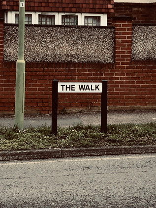
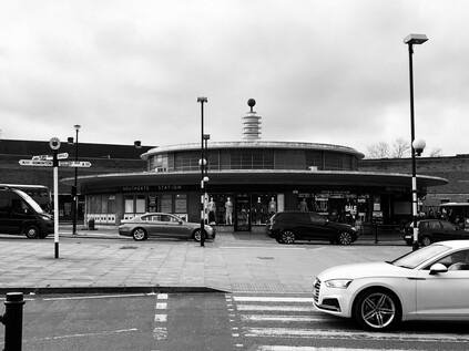
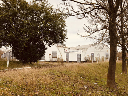
Until today I had only the most theoretical idea of Potters Bar. It is a cypher for a particular type of commuter-land misery, somewhere widely understood as utterly ordinary and unremarkable. You can slide Potters Bar into a comedy riff to short-circuit the descriptive process. It stands as everywhere and nowhere. A shifting allegiance from Middlesex to Hertfordshire cemented a long, slow shift from provincial market town to city dormitory which had been on the cards since the arrival of the Great Northern Railway a century before. Outside the station buildings, topped by an uncomfortable post-modernist office block beside a bus circle, a tiny shrub-infested garden almost hid a memorial to the seven victims of the 2002 derailment. Regarding the modest, almost apologetic tribute, I recalled the day unusually clearly - a commuter myself back then it focused a wandering mind on the train home that night. The remembered sight of an upended carriage forcibly removed from the rails, sitting askance under the platform canopy was a cruelly accurate simile for the then decade-old corporate separation of track from train services. These events would finally put paid to that use of private contractors in track maintenance, after many months of disruption due to checks on similar infrastructure to that which caused the crash. The sheer normality of the bustle around the station - the busy Caffé Nero and the swirl of arriving and departing buses - felt strange. The pall of horror felt fresh and present and I struggled to shrug off this early gloom. Potters Bar is a town with two distinct centres - one, modern and chain-stored focused, coalesces around the station, and the other hugs the line of the old Great North Road a short way to the east. I set off across town to reach this second, slightly less salubrious focal point, noting that the street which climbed towards the ridge which the old topped was named, fittingly, The Walk. It was a warm and humid morning, the avenue alternating between tidy bungalows and sizeable semi-detached houses each with a clutch of reasonably new cars outside. There were few pedestrians on The Walk, and the ones who spotted me eyed with suspicion. There was no need to out on foot beyond the short skip to the vehicle, surely? Across the cricket pitch, the unlikely headquarters of Canada Life insurance dominated the pale sky - an incongruous if unambitious block which provided a convenient host for an infestation of aerials and antennas. Potters Bar had done nothing to shrug off its mildly unsettling suburban status just yet.
Arrival at the junction where The Walk met the High Street presented a choice for the traveller: to the north lay provincial England, starting semi-officially just beyond the bus garage which marked the end of the long journey from London for the familiar red buses. The road south would lead me into familiar territory: the bucolic outpost of Hadley Wood and thence to Barnet. It was a solemn reminder that I'd travelled more in these northern climes than perhaps I'd realised. There was a welcome if unexpected sense of geography slotting into place, tiles of land ordering themselves with a logic which at once made things more familiar and even more intriguing. My plan though was to turn aside from the old road and bear east across the last miles of Hertfordshire. As the convenience stores and pilates studios gave way to the last sprawling edges of town, I turned southeast onto Southgate Road. Most of the passing traffic did the same, as this was the gateway to the M25. The old A1000 pressed on south: a backwater for those who knew better than to brave the approaches to the Orbital route. Even on a sleepy Saturday morning on which people were beginning to shun the viral city, the traffic began to slow long before the interchange. The somewhat drab row of semis spread into a run of sizeable villas before the scruffy motorway fringe of fly-tipped woodland encroached on the immense roundabout, abnormally elongated as if it was awaiting some other convergence beneath.
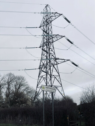
Pedestrians were left to fend for themselves on the slip-road crossing. A pulse-elevating dash, and the knowledge that relative safety had been reached when the crunch of gravel underfoot meant you had reached the margin of the carriageway, where a spray of dust and stone kicked up by careering cars lay undisturbed. The bridge over the carriageway was a perverse sanctuary: howls of engine and groans of diesel churning beneath, but up here at least, I felt secure on a wide pavement. These places were easy to understand - you kept to your permitted zones and assumed the drivers who flashed past giving only the most cursory attention to those on foot would keep up their end of an unspoken bargain. The westbound on-ramp presented a further challenge - the long straight of the roundabout giving drivers ample time to accelerate into the turn. I scurried across and sheltered under a temporary variable message sign which flickered speed limits and traffic conditions back at the joining traffic. Stagg Hill disappeared quietly between the trees, flanked by a dusty white track leading to a clump of small industrial buildings nearby. There was a footpath - sometimes narrowed by overgrowth and often rutted and treacherous to walk. I was glad of it though - the few cars ascending the hill towards the Motorway howled by at speed, seemingly desperate to escape the environs of London while I was just arriving. The slow descent provided sweeping views over the last yards of Hertfordshire, a twin procession of high voltage lines marking the border. As ever, the change was imperceptible - a small sign welcomed me to Enfield, while behind me a larger board indicated I was leaving the 'county of opportunity'. The slope bottomed out beside another cluster of light industrial buildings around a farmyard. The track which had shadowed the road downhill curved to the west to meet this silent and rather sinister facility. It was probably just a farm, but in the quiet warmth of a morning where the very air seemed hostile, the mind conjured unabated. No-one and nothing moved within. A stand of modern metal railings beside the road marked the passage beneath of the Salmon's Brook on its journey towards the River Lea. A sluggish and reluctant stream here, tangled in weeds and roots, and glistening with sickly smelling chemical run-off, I recalled its lower reaches, penned in by concrete and even more polluted. I was closer to its source than I'd dared to walk before - my horizons having slowly expanded out of the suburbs and into the rural edges of the city over the intervening years. The road rose gently ahead, a narrow band of development appearing on the edge of the clay ridge which separated the Salmon's Brook from the Monken Mead Brook. Once again I was approaching the intersection of several previous walks: to the west, the impressive houses of Hadley Wood shimmered in the morning sunshine, while ahead of me the carefree cafés and futuristic architecture of Cockfosters signalled the beginning of London's unabated conurbation. I'd soon pass a point where the shift would be palpable, a puncture in the skin of the city - the medical metaphor not lost on me today. To the east, the countryside continued: a patchwork of fields fading into Trent Park. The stream of traffic leaving London continued, and I pushed on against it.
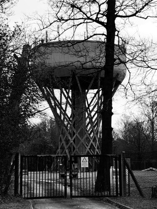
Development hugged the western edge of the road, showing a defiant cliff of high-value apartment blocks to the wildlands beyond. Some of the older properties had made the inevitable shift to high-end convalescent or nursing accommodation, others had succumbed to modern rebuilding in unsettling 1990s parodies of the vernacular. Narrow, curving ramps which wouldn't meet current regulations swooped into underground car parks, while automatic gates silently shifted into place behind incoming vehicles. Once, beginning a walk from Cockfosters, I'd wondered from where the expensive cars and clothes evident in the carefree and cash-rich pavement culture emerged? I'd found the source: a band of out-of-town bolthole apartments which while handy for the Piccadilly Line would almost certainly be linked to the City by a car journey. From one underground car park to another - no risk of breathing the tainted air which now more than ever had a bitter tang of danger about it. A little way along the ridge the uninterrupted views of countryside which Estate Agents would no doubt be carefully noting were compromised by the uncanny helical concrete stem of Cockfosters Water Tower. Built in 1968 for the Lee Valley Water Company, the elegant hyperboloid latticework twisted into a bulky drum festooned with telecom aerials and conductive spikes. The architect was Edmund Percey - veteran of a number of fascinating similar constructions. On leaving the RAF, Percey began work at the London County Council before moving to Scherrer & Hicks where he was involved in numerous industrial architectural schemes. His work includes the Lee Valley Water Company headquarters in Hatfield which incorporated a full-height relief by William Mitchell, another former LCC employee. The amalgamation of water supplies in London into the almost amusingly shifty and anonymous Affinity Water is a history of declining municipalism. First, the Colne, Rickmansworth and Lee Valley companies collapsed into Three Valleys Water, then the service-industry giant Veolia stepped in. Eventually, water became big business and the company letterhead became a litany of investment banks and finance houses. Affinity makes more sense in this context: a press release compatible, gently positive name for an unseen industry. Nothing to see here: nearly 1200 cubic metres of water stored for our convenience. Move along, and let the heavily fortified gates to the facility persuade you that this architectural marvel isn't worthy of photography. It's a utility, after all. I lingered a little longer than perhaps I should at the gates and maybe it was the frisson of paranoia in the air, but I'm sure more cameras were pointing at me when I left that when I'd arrived.
Resisting a diversion into the bucolic corner of Cockfosters which remains along Chalk Lane, I re-entered modernity via an impressive gateway with Charles Holden's bus shelters flanking the street and providing access to the cathedral-like cavern of the station which marked the end of the line. The line curved towards the road below ground level, the concrete beams rising above the line but hidden from the street above. To the west, the sleek 1960s lines of Metro Point framed the concrete bus shelter perfectly. This futuristic, white slab of offices is regarded by Enfield Council as of 'moderate architectural quality' but it typifies the low-rise schemes which cluster around the Underground's termini. Beside the station another example, Holbrook House, was nominally in NHS ownership but looked abandoned. Its glassy exterior coated with reflective material which peeled sadly. I slipped into the station in the hope of using the facilities but found them locked out-of-use. I'd been somewhat apprehensive about how things might feel on re-entering civilisation when it was busier a little later in the day, but it seemed all was well. The light and airy concourse was busy with travellers, and there was little hint of menace in the air. I returned to the street and walked the broad shopping parade as far as the roundabout where the A110 crossed my route on its journey towards World's End. This was a familiar spot where I could find topographical moorings: the moss-covered 'County of Middlesex' sign and Pymmes Brook tumbling in its concrete trough through Oak Hill Park. My navigation of these northern heights would never be complete, but it was becoming comprehensive - and in a pinch, I'd found myself back here again.
I headed south along Chase Side, named for the great hunting grounds of Enfield Chase and once famous for sporting a run of fine coaching inns along its length. This ancient way provided a route from London into the southern flank of the Chase, which was until the 18th century part of a great forest stretching north over much of the ground I'd covered today. Legally unrecognised after 1777, the once expansive woodland was divided and sold, with much being deforested very swiftly. This paved the way for the suburban expansion which engulfed the forest hamlets of Osidge and Winchmore Hill, creating the low-rise dormitory landscape which has survived largely unmolested into the twenty-first century. There were notable patches of the old geography scattered along the old road: to the west, the forest remnant of Oak Hill Woods stretched towards the high ground of East Barnet, while to the east Bramley Recreation Ground housed the tumbledown changing facilities of Saracens Amateur Rugby Club. The top-flight team turned professional in 1995, heading for their new home at Allianz Park via several ground-sharing agreements. This suburban scrap of grass would never do for the kind of plans the new owners had. So, their home for almost sixty years was now a haven for dog walking and pram pushing when not in the service of the part-time team, the tall nets along the road torn and flapping in the breeze. Meanwhile, Chase Side continued its curve towards the southeast, following the almost imperceptible valley of the northern branch of the Houndsden Gutter. The road hugged the slight interfluvial ridge, now dividing a sea of pleasant suburban villas. Beyond the gardens, the hidden river carved an ever deeper path around the edge of Southgate, causing the Piccadilly Line to climb over its valley on a viaduct before plunging into the hillside and into Southgate station, which despite sitting at the edge of this valley is the most northerly station on the network to be truly underground. The steeply sloping ground behind St. Andrew's Church had once been a recreation ground, sloping down to allotments on the valley bottom, but now a supermarket protruded oddly on an artificial plateau, with ramps descending to underground parking. Despite the presence of a huge superstore selling almost everything one could need, Southgate Circus still genuinely bustled in a way which many of London's minor centres don't often achieve. Cars swirled around the unusual figure-of-eight shaped traffic island, while the abandoned spaceship of Charles Holden's station shimmered through the heat and pollution. The brick curve of Station Parade wrapped around the beached saucer, flanked by columns with large Underground roundels which stood like sentinels at each end of a rank of bus stops. The station dates from the northward expansion of the Piccadilly Line in 1933 - something of a landmark year for Southgate with its elevation to Municipal Borough status. The ring of busy shops and cafés around the Circus still managed to convey something of that civic pride: Southgate was determinedly not just another parade of shops in a sleepy suburb.
I was tempted to linger around Southgate Circus, not least because its no-nonsense getting-on-with-the-job feel was at odds with the increasing viral paranoia in news stories pinging regularly on my 'phone. Paradoxically, this bluff busyness probably meant it was the worst place to be, so I continued south-west along The Bourne, immediately plunging back into a quiet residential area. Much of the eastern flank of the road was taken up by the beginnings of Grovelands Park, near an entrance to a Priory Group mental health and addiction facility, sited beyond the impressive Ionic columned villa of Grovelands House. The house was built by John Nash around 1798 for Walker Grey, a brewer. Grey secured the services of Humphrey Repton to landscape the extensive grounds, reputedly so that he need not have a view of other's chimneys. The house passed into the hands of another London brewing dynasty, the Taylors, who sport a lineage from a site in Stepney to the modern multinational Carlsberg Brewery. Ultimately, given the vast sweep of suburbia that now enveloped the park as the Taylor family sold off parcels of the estate, even the mighty Repton couldn't prevent the march of progress. In an unexpected twist, Grovelands echoed the fate of Repton's commission at Claybury, where his landscape gardens became the grounds of a hospital. However, they survive though much reduced and the park includes a sizeable lake fed by a second headwater of the Houndesden Gutter. From the shallow but marked valley into which The Bourne passed, along with the very name of the road and the long-deleted hamlet of Bourneside, it's likely this stream was once a more prominent feature of the topography here. Alas, it had disappeared from most maps by the end of the 19th century, while the stream exiting the park on route to Winchmore Hill remains, itself slowly disappearing behind back gardens. Roughly at the valley bottom, the impressive Inverforth Gates gave access into the formal avenue of the park, a gift from Andrew Weir, the 1st Baron Inverforth of Southgate who had little connection with the area save for his peerage. From the gates, my route became a long, slow clamber out of the valley and it was easy to see why The Woodman had remained a popular watering hole on the route since 1810.
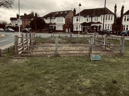
Near the Woodman, the road divided: my route continued along what was formerly known as Dog and Duck Lane while Fox Lane turned south to pass through the long-since erased hamlet of Clappers Green. At the junction, a tidy triangle of land was trimmed neatly and provided with benches to form an unlikely oasis of green space. At the wider, southern extremity of the wedge of greenery, the grass grew tall and yellow within a fenced area. I crossed the road to find a small 'Borough of Southgate' plaque which explained that the pound was a 'relic of early days' and had been last used for impounding stray cattle in 1904. Retrieval came of course, with a fine for the owner of the errant livestock. It felt odd to imagine this spot being in open countryside, the pound and the inn standing among the trees. What was perhaps stranger was that it had been preserved for so long. The Borough of Southgate disappeared into Enfield by way of the Local Government Act 1963 which also put paid to Middlesex, but its considerable and grand public works endured hereabouts. Those works even extended to the protection this tiny patch of greenery, unmown and littered with cheap vodka bottles, in the midst of sprawling twentieth-century suburbia. Leaving the pound, I crested Bourne Hill and began the gentle descent towards the New River, snaking along the 100ft contour towards the City. This relatively easy route from the north was shared by both the railway heading into Liverpool Street and the ancient track of Green Lanes. I crossed the tracks on a curious footbridge which ran parallel to an abandoned road bridge. A more modern, wider crossing now curved to the south avoiding what appeared to be a significant bottleneck in the broad carriageway. The newsagent and laundrette were quiet in the afternoon heat, the road empty. The area felt suddenly deserted by humanity. A train clattered below, breaking the uncanny absence of activity. I hurried on towards the crossing with Green Lanes where a parade of buses shunted for priority at the lights while the verdigris-topped towers of St John the Evangelist bore witness over my road onward. I had only the vaguest memory of passing this crossing before when it would have course have been an insignificant waypoint on my route. Now though, having crossed the path again it took on the usual significance. Territory crossed and recrossed in this way feels like a kind of time travel - my footprints intersecting themselves years later in these suburbs which stop moving for no-one. The crossing of the New River was equally unmemorable, occurring on a fractured stretch of the New River Path where straying onto the street was frequently necessary. I didn't recognise the low parapet of the bridge on Hedge Lane in particular, but I paused to admire the curve of the still waters away north toward Enfield and their source. There was a strong temptation to stray south along the path, but that was a different journey.
Instead I headed on through the relentless ranks of side-streets populated by solid, familiar London homes. My feet were tiring from the long stretch of pavement walking and I was beginning to fall into an absent-minded fugue which sometimes descends on these suburban walks. It was time to rest, and unexpectedly I found myself beside the gates to Tatem Park. The park existed thanks to a remarkable feat of cooperation between the Borough of Southgate and Edmonton Urban District Council who jointly sought the donation of land by the Harman sisters, nieces and only surviving relatives of James George Tatem - the last owner of Weir Hall and heir to the Huxley family estate. Weir Hall stood at the west end of Silver Street, the most recent house being built on the site of a much older property by 1611. The building was demolished in 1818 and the site was turned over to market gardens. In the meantime, the area which would become the park I was now resting in, became the site of gravel pits and brick kilns feeding the expanding suburbs which grew as the sisters slowly disposed of the estate. Throughout the 19th and early 20th centuries, Tatem family correspondence refers to 'Gravel Pit Fields' and indicates the tenacious efforts of the councillors of both Edmonton and Southgate to engage with the agents of the Harman sisters regarding the site. Excavations in the gravel pits revealed a final surprise before the land was turned over to the people of the boroughs: ice age deposits rich in the bones of Mammoth and Mastodon were uncovered, the remains being turned up in such abundance that workers would often take home relics as ornaments or paperweights. The inhabitants of these northern suburbs were far from the first to dwell on the slopes rising from the Thames, and in 2012 they began a campaign to return these old bones to their home territory, completing the circle in this apparently insignificant corner of Edmonton. I rested a little longer than I'd planned before creakily moving on through the aspirationally named Hollywood Gardens - in fact laid out and dedicated in 1945 to Cllr George Hollywood. The rest of the walk was only a hazily uncertain plan, and this quiet spot seemed like a secure place to ponder my next move without too much urgency. But move I eventually had to, and it was to more familiar territory as Hedge Lane sputtered to a halt at Great Cambridge Junction, colliding with both the A10 and the mighty North Circular Road. I'd approached this location before and knew the drill: descend into the subway which passed between the layers of road, pick an exit and head out of the dusty, grim bowl as fast as possible. It was difficult not to linger though, and I had a hard-to-resist urge to watch the traffic flash past beneath me as I hovered over the road. Shaking myself free of the spell of the mighty North Circular, I headed south and surfaced at the corner of the A10. Hermitage Lane sneaked away to the east, following the course of Pymmes Brook where it re-emerged from a short culvert. The correspondence with the Harman sisters had been addressed from 'The Hermitage' - another lost house with links to the Huxley and Tatem family. The brook was not visible from this corner where I recommenced my walk south alongside the six lanes of seething traffic. The air was dry, clouds of road filth kicked up by buses swirled around me as I stumbled along the lines of ill-kept paving slabs. Pedestrianism wasn't encouraged here - except for the brief scurry to the bus stop. Small groups waiting for city-bound buses eyed me with suspicion as I flapped by, sweaty and tired. Who in their right mind would walk along this road?
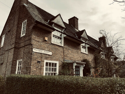
I realised I was heading into further familiar zones as I passed under a none-too-safe looking metal footbridge which allowed pedestrians to cross the impossibly busy road in order to access the short run of currently shuttered shops and takeaways which lined the eastern footpath. A little further on I'd cross more than one of my previous walks at Lordship Lane, and I had to decide where to head now. Traffic slowed and lurched, horns sounding in a futile attempt to gain ground at the lights as the fractious front rank of vehicles snarled at those of us who dared to cross on foot. Ahead of me, slicing through the broad ellipse of land created by The Roundway was the Tower Gardens Estate. Designed along the principles of the Garden Suburb, this impressive swathe of good quality public housing began construction in 1899 but was slowly expanded throughout the early years of the century as the remainder of Tottenham's farmland finally disappeared under paving. The district was growing, in large part due to the slow exiling of poorer residents of the inner boroughs to the new suburbs. Architecturally the houses were pleasant, well-spaced and provided with both front and back gardens, the latter accessed through arches penetrating the short terraced blocks. The site was developed chiefly by two London County Council architects: the northern segment by George Topham Forrest who had cut his teeth on similar projects in Leeds, and the southern by W.E.Riley, a military veteran who spent much of his career battling the interests of private architects in their attempt to intrude upon and denigrate the work of public sector departments. By 1939 over 2200 dwellings for the 'well-to-do working classes' had been built, including a small contingent of flats dedicated to housing those displaced by slum clearance in Shoreditch. The resulting estate remains coherent and comforting largely due to a very early designation as a Conservation Area which thwarted most of the 'right to buy' improvements which might have been perpetrated by the residents. In many ways, the area has changed very little since the architects began their work: the low hedges and red-brick cottages with distinct nods to the Arts and Crafts style cluster around a central spine known as Waltheof Avenue, named for the Earth of Northumberland who in 1065 or thereabouts took ownership of the manor of Tottenham. Waltheof's own north-south divide was not as harmonious as the two architects responsible for Tower Gardens, as he left a trail of intrigue and bad blood in the north of England before becoming entangled in an ill-advised rebellion of Earls against William I who finally had him executed. Waltheof lived on as an avenue through the development: a common green space which once included tennis courts and a community centre, providing a central boulevard for the suburb and continuing the line of the A10 southwards while traffic was forced to spiral off east or west, depending on its destination.
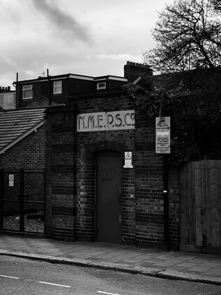
For a little while at least, I reversed that walk which seemed so improbably long ago now. Crossing into Downhills Park I followed its rather sedate central avenue - known historically and for reasons unknown as Midnight Alley. The quiet path divided the two distinct halves of the park - to the west a broad, flat recreation ground used by local Rugby teams, to the east a formal rose garden and café. Once the largest private park in Tottenham, Downhills was named for a large house built in the northeastern corner of the site in 1728, and rebuilt and extended at various points over the following sixty years. Also occasionally, and confusingly known as Mount Pleasant - as were several other local homes on the high ground here - the house changed hands frequently during the 19th century as the fortunes and standing of the area changed and suburbia swept around the park. By 1902, Tottenham Urban District Council had acquired the site for the local people, demolishing the now decrepit house while retaining the formal gardens and turning the area over to tennis courts and other amenities. The western edge of the site was described by the Palace Gates branch which swept southwest towards West Green station near the southern tip of the park. The line's path had been obliterated by the modern buildings of Park View Academy, but across the street, beyond the bus-stop, the tell-tale brick parapet of a bridge over nothing stood guard. Should the original Crossrail project ever complete its work and move onto Phase 2, this line would be shadowed by an underground branch from Seven Sisters, repairing the damage wrought to the network in 1964. For now though, the railway is a memory recorded only in the diagonal slash in the street pattern here. Whenever I pass this point there is considerable traffic from the nearby Seventh-Day Adventist church, but today things felt a little subdued. The bus stop was not thronged by worshippers and the area around the small but sturdy War Memorial was quiet. I wondered about the news from the world outside, and whether the congregation was already being extra cautious - or perhaps my timing was just off? I continued south along Cornwall Lane, once again crossing the trackbed of the erased railway, near which a small electricity substation building gave a striking insight into the growth of these suburbs. The Northern Metropolitan Electric Power Supply Company was a private undertaking based in nearby Wood Green, until it was absorbed into the Eastern Electricity Board on nationalisation in 1948. Aside from the fine office buildings which are now a self-styled 'arts hotel', little evidence remains of this local enterprise aside from the tiny brick building beside the bridge parapet, inscribed N.M.E.P.S Co. in fine, art deco style lettering. The road felt long and featureless, and there was an unexpected sense of unease and urgency growing in this walk. A sense that I had to reach a destination but little clear idea of where I was heading. The early part of the walk had seemed logical and linear - a permeation of the city from the northern fringe - a theme which I'd been worrying away at for months. But now, as I passed into Inner London I'd begun to wonder what I was really doing here? These last few weeks of turmoil and pressure at work meant I'd done nothing to think through my route beyond the earliest stretches. Now, I was suddenly considering the uncertainty ahead - the possibility that I might not be back here for a while. I'd been in this bind before of course - but always managed to navigate around it. This was different. Distracted, I tumbled out unexpectedly into St. Ann's Lane opposite the sprawling hospital campus. A sizeable length of the site behind the institutional brick wall was under redevelopment, but beyond the hoardings the site retained the character of the North Eastern Fever Hospital, built in 1892 by the Metropolitan Asylums Board. The hospital was one of a ring of facilities to treat and isolate infectious disease around the city, but had originally been shelved in 1890 as an unnecessary expense. An outbreak of Scarlet Fever soon followed, convincing the authorities that the site should be developed after all, and despite much local opposition to such a hospital in the now busy suburbs, a temporary facility with 500 beds was soon in operation. The hospital provided wartime support for the American Expeditionary Force before joining the NHS as a general hospital, with a range of services located in the generous accommodation. The site has though, never been popular, with its widely spaced blocks proving difficult for patients to navigate. The very space and isolation which was built to protect its original patients now inconveniencing their modern counterparts.
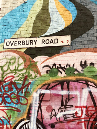
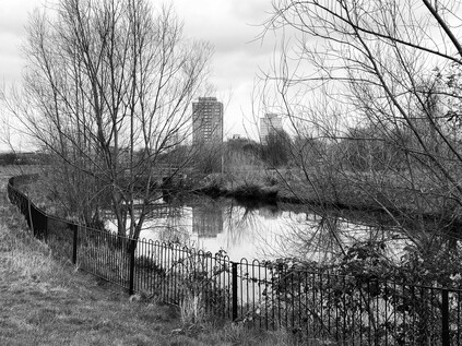
I zig-zagged south again, along Hermitage Road and under the railway line from Gospel Oak at one of the few crossing points into the Haringey Warehouse District. I'd passed through before, on more than one occasion when walking along the New River which forms a southern border to the zone atop a steep, grassy embankment. This sequestered corner of the borough was once home to a huge variety of industry: piano manufacture, cabinet making and confectionery among others - but by the 1980s was largely a zone of derelict premises and small-time semi-official businesses soldiering on through recession in the workshops and lock-ups which remained. It's a story echoed across the eastern districts of London: of aspirational populations moving on, industry declining and a slow, stumbling journey to urban renewal. The progress here has been slower than further east, the creatives picking up the baton rather less eagerly - but as I turned into Overbury Road with its long lines of light industrial units in the shadow of the huge brick chimney which marked the site of the former Maynard's sweet factory, I was met with a surprisingly colourful site. These long-since abandoned units have gradually been repurposed as artist's live-work spaces and while often not visibly improved from their former condition, were a riot of colour and variant purpose. A rank of wheeled bins paraded along the pavement, occasionally interrupted by bicycles or stacks of wooden palettes, half-finished projects caught in a snapshot of an area changing quickly. At the junction with Netherton Road, old collided resolutely with new: the brightly coloured converted warehouses meeting a row of more traditional businesses, mostly engaged in the final stages of the lifecycle of the automobile. At the end of the street the curious squat building at the head of the Victoria Line ventilation shaft glowered, while above the collapsing garages and dubious MOT testing stations, the tall Victorian shop buildings of Seven Sisters Road reared up, their lower floors below the level of the street. I trusted the map and shuffled into the stinking and unwelcoming corner where the former Courtney Pope factory had become an affordable housing collective, and began the ascent of a steep, damp stairway to street level. The crevasse between buildings was as brightly adorned as the buildings below, and emerging into the shabby gloom of the main road above was a shock. I'd worried about finding those life-affirmingly strange, transporting moments on this ill-considered walk - but this transition had surely been one of them.
I was footsore now, and I still had no real plan - but I decided that I should at least pay my respects to the New River properly. Eschewing the long curve to the east, I cut through the remaining unrefurbished blocks of Woodberry Down to reach the path. Once near the river it teemed with walkers and still reflected the changing strata of the local population. Expensive buggies cut deep grooves in the unmade surface with aspirational parents at the helm, while young couples shuffled along deliberately slowly, prolonging their rare moments of privacy while on the path. I swerved between them, eager to get refreshment from the supermarket before heading south again. I could have continued a little further to regain the familiarity of Green Lanes but instead, I decided to take a new route by following Lordship Road between the expanses of the East and West Reservoirs. Once out of the orbit of the shining glass towers in Woodberry Down, the road quietened and pedestrians evaporated. It was just me and the occasional local heading for the shops. The afternoon had become still warmer, the sky a churn of clouds and the air oppressive. I pushed on despite feeling tired and a little dejected by the slow decay of this little island of community on the fringes of Hackney. My route felt endless and still aimless as I trudged on, the road finally dividing around a narrow building which had once been the Parish Watch House and Fire Engine Room. The lock-up moved onto this site in the yard of the Red Lion in 1824 having previously been sited on the south side of the long-since disappeared Hackney Brook. This establishment passed into the hands of the Metropolitan Police in 1831, but despite maintaining it for a further forty years it was little used for incarcerating prisoners after 1834. Lordship Lane skirted the site and the neighbouring Inn, ending abruptly on Stoke Newington Church Street. This picturesque little lane, fronted by largely unspoiled brick shopfronts would have been unremarkable had it not seen an improbable change in fortunes in recent years. It would be easy to be judgemental and unkind about the transformation into a hipster destination: to take cheap shots at the coiffured facial hair and carefully assembled vintage outfits. It is, after all, what self-styled bloggers or writers are almost duty-bound to do when in the area. But in fact, the place felt rather energised by this presence. Removed from the centre of the city, there was a little less of the desperate ache about the place. The narrow street was lined with pastel-painted, independent businesses which harked-back to the glory days of the London High Street. Just to show that this gentrification was mature enough to have gone mainstream, the occasional national chain sneaked in a branch here and there, taking just enough care that it didn't clash with the parade of wood-fired pizza parlours and bespoke childrenswear boutiques. A sizeable branch of Nando's did its level best to remain anonymous from the casual pedestrian in a way that no provincial shopping centre counterpart ever would. In a courtyard nearby, a teenage idol of mine sold records at his pop-up emporium, Ecstatic Peace Library. It all seemed utterly unlikely but oddly felt like it made a sort of sense. The street vibrated with life: groups of young people promenaded, while weekend fathers wheeled children between them on the precarious strips of pavement. The bars had their shutters open, and chatter and vape fumes filled the air on the street. It felt carefully curated - people being seen just how they wished, in the company and situation which they hoped would convey the right message. Again I thought how oblivious they appeared to the unseen menace which seemed to be creeping closer, and looking them in their passing, innocently unconcerned faces I wondered if perhaps I was the one being alarmist and risk-averse? I turned aside rather thankfully from the crowd into the long sinuous curve of Albion Road. The shops here were crumbling and shuttered, they sold what people needed and folded quietly when their requirements changed. There were no mission statements or manifestos here, no popping-up or curating: just the collision of Victorian avenues with low-rise post-war flats - familiar, but after the subtle and carefully-kept curve of Church Street, notably jarring. This felt a little easier to navigate.
Shuffling onward, I unexpectedly found myself at Newington Green - the meeting point of roads from all directions, converging at a swirling gyratory created by a small island of public garden. I navigated around two sides of this quadrangle of arms, passing fancy and expensive restaurants and impressive townhouses-turned-offices with discreet brass plaques. There were dwellings too: in rather cramped but expensive-looking units wedged into scraps of land between more venerable buildings. I was familiar with this place via my equally abrupt decanting from the endless tramp along Green Lanes, and knew too well the risk of mistiming my exit and ending up deeper than anticipated into the suburban pattern of streets. With care I was able to head south again, onto Southgate Road - thus connecting the beginning of my walk with its nearing end. Tiredness was overwhelming me now, and the last trudge through the quiet streets of De Beauvoir Town felt like a fitting calm-before-the-storm entrance to the City of London. My travels have taken me often along the streets east and west of here, but this was new territory for me. I felt no shame for my omission: De Beauvoir Town has often been overlooked and unregarded. The land was acquired by William Rhodes in 1821 as the site for a speculative, high-class development of fine town houses, their location improved greatly by the opening of the Regent's Canal in the previous year. Work began slowly, and the development was soon mired in legal proceedings with Rhodes eventually found to have obtained the lease to the land unfairly. The rights reverted to the De Beauvoir family, but the moment had passed. While Rhodes and the De Beauvoirs had scuffled in court, the grand squares of the West End had taken shape and the pattern of wealth and privilege in London which persists to this day had largely been settled. De Beauvoir Town, incomplete and truncated in scale, soldiered on into the 20th century. Quiet and unloved despite its fine houses and distinctive square. Its lack of popularity and perhaps those historical pretensions to grandeur made it an easy target for the upstart borough planners of Hackney who turned great swathes of the original area into experimental new estates clustering along the banks of the Canal and replacing the narrow belt of industry around Kingsland Basin as it too lost a foothold. Perhaps it was this underdog character, along with the relative seclusion. which attracted the attendees of the 5th Congress of the Russian Social Democratic Labour Party to the Brotherhood Church on Southgate Road. This stormy clash of revolutionary and democratic rhetoric was decided from the outset with a Bolshevik majority in attendance - paving the way for a revolution in Russia and the creation of the Soviet Communist Party. Lenin, Stalin, Rosa Luxemburg and Leon Trotsky attended the congress - though none of these future luminaries were elected to the Central Committee during the proceedings. Their stars would rise later, the impact rippling out through history from this sleepy corner of Hackney.
The history of concealment and secrecy here persisted into the later years of the century too. In 1969, William Lyttle inherited the large 20-room home which stands at the angle of Stamford Road and Mortimer Road, a broad triangle of land created by the diagonal street pattern which survived from the early, much grander plans for De Beauvoir Town. The retired engineer set about constructing a subterranean wine cellar - but having "got the taste for it" began to tunnel out from under the property with remarkable industry. It is hard not to be captivated by the idea of Lyttle - the 'Mole Man of Hackney' - silver-haired and bearded, hacking his way through the earth of London to create this network of secrets and stashing the spoil along with countless other artefacts and curiosities within the walls of his huge home. But the impact on his neighbours over his four decades of tunnelling was considerable, and eventually bought about his downfall. Intermittent power supply issues and unstable foundations plagued the area and eventually, in 2001, the appearance of a sinkhole which hinted at the vast scale of his excavation was the last straw. Hackney Council finally acted, eviction proceedings finally finding their way to the High Court by 2008 where Lyttle was banned from the property and order to pay £293,000 in costs. Lyttle briefly returned to the property in 2009 to find his constructions partially filled with aerated concrete, but was soon ousted once again and rehoused on the top floor of a tower block on the nearby De Beauvoir estate to prevent him from tunnelling again. He died in 2010, his purpose and vigour lost, but not before he had knocked a hole between the rooms of his new home. The Mortimer Road house is now the home of artists Tim Noble and Sue Webster and a Vogue show-piece, rebuilt by Adjaye Associates with multiple entrances and exits to echo its unlikely history. The details of Lyttle's clandestine works, along with an exploration of his intent can be found in far greater detail in Iain Sinclair's affectionate address to his then increasingly threadbare and complex home turf 'Hackney, that Rose Red Empire'. But as I neared the end of my own day of sometimes rather directionless walking, I was struck by a remembered phrase from interviews with Lyttle at the time of his eviction:
Curiosity is my curse. If I make a start, I must know where it ends
For me, it would end at the gates of the City. I'd crossed the Canal at Rosemary Branch Bridge - named for an ancient part of the Parish of Finsbury, long since absorbed by the growing industrialised fringes of the city, and headed rather haphazardly across Hoxton via Shoreditch Park and Pitfield Street. I finally crossed the threshold via Curtain Road, piercing the boundary in the well-trodden territory around Great Eastern Street. I was surrounded immediately by memories of prior visits, quiet nights surveying the Overground from above, and walks beginning or ending here. This part of London holds a special, sometimes bittersweet, place in my mental map of the city - and signifies that rarest of things: a part of the territory I genuinely share with someone. Perhaps that's why, as I made a tired and desperate trudge to Liverpool Street station and much needed coffee, I felt melancholic and afraid. I felt, just for a moment, that the virus was stalking my steps and heading into this sacred - to me at least - spot. It seemed like my ever-tenuous sense of my own place here was under siege. As the wall of buildings announcing Broadgate Circus towered over me like walking into a tsunami of glass, I couldn't know what would happen, or how things would change to accommodate something we may have to live with for years to come. But thinking back to the very origins of this ill-planned and much-needed escape in Southgate led me to the words of Leigh Hunt, a poet of those emerging suburbs:
It is no remote infection - no 'Plague of Athens'. The disease is next door, - a pestilence that loungeth at noon - a dandy cholera.Leigh Hunt - Table-Talk, 1851
As I climbed aboard the homeward-bound train at Paddington that evening, I took a photograph of the sleek new carriages under the impressive curve of the station roof. I wondered when I'd be back, and in what strange circumstances I'd be travelling? The world felt uncomfortably imprecise and uncertain, the solidity of Brunel's engineering at odds with the forces which moved around it. I felt fear more keenly than I had for years - the impending sense of loss that only comes from allowing oneself to connect. Strange times were ahead, for certain.
You can find more pictures from the walk here.
The Uxbridge Road: The Exorcism of Boris Johnson
Posted in London on Saturday 7th December 2019 at 10:12pm
I don't believe in magic. That said, there is a strain of mysticism which seems to synchronise with the practice of walking. The ancient lines which are inscribed in the land, though buried beneath asphalt and brick, are present for reasons we'll likely never entirely know. But sometimes they are closer to the surface, and part of the reward for walking in London is the frequent sense that time is stretched and thin, uncovering these old ways. While that sense is invariably present in the ancient precincts of the City, surrounded by the remains of the Roman and Mediaeval, it is often strongest in the suburbs where it doesn't need to compete for attention. Out here on the fringe, there is a thinner layer of overlaid civilisation and the ancient tracks are closer to the surface. While I'm more accepting nowadays of the unseen and uncanny rather than the downright magical, I'm sometimes equally sceptical about the political world. That said, John Rogers has written convincingly about the revolutionary power of walking, drawing together the threads of high-minded European theory and resolutely muddy-booted British practice. While the pioneers who kept Britains' byways free for rambling and trekking were fighting a battle against ancient baronial land rights and sometimes an overbearingly elitist state, the idea of walking for leisure remains a solidly middle-class pursuit practised mostly by those of us with an excess of time and resources to spend on it. Perhaps the most eloquent proponent of the democratic value of walking was the topographical writer S P B Mais, who railed against the cry for 'distraction' and saw walking as a redemptive and recalibrating force. Today, I wondered if I could combine these two concepts, somehow uniting the political and mystical traditions in a more contemporary project? If reconnection to the land could offer health and reason - and if walking was truly an act of democratic expression - then perhaps I could devise a walk to resolve a dangerous and diseased situation in the heart of Westminster. Perhaps I could walk to exorcise Boris Johnson from the political map? If he was victorious he'd head from Uxbridge to London to resume control of the government. Perhaps if I could pre-empt this journey by uncovering the lie of the land along this ancient route, I could somehow tilt the outcome on its axis? It had to be worth a try...
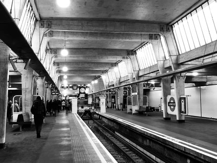
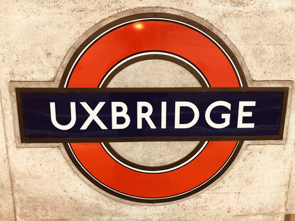
I arrived in the cathedral-like terminus at Uxbridge under uncertain skies. The forecast was dull, dry and mild despite the advance of December. Uncomfortable weather for trying times. The weak winter sunshine barely illuminated Ervin Bossányi's stained glass panels in the clerestory above the lithe concrete struts of the station roof. The arms of Middlesex and Buckinghamshire cast a dull glow over the gateline as I followed a sizeable crowd out into the High Street, turning around immediately to appreciate the exterior of Charles Holden and Leonard Holcombe Bucknell's imposing entrance, flanked by the winged wheels of progress. Uxbridge felt prosperous and busy - a distinct and self-assured market-town which existed firmly outside the gravity of London. A few streets beyond the town centre the Frays River and the Colne Valley marked the edge of the metropolis, administratively at least, but the mood and tone here were already provincial. The train had been busily gathering passengers during the last few stops, and the glassy, modern shopping centres which clustered around the terminus were already busy. Uxbridge was clearly a destination, not a satellite. It had of course been a regionally significant centre for centuries: this was a Saxon market town, named for the Wixan: settlers from Lincolnshire who farmed the fertile Pinn and Colne valleys, likely establishing their settlements where Bronze Age predecessors had founded their villages before the interlopers arrived. The town became a garrison for the Parliamentarians in the English Civil War, hosting a summit between King Charles and Parliament which failed to secure a resolution - reportedly due to the King's mistaken belief that military operations were already turning in his favour. As such, the Treaty of Uxbridge isn't the defining event in British constitutional history which it might have been, but the town nevertheless has a long association with the political life of the country. The Crown and Treaty inn where the opposing commissioners met still stands, a rambling red-brick building dating from 1576 but now dwarfed by modern developments which cluster impatiently around it, awaiting its eventual collapse. Uxbridge is also the administrative centre of the Borough of Hillingdon and as I sought the edge of town to begin walking along the road to London, I found myself caught amongst the various and improbable geometries of the Civic Centre. This weird, sprawling building with haphazard jutting eaves and a meandering footprint was designed by Sir Andrew Derbyshire and finished in stages by 1976. The building aims at a British neo-vernacular style, using tile and brick which echo traditional materials in the area. I walked a near-circuit of the outflung ziggurat, passing the site of the former GWR Uxbridge (Vine Street) station, now buried under tarmac and shopping arcade - a Crossrail connection opportunity missed? As a demonstration of its stature and indepdence, Uxbridge once benefited from three railway stations on separate lines - but now just one survives. Aiming for the spire of St. Andrew's church at the top of the rise, I pressed on into the gloomy morning. Uxbridge owes a great deal of its growth over the centuries to providing the first stop on the coaching route from London to Oxford. That road, once the route of the mighty A40, was now relegated to a supporting role - but it still regularly seethed and jammed with traffic pounding in and out of London. The settlements along it were supremely badly connected, mostly sitting some distance from Underground or railway stations which only nominally served them. Several bus routes remained dedicated to plying a linear course along the Uxbridge Road and avoided attempting to serve other areas, so prone is the route to snarling delays and unreliability. Topping the rise near the gold and terracotta brickwork of St. Andrew's Church, I realised I'd climbed out of the valley of the Colne and turned towards London at last. The road ahead led downhill, for now at least, as the carriageways split. On the western side of the road, a range of 1930s villas followed the gentle curve, while the eastern edge was in the process of becoming St. Andrew's Park: a vast new residential development which sprawled along a stretch of derelict light-industrial land. The quarter was slowly growing from the ground, apparently pleasant and low-rise, a modern equivalent of the kind of housing estates which crept towards Uxbridge in the middle of the last century, slowly engulfing it in the metropolis. There was little novel or attractive about this sprawl of housing - but it was at least built to a far more human scale than the clumps of stocky and anodyne new towers which dominated closer to London. Between the carriageways of the gently curving road, a broad swathe of grass hosted mature trees, indicating how this road was doubled in width long ago to cope with the growing traffic of the 20th century. The twin ribbons of asphalt twisted west and south, descending towards the valley of the River Pinn. I picked up the pace and begin my walk in earnest.
The valley bottomed out at the edge of Hillingdon Golf Course which rendered the Pinn's tangled and weed-choked banks inaccessible. The river passed beneath the road via an unremarkable bridge and headed west towards the Frays River and their nearby confluence. The road's edge described the southern limit of the grounds of Hillingdon House, formerly a grand hunting lodge built by the 3rd Duke of Schomberg in 1717, perhaps something of a retreat from his more ostentatious and notable Pall Mall pad completed some years earlier. The Duke, of German Huguenot descent, had served under his father, the 1st Duke at the Battle of The Boyne in 1690, leading the decisive river crossing which largely decided the conflict. For his efforts, he was granted British citizenship by Act of Parliament and later commanded British forces in Flanders and Portugal. While the echoes of the events in Ireland had reverberated through the centuries, Hillingdon House remained somewhat unremarked for many years until it succumbed to a catastrophic fire. Rebuilt as a grand mansion in 1844, it eventually passed into Government hands with plans to build a prisoner of war camp in the grounds during the First World War. Local opposition put paid to this scheme, and the site became a Canadian Military Hospital which remained on site until 1917 when the men of the Royal Flying Corps moved in to found their armaments training school. RAF Uxbridge and the attached RAF Hillingdon - in reality, a single large site divided by the River Pinn - provided a supply base and a tactical command post throughout the Second World War. During the increasing tensions of the 1930s, thoughts turned to how British airspace could be defended effectively, leading to the RAF adopting the Dowding System: by combining radar data and reports from the Balloon and Observer Corps with telegraphic contact to the airfields ranged along the eastern flank of the UK, it was possible to anticipate and respond to the incoming threat of the Luftwaffe. Realising that the wooden surface buildings of RAF Uxbridge were vulnerable to attack, a contract was hastily let to Sir Robert McAlpine to secretly excavate an underground control room, purpose-built to withstand attack and provide an around-the-clock response to enemy activity. The Dowding System proved remarkably successful, slowly grinding down the enemy's capacity for sustained air warfare and effectively laying the groundwork for modern air defence systems. It was following a visit to the control bunker in August 1940, watching the flickering lights which indicated squadrons engaging in combat, that Sir Winston Churchill uttered the phrase "Never in the field of human conflict was so much owed, by so many, to so few" which he later repeated in the House of Commons. Following the Battle of Britain, the control bunker would go on to support defence against the Blitz and to coordinate the air support for the D-Day landings. The RAF continued to use the Uxbridge and Hillingdon sites until 2010, when the remaining logistical and administrative functions moved to nearby RAF Northolt. The site was more rececntly obtained by Hillingdon Council who now operate it as tourist attraction including a modern visitor centre opened in 2018.
Churchill visited RAF Uxbridge on one further occasion during the war - but that hasn't stopped the Borough from co-opting him as a local celebrity and de facto genus loci. His name appeared everywhere as I continued along the road, curving subtly northeastwards towards the suburban fringes of Hillingdon. A road named in his honour formed the spine of a housing estate, while the dilapidated twin nissen huts of the Battle of Britain club decayed nearby, closed when the Ministry of Defence billed the hostelry for rent it had neglected to charge for 16 years. Perhaps it was no accident that when choosing a safe Conservative seat on which to base his re-entrance to Parliament after two terms as Mayor of London, Boris Johnson selected Uxbridge and South Ruislip? His oft-professed hero loomed large over the sleepy edges of Middlesex, preserving a sort of sleepy post-war peacefulness which radiated along the old road towards London. This was the essence of Johnson's appeal: a return to the settled state in which much of suburban England slumbered through the decades after hostilities ceased. A time on which idealised Blitz-bonhomie memories were based. Here in the southeast, where to some extent the hardships of recession and austerity had failed to bite, the urge to leave the EU was less compelling. Those who wanted to secede didn't base their vote on the sense of inequality which triggered it further north. Instead they heard the referendum as a call back to easier, simpler times when people knew where they stood, and most importantly who their enemies were. Memories are long in the suburbs where time moves more slowly, and life is always easier with a shared foe to rally against, real or imagined. The Uxbridge Road was a parallel to this historical self-deception: superceded and no longer the main road, but still a thundering trail of tail-lights and angry metal. The businesses flanking the street looked downtrodden, broken by lack of passing trade. No-one walked here. Hillingdon - meaning the town rather than the Borough - was a place with no centre. The cluster of streets around the Underground station much further north was its nominal town centre, while this ribbon of closed shops, takeaways and newsagents was Hillingdon Heath. An absence of a community. As I trudged the familiar landscape of mid-century development and light industry, I realised that despite a year or more of tentatively walking out here I still had no words for the West. For the east, I'd developed a vocabulary of absence and deletion, much of it shamefully borrowed from brighter minds and more authentic voices. But out here I was alone. The ghosts of long-dead airmen, of fleeting presidential visits by Churchill and of the dying culture of suburbia haunted the Uxbridge Road.
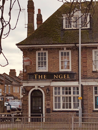
Cowed by the combined forces of ubiquity and mundanity, I sought the purpose to continue east. I thought back to the reason for this strange ambulation and recalled S P B Mais again. He had urged his readers, ultimately perhaps very wisely, to 'eschew therefore any walk that entails any more than a hundred yards of high road'. This walk, in fact, many of my walks this year had been all High Road and little else. I was tired and fractious, I'd absorbed the disturbingly divided politics and was trying to walk them out in an area which felt equally split and unresolved. I sleepwalked into Hayes End - the cluster of civilization which straddles the Uxbridge Road but again isn't any kind of urban centre, requiring a long detour to the south to reach Hayes Town or the railway. In doing so I crossed the constituency boundary - from the Conservative safe seat of Uxbridge and South Ruislip into the Labour stronghold of Hayes and Harlington. The boundary was unremarked at street level, but the shift in tone wasn't lost on me. This strip of retail activity could have been parachuted onto the sides of any of the major arterial routes in London: a run of Tudorbethan gabled shops housing tanning salons, hairdressers, a post office and some minor branches of national chains. Between these, light industrial units dating from the middle of the last century rubbed up against the remaining social housing stock of the Borough. Two properties stood out, both of them across the barrier-enforced central reservation: Lots of Rice - a Chinese Takeaway which set out its consumer benefits with remarkable clarity, and that other stalwart of the pre-motorway high roads: a sprawling red-brick roadhouse - closed of course. This wouldn't have struck me as unusual but for its name. Formerly The Angel, an unfortunate accident had disposed of its initial vowel, and for one dark moment I read it as 'The Nigel'. Perhaps it was the tattered, flapping St. George flags which were developing a coat of carbon, or maybe the general sense of decay of an establishment well past its prime? Disbelievingly, I scraped road-dust from my eyes and spied the vacancy for a capital letter. Thankfully things hadn't gone too far yet, and there was light at the end of this particular section of the grim tunnel as I approached the Borough boundary.
A branch of Premier Inn nestled into a corner of Yeading Lane, the now far less important north-south thoroughfare which led towards Hayes - the place for which the budget accomodation had been named despite its distance. The hotel had cynically added 'Heathrow' to the end of its name in the hope of scooping in a few hapless but geographically innocent travellers. Escaping Hillingdon here meant crossing The Parkway, my recurring western foe, as the Uxbridge Road descended to meet it in the valley of the Yeading Brook. The lie of the land was familiar from my walk along the progenitor of the River Crane, and as I tackled the multiple-stage road crossing via the centre of a wide roundabout which disgorged three lanes of traffic towards me, I recalled just what a confusing zone this was. The brook surfaced in two distinct branches, one which appeared to be a modern culvert providing drainage for The Parkway in its guise as The Hayes Bypass. The other clung closer to the Grand Union Canal which also shared its shallow valley, all three passing under my route to emerge either in the sprawling Lombardy Retail Park or in the tangled scrubby woodland of Minet Country Park. This relatively modern green space was dedicated to the public only in 2003, having until the middle of the twentieth-century been part of the Coldharbour Estate, owned by the Minet family. When I had passed this way in pursuit of the Yeading Brook, I stuck to the towpath of the Canal, somewhat daunted by the confusing appearances and disappearances of the waterway. Now I straddled the valley, awaiting my turn to shuffle across the traffic on the Ossie Garvin Roundabout. Garvin was a long-serving Labour councillor who, after an early move from Lancashire to Hayes to escape the mines and work at EMI, became the Leader of Hayes and Harlington Urban District Council, later serving as Mayor of Hillingdon. Garvin was reportedly never enamoured of the post-1965 borough, feeling that locals of the eastern parishes of the new sprawling authority would lose out in the process of integration. It's possible that he was right in a number of ways, not least that the long struggle to see the town bypassed and traffic gridlock reduced would not end until two years after Garvin's death in 1990. Along with John McDonnell, now elevated - sometimes seemingly to his own surprise - to the office of Shadow Chancellor of the Exchequer, he endlessly lobbied the GLC to build The Parkway, both politicians resorting to civil disobedience to press the case. Now the bypass he'd staked a career upon cannoned under a roundabout bearing his name, fittingly marking the extreme boundary of a Borough he served dutifully but never loved. There were however just a few more short yards of McDonnell's constituency left to walk, as it petered out beyond the Parkway at the bridge over the Canal. McDonnell would be returned to Parliament for sure - only a mammoth swing could unseat the stalwart campaigner, though this wasn't always a safe Labour seat. Prior to McDonnell's arrival, the loathsome Terry Dicks had held sway in Hayes and Harlington. Born with cerebral palsy he described himself in the house as 'a spastic'. More recently famous for an unearthed incident where he expressed disdain for the apparel of an upstart Jeremy Corbyn in 1984, he abhorred immigration and openly mocked the unfortunate and disabled, but nevertheless comfortably held this seat until retirement in 1997. Still alive and in his 80s, he sits on Runnymede Borough Council in Surrey, presumably an area which provides him with far less uncomfortable evidence of the immigration and integration which he appears to fear so greatly? The shift from right to left here was more extreme than the pendulum swings in other parts of the city. Something about these rather grey suburban avenues not far from the Heathrow flightpath provoked unease and discomfort. It was no surprise that a mace-wielding McDonnell in vigorous opposition to a third runway would inspire the voter here. However, considering the reliance of the locals on the airport economy perhaps the turkeys would be voting for an early Christmas?
Crossing the Grand Union Canal, I looked down at the spot near the Territorial Army depot where I'd zig-zagged up to street level a month back when an inconsiderate bird feeder had blocked the towpath with a flock of angry swans fighting for scraps of bread. I was now in the borough of Ealing, and walking a string of Labour-held constituencies which would take me into Central London. Uxbridge Road temporarily became The Broadway and the suburban sprawl gave way to the narrow High Street of Southall. The street vibrated with life which had been missing since the centre of Uxbridge. Hemmed into narrow single lanes between street furniture designed to quieten traffic, there were fractious scenes at junctions. Horns sounded, and an ambulance driver nudged and cajoled the traffic into letting him swing off the main road into a side-street. The coming of the Grand Union Canal and then later the Great Western Railway brought industry to Southall, seeing the rural Middlesex fields develop rapidly into a busy zone of factories and works. Martinware pottery, cereals, margarine and animal feed production required a workforce, and as such Southall was a destination for migration from the earliest years of the 20th century. First came a wave of Welsh mining families fleeing poverty in the Valleys, followed by Poles escaping unemployment and Imperial repression. From 1950 however, events would change the character and demographics of Southall entirely. Following the partition of India in 1947 and the passing of the British Nationality Act which allowed largely unrestricted movement to Commonwealth citizens, a steady flow of Indian and Pakistani families began to arrive in West London. While many of the new arrivals were highly educated and skilled, they experienced great prejudice, with their poorly spoken English mistaken for stupidity or ignorance. Many found unskilled opportunities in the factories around Southall, Hanwell and the Golden Mile of Brentford, not least in the R. Woolf and Co. rubber works, run by a former British Indian Army officer who had served in India and was sympathetic to their situation. As Southall prospered and grew, not least due to the need to support the expanding activity at Heathrow Airport, so did the South Asian community, with the area developing to meet their cultural and religious requirements. The result is 'Little India' - the dizzying collision of cultures along the Broadway which sees familiar British chain stores nestled between shops selling jewellery, Halal meats, saris and enticing trays of Indian sweets. The high street bustled in a way that few of the suburban centres around London manage. Proprietors stood outside their premises, surveying the street and calling to each other. People moved through a crush of shoppers and businessfolk, deftly weaving towards their chosen destination avoiding what appeared to be inevitable collisions. I have rarely felt such complete dissonance: tramping out east had brought me to areas built on a palimpsest of immigration, but gentrification had shifted their balance and left them contested. Southall however, was a different world - it was thrilling, enthralling and a little unsettling to find myself so completely subsumed by an entirely different culture to my own just a few steps along the greyness of the Uxbridge Road. It is of course frowned upon to suggest that anything less than integration is possible where immigration is concerned - and that very fettering of discussion is the seat of many current issues - but Southall worked on a different scale. This wasn't about individuals being subsumed into British culture - whatever that might mean in a world where Boris Johnson could be Prime Minister again soon. This was about Southall as a whole being integrated into the fabric of London. It worked, and it had rather shocked me into rethinking my map of the city.
Unsuprisingly, such cultural change has not been without incident: on the wall of the old Southall Town Hall is a plaque commemorating Blair Peach. Peach was a Special Needs teacher born in New Zealand and living in Bow, who emigrated to the UK in 1969 after visiting the country as a student. Active in the Anti-Nazi League, Socialist Worker Party and various other anti-racist causes, he was alarmed at the rise of the British National Party and the National Front, and the growing polling figures their candidates were achieving by standing on anti-immigration platforms in areas such as Southall. The killing of 18-year old Gurdip Singh Chaggar outside the Southall offices of the Indian Workers Association in June 1976 had sparked the organisation of local youth movements in the Sikh and Hindu population. The establishment response which sought to minimise the part of any racist motivation in the attack on Chaggar further stoked tensions which were rising in the area, fanned by the electoral performance of the BNP and National Front whose chairman John Kingsley Read had responded: "one down, a million to go" when commenting on events in Southall. On 23rd April 1979, the National Front organised a demonstration at Southall Town Hall in the lead-up to the General Election. An extensive petition to Ealing Council had prevented previous similar gatherings, but the Council felt unable to stop this assembly from taking place on the basis that it constituted legitimate campaign activity. This seems strange in hindsight, but there were at the time representations which went as far as Downing Street to prevent the meeting. The lack of political appetite to change legislation or to authorise the council to act outside the law as a contingency reflects the febrile political atmosphere prior to the election, with James Callahan's government on the ropes following the Winter of Discontent. Counter demonstrations were swiftly organised by local groups and anti-racist organisations, including a march and a seated protest at the Town Hall, resulting in a presence of around 3000 police officers being assigned to keep order, including officers from the Special Patrol Group. Tensions rose throughout the day, with skirmishes escalating and missiles thrown as National Front members arrived at the Town Hall for the 7:30pm meeting. The Police response was to contain the protesters along The Broadway, keeping the street open to allow access to the Town Hall. Once the meeting had begun, with a small contingent of members of the public admitted to nominally satisfy the requirements of the Representation of the People Act, the Police moved to begin dispersing the protesters outside. Accounts of the day are confused and various, but a common view is that this tactical switch from containment to dispersal precipitated a course of events which saw the SPG units deployed to round up so-called 'militant' protesters who were, in fact, heading away from the disturbances and into side-streets in an attempt to leave the area. The SPG were regarded as an 'elite' unit deployed to manage public unrest and serious disorder. Effectively a 'force within a force', they worked largely independently of the rank and file uniformed officers, travelling in their own vehicles and communicating on their own radio channel. Despite the confusion surrounding events, witnesses attest that soon after the arrival of the vehicle carrying SPG Unit 1-1 in Beachcroft Avenue, Blair Peach was struck on the head by an officer likely using an unauthorised weapon, and left on the ground incapacitated and unattended. He died early the following morning in Ealing Hospital having suffered a catastrophic brain injury. Immediately after Peach's death, an investigation commenced, headed by Commander John Cass of the Metropolitan Police Complaints Investigation Bureau. His work was completed by the Summer of 1979 and sent to the Director of Public Prosecutions, who while acknowledging the likelihood that one of five Police Officers from the SPG was responsible for the death of Peach, found there was insufficient evidence of reliable clarity to begin proceedings. Cass' report also noted that when these officers were investigated following the events in Southall, they were found to be in possession of numerous knives, coshes and other non-Police issued weapons, along with in once case, Nazi memorabilia. All of the officers in Unit 1-1 subsequently left the force without action or further investigation. The Cass report was not published in full until 2010, and then with only Blair Peach's name unredacted. The SPG continued to operate until 1987 but became rather symbolic of the mistrust that minority ethnic communities felt in the Police - a situation acknowledged by Chief Constable Geoffrey Dear who noted that they "might apparently solve one problem but in its wake create another of aggravated relationships between minority groups and the police in general". The policing of events such as those in Southall showed the supreme inability of an establishment dating from the colonial era to adjust to a changing society. The overriding view was that all would be well if minorities would quietly allow the protest to pass by, echoed by the Commissioner at the time of the event, Sir David McNee who told the Sikh community: "I understand the concern of your people. But if you keep off the streets of London and behave yourselves you won't have the SPG to worry about". McNee continued to hold the view beyond his retirement that the Police were unfairly blamed for the failures of government to respond to changes in the social fabric of Britain during his tenure. While that may be in essence true, the events in Southall only confirm the widespread corruption and right-wing activism within the Metropolitan Police during the 1970s and 1980s. The echoes of these attitudes are in many ways still with us, and at times of division and unrest not unlike those which led to me walking this route, they haunt the streets and the people of places like Southall.
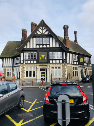
The limits of Southall were signalled by the Iron bridge carrying the Great Western Railway above the road. Nearby was something of an iconic staging post on my journeys into Paddington: the extensive mock Tudor gables of the former Greenford Arms Hotel, now inevitably a branch of McDonalds. Spotting this building from the train is a sign of London's imminence, but here on the road it signified distance: these wayside inns on arterial routes splaying out of the capital were seen as safely far away to conduct illicit assignations and undetected business. This slightly louche reputation sealed the fate of this establishment, which served as a strip club known variously as Barbarellas and McGinty's before rallying for a final stint as an old-school boozer known as the Pig and Whistle. Nothing could stop the march of the Golden Arches, however, and since the late 1990s it has served as perhaps one of the most striking restaurants in the chain's portfolio. Beyond the railway bridge, the road began a descent into the Brent Valley which was dominated by the concrete tower of Ealing Hospital. Prior to its opening in 1979, hospital services had been distributed across a range of outdated facilities in the borough and the provision of a modern General Hospital was seen as a much-needed improvement. By the turn of the century, however, the new hospital was consistently delivering the lowest rankings for patient care and experience. The new site, on a damp corner of ill-starred land hemmed in by the Brent and the Grand Union Canal, was part of the sprawling site of the Middlesex County Asylum, opened in 1831. The changing face of mental health care is reflecting in the name of this site over the years: Hanwell Insane Asylum became the Pauper and Lunatic Asylum, and finally St. Bernard's Hospital - under which some aspects of the site still operate. From the Uxbridge Road, the presence of the site was marked by a long, solid yellow-brick wall surrounding new housing which occupied the west of the asylum's former footprint. A solid, austere gateway arch had secured the site, but now gave access only to these exclusive dwellings. Watching prospective buyers arrive to be greeted by an uncomfortably stiff-suited Estate Agent, I wondered if her patter would extend to the former use of the site? How many Londoners now occupied these sites, utterly unaware of the purpose to which their cul-de-sacs and crescents were once put? Did they even register the strangeness and disconnection of the lands, often sequestered by awkward access or administrative borders which must, at least, be experienced as a lasting inconvenience even now? In the case of the Middlesex County Asylum, assessments of its' work were far more positive that those which its successor has enjoyed. The hospital was widely seen as a flagship for then-modern standards in mental health care. Its first Superintendent, Dr William Charles Ellis was a proponent of "the great principle of therapeutic employment" and amazed sceptical colleague physicians with the recovery he demonstrated among patients who were regarded as requiring incarceration and control rather than treatment under the accepted methods of the day. Later, John Connolly, the third incumbent of the post, undertook to entirely abolish the practice of using mechanical restraint on patients. He achieved his goal within three months of taking up the role in 1839, somehow convincing an initially resistant staff who would have feared greatly for their safety. His efforts were praised by the Visiting Justices of Middlesex who somewhat uncharacteristically for the times, recognised the improvement in both wellbeing and dignity which Conolly's patients experienced. The hospital - known as the London County Asylum at this point - expanded throughout the Victorian era, and by the 1920s it was noted that beds were sufficient that no patient in need of treatment was admitted to gaol without cause. It is perhaps the sheer scale of the Asylum which led to Hanwell becoming a cypher for insanity and mental ill-health. Notably, G.K Chesterton in Orthodoxy, his second volume of Christian apologia, ruminates on how only the 'insane' are truly full of self-belief. In comparing the changing attitudes of the time to religion and sanity he concludes:
"Men deny hell, but not, as yet, Hanwell"Orthodoxy: The Fundamentalist Argument, G.K Chesterton, 1908
There was no denying Hanwell: St. Bernard's Hospital continued to provide mental health services in Victorian buildings which felt surpringly human and decent beside the towering and somewhat grim modern monolith which sat at the bottom of the valley. I recognised this spot from walking the Brent: at this point a waterlogged path passed under the Uxbridge Road avoiding the need to ascend to street level, and I'd passed by largely unaware of the busy carriageway above. However, to the north across a field of a grass a broad and spectacular view of the Wharncliffe Viaduct opened. I recalled wandering across this field trying to find a good vantage point for a photograph of the spans as they strode across the Brent Valley. The feat of engineering remained a wonder to me, and the elegance and grace with which this huge structure strikes out for the west still arrested me in my steps. I paused and took a picture, the low afternoon sun reflecting the last bleached summer grass from the red bricks. Behind me the modern hospital buildings glowered in the gloomy dampness of the valley. This was a transitional point on the road - I felt like there might be a purpose to my walk after all. I paid silent respects to the Brent, gurgling sluggishly below the road, almost appearing unwilling to make the journey past the hospital to be unceremoniously decanted into the Canal nearby.
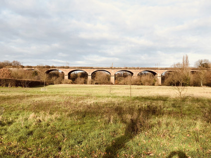
Climbing up from the Brent, I entered Hanwell - a place little known to me, save for missives I received from an old friend who lodged here during an abortive attempt to study English Literature at nearby Brunel University. I remember very little of those curious letters from the early 1990s, which mostly concerned the struggles of living with an unstable landlady and coping poorly with the lackadaisical financial freedom of student life before Loans and Tuition Fees. I do however recall how we provincials were led to believe via these bulletins that Hanwell was a thriving hub of bohemian life, something I doubted then perhaps even more than now. The town centred on a fork in the road, dividing around the fine modern clock tower unveiled to celebrate the coronation of King George VI in 1937. The clock was to be a controversially long-lived monument, with a local businessman campaigning vigorously to demolish the dreadful concrete eyesore in the 1970s when much good design from the early part of the century fell to the moderniser's hand. The clock prevailed though, and still provides a meeting point surrouned by pleasant cafés and independent shops. Perhaps Hanwell will one day become the bohemian oasis I was once promised after all? Pushing forward, the Uxbridge Road bisects what appears to be a single burial ground but which is in fact two distinct cemeteries: to the north, that of the Royal Borough of Kensington and Chelsea, and to the south the City of Westminster. The Westminster burial ground arrived first, consecrated in 1854 primarily to secure space for burials which could no longer be safely or hygneically accomodated by the churchyard of St. George Hanover Square. The Kensington and Chelsea Cemetery followed in 1855, occupying once fertile farmland known as the East Field, fed by a long-since culverted tributary of the Stamford Brook which ran along the edge of the plot. John Connolly, superintendent of Hanwell Insane Asylum was interred here in 1866 when local residents could still lay claim to graves in these extramural cemeteries. Somewhat segregated from the main road, the Kensington Cemetery had become something of a haunt for wild birds and woodland creatures. Indeed, both burial grounds would have slumbered peacefully into eternity had it not been for the actions of Dame Shirley Porter, Leader of Westminster City Council who in 1987 sold the southern plot to developers for the sum of five pence, along with two other cemeteries run by the Council - each for the same peppercorn. Ostensibly a means of avoiding the maintenance costs of the grounds, the sale placed the responsibility for upkeep on the buyer - but notably there was no such covenant to bind any subsequent purchaser. Inevitably, the grounds were swiftly resold to a subsidiary of the original buyer and soon fell into disrepair and overgrowth. An appeal to the Local Government Ombudsman and Audit Commission determined that the City Council had acted improperly and in 1992 the council was forced to buy back the graves at a cost to the taxpayer of around £4.25 million. The cemeteries, both now safely back in Council ownership and collectively known as Hanwell Cemetery, have been tidied and refurbishing and presented a peaceful transition from Hanwell to Ealing, marking an ancient boundary. Porter was to eventually find herself surcharged by the Audit Commission following the discovery of the secret 'Building Stable Communities' gerrymandering scheme devised in response to an unexpectedly narrow Conservative victory in the 1986 local goverment elections, with hiterhto safe seats threatened by both Labour and the Social Democratic Party. Porter's plan saw services focused on safe Conservative wards while homeless individuals and those less likely to vote for the ruling party were decanted to other Boroughs via an illegal housing policy, effectively socially cleansing troublesome wards. Following efforts to offload her considerable assets to family members and settling in Israel to avoid the payment of the surcharge, she was described by journalist Nicholas Lezard as "by a considerable margin, the most corrupt British public figure in living memory, with the possible exception of Robert Maxwell."
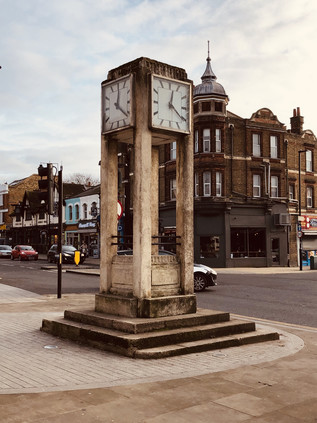
Beyond the cemeteries Ealing began with a marked shift towards the urban. There was something more of London than of Middlesex about Ealing, and the long strip of retail which began near West Ealing station continued unabated along the New Broadway and out to the Common. I've lingered in Ealing before and found it unremarkable but well-connected, the ideal spot for lodging on the edge of London. It had changed considerably in recent years with new developments growing from the streets around the high road, taller and more mundane than the rows of Victorian and Edwardian frontages which they towered over. One on long boarded-up shop front, grafitti urged passers-by to vote out Ealing Council to 'stop the towers' - but it was far too late for that. Buildings loomed over the odd, squat spanner-shaped block of Perceval House, Ealing Council's offices, built in 1982 for Sidney Kaye, Eric Firmin & Partners, which were soon to be redeveloped as housing. Around Ealing Broadway station in particular, regeneration remained in full swing, having seemingly been underway for years now. The little parade of shops I recalled from a previous visits had disappeared behind wooden hoardings and a new station parade was under construction. All of the posters and computer-generated views of this new Ealing were keen to remind me how The Elizabeth Line will bring amazing benefits - glossing over its increasingly indefinite opening date. Financial, political and operational failures meant the central section which would provide the swift link under the City of London which the ambitious advertised times relied upon would be delayed for years. In a few weeks the distinctive purple trains would begin plying their trade from Paddington to Reading, another disconnected arm of the grand plan with Ealing Broadway at its elbow. I didn't feel the need to linger here long: I filled my coffee cup and moved on, drinking on the hoof, eager to reach Ealing Common to briefly rest. The walk was familiar and I was soon greeted by the open, green sward ahead of me, dotted with bare trees set against blank, grey sky. I paused at a collapsing and rotten bench to watch the traffic hurtling towards the crossroads up ahead. I contemplated the crossing of the North Circular - another of the permeable layers of London burst through. My passage through this junction on another journey seemed distant and a little naïeve now. The crossing process was slow and cumbersome, skipping from island to island with the lights while regarding the hotel beyond which appeared closed and abandoned from this vantage point, though the busy car park suggested otherwise. The walk along this stretch was redolent with memory: from Ealing Broadway to Ealing Common station, an unknown walk back then which seemed unwisely risky out here in the suburbs. Passing the string of eateries in which I'd found a passable Indian meal a decade ago, I wondered which one I'd visited and if it was still in business? Amidst the neon and shaded glass of these establishments, Ealing Common station seemed unnaturally pale and white in the fading afternoon light, its Portland stone frontage seeming to emit sunlight gathered and stored during the scant brighter hours of a December morning. Above the station, the glimmer of sodium-light glowing from Charles Holden's distinctive heptagonal lantern made the idea of escaping onto a District Line train seem extremely inviting. The remainder of my walk into London from here felt impossibly long and challenging now. I wondered what I'd really let myself in for - and if it wasn't me who was being erased from London by this walk, rather than by some ludicrous magick, Boris Johnson?
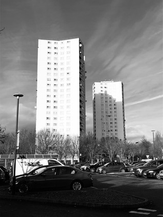
After the comfortably familiar passage of the Common, Ealing bled into Acton with little clear idea of when the transition occurred. In one sense, the passage through Acton felt like an extension of Ealing: the long strand of retail unbroken, with change signalled only by new branches of the same banks and stores recurring to serve each new locality. The road divided at a swirling and ill-tempered roundabout in front of a huge branch of Morrisons. Shoppers jostled to enter and exit the car park near the makeshift Christmas Tree store which had set up shop nearby, leaving a resinous pine smell hanging over the junction. This was a part of old Acton known as The Steyne. The local significance of the word appears lost, but most sources are content to assume it referred to a patch of rough, stony ground north of the Church, which may have been used for impromptu public assemblies, markets and the like. The term occurs rarely in London but can be found much more commonly along the Sussex coast where it variously appears to mean rough, unadopted ground or a stony valley floor. The Steyne was certainly built upon by the end of the 19th century with an omnibus depot and a dyeing mill nearby. The latter stood close by The Warple, a stream which flowed from a nearby spring, to form one of the three headwaters of the Stamford Brook. There was a distinct rise in the road away from the junction - an area which had once be known as Acton Bottom - but no other evidence of The Warple having flowed in recent memory here. Instead, Rufford and Moreton Towers stood as unblinking sentinels at the foot of the slope, situated almost exactly at the point where two short branches of the stream merged into one before turning east and south towards the confluence with the other sources of the brook. This pair of 22-storey blocks, completed in 1968 for Acton Municipal Borough Council were by far the tallest buildings in the vicinity, but that might change. Here, as in Ealing, the developers were moving swiftly and directly against public opinion to erect clusters of tall towers. The pressure on land and the lack of good brownfield sites pushed progress upwards rather than outwards. It was an impossible bind: the Borough needed new housing badly, but the residents wanted light and space. In the meantime, the two towers of the Steyne Estate displayed a strident, striking elegance which it's unlikely any modern scheme would echo.
The climb out of the valley was long and gradual, passing the grand facade of Acton's Old Town Hall dating originally from 1910 but much extended in 1939. The arms of the former Borough still hovered above the street despite the building's conversion to luxury housing. Perhaps this gradual gentrification was a natural conclusion, an expected free market end-state based on the former Municipal Borough's motto of Floreat Actona? The blazon of Middlesex County Council was at the centre of the huge stone crest, like Acton also long ago subsumed into a hungry and ever-growing city. The Uxbridge Road became The Vale here for a long, straight stretch. A couple stopped me to ask if there was anywhere to buy a Christmas tree nearby, and I directed them back to the stall I'd seen, warning them it wouldn't be cheap. I couldn't summon any sense of festive spirit myself, the upcoming General Election had swallowed all seasonal concerns and drew all of my energy. Holding this unwanted and unexpected contest now was either sheer genius or utter folly, and we wouldn't find out until it was too late. I passed the same couple, treeless, hurrying back in the other direction soon after and wondered if perhaps they too had suffered a failure of festivity in the face of things, or just been defeated by the Uxbridge Road? Looming large on the northern side of Acton Vale, the huge rectangular facade of The Pensions Building slowly expanded to occlude the view. This stately but rather severe building was hastily constructed following the First World War to provide accommodation for civil servants operating the War Pensions system from temporary huts. The sheer scale of the building, oblong and slatted like a prone bookcase, was dizzying. It would seem considerably more comfortable as a Manhattan office block than a British public building. Now, inevitably, it was an opportunity for exclusive city living - not far from the still spectral Crossrail service and of course regarded as just 'minutes from Central London.' It felt much further to my aching feet, but I was distracted by a growing crowd through which I was being jostled. I often feel that I'm somehow going against a tide on these walks, and that the greater flow of humanity is pushing back against my progress - but today it was evidently true and the crowd into which I was attempting to walk was wearing a distinct uniform of blue and white under their winter coats. The Queens Park Rangers fans were on the march: their home ground nearby at what would have been known as Loftus Road during the short period in the mid-1970s when I briefly cared about football . Now it was known as The Kiyan Prince Foundation Stadium in honour of a talented youth player who was stabbed to death in 2006 while intervening to help another boy who was being bullied. Loftus Road was a compact stadium, hemmed tightly into the backstreets of Shepherd's Bush with little scope for expansion. The club have considered a move elsewhere in West London for some years, but for now they cling to their W12 roots proudly. They were, for the most part, an even-tempered and decent crowd today as they contemplated an ultimately successful afternoon clash with Preston North End, something of a revenge for a trouncing at the start of 2019 by the same team. This was something of a relief as the exploits of the notorious Bushbabies, the firm of hooligans who follow QPR, are historic - and there are recent records of fairly serious skirmishes even recently, particularly with Chelsea's Headhunters. Having been caught up with football gangs during my years travelling extensively by train, I'd learned to expect the worst and would usually prepare to get as far away from match day as possible.
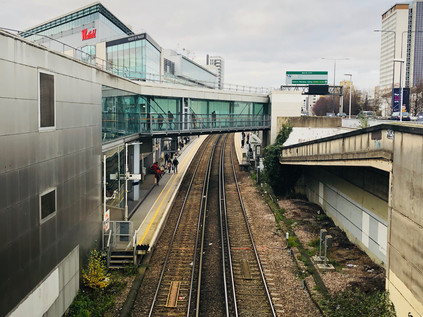
Today, however, all seemed calm as I threaded through the mix of football fans and shopping crowds milling around the entrance to Shepherd's Bush Market. The market had occupyied the same tiny sliver of land in the shadow of the Circle Line's viaduct since 1914 or thereabouts, survivng numerous plans to redevelop the area. Perhaps the market's biggest challenge though was the coming of Westfield London. Opened in 2008 and gradually extended onto adjacent sites since, there was currently around 1.6m square feet of retail space built upon what was once the White City exhbition complex and London Transport's former Central Line depot. The railway history of this area is exceptionally complex, and much that influenced how this area would grow and change was now buried forever. Westfield was safely tucked away behind a run of Victorian terraces which had survived the redevelopment, preserving the appearance of shabby continuity on the Uxbridge Road. Beyond this however, the forest of cranes indicated a zone still in flux. The site of the greyhound stadium and of the former Wood Lane BBC studios were locations of opportunity, absurdly well connected by a confusing range of Underground and Overground stations sharing some form of the name 'Shepherd's Bush' which all jostled together to serve the retail nexus. I felt like my route had reached London at last: in one of its more voracious incarnations at any rate. I navigated the crowds which were milling around the new entrance to Shepherd's Bush station, noting the Overground lines curving into the platforms deep in a cutting beneath my feet. The footpath directed me north, briefly climbing a sliproad onto the A3220 West Cross Route. I've written often about the London Ringways, those ambitious but controversial and flawed plans to encage the City in a box of high-speed, high density urban Motorways which were finally abandoned in the early 1970s. My suburban excursions have often stumbled across curious blighted zones which were developed as in-fill after the plans were shelved, or half-finished stubs of road which hint at the devastation that construction would have wrought had the carriageways crashed onwards into the suburbs. Here however, was one of the rare parts of that network which actually made the leap from drawing board to the ground. Traffic congestion on the western approaches to London was a longstanding and intractable problem, and the solutions were never subtle - but the West Cross Route, scything along the edge of exclusive Holland Park and dividing it from the less salubrious Shepherd's Bush, was a dramatic plan. Urban motorways were an acceptable evil in the post-war era of ambitious reconstruction, and it would seem perhaps unusual that Leeds, Manchester and Glasgow had pressed ahead with their plans while London was left behind. By the late 1960s, the plans were buried in a sea of bureaucracy, protest and endless Public Enquiries. The situation in West London though, was urgent and surprisingly, the Greater London Council had been given something of an easier passage for the western section of the motorway box. Perhaps it was its location, running alongside the existing division of the West London Railway, or the equally apparent psychological gulf between the communites on each side? In any case work began on a small strip of the West Cross Route on the basis that it was essential to feed traffic to and from the soon-to-be-opened Westway on its impressively bleak viaduct. Thus in 1970 a kilometre of new road was opened between Holland Park Roundabout and the Westway, with huge and over-engineered roundabouts at each end to facilitate future expansion. It wasn't the ringway that Patrick Abercrombie had specified, nor perhaps even the compromise the GLC had long sought - but it was built: a claim few sections of this infamous plan can stake. While the urban motorways of London had long been widely considered a poor solution to a growing problem, the M41 managed to persevere until 2000 when it lost its Special Road status and was handed over to Transport for London by the Highways Agency. Rechristened the A3220, it looked like an anomaly on the map - and it felt even stranger to a pedestrian on the ground. While the West Cross Route hadn't attracted much in the way of resistance when conceived or constructed, it did enjoy a moment of celebrity later. On 13th July 1996 around 6000 protesters from Reclaim The Streets blocked the motorway, laying sand for children to play on, firing up sound systems and dancing. Among the crowds of dancers were stilt-walkers wearing huge diaphanous skirts. Under the cover of these, protesters drilled holes in the carriageway and planted trees. Over this unseen act of guerilla rewilding they unfurled a banner bearing an unattributed slogan which linked them back to the Situationist International: "The Society That Abolishes Every Adventure Makes Its Own Abolition the Only Possible Adventure."
A pelican crossing halted cars accelerating away from Holland Park in the hope of a clear run onto the Westway, as a horde of Christmas shoppers poured west with me caught in their draught. Drivers snarled, their engines growling even louder as they faced the indignity not only of stopping, but stopping for mere pedestrians. As soon as the light changed, they were snapping at the heels of the last to cross, who were startled out of their phone-screen reveries by angry metal approaching their shins. Pausing on the central reservation - over what would likely have been six carriageways of road had the plans been completed - I surveyed the scenes around this nexus. To the west lay the road I'd walked, leading back from the shimmering glass blocks of Westfield into the grimy and interesting old streets of Shepherd's Bush. To the south, the Thames Water tower exposed the hidden infrastructure of the city, topping a surge outlet on the vast Ring Main providing potable water to Central London. The level of water visible in the tower responds to demand on the main, leading to many online complaints that it "wasn't working" when visitors passed by. There was no obvious activity in the cylinder today. To the west I faced a divided view: my route pressed on into the leafy, gentile avenues of Holland Park while to the north the three ominous towers of the Edward Woods Estate loomed over the road. The clearance of railway yards and sidings to create the West Cross Route provided much-needed building land to the Borough of Hammersmith and Fulham, which needed to complete slum clearance work with very little usable land of appropriate value. The solution was to propose three of the tallest residential blocks London had then seen. Despite building Poynter, Stebbing and Norland Houses and the low-rise blocks surrounding them with their own direct labour, the Borough experienced the same issues with snagging and build quality which lower-cost system-built blocks suffered. Also, over time, many of the social issues which were commonly said to result from high-rise living settled on the estate too. But surprisingly, residents rather liked their homes and despite concerns about safety and poorly-performing lifts, wanted to see improvements and repairs rather than being removed to new dwellings. These positive changes have, gradually, arrived in recent years and despite being situated in one of the most deprived wards in the country and serving a vulnerable population heavily reliant on state benefits for income, over 75% of tenants describe their quality of life as 'good' or better and many were proud to say they lived on the estate. The Borough also offered desirable upper floor flats to teachers and other essential public employees. I've often stumbled into neglected and ill-supported housing schemes around London which appear to have negatively affected the very people they were concevied to support. Here though, where the snags and issues were in the process of being addressed, it was good to see the a challenge to the idea that it was the nature of the estate or indeed its residents which were the problem needing a solution.
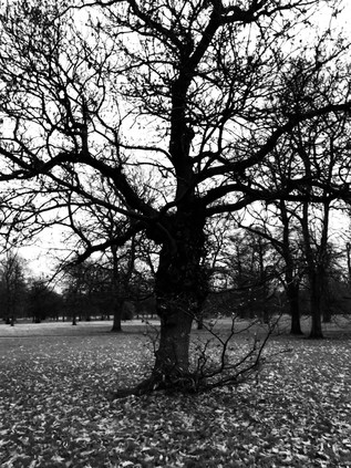
Beyond the former motorway my route rose out of the unnatural valley which accomodated the road and railway dividing Shepherd's Bush and Holland Park, and climbed into a different world. The leafy avenues of grand houses and the ranks of high-end bakeries, cafés and kitchenware stores signalled a shift. The crowds here walked a little slower, shunting empty expensive prams along the pavement while sleepy-eyed children swayed on dad's Barbour-clad shoulders. Ludicrously unnecessary high-performance cars nudged around the stucco-fronted side-streets, even the fastest Lamboughini reduced to a puttering pace by the congested narrow streets and lack of parking spaces. This stretch of West London, from Holland Park to Notting Hill Gate was only vaguely known to me - but I knew it wasn't somewhere I'd comfortably fit. It was also difficult to square the inequality here - and even a dedicated capitalist walking over the divide I'd just crossed would be hard pressed to make a compelling case for this. Holland Park was a cartoon of affluence, an amusingly obvious collection of stereotypes funnelled into a tiny stretch of the Uxbridge Road. It struck me that I'd completed a circuit here: from well-to-do provincial Uxbridge to even-better-off Kensington. The bypassing of this ancient coaching road by the soaring carriageways of the Westway just made it easier for the commuters to ignore the intervening stretches of average, just-about-managing suburbia. As I surveyed the route towards Westminster, I noted substantial houses given over to use as Embassies and High Commissions which signalled the approach to the precincts of Hyde Park and with royal associations. Nearby in Campden Hill Square, the anglo-Catholic mystic and theologian Evelyn Underhill had lived and written. The first woman permitted to lecture the Church of England clergy, Underhill's writing wrestled to bring together the psychic, spiritual and occult ideas of the Medieval Catholic church with the staid and prosaic world of Anglicanism. She wrote often, especially in three early novels which used fiction to expound her ideas, of living in two worlds at the same time. Her words struck me as I progressed through the contested and divided communities of Kensington. Though the duality here was material rather than spiritual, the same rents in the fabric were apparent here in Holland Park:
She had seen, abruptly, the insecurity of those defences which protect our illusions and ward off the horrors of truth. She had found a little hole in the wall of appearances; and peeping through, had caught a glimpse of that seething pot of spiritual forces whence, now and then, a bubble rises to the surface of things.The Column of Dust - Evelyn Underhill, 1909
As I crossed to the southern side of the Bayswater Road, I was gradually nudged against the railings of Hyde Park by the insistent crowds heading for the Winter Wonderland event, an annual and highly effective monetizing of the festive season where every attraction was ticketed and nothing was free. It was, however, proving remarkably popular and I decided to strike out across the park instead of sticking to the road. It would save time and painful steps, and would hopefully avoid the most frustrating congestion around the entrance to the temporary theme park, marked by whirling and flashing fairground rides and a pall of thin generator fume emanating from the vicinity of Speaker's Corner. In the gathering dusk, I took a diagonal route skirting The Serpentine, towards Hyde Park Corner. Despite the unexpected familiarity of the leafless, wintry trees which took me back to a comfortingly bleak visit to the park the morning after my mother died, I was in a world I'd never found comfortable. The presence of huge crowds unsettled me as I tried to process the conflict and strangeness of my walk today and my memories of prior visits. The happy family groups skittered towards me, and I felt the need to dodge them by walking on the grass. They must have been equally concerned by my shambling, sweating presence as I tramped onwards. My feet ached and I longed for this part of the walk to be finished. This had now genuinely taken on the aspect of a pilgrimage or mystical intervention and my glib and silly idea of an exorcism didn't seem either so amusing or indeed so impossible. Skirting the press of humanity around the Tube station - exit only due to overcrowding - I suffered the crowds along Constitution Hill and endured their milling around Buckingham Palace. The building shone unnaturally in the dusk, the monarch absent and the edifice required to provide a proxy for constitutional leadership in the absence of an effective government. In a few days time, an unassuming black car would be taking a new Prime Minister into the inner precincts of the Palace and it felt near impossible to predict who among a singularly unedifying field it might be at this juncture. Onwards, along the Mall into another tide of tourists and shoppers, from which I overhead someone claim with authority that 'Harrods is just a few minutes walk this way...'. I anticipated the collective groans of his group when they were still struggling through the multitudes in an hour's time, their tangled carrier bags flapping against their tired knees. Maintenance on Admiralty Arch pushed the stream of pedestrians into the normally little-used alleyway of Spring Gardens, emerging near to the grand buildings of the Department for International Development on Whitehall. I turned south, my goal in sight and marked by a cluster of tourists pressed up against the security cordon at the end of Downing Street. I initially assumed that they were trying to snap the iconic black door, which seemed unlikely given its distance from the street and the deepening twilight. When I reached the gates, however, the attraction was the six armed Police officers who were busily shoeing tourists back from the gate and asking them not to take pictures of working security forces. It felt like a highly dubious application of The Terrorism Act, but then much about these times felt unusual and unprecedented. I retreated to the median in Whitehall on which the Cenotaph sits, a stately and enduring symbol of bravery and service which was more permanent than any inhabitant of that exclusive address just across the street. It was time to turn towards Parliament, veiled in white sheets and supported by scaffolding - a powerful statement on the broken institution.
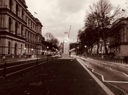
As I descended into Westminster Station, contemplating what might be a long break from walking in London, I tried to visualise the Uxbridge Road stretching back west, unravelling a route which, should he retain a majority, Boris Johnson would need to traverse. The layers of history and memory of London's people which he'd permeate as he passed would probably have little consequence for him - his conception of history was built around times more ancient and figures more stately. Could a walk which tried to uncover and foreground the difference, diversity and struggles at large in a City which he'd presided over as for two terms as Mayor and lately as Prime Minister make any difference? Of course not. It had been a fool's errand and a silly conceit for a psychogeographical ramble. But there was just the faintest hope - it was surely worth trying anything now. The idea that the resolutely human and mundane Uxbridge Road had attracted the attention of Evelyn Underhill, herself normally preoccupied with humanity's capacity to dwell within the lofty and spiritual, provided some sliver of possibility that it wasn't all about cold, hard reality in these western environs after all:
The western road goes streaming out to seek the cleanly wild, It pours the city's dim desires towards the undefiled, It sweeps betwixt the huddled homes about its eddies grown To smear the little space between the city and the sown: The torments of that seething tide who is there that can see? There's one who walked with starry feet the western road by me!Uxbridge Road - Evelyn Underhill, 1912
You can find more pictures from the walk here.
Returning to the scene is never wise, but if I was to fulfil my debt to the River Crane, it had to happen. Over a hectic summer with numerous missteps and changed plans, I'd always found somewhere else I needed to be. There was a strange hiatus too: a reaction to finally completing the London Ordinal walks. While I usually benefit from a plan, I so easily become a slave to the method I've determined. So, cast free of any real or imagined obligation I'd struggled to find the right walk, confused by options and dismayed by unchecked difficulties. During my last walk I'd had a fractious, disconnected response to the city which troubled me. Today though, I knew I was in the right place. Since I'd walked the A4, this unfinished business on the western edges of London had been gently edging into my thoughts again. So after a timely arrival in Paddington and a swift dash around the concourse, I was heading back west into the suburbs. I alighted at Hayes and Harlington: often passed through at speed, but never before visited, it felt oddly familiar and entirely alien at the same time. Outside the station, a brand new development of homes and ground-floor shops housed a small supermarket. I ducked in for water supplies, then headed for the Grand Union Canal. This too was a sliver of unwalked waterway which I knew I would need to revisit - but the brief section I found on descending to the towpath wasn't entirely unrecognisable: I'd gazed west from a previous walk, overlooking the derelict remains of the Nestlé works. Now the plant was a skeletal ruin, its white plaster walls remaining as jagged fragments of facade in a landscape of rubble. The towpath was litter-strewn and overtopped by energetic fronds of buddleia waving in the breeze. Amidst a cluster of old clothing, discarded cider bottle and the tell-tale silver pellets of N2O canisters, I turned aside and headed up the ramp.
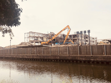
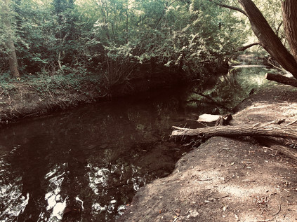
The familiar path took me to the litter-strewn, wooded embankment of the M4, turning west and following the road briefly to an underpass. Noise is so much part of the fabric of this part of London that it almost disappears, and the constant drone of traffic above was almost a comforting vibration. The tunnel under the motorway emerged in Cranford Park, passing through the gatehouse of its stable block which had both enchanted and unsettled me on arriving unexpectedly here before. The rather forlorn, abandoned building still had the power of surprise, and emerging into the open, green spaces of the park was equally jarring after the straggling urban clutter of the first miles of my walk. I lingered a little longer around both the remains of the once-great house and the tiny church of St. Dunstan and the Holy Angels with its Templar and Hospitaller associations. The road to the church was busy with volunteers and visitors, a strange young man - well-dressed and agitated - pacing around the headstones in the churchyard, crossing and recrossing my path as I ambled among the memorials. Here in this little-visited but hardly quiet spot near the M4 lies Tony Hancock, the embodiment of the tragic comedian. A little before my time, his work overshadowed my own early discoveries and seemed tame and compromised as I delved into Monty Python. But as I've grown older I've found myself appreciating the pathos in his despairing looks to camera as the situation unravels around his character. In truth, Hancock's frequent sidelong glances are often his resort to a teleprompter having suffered memory problems after a car accident, but there seems a haunted look about him. As he wrote in the note left on his suicide in Sydney: "things just seemed to go wrong too many times". It's a simple, pathetic observation we could probably all make - but here in Cranford, he was at peace at last. Nearby was a character who sounded no less tragic, but was far more mysterious: John Finall Cook, described in his own epitaph as "the worst used High Constable in England". Despite leaving quite a trail, there is little to tell quite what ill-use cook suffered. Aside from a case of 'burglariously breaking and entering' heard at the Old Bailey - the defendants found not guilty - his career as the High Constable of Isleworth does not seem to have been worthy of much remark. He lived to the respectable age of 85, and in his 70th year prepared a book of bible selections - Sacred extracts, or, The Beauties of the Psalms and the Apocrypha. In 1845, Cook petitioned the House of Lords to pass a bill rewarding High Constables for 'meritorious services'. Given the reputation of Hounslow Heath as a dangerous and forbidding wilderness, it's perhaps possible to imagine Cook run ragged by a rural crimewave during his career. If that was the case, little evidence of it survives and the curious wording of his gravestone remains a mystery.
The path followed the bank of the river southwards, shadowing The Parkway for some distance, and I felt somewhat foolish for having abandoned this more pleasant passage for the tarmac on my last visit. Crossing the river into Avenue Park, I met a clutch of friendly dog-walkers tramping across the unmown tinder-dry grass rather than edging around the field. I followed suit, abandoning the river for a stretch, as I needed to head for an exit onto the Great West Road. The distant line of hotels and offices strewn along the Heathrow fringe shuddered in a heat haze while planes wheeled overhead after their steep ascent, insignia clearly readable in the glint of sunlight. It felt like a good morning to be walking, even the glowering owner of a trophy-dog greeting me with a smile and a nod as I passed out of the park and into the urban hinterland of Cranford. I needed to walk the pavement a little here to regain the river, crossing the A4 at a point I remembered well from my recent linear walk. The road shimmered in the heat, still unexpectedly quiet considering its importance, and I was swiftly across and diving into a cul-de-sac of semi-detached homes which had been slotted into the irregularly shaped parcel of land next to the river. The sun-baked concrete roads were dusty and reflected the heat back at me. A huge black four-wheel-drive car with dark glazed windows snaked into a space at the roadside, the rear door opening to admit two elegantly dressed young Indian women heading for a function, before speeding off around the loop and back towards the main road. Between the houses, at the end of the close, I found the unmarked pathway into the park and allotments which petered out into rough heathland on the edge of the river. Once into the park, I struck out to the west getting as close to the water as I could. The river flowed quick and clear through the narrow wooded strip which shadowed its passage between the eastern perimeter of Heathrow and the Cranebank complex, home of British Airways' training centre amongst a sprawl of disused and apparently abandoned buildings from an earlier phase in the development of the Airport. Heathrow dominated the zone: tall lights towered over the treeline, and a vast hangar was visible between the trunks of ancient riparian oaks. Every few seconds, the air was rent by the searing jet engine sound of take-off or the reverberating howl of resistance as a descending airliner fought its purpose to stay aloft. At such close quarters, the noise was like nothing I'd experienced before: for a few seconds, my hearing was overwhelmed to the point of shutting down. It was not, as commonly thought, a roar: it was a tearing apart, a sundering of air. The view of the underside of the passing jets allowed me to pick out tiny details, like turning over a model plane for inspection. Living here must, of course, afford one some sort of immunity to the constant sound - and it's possible that, like passing trains, it could become an almost soothing clue to the normality of life continuing outside. But here, under the flight path, I wondered how human beings could adapt to such hostile audiological conditions?
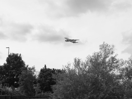
The path emerged from the trees, depositing me unexpectedly onto Earhart Way. This was part of the Heathrow estate and I was immediately aware of the scrutiny of CCTV around me. The road layout had altered here, access now being from the eastern end of the industrial park, meaning that traffic avoided entering via the airport's well-guarded gates. An abandoned checkpoint to the west was blocked with concrete barriers and signs signifying there was no passage for pedestrians. Interestingly, waymarks for the London Loop path also pointed west, defying the otherwise omnipresent authority of the airport. Despite the neverending pulse of aircraft movements, my walk had felt largely separate from humanity and its machinations since leaving The Parkway behind, but now I was faced with multiple layers of human activity presenting barriers to my onward passage: ahead of me, the Piccadilly Line extension sloped out of its tunnel to pass over the Crane - the cost and complexity of remaining in tunnel beneath the water table too great. Beyond the concrete retaining walls of the railway, the Great South West Road blocked my path, cars flashing by as they accelerated towards London. This corner was not always a nexus of busy routes: Dockwell Lane had once cut a lonely path across the northern reaches of Hounslow Heath, fording the River Crane at this spot. It was in fact the perfect place for Heston and Isleworth Urban District Council to site Dockwell Isloaton Hospital which opened in the early 1890s. In 1895 a scandal arose regarding the poor conditions at the hospital and it was resolved to build a new, modern facility at Mogden which opened in 1898. From this time onwards, the Dockwell site was vacated, opening only infrequently when epidemics overwhelmed the new hospital. Staff would be seconded to reopen the somewhat outdated and increasingly dismal wards for tiny groups of Smallpox and Diptheria patients during the 1920s and 30s, with the site finally closing entirely in 1935. No trace remains of the hospital, with much of the site being absorbed by Cranebank. It seemed odd to imagine the next generation of pilots using complex simulators to learn their craft on the site of this gloomy and forsaken institution. I turned west, navigating the barriers and heading along the airport perimeter road for a short stretch before joining the footpath along the A30 and immediately feeling more secure. The vast hangar building which had appeared fitfully along the river path was now in full view - impossibly proportioned but still dwarfed by the huge areas given over to staff parking on the eastern edge of Heathrow. Empty shuttle-buses rattled by, heading for hotels and terminals, while Underground trains clattered along beside me in their concrete gully. This part of the route had seemed unnececssarily complicated when I was planning to walk along the Crane - there would surely be some other means of crossing the road without the long doubling-back to Hatton Cross, but sure enough, the unbroken streams of traffic were unrelenting. I finally made my crossing at the site of the almost entirely deleted hamlet of Hatton, the sleek blue glass lozenge of the new Atrium Hotel now taking up almost the entire footprint of the former village, the established pattern of roads which had once encircled it relegated to the status of a gyratory. Nestled into the corner of the junction, near a farmhouse decked-out in 'Help for Heroes' banners and repurposed as an X-ray freight scanning business, horses grazed lazily in the sunshine. I was now directly under the path of departing planes on the southern runway, feeling their tumult rather than hearing it now. The horses munched on, unconcerned by the cacophony above. I set out to retrace my steps towards the river, and the opportunity to disappear into the woods once again.
The section of the river south of the Great South West Road wound along a damp and boggy plain, dominated by the huge balancing reservoirs which managed the water running off the airport site and preventing the escape of kerosene and de-icing agent into the Crane. The path clung close to the river, raised on a walkway above the marshy ground. Aside from the regular interruption by aircraft, the path was quiet with only the babble of water and the scrabbling of unseen creatures surprised by my passing. Relaxing into my surroundings, I realised how tense the passing of Heathrow had left me feeling. The river occupied a narrow strip of scrub and woodland between large industrial and distribution parks which clung to the edges of the airport. This industrial encroachment wasn't new however, and the banks of the Crane here had always served a purpose: despite the relatively poor flow of water there had been a succession of mills along the river. As early as 1630, Benjamin Stone's sword manufactuory had finished weaponry imported from Germany, stamping it 'MI FECT HVNSLOE'. Contracted initially to supply the army of Charles I at the nearby barracks, the King's flight from London left him near bankrupt. But the business was momentarily secured by the raising of a public subscription to purchase swords for Cromwell's parliamentary army. Thus Hounslow-made blades may have been the downfall of combatants of both sides of the conflict in the English Civil War. The water meadows here, while naturally marshy, were made more so by a complex of mill leets dug between the Crane and the man-made cut of the Duke of Northumberland's river, a canal constructed possibly as early as 1530 to augment the waters of the Crane with flow from the Colne abstracted at Longford. This waterway, much re-routed and reconstructed at various points by the expansion of Heathrow finally found its outflow amongst the boggy copse of Donkey Wood, where I crossed the head of a broad green pool before finding the spot where the water tumbled down a weir into the river. This confluence of man-made and natural rivers lay a little north of ancient Baber Bridge where I once again crashed out of the woods and into civilisation, however briefly. There had been a crossing of the Staines Road here for time immemorial, and certainly, since a wooden structure was first recorded in the 13th century, then known as Beaver Bridge. The current crossing, distinctly broad considering its great age and built of a purplish-grey brick, dates from 1798 and is the work of the County of Middlesex. This route was part of the Devil's Highway - an impressively durable and direct route from London to Silchester and eventually to Aquæ Sulis which survived as an important highway long after the Roman occupation of Britain. The origin of the name was regarded as 'fanciful' by Lt. Col P L Macdougall who gave an inaugural address to the Surrey Historical Society on the matter of the route in 1854. While parts of the route into London are still debated, the celebrated antiquarian William Stukeley rode out of London to Staines with some confidence he was tracing the correct path. General William Roy also uncovered part of the route himself when undertaking his pioneering measurement across Hounslow Heath in advance of a triangulation of the whole of the isles of Great Britain which he wouldn't live to see completed. Today, Baber Bridge was busy with traffic battling roadworks and congestion, drivers barely noticing their passage over the Crane as they navigated what seemed to them I'm sure to be nothing more than a clump of unusally dense woodland. I chose my moment and crossed the venerable road to the west, finding the continuation of my path a little hidden in the entrance to a busy Jet filling station which added all the usual conveniences to its offer. I resisted the promise of Costa Express and passed through a cluster of seemingly disused vehicles and over a gate into Brazil Mill Wood. Within easy reach of Hounslow Barracks, use of the various mills along the Crane often turned to martial duties, with numerous former grain and dye mills turning to the manufacture of gunpowder. With the vast Hounslow and Bedfont mills already engaged in this hazardous task, this made the banks of the Crane a somewhat risky place, prone to frequent fire and explosion. In 1752 the mill situated in the woods here shifted to the more pacific pursuit of creating a distinctive red dye from paubrasilia, and leaving this narrow strip of surviving woodland its current name.
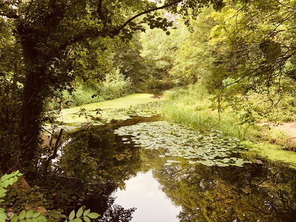
Below Baber Bridge, the Crane splits into two streams and skirts the western edge of the remnants of Hounslow Heath. This wide plain of both wooded and coarsely grassed wild land was once much larger, and not a place to linger on the roads west of London. It was the isolation which provided an opportunity for military assembly on the heath and the lawless reputation of the place which likely required the army retain a presence here in the longer term. Cromwell stationed his troops here in 1647 as the Civil War came to a close, with James II subsequently exercising troops here to intimidate Londoners into accepting his position. A permanent barracks at Hounslow was founded in 1793 in fear of an impending French invasion, with troops regularly performing cavalry exercises on the Heath until the First World War. Urbanisation gradually encroached on the Heath from the 18th century, in part due to the presence of the barracks and then the coming of the railway which crossed the Heath on route to Waterloo. Though much smaller as a result of this gradual erosion by the city, the Heath today still has a desolate and lonely aspect, and I felt surrounded by the sense of loss and excision which appears to haunt the valley of the Crane throughout its length. The path meandered with the westernmost stream of the crane, buried in unruly trees and largely separated from the broader expanse of open land which was briefly London Terminal Aerodrome until Croydon took its place in 1920. South of the tracks, a large part of the Heath was purchased by the London & South Western Railway in 1914 to form its huge Feltham Marshalling Yard. With the outdated facilities at Nine Elms overwhelmed by new traffic and losing profitability as early as the turn of the century, the LSWR had decided to construct a new yard to aid in combining joint traffic with other railway companies more efficiently. Impressed by the 'hump yard' principle in use in the massive stockyards opening in the United States, Sir Herbert Walker, General Manager of the company persuaded directors to purchase additional land to the east in order put these innovations into practice. The shaping of the yard involved diverting the Crane and the Millstream and excavating huge amounts of earth. Around 200 German prisoners of war assisted in the effort, and the first sidings were opened in 1917. The yard was a technological marvel in its time: using the hump shunting system, track circuits for signalling and electronic control from a central 'tower' which allowed gravity and switching gear to sort an incoming train in as little as twelve minutes.
Approaching the much-reduced railway lines today, the path meandered into an open field before stopping abruptly at a graffiti-daubed wall with trains clattering by just feet above me. The river plunged into a dark tunnel with a ripe, sewer-tainted atmosphere, and a cursory inspection indicated two issues: firstly, the tunnel was much longer than I expected, and secondly, there was no walking route beside the waterway. Near the tunnel-mouth was a metal gate across a second portal, drawn back just far enough to give access to a broad brick arch. It didn't look welcoming, but it offered the only hope of a route onwards. I entered, encouraged by a faint glow of light which seemed not far ahead, but was plunged almost immediately into deceptive darkness. The curved brick soffit stretched into the distance, soon disappearing from view. A prick of light seemed impossibly tiny and far away, the debris-littered floor visible for only a few feet ahead. This couldn't really be the path onward could it? I tried not to lose my cool: I was in the environs of a city which hadn't managed to daunt me yet - but this might finally be enough. Latent claustrophobia which I could usually suppress crept over me as I edged forward towards the slim patch of light I'd seen. Somehow I found my nerve and pushed on towards it, moving as fast as the treacherous ground would allow. Cut into the tunnel's western wall, an equally narrow doorway allowed enough light to identify it as the source of the glow. A tiny, rutted path rose out of the gloom. I gladly took it, following the confusing route as it doubled back onto the top of the tunnel I'd just escaped from. I was disoriented by my brief time underground and felt disinclined to wait here. The whole zone seemed deserted, even the people looking out of the frequently passing commuter trains seemed to look right through me into the distance. Who would expect to see anyone out here after all? I stumbled south along one of the barely discernable paths, much relieved to be outdoors. A mixture of haste, relief and I'm ashamed to say a little post-adventure bravado led to some poor route choices here. The paths over the tunnel were unofficial and somewhat provisional in nature. Little more than desire lines in places, sometimes giving out altogether at an overgrown tree or deep copse of tall bushes. I faced some confounding choices but aimed roughly south, using the noise of the railway behind me as a guide. At what would turn out to be a crucial juncture, I took the wrong fork, crashing through shoulder-high nettles and brambles to descend onto an initially welcome, if filth-strewn tarmac path which skirted the edge of the Jubilee Mail Centre. The path was littered with fly-tipped obstacles and overhung by thick branches which whipped at my face. It reeked of human filth from the lorry drivers which parked up outside the warehouses ranged around the mail hub and apparently regarded it as a public convenience. At the end of the path, I found myself in a cul-de-sac - the only way out was a circuitous navigation of the industrial park which would deliver me some way off my route. There had to be another way. Recalling the point where I'd decided that the unofficial path looked more likely than the gap in a high palisade fence, I decided to retrace my steps. I almost never do this - it feels so unintuitive in most cases, but I needed to find the Crane again to reorient myself and not feel like I'd been defeated by my foolish phobias. I crashed back into the bushes, finding the route much harder going when I was fighting gravity to get back onto the crest of the tunnel. I was rewarded with a surprising sight I'd missed on my descent: in the rough gorse beside my path was a stretch of long-abandoned railway track.
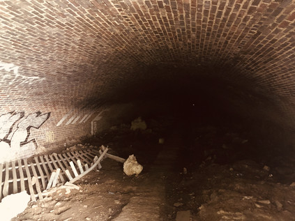
Beyond the fence and with my unplanned and falteringly fearful Cavalry Tunnel experience behind me, the deep green gloom of Pevensey Nature Reserve was almost welcome despite the humid and still air under the trees. I followed the main path, noting that I should be able to take a fork to the east which led back to the riverbank, passing a range of apple trees planted by the community. The ground was littered with early windfalls and the air buzzing with bees and insects as I followed an indirect route back to the bank of the river, still flowing swift and clear despite its long journey under the old Marshalling Yards. This wild and long-abandoned patch of former farmland formed a narrow municipal dividing zone between the sprawling edges of Hounslow and Feltham. Hidden in the scrubby trees was a series of circular concrete bases which once contained the collected effluvia of the district, and nearby the South Middlesex Crematorium still performed its ever-necessary function among the woods. The paths closest to the river in the most recently annexed part of the reserve were informal - officially still "subject to consultation" - which made for a quiet and pleasant section of the walk somewhat insulated from the surprisingly nearby suburbia, and screened from activity in the better-used Leitrim Park. It was a rude shock to be deposited onto the Hounslow Road via a narrow gap in an old railing. The road bridges over the twin streams of the Crane presented a dividing line here: to the west was the Borough of Hounslow, and to the east Richmond. The river had been a dividing line for time immemorial, and it now split these relatively modern jurisdictions neatly along a largely undeveloped strand of formerly industrial riverine parkland. Crane Park is shared by the boroughs, a mile-long oasis of green in the otherwise uniform suburbs which nestle in the arms of the Hounslow Road and the Great Chertsey Road. Once across the street and inside the park I found a seat in the neat outdoor classroom area and rested for a while. Having failed to plan this walk, I'd been guilty of a little complacency too - I'd walked rivers before, and thought I knew what to expect, but this had thrown me some very unexpected experiences which I needed to consider before pressing on. I watched a community of dog-walkers assemble, exchange news and disperse while I snacked on oranges and gulped water.
The day was getting warmer and stickier, the riparian air still and humid. It was time to press on into the busy park, cyclists buzzing my elbow and joggers huffing by. The river split into multiple streams, pools and reservoirs here which had served to control the flow of water through the Hounslow Gunpowder Mills which once straddled the banks here. The site was ideal for a mill, with a ready supply of willow and alder for charcoal, navigable access for barges and sufficient water to drive the wheels. Initially a corn mill, consent for the manufacture of gunpowder was given in 1768 though it seems likely that this hazardous production had begun unlicensed on the site prior to the Earl of Northumberland's permission. Explosions at the mills were frequent, with loss-of-life almost mundanely common. A particularly devastating event in January 1798 claimed four lives, with further accidents in July of the same year claiming three more. This pattern continued into the next century, and in 1859 Abraham Slade, Somerset-born builder and diarist recorded that: 'On the 29 of March the Powder Mills blew up, sending seven poor souls into eternity in a moment. It has broken a great deal of glass in Twickenham & neighbourhood.' Gunpowder was produced at the mills until 1927, and following closure the site was almost entirely cleared of structures given the hazardous nature of its business. Among the remaining blast mounds and sluices in the mill streams, the only remaining building is the much restored Shot Tower, believed for many years to have been used for the manufacture of lead ammunition, but more recently considered likely to be a windmill. Upon closure, the former Gunpowder Mill site was purchased by a local councillor with a view to selling it as a going concern but with this proving an unlikely outcome, he sold the land to the Borough of Twickenham which opened the area as Crane Park in 1935, with the Shot Tower becoming a small museum and visitor centre in more recent times. The island in the divided stream of the river has, since 1990 been a local nature reserve and was busy today with families looking out for wildlife in the ponds and surrounding woodland. As I continued through the busy park I reflected how the nature of my route had changed in such a short time. The fearful, lonely crossing of the Heath seemed far away now.
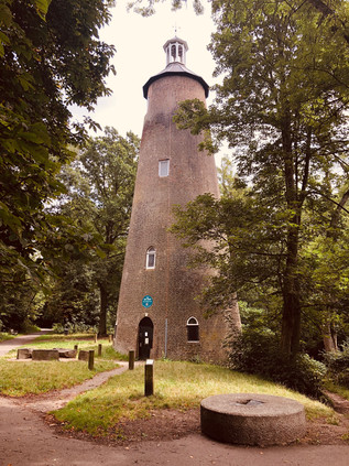
The river passed under Meadway by way of a handome concrete ballustraded bridge, providing something of an ornamental entrance to Kneller Gardens. Named for Sir Godfrey Kneller, the remarkably prolific court painter to monarchs from Charles I to George I who produced society portraits on a near-industrial basis. Kneller is reported to often have worked with other painters in form of production line, each undertaking the part of the portrait in which they were specifically skilled: faces, fabrics, animal companions and suchlike. Kneller set up home in nearby Whitton in 1709 in a mansion reputedly designed by Sir Christopher Wren. His home was in turn largely demolished and replaced in 1850 by Kneller Hall. Lately the building has been occupied by the Royal Military School of Music, and served for a time during the Second World War as the HQ of the Commander-in-chief of the Home Forces, The MOD has longstanding plans to close the site in 2020, when it seems likely to fall into use as high-end residences in common with many of the fine old houses of South Middlesex. The more modest park named for the portraitist was home today to well-attended summer holiday events, the café busy with relaxing cyclists, and the shady riverside paths thronged with strollers. I presented a pretty fearsome sight I'm sure now, thudding along in heavy boots, sweaty and ruddy from a long slog along the river. All around me I was concious of the conspicuous health and affluence. The first leg of this walk had begun in the comfortable suburbia of Harrow, and I was now, many miles of intangible no-mans-land later, finally entering a similar zone. At the eastern corner of the pleasant little park I faced a decision: here the Crane split again from the Duke of Northumberland's River which turned north passing Twickenham's brace of Rugby stadiums and heading through the midst of Mogden Sewage Works, much beloved of Nick Papadimitriou, Seer of Middlesex and veteran urban perambulator. The junction was marked by a tumbling weir and a sluice. The 16th century artificial channel turning north and passing under the railway was walkable, and my earlier researches told me that the final stretches of the River Crane - now in an albeit in a more modern man-made channel of its own - were most assuredly not. But whether from loyalty to this persistent little river, or because I found myself once again enslaved to my methodology, I took the path along the Crane. The Kingfisher Bridge was a recent development, linking Kneller Gardens to the Mereway Nature Park since 2010. This scrap of green space bounded by the railway line and the river was originally marshland, but once drained provided a site suitably far from civilisation to build a sewage works and a small isolation hospital. A few surviving hospital buildings were marooned in the midst of sparkling new wheelie-bins and redundant roadsigns in Richmond's Central Depot. The idea of this tiny island in the midst of dense surburbia being considered remote felt unlikely now, and as I paced along the fence of the Depot, dodging prams and cyclists who were skirting the edge of Craneford Way Playing Fields, I noticed the butts of Twickenham Rifle Club across the concrete channel of the Crane - another facility which would have originally benefited from the isolation of the site. This last truly walkable stretch of the Crane was bounded by a tiny sliver of recently re-opened land known as Twickenham Junction Rough. A decent surface had been laid alongside the river as it skirted the broad loop of railway which swooped across the mainline bringing the line from Strawberry Hill to Twickenham Station. The isolated land had been acquired by the developer of the former Royal Mail site beside the river and opened to create an apparently already well-used local link. The river was sluggish in its channel now, somewhat narrower than its natural flow further upstream, but surprisingly still free from litter and running clear despite the built-up surroundings. The land here had once been known as Marsh Farm and was in the ownership of the Pouparts family. This line of notable market gardeners were of Hugenot descent with Samuel Poupart first setting up gardens in Battersea, where the family name remains in Pouparts Junction on the West London Line. His nephew WIlliam began growing apples, cherries, lettuce and cauliflower at Marsh Farm from around 1882 and his son began trading at Covent Garden market around 1892. The company continued to trade in the New Covent Garden site into the 1990s, close to Samuel's original Battersea lands, and the company remains extant as the marque of a specialist fruit importer.
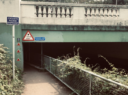
The railway swooped in to land beside the mainline while the path hugged the bank of the river. The land in between was now known as Brewery Wharf - a textbook mixed-use development. At the front, near the station it was a modern range of commuter-friendly studio flats with café opportunities and retail units, while the island of land between river and rail was given to ranks of faux-victorian blocks in yellow London brick, like some sort of simulacrum of a Peabody Estate. Despite the outward appearance of period industrial dwellings, this was of course a luxury development which featured a range of four-bedroom townhouses marketed at somewhere around the £2m mark. It represented a pretty good return on a narrow and unpromising plot which had once been part of the grounds of Heatham House. This tidy but extensive house still stands near the bridge over the Crane, having been built at some point in the 18th century on what were previously recorded as apple and pear orchards. The origins of the house aren't noted, but it was likely built for Stephen Cole, who lived here until his death in 1790. The house remained on the increasingly busy junction at the edge of Twickenham's centre, passing through the hands of the statesman Roger Wilbraham, the actor-manager Sir Charles Hawtrey and to its final public owner William Thomas Lane who sold his independent fisheries business to Unilever owned MacFisheries. The house was purchased by Middlesex County Council in 1944 and after local lobbying was sold again to the Borough who began providing youth services in the house from 1950 which continue today. The Cole family brewery was extant on maps of the area in 1635 and expanded into the management of local public houses throughout the following centuries. By the 1890s though, the company's debt was mounting, and George Cole sold the brewery to Brandons of Putney. Looking for wise investments to further clear the family debt and noting the growth of the commuter suburbs along the railway, he ploughed the proceeds from the sale into developing a new estate on the familiy's land near Heatham House. The first homes were occupied in 1898, and by 1902 a bridge over the Crane had been erected to link with newly provided recreation grounds. After a hazardous crossing of London Road I ventured into this legacy via Cole Park Road, still a leafy, quiet street of victorian villas today. The afternoon was close and humid, a churn of gloomy clouds progressing across the otherwise blue skies. Under the suburban trees, life seemed easy and remote from the uncanny tensions of the airport zone where I'd begun walking. I slipped into an alleyway between driveways which housed fine, expensive motor cars, and crossed Moor Mead Bridge into the recreation grounds which Cole had thoughtfully provided his residents. Despite being somewhat marooned by the railway line, the green spaces were busy with families - the children's play area particularly so, making sticking close to the edge of the river a risky business. A lone walker appearing from the treeline is never a welcome sight to risk-averse parents raised in the era of stranger danger and steeped in recent lurid exposé. I skirted the playground carefully, heading for the exit into the quaint, flower-bedecked cottages of Brook Road which were an unlikely introduction to the chaos and fumes of the Chertsey Road. I took a last glimpse of the River Crane as it disappeared under the road to resurface in an inaccessible strip of allotments. Turning east towards the Thames, I headed for St. Margarets Roundabout avoiding a rusting and inhospitable looking footbridge over the busy route which was, nonetheless subject of a campaign to retain and restore it by concerned parents.
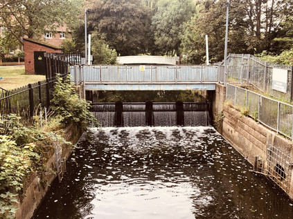
I knew little of this part of London - St. Margaret's had been little more than a wake-up call on the rail journey into Waterloo: you're almost there, gather your wits and your belongings. The surrounding environs, seemingly inert and rather tamely dull, had also found infamy as the unlikely stalking ground of the Bus Stop Murderer, finally unmasked as the repellant Levi Bellfield who has still yet to admit to the extent of his actions. The walk along what was ostensibly its main thoroughfare did little initially to budge the sense of banality and inconsequence. But this area was once a zone of exclusive and fashionable riverfront properties, and some survived - not least Gordon House. Originally known as Thistleworth House, it was purchased by General Humphrey Bland, author of A Treatise of Military Discipline, who demolished the older property in favour of a newly built mansion, one of the earliest designs by Robert Adam. In 1868 it passed to Francis Jack Needham, 2nd Earl of Kilmorey who modernised the house and incorporated his capital-K family insignia throughout the buildings. He also moved an elaborate egyptian-style mausoleum to his mistress and ward, Priscilla Anne Hoste into the grounds. Kilmorey had outraged Victorian society in 1844 by eloping with his ward, and fathering a son to whom he gave his name. Despite this scandal, and in a surprising nod to propriety, he housed his family in a property separate to his own home but constructed a tunnel between his home and theirs. Hoste died of heart disease in 1854 and the distraught Earl spent a remarkable £30,000 on the mausoleum by Henry Edward Kendall Jr. in pink and grey granite, bronze and marble. Devastated by Priscilla's early demise and unwilling to be separated from her, The Earl moved the mausoleum several times at considerable cost before settling on a location in the grounds of his much-rebuilt Gordon House. Here too he constructed a tunnel, linking the mausoleum to the house. He is said to have then initiated the mawkish practice of often dressing himself in a shroud and lying on a trolley to have his household practice his last journey to accompany Priscilla in her final resting place. The tunnel fell into local legend after the passing of the Earl and the site became a Teacher Training college, latterly part of Brunel University, but excavations in the 1960s during the construction of modern college buildings in the grounds revealed the tunnel, tiled and decorated with slopes at each end. Somewhere in my walk along these final stretches of the Crane I had passed over the Earl's subterranean via dolorosa. A little north of the end of the snaking brick wall which once enclosed the grounds of Gordon House but now screened a range of luxuriously appointed infill developments from the road, I crossed the river for the last time. Through a chainlink fence, I could see its last narrow stretch emptying into the turgid muddy Thames near the southern tip of Isleworth Ait. A modern apartment block hemmed in the river, the confluence hidden behind lazily repetitive red brick stacks and a private waterfront. This reduced and constrained channel felt an inauspicious and anonymous ending to a river which had flowed swift and broad further upstream, and which had endured the interference and industry of mankind largely without injury over the centuries. I turned aside to complete the last stretch of my walk, feeling uncharacteristically deflated.
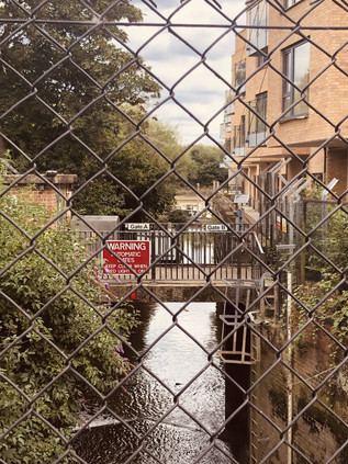
As soon as I could, I found my way onto the bank of the Thames. At times like this, it felt like a surefooted way to regain a sense of the walk I'd just completed. Instead, I found myself navigating the primped and managed edge of Berkeley Homes' Fitzroy Gate development. The White House, built in 1832 by Pugin & Pugin, gleamed across the private lawn enclosed by crescents of new-build townhouses apparently - but somewhat inexplicably - constructed on the principles of ancient Chinese geomancy. I glanced back along the river, but the inconspicuous mouth of the Crane couldn't be seen. I headed north, along the riverfront terrace of the Town Wharf public house, which felt like an unwanted intrusion on the afternoon of the patrons, and towards a large metal crane which stood inert on the riverbank. This totem marked a second confluence - with the Duke of Northumberland's river. This shadow of the Crane had crossed my path at Colnbrook when I walked the A4, joined the Crane in the clammy midst of Donkey Wood and left it again to detour through Mogden's massive sewage works. Now it too met an unremarked end not far from the Crane. I walked it back to the main road, though the pretty, rural edges of Syon Park. This apparently idyllic reach of the Thames concealed a deceptively brutal history: the embarkation point of both Catherine Howard and Lady Jane Grey on their last journey to the Tower of London. My last view of the river as it curved to the east was of the medieval ragstone tower of All Saints Church amid the trees and watermeadows. The Crane had revealed an older Middlesex: the market garden which supplied the growing city, but which was finally swallowed entirely by London. I circled the turgid millpond and followed the ancient line of Mill Plat along the edge of almshouses built in 1664. All seemed quiet as it likely had for centuries beside this stream.
As I made my way back to Syon Lane station, remarkably close to the factories and progress of the Golden Mile where I'd found myself just a few months ago, I reflected on the journey I'd finally completed. The initial walk which began alongside the Yeading Brook had seemed unlikely to yield any great revelations - but the prim net curtains from Ruislip to Isleworth had twitched to reveal surprising histories: unsolved murders in the upper reaches and the stalking ground of a serial killer nearer the Thames. The unsettling isolation I'd felt in the wilder stretches of the nascent Crane in Ickenham and Northolt was repeated in the heightened tensions of Heathrow and the oppressive crossing of the wetlands around Cranford. The Crane was not a lost river - spending perhaps more time above ground than any of the Thames' western tributaries rising in London - but it was unremarked and often uncared for. In some ways, this left it free of some of the indignity wrought on its sister streams. With its heydey as an industrial power long faded, and its situation in the hinterlands of the airport making it largely unattractive for waterfront development, it still flowed swift and true though woodland, heath and park. Following the dissolution of Middlesex, the river's function and status as an administrative boundary often ensured that no single authority could decide to divert, pollute or enclose it. The Crane was a truly suburban entity: going about its mundane business largely without fuss or recognition, its roaring days behind it and only a quiet and undistinguished ending to look forward to. While Betjeman lauded his 'gentle Brent' it was hard to imagine him eulogizing the Crane - this story of the banal suburban propiety, suppressed dark histories, and compromised futures would be more suited to Philip Larkin's darker territory if anyone's. Perhaps J.G Ballard had encapsulated the surprising persistence of the river best:
Prosperous suburbia was one of the end-states of history. Once achieved, only plague, flood, or nuclear war could threaten its grip.The Crane lacked a patron poet of any great stature, but as I clambered onto the eastbound train and headed back towards the City I felt like I'd done it some sort of service in finally completing my walk of its route as I'd set out to.J. G. Ballard - Millennium People, 2003
You can find more pictures from the walk here.
The East Bank: Walking the Antihistamine Trail
Posted in London on Saturday 6th July 2019 at 11:07pm
The train doors clattered open, and I stepped onto the platform of what felt like an old, rural station which long predated the electric Underground train I'd arrived on. I was the only passenger to alight, all interest apparently being focused on city-bound trains on this pleasant summer morning. It had been a long, hot ride out from the stuccoed villas of Lancaster Gate where I'd descended into the earth.
Less than twenty miles away from Bethnal Green, the automatic doors of the tube train open onto the land of Greenleigh. On one side of the railway are cows at pasture, on the other the new housing estate.Family and Kinship in East London, Michael Young & Peter Wilmott, 1957
Alighting at Debden felt like a return to more innocent age of these walks: when I'd first ventured along the valley of the River Roding, it felt like something of a revelation. I'd been straying further afield for some time, worrying the greener edges of London - but that walk truly took me out of my comfort zone, and reminded me what my walking boots were really for. At the end of that summer day, drenched by an unexpected downpour in Ilford, I knew my horizons had expanded. Yet again I'd strayed outside the self-imposed cordon, pressed against the membrane of anxiety which the edge of the map always offered. Today, the valley was dry and hazy, the intermittent summer having returned in the week or so before my walk, frazzling the grasses and drying the earth underfoot. I started out with a quick trip for provisions which involved a detour into Debden's Broadway - a wide boulevard between terraces of shops and maisonettes opened in 1958. Debden was Young and Wilmott's 'Greenleigh', and when the shops of the Broadway finally opened for business, the earliest parts of the London County Council estate in Debden had already been in existence for a decade. This suburban extension which almost joined Loughton to Theydon Bois was largely unwanted when first mooted between the wars, not least by locals who feared overdevelopment of their relatively rural surroundings. Housing between the two villages was initially proposed under the powers granted to the LCC by the Housing Act 1919, but work did not commence until after the Second World War in 1945 by which time the need was greater than ever: the densely populated East End had been pulverised by enemy bombing, and the population had already begun to scatter into the edges of Essex. The acquisition of land near the Roding at Oakwood Hill for prefabricated homes was the beginning of a much larger development which would see the estate spread north and east, crossing Chigwell Lane and finally stretching along the western side of the railway. Expediency and cost meant that a number of prefabrication and building systems were employed, and for all the talk of a warren of identical houses, the estate remains in fact a mixture of interesting and novel styles of home from the Laing Easi-form to the Cornish Unit. For the locals though this was no succour: the trade between necessity and the destruction of the Essex countryside was hard to balance. Donald Gillingham, the hyper-local naturalist who rarely roamed more than a few miles from his home in the Roding Valley wrote of these times:
The war was not over. A new invasion had begun - all the more tragic because, perhaps, necessary. It had begun insidiously when surveyors went out like a fifth column and drove in red and yellow stakes.Unto The Fields - Donald Gillingham, 1955
Tensions rose further when it became clear that the LCC estate would primarily house displaced Londoners: either those bombed out of their homes, or others decanted to allow clearance of urban slums. There would be few homes in Debden for the local families in Loughton, which too was growing into a sizeable town. Instead, those locals seeking properties would likely be offered tenancies in Essex County Council's own Harlow New Town some ten miles to the north. With the identity of this growing suburb contested and the links to Loughton and Essex now tenuous at best, the question of a name for the area was equally fraught with local politics. The issue was settled in 1949 when the Great Eastern Railway's Chigwell Lane station became London Underground's Debden Station on the newly electrified extension of the Central Line. The name, drawn from the nearby hamlet of Debden Green, paid ancient homage to the valley of the Roding which the estate bordered. But there is no escaping, even today, the sense that this is a little bit of London outside its boundaries. The bright red buses turning at the end of the Broadway, the clatter of the Central Line trains heading for the distant city and the hum of the M11 all draw the ear and the eye south and west. I was going to follow the same line today, for a little while at least.
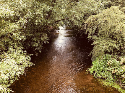
I retraced my steps, heading under the railway bridge towards the Motorway and knowing that I'd soon be leaving the urban fringe behind for a while. The familiar gateway to the green path along the river was a welcome sight, and once again I experienced the sense of plunging into the countryside despite walking a narrow margin between road and railway. The cracked asphalt of the path had deteriorated over the previous two years, grass and weed pressing up through the untended surface. Tall thistles and an impressive crop of nettles swayed beside the path, almost hiding the busy trickle of the river from view. Insects flitted across my path, the drone of the M11 almost hidden by the constant buzz of life in the grasses. When I'd been here before I'd hesitated: this felt too far off the beaten track, too unlike my preconceptions of the urban rivers of London. But I'd persisted in walking the meanders, sticking to the paths which were vague then and even harder to discern today as the grass had converted alternate weeks of rain and sun into spurts of furious growth. The reward was the surprising peace of the Roding Valley and it was good to be back. I was determined though, to walk the eastern bank as far as I could today: last time, this had eluded me. The one crossing point I'd planned to take was blocked by a locked entrance gate, and I'd found myself confined to the western side of the river and a number of circuitous diversions from the bank. So at the first opportunity, the Charlie Moules Bridge, I made my crossing. The bridge, built in the 1950s following a campaign by Councillor Moules to link the recently acquired meadows in Chigwell with the band of development along the western side of the river, delivered me into silent grassland. The barely visible path was a worn groove leading into the treeline ahead while clouds brooded over Essex to the east. I wondered if I would once again find my progress halted by a storm? Reflecting on my first visit, I suspected the sight of these remote, quiet meadow paths would have sent me scurrying back to the relatively civilised western bank - but today it was perfect. Barely more than a trail through the ribbon of woodland on this side of the river, the tree cover occasionally left sheltered patches of the path surprisingly muddy underfoot. I saw and heard no-one until the path came alongside the fishing lakes and the distant, low voices of anglers comparing catches could be heard over the river. A little way ahead, I was faced with a decision - both forks of which led to a diversion. I could head west and retrace my route from last time, or turn east and edge around the David Lloyd leisure centre and the extensive grounds of the Guru Gobind Singh Khalsa College complex. The river was off-limits, for a brief stretch at least - so I struck out east, seeking novelty. The diversion was no shorter than the western option, taking in a snaking access road around the school and the gym, finally coming alongside the sliproads for the unbuilt Chigwell Motorway Services. Provision had been made for this site when it was intended to continue the M11 deeper into London. In the event, with the motorway griding to a suburban halt at the North Circular, a service area here had never attracted the interest of operators and the two wide loops of road encircled rarely visited oases of green space, linked by a disused subway. For a brief spell prior to the 2012 Olympics, the southbound island had served as a temporary logistics base for DHL, but they had not taken the option of a permanent lease and the site had returned swiftly to nature. Finally, the long access road decanted me onto Roding Lane, the buzz of traffic unfamiliar after the quiet of the wooded riverbank. I knew the way here: west along the edge of the cricket ground where I'd struggled to escape before, the road briefly rising towards Buckhurst Hill. I turned aside as soon as I could, heading back to the river along the path beside the allotments near The Cascades. Feeling like a seasoned veteran of the Roding Valley, I was soon beside the water again.
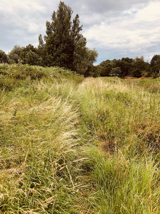
My aim now was to return to the eastern bank as soon as possible. I knew that the path along the western side of the river was tricky to follow, and given my greater confidence and experience now, I figured it was worth trying to stay the eastern course. I found my opportunity immediately after passing under the impressive brick viaduct carrying the Hainault Loop of the Central line, near the lesser used Roding Valley station. This cool, quiet spot remained a favourite for taggers and more creative street artists alike and I admired their work briefly before crossing the river onto a largely uncharted path. I was soon plunged into deep grass and tall swaying heads of cow parsley. There was really no path here at all - perhaps just the merest suggestion of a depression in the sea of green ahead of me. I pressed on, kicking up a cloud of pollen which I knew would cause me issues later. To my left, the boundary of a new development on the site of the former Tottenham Hotspur training ground snaked along the ridge of the valley. The housing here was part of the planning gain supporting the impressive Anderson Foundation school for children with Autistic Spectrum Disorder which occupied the site of the former training centre after the team's move to a purpose-built facility in Enfield in 2014. Pushing on further south, my makeshift path bordered a scrubby, wooded wasteland which had for almost a century provided the well-heeled Epping Forest District Council with a site for disposing of its detritus. Since the 1920s, parts of the site had provided a landfill dump, and a sizeable sewage works left strange concrete hardstandings amidst the trees and scrub. This was, strictly speaking, Metropolitan Green Belt land - but the presence of the final stretches of the motorway, and the permitted encroachment for school and housing gave it a distinct edgeland feel. I was walking the transition line here: wading through armpit deep grass and foliage, guessing at the path onwards and feeling incredibly remote from the playing fields and parkland on the western side of the river. Beneath me, the Roding snaked onwards towards the Thames, the path occasionally coming precariously close the edge of the gully which the river had worn over thousands of years of frequent flooding. I ignored the catch of hayfever in my throat and the irritation developing around my eyes: I'd walked plenty of trails in the past named for ephemeral flowers and natural features along their route, but as the only person foolish enough to tread this path today, I claimed the naming rights - this was The Antihistamine Trail.
Rather unexpectedly the path widened and developed a stony surface, the mark of adoption by the local authority. The Roding Valley Way had reached this far along the east bank at least, and I soon found myself contemplating the other end of a bridge which had been securely locked out-of-bounds on my last visit despite being signposted towards the sometimes poorly marked footpath along the riverbank. I recalled sitting in the park on the other bank, applying sunscreen and recalculating a route which would take me the entire length of Ray Park before getting back to the river at Snakes Lane. This time I was able to follow the path I'd originally planned which from here to Chigwell Road was surfaced well enough that I passed someone pushing a pram in the humid air of the early afternoon. To the east, the baleful water tower of the former Claybury Asylum glowered over the treetops. Yet again, my walks began to entwine themselves into a network of knowledge: always selective, and sometimes false. The territory slowly gave up secrets and allowed me to link things together, my own travels dissolving into others' mythologies. The thin tongue of land between the river and the motorway dwindled to a narrow point, hemmed in by the built-up edges of Woodford encroaching from the west, and I was unceremoniously decanted onto the edge of the busy A113 as traffic hurtled under the motorway. I made the crossing with care, noting how alien traffic felt after the quiet isolation of the riverbank. I wasn't sorry to plunge back into the long grass for one last relatively wild stretch along the edge of the M11 as its carriageways began to divide to accommodate a ghost interchange. Here, the road would have ploughed on towards Islington, soaring over the North Circular and carving into the suburbs - but of course things didn't go quite to plan, leaving the motorway beached on the edge of the city. I soon found myself at my own junction: I could cross a narrow bridge to the west and find myself at a very familiar filling station, or turn east and walk an even better-trodden path between the motorway viaducts. I headed under the shadows of the concrete stilts - this was a special place, familiar from several walks which all seemed to converge on this dusty underpass. Walking among the huge, grey piers of the bridge felt like meeting old friends unexpectedly, and despite a pang of regret at leaving the river and the rough, challenging walk which had tested my resolve to get here, I was glad to be back on well-worn routes.
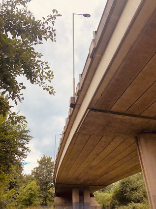
I've written several times before about the stretch of footpath which curves alongside the North Circular as it turns south towards the river. It was the closest I could walk when I was shadowing the broad, elevated road, upgraded to cope with the traffic spilling off the incomplete M11. It was also the path I'd taken when I'd walked along the Roding, and I realised now how deceptive it was. The gully of green-shaded water and the ranks of pylons which stalked the banks were corralled into a remarkably narrow strip of wasteland which was barely wide enough for the river and road, Indeed, it only accommodates them due to artificial straightening of the meanders in the course. I stepped up my pace, glad to have a good surface and childishly content to be kicking up clouds of Essex dust over my boots as I trudged onwards. I spied a familiar sight - a three-cornered pylon which shivered with multiple high-tension lines. It was strange and monolithic, standing in the deserted river valley largely unregarded by humankind despite their dependency on its steely purpose. The pylons here, like those which marched along the Lea Valley, felt like fellow travellers. They were ever-present, always more numerous than other walkers, and often felt far less threatening. I passed under the North Circular via the broad concrete subway which led to Redbridge Roundabout. I needed to detour here, passing under the angles of the junction to resurface on the south side of the A12 and double back. Rather sentimentally, I checked the short entrance road to Wanstead Pumping Station to see if the cat I'd met here a while back was still resident. If he was, he was sensibly sleeping in the cool shade somewhere in the overgrown garden of the lodge. I pressed on, turning aside in the backstreets of suburban Wanstead. Instead of my usual route to Ilford via the filthy litter-strewn backstreets beside the A406, today my aim was to head into Wanstead Park. The history of this substantial green space, now administered as part of Epping Forest by the City of London Corporation, is not entirely a happy one. A manor at Wanstead is recorded in the Domesday Book, and at the time of its acquisition by Sir Richard Child in 1703 a sizable house already stood on the site. Not imposing enough it seems for Child, who then set about building one of the first great mansions in the Palladian style to be seen in Britain which was completed by 1722. With Child created Viscount Castlemaine and married to Dorothy Glynne, heir to the Tylney family lands and fortunes, the impressive colonnade of Wanstead House provided a fitting seat for the now influential family. The inheritance of the Tylney properties was conditional on Child changing his family name, for which he obtained an act of Parliament in 1734. This set in chain a series of events which left, via generations without issue and the torturous laws of inheritance and title, the entire fortune in the hands of Catherine Tylney-Long. As the richest unmarried woman in the land, it is perhaps unsurprising that she was courted by the dissolute and caddish William Wellesley-Pole, nephew of the Duke of Wellington and already a notorious character.
Catherine accepted his proposal, and to suit the conditions of inheritance Pole sought a royal license to change his name again, becoming the faintly ridiculous William Pole-Tylney-Long-Wellesley. He was thus elected to Parliament for St. Ives, and then for Wiltshire where the Tylney name remained influential. As an MP he was noted primarily for his extravagance rather than any great political acumen, and in 1814, Pole hosted an impossibly flamboyant fête at Wanstead House to celebrate Wellington's victory over Napoleon. The event was attended by numerous royals, including the Prince Regent and marked a high point in the houses' fortunes. The property and lands were held in a complex trust to protect the inheritance of Catherine's heirs, against which Pole raised an unwise mortgage to pay his spiralling debts. In 1822, the trustees stepped in to secure the situation - and with the land protected from sale for 1000 years, they liquidated every possible asset instead, auctioning the couple's personal property, demolishing Wanstead House and selling-off the building materials for a fraction of the cost of raising the great house. Catherine died from an intestinal complaint in 1825 having been abandoned by her husband, though letters to her sisters imply that her illness may have arisen from a venereal disease he had passed to her. Meanwhile, Pole remarried and returned to Parliament, though his second marriage was little more successful than his first. He continued to do his utmost to avoid accounting to his creditors, particularly seeking the custody of his son William with whom Catherine's remaining estate would rest. His uncle, the Duke of Wellington mounted a furious defence to prevent this, and Pole's petition was denied by the Court of Chancery. In contempt of court, Pole found himself committed briefly to the Fleet Prison. Retaining an interest in the estate until 1840, Pole oversaw the removal of many trees and destruction of original features of the gardens in an attempt to raise further funds, but he was finally prevented from further interference via a court injunction. The grounds of the house thus passed through the Wellesley line, with a portion sold to the Corporation of London in 1880. Wanstead Park subsequently opened in 1882, and has remained largely unaltered with the retention of remnants of the formal gardens designed by George London and improved by Humphrey Repton. In particular, I wanted to find the Grotto. Completed around 1760, this structure beside the ornamental waters in the grounds was not entirely a folly, providing a boathouse and repair facilities with a small lodge for the keeper. The building was decorated with shells, crystal, and mirrors under a domed ceiling which allowed in light from above. When the park opened to the public in 1882, tours could be arranged with the keeper - a Mr Puffem - and these were popular enough that the man received the honour of a humourous portrait in Punch magazine. In 1884 a fire, caused by overheating tar being used to repair a boat largely destroyed the grotto leaving only the facade standing. The structure was made safe and retained as a ruin, the bridge which formerly linked it to the eastern side of the water long since gone. Now the grotto sits safely behind a palisade fence, designed to prevent the inevitable insurance claim from someone clambering inexpertly over its ageing stonework. The lower area where boats could dock was uncovered by MoLAS archaeologists in 1998 but the structure was then left undisturbed behind its protective fence for some years, with vegetation soon taking hold and obscuring the remains from view. In 2011, a clearance operation revealed the grotto once again.
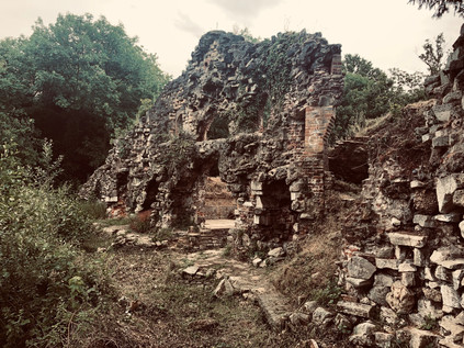
I explored the area around the Grotto for a while, enjoying being the only person around as the cloud finally passed over and illuminated the dried-up reed beds of the ornamental waterway. My route out of the park took me across the swaying grasses, aiming for a crossing between the Heronry Pond and the Perch Pond near a busy café. The earlier pollen exposure had begun to take its toll, and an oppressive headache was descending. I decided to tough it out for a while in the hope that I wouldn't have to cut short my plans. The next stretch would take me back onto the streets, among far more people than I'd seen all day and the thought wasn't welcome just now. I resisted the urge to remain in the park and to seek out the other hidden treasures which remained from Wanstead's spell as the centre of London society. Eventually, though I had to leave, taking the long, hot slog along sleepy Wanstead Park Avenue which led me to the eastern edge of Wanstead Flats. It was good to see the Flats recovering from the fire last summer, and from the brief walk alongside them, I could see foliage and insect life aplenty. Nature finds its way, it seems. I passed the impressive gatehouse of the City of London Cemetery where I took the southern fork in the road towards Manor Park, the route lined by mature trees and feeling rather cut-off from its urban surroundings. The remained of my walk would be a continuation of this route, often crossing my previous paths as I headed directly towards the Thames. Epping Forest finally gave way to London near Manor Park Station, sleepy in the afternoon heat as it faced the last tree-lined edge of the ancient woodland. A little further on I crossed Romford Road, a route I'd walked at the end of last year in a surprisingly memorable east-west perambulation. It was a shock to suddenly be surrounded by people again as I waited for the lights at the busy crossing. On the south-western corner of the crossroads, the grand brick and stone Earl of Essex with its imposing corner-turret remained empty and awaiting its conversion into the inevitable luxury dwellings, following a battle to retain it as an asset of community value. Beyond the crossroads, my route continued as High Street North, forming the spine along which the drawn-out town of East Ham spread its busy centre.
East Ham can claim origins in the Saxon settlement of Hamme which roughly constituted the dry land between Bow Creek and Barking Creek. Recorded as early as 958, the area was neither populous nor prosperous for the following nine centuries or so, presenting a marshy and inaccessible face to London. Transport thus defined modern East Ham - Victoria Dock opened in 1855 and the railway arrived in 1859. While in 1863 the area was still described as a 'scattered village' the following decades saw rapid urbanisation. As with other districts in the East End, the area was never affluent and the population largely worked in the docks or industry nearby. The pattern of terraced streets fanning out across the marshes remains familiar today, though the demographics have shifted dramatically. A County Borough since 1915 despite the protestations of Essex County Council, East Ham was absorbed into the London Borough of Newham in 1965, but by then was already a busy town centre in its own right. The area had weathered tremendous upheaval in its short tenure as a unit of government - relentless wartime bombing, rising poverty following deindustrialisation and the closure of the docks, and the tensions arising from successive waves of immigration. My walk along the High Street - on the face of it, not unlike any small British town centre - surprisingly reflected all of this history. Firstly, the mix of shops was a clear marker of the demographics: Halal butchers and fried chicken shops rubbed shoulders with Polish supermarkets and traditional Kosher stores. The street was still busy with traffic here, and the narrow pavements were a challenge to navigate, as I weaved dizzily between family groups stretched across the path, children lagging at the end of the line and teenagers texting furiously a few steps behind. The bright afternoon was charged with an urban energy and enriched with the smells of competing cuisines. I couldn't pass through quickly, even if I'd wanted to - the sheer press of people prevented it. South of East Ham Station, opened by the London Tilbury & Southend Railway in 1868, and served by the District Railway since 1905, the street is partly-pedestrianised and the local stores jostled for attention with branches of national outlets. Later in-fill development is evident here, corresponding chillingly with the sites on which high-explosive bombs fell. Proximity to the docks clearly drew the enemy closer here, and the curious mix of Victorian and modern was jarring when I cast my eyes above the shopfronts. Avoiding this part of town, the traffic took a spin to the west along Ron Leighton Way, named for the Labour MP for North East Newham who served from 1979 until his death in 1994, and who was a notable Eurosceptic .
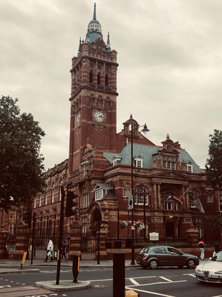
But these former marshy flatlands are home to others too: the dead cluster around East Ham. The old Jewish burial ground at Plashet was opened by the United Synagogue in 1896, and despite being closed for burials now sits just a narrow terrace of buildings away from the busy High Street. Further south, the vast East Ham Jewish Cemetery of 1919 was still operational, tucked away between the High Street and the line of the Northern Outfall Sewer. As London crept out across the marshes to the east, so new plots were needed for living and dead alike, and the alien east with its air and reputation already regarded as unwholesome had to carry the burden. Much of East Ham's heydey coincided with a golden age of municipalism, and the pride in the new Borough was reflected in the vast and ornate Town Hall completed in 1903 and still standing proudly at the crossing of High Street and Barking Road. The buildings ceased to be Council offices when the borough decamped to the Royal Docks, exchanging Edwardian brick for a huge glass-sided hangar overlooking London City Airport. While the Town Hall was being built and subsequently extended, the Borough was taking an enlightened approach to further new duties: appointing a permanent Fire Brigade, building new schools and dabbling in public housing. I paused to rest my aching feet and weary head at the corner of Central Park, a result of the early policy of the newly independent District to provide green spaces in each of its four wards. The grounds of Rancliffe House were acquired in 1896 for the laying out of a public park. Opened in 1898, the house was demolished a decade later and the park expanded to include an open-air swimming pool. The garden and art-deco Fist World War memorial at the corner entrance where I was seated followed in 1920, with the pool closing for good in 1923. Today, the circle of benches around the memorial was home to an extensive and expressive school of drinkers. As I stopped for refreshments and antihistamines I realised I'd strayed into someone else's drama: insults had been traded between benches, and tensions were rising. No-one seemed inclined or perhaps sober enough to make the first move, but catching the eye of an apparently uninvolved older drinker with a ruby-red nose and sad, drooping eyes, we tacitly agreed it was time to leave. He shambled off into the park, defying fences erected to safeguard the setting-up of an event, while I returned to the High Street. As I passed through the entrance gate, a proud survival from the earliest days of the park I heard the crash of glass and the yelp of pain which suggested that someone had finally managed to get their act together behind me. I didn't look back.
I was nearing the end of my walk now, but I didn't appreciate quite how suddenly it would come upon me. A consequence of the walking the arterial routes in this part of London is that while I appreciate how far things lie from the City, I often fail to appreciate their relative proximity to each other. Looking up I was surprised to see a sign advertising the junction with the A13 at Beckton Alp. I'd passed this way several times, and knew this junction well from other angles, usually arriving at the end of a long walk from elsewhere. I was nearing a spot I considered almost sacred on my walks, but I hadn't realised that this spot had a much longer history of worship. Tucked into a wooded corner where East Ham dissolved into the scrappy retail-park edges of Beckton stood St. Mary Magdalene Church, extant since around 1130 and built from stone including fragments of far older Roman remains. The low tower, a 13th century addition, was masked by ancient trees which clambered around the stones of a mossy, dark graveyard. It felt out-of-place here at the careening junction of major roads. Annexed to the church was East Ham Nature Reserve, an extension to the churchyard which made it one of the largest in London, and now a wilderness-like environment. Under the tangle of trees and through the bramble bushes, all appeared calm, green and humid. The fringes of the site had seen some speculative fly-tipping or drifting roadside rubbish but deeper into the plot the litter petered out. I stared deeper into the woodland, surprised by the sight of an old memorial at a queer angle. As I looked longer, more appeared: moss-covered and weather-worn, these old stones bucked from the ground in unsettling ways which suggested recent upheaval. I turned to check I was still on the busy road, with traffic queuing to swing out to coastal Essex or into London. It was, reassuringly or not given the strangeness of the times, still 2019 out here on the edge of Beckton. Somewhere ahead of me though, in an unmarked grave, lay William Stukeley, an antiquary and archaeologist who had made surveys of sites such as Stonehenge, Avebury and Rollright during the eighteenth century, largely founding the modern archaeological method. Stukeley's career was long and varied, taking in medicine and service as a clergyman, and his tendency to seek theories which placed ancient monuments and fossils in a Christian tradition as he grew older assured a devaluing of his work in later centuries. However, it's likely that Stukeley's annual expeditions on horseback to record these sites, and his evident zeal in discussing their history in eminent company has resulted in many of them surviving until now. His earlier research drew greatly on speculative ideas about Druidism and Egyptology, giving his work an almost mystical quality. Indeed it was hard not recall his description of Rollright Stones as I gazed across the gnarled trees of his resting place:
...a very noble, rustic, sight which could strike an odd terror upon the spectatorsWilliam Stukeley, an eighteenth-century antiquary - Stuart Piggott, 1950
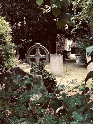
I crossed the slip-road of the A13 and passed under its thundering concrete carriageways, emerging on the relatively quiet road into Beckton. Above me, the green flanks of Beckton Alp glowered over the flat marshland which was slowly disappearing under new development. It was impossible not to be drawn through the gateway, and to start the zig-zag climb to the peak. I wasn't alone today - it was a glorious afternoon with clear views across the estuary, and a group of young women had ascended just before me. I found the old gap in the fence mended, but a new opening had been twisted into the palisade nearby. It was a tighter squeeze, but I managed it without losing too much dignity and soon found my way to the peak. The group of youngsters lounged, laughing and chattered in the artificial bowl at the top of the hill, entirely ignoring me as I wandered the edge of the peak taking in the views. London unfolded: the city hazy and indistinct in the near distance. The dark ribbon of the A13 snaked back towards the city - walked, written and re-written but still somehow holding my attention. It was easy to understand Stukeley's instinct to romanticize and mythologise his findings from this vantage: while I'd made no novel discoveries on my climbs up here, I'd certainly found solace and sometimes unexpected resolution in the sweep of views and churn of winds. The view changed subtly as the sun shifted and clouds formed and drifted. Time seemed to slow. The regular pattern of terraces and patches of green parkland stretching away the foot of the hill signified the territory I'd just walked. I looked north, the tower at Claybury was just visible and beyond it a smudge of dark green signalled the distant forest and the valley which I'd navigated to reach this spot. Only the giggling and excited chatter behind me reminded me that I was still anchored to the vast sprawl of a city between me and the towers in the west. That the city could still surprise, delight and inspire me wasn't in doubt at all. Being back here, arriving from a different direction and viewing it in fresh context felt like a reward for the miles I'd covered. I started my descent to the DLR station, eager to make sense of today in writing.
You can find more pictures from the walk here.
Lost::MikeGTN
I've had a home on the web for more years than I care to remember, and a few kind souls persuade me it's worth persisting with keeping it updated. This current incarnation of the site is centred around the blog posts which began back in 1999 as 'the daylog' and continued through my travels and tribulations during the following years.
I don't get out and about nearly as much these days, but I do try to record significant events and trips for posterity. You may also have arrived here by following the trail to my former music blog Songs Heard On Fast Trains. That content is preserved here too.
