Timber and Fire: Epping Forest from Gate to Gate
Posted in London on Saturday 4th August 2018 at 10:08pm
The last few moments of my long tube journey to the furthest reaches of the Central Line were occupied by slathering sunblock onto my exposed temples, musing that when I was last here there was probably more natural coverage. The last time I'd arrived at Epping was in a post-viral haze, stumbling about the station and feeling sorry for myself, doubting the wisdom of travelling after a week of confinement with a case of H1N1. I recalled sitting on a bench on the silent platform, lacking the energy to head into town and wondering at how unusually rural and quiet it felt, and pondering the range anxiety I'd experienced as the train sped past large tracts of green, rural, definitely not metropolitan-looking scenery. Given that I was the only passenger in the carriage I expected much the same from my arrival today - albeit in far better fettle this time. I couldn't have been more wrong - once I passed through the ticket barrier I was caught up in a tide of people. The bright summer day had bought competing crowds to the station: some waited impatiently for the bus into town to manouvre around the busy car park while others jostled to get onto the train into London. The next wave of passengers trotted down the hill or scrambled out of taxis and parents' cars to make the long ride back into the city. It was a Saturday morning full of promise and possibility: over made-up teenagers gossipped in an awkward spot on the pavement, their cheeks burnished to an alien chrome. A taxi set off before its occupant had retrieved their bag, the casually suited former occupant rapping on the roof and swearing generously at the top of his voice to stop the driver in his tracks. The bus lumbered around in an attempt to reverse, lurching to a stop behind the taxi. All was good-naturedly, loudly chaotic in Essex today. I made swift work of the hill out of the station and found the road to town a little less hectic. It was good to be back, despite the fury of the welcome!
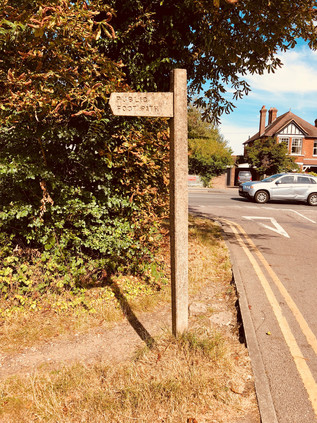
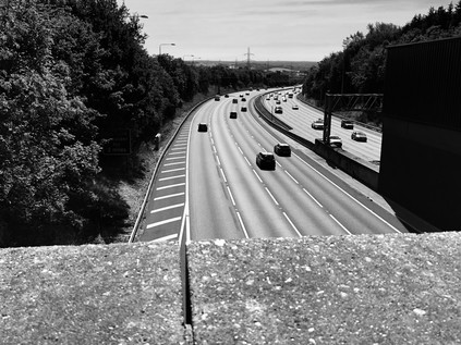
My memories of Epping beyond the platform were vague at best, but I soon found the supermarket and filled my bag with water and drinks. The temperature was already touching thirty degrees and was forecast to get warmer. There was coffee to be had here too, but my instinct was to head straight out of town. Epping is a long, drawn-out kind of place sprawling along a ridge of high ground which threads lazily into Essex, dividing the valleys of Cobbins Brook and the River Roding. My route - the aptly-named High Road - headed south, passing the Victorian mock-gothic water tower, now marooned in the middle of a used car lot. As the busy shops of the High Street begin to peter out, the houses became larger and were set a little further back from the busy road. Stocky Georgian brick piles sat beyond tall hedges which shade convertible BMWs. This was all undeniably a little less gauche than the Essex of popular perception. It was more conservative, very new-monied, a little brash. A broad stripe of grass, once green and now burned amber by the weeks of sunshine, broke away from the road and I gladly plunged between the trees noting an impressive and moss-covered concrete fingerpost indicating the public footpath across Bell Common. The sun beat relentlessly down on the sleepy village-end while a taxi waited outside one of the cottages beside the path, a heat haze shimmering over its roof. The string of houses ended abruptly where the road forked - the branch I now needed to cross headed south to Theydon Bois, while the main road to London turned further west. A high concrete wall and a shuddering equipment room were screened by a scrubby line of bushes. From beneath this parapet, traffic pulses along the M25 and began to slow for the whirl of sliproads onto the M11. Under my feet here is Bell Common Tunnel, an unusually environmentally aware attempt to hide the churn of the Orbital road from view at a pinch point where the important forest habitat and the peaceful community squeeze the road into a tight bend. Built between 1982 and 1984, and some considerable time before the high-profile road protests of the 1990s, the cut and cover tunnel is an unexpectedly sensitive response to the problem of completing the ring of tarmac around London. I've written elsewhere about the various Ringway plans which spun out over the post-war decades following Patrick Abercrombie's vision of a city encircled by roads which took the strain away from the mediaeval street pattern. Little of this materialised as the inner segments of the plan, which would have destroyed many homes and businesses, became entangled in long planning disputes. However, out here on the margins there was less heat in the argument. Perhaps, even by the early 1980s we had not quite grasped the impact of the loss of green and pleasant land in the same way we do now? The final shape of the M25 is a compromise: a lopsided and off-centre mash-up of Ringways 3 and 4. The motorway which was finally built and which squeezes through this future bottle-neck under Bell Common is never quite wide enough, never quite fast enough - and as a result, it creeps quietly out of its original footprint. Elsewhere lanes are added to patch up the broken circle with depressing regularity. But here, the landscape corrals the traffic and Bell Common with its cricket pitch and a dusty forest-edge car park is troubled only by the hiss and shudder behind the high brown wall.
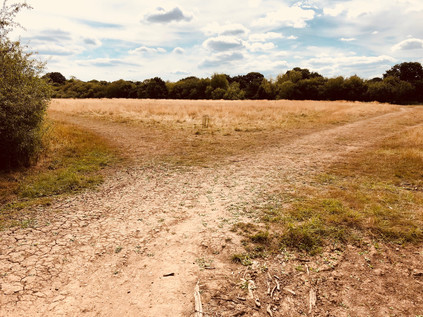
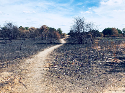
As I turned aside from the motorway, unable to get a panoramic view due to the height of the barricade erected to protect Epping from the noise of traffic, I found myself facing the forest for the first time. The small car park was busy with dog walkers loading and unloading their charges. A couple of early cyclists paused to check maps and adjust equipment. I made my own preparations, realising that I'll be leaving civilisation behind for a little while, and strode out between the trees onto a well-made path with a dry and cracked surface. The recent heat had penetrated even the deepest corners of the forest it seemed: the perma-mulch of the floor is littered with brown, sun-crisped fronds of foliage. The earth was splitting and opening, deep crevasses revealing loam which hasn't been exposed for what might be centuries. It felt like the forest was protesting against the indignity of the heatwave, and blaming us for our negligence in letting the climate interfere with its finely balanced ecosystem. But the woodland is resilient too, and only a few yards into the woods I'm covered by a cool canopy of leaves which keeps out even the most penetrating rays of sunlight. Occasional clearings fill the forest with light, like a zirconium flashbulb detonating overhead, and I took to wearing sunglasses to reduce the weirdly hypnotic effect as the sunlight strobes between limbs of the trees. It was good to be back, and once I'd passed sufficiently far into the woodland for the casual visitors' range anxiety to have them backtracking to the carpark, I was entirely alone in the ancient forest. The crunch of dry, friable earth underfoot echoed, occasionally startling creatures which skittered and crashed into the undergrowth. Aside from a few gentle dips and ascents into the valleys of currently dry streambeds, the walking was pleasantly gentle. Striking out to the south-west, I felt entirely enclosed by the woodlands, despite in fact walking a fairly narrow strip of the forest at this northern tip. Epping Forest once covered much of Essex and during the reign of King John still covered much of the ground between London and the coast. Curiously, it was John's signature of the Forest Charter, a lesser known counterpart of the more influential Magna Carta, which led to the preservation of the forest for future generations. This charter addressed deepening disquiet and economic strife arising from the designation of 'Royal Forests' - a status originally given to Epping Forest by Henry II. The Norman ideal of a forest was an enclosed area of woodland, grassland and marsh reserved for the monarch's use and inaccessible to commoners. For many, not least those living in Western Essex, the forest meant survival: in the form of fuel, grazing the land and foraged food. Increasing designation of Royal Forests, especially by King Richard, had resulted in around a third of Southern England being restricted, with rural populations struggling as a result. The Carta Foresta of 1217 restored the right of free men to gather wood and forage in the woodland, while allowing only the King and his appointees to hunt. Despite being somewhat less celebrated than the Magna Carta, the Carta Foresta enjoyed a greater longevity, with large parts remaining in force until the Wild Creatures and Forest Laws Act 1971 repealed and replaced its provisions. I was reminded that the forest is a strange place, and things seem to move far more slowly under the trees - including it seems the machinery of government.
I realised as I tramped along the path, that I knew very little of the interior geography of the forest. This was brought rather surprisingly home to me as I spied through the trees a smooth bank of earth, curving out of sight to the west. I had stumbled across Ambresbury Banks - now a haven for tall, slender beech trees but once a securely fenced Iron Age stronghold surrounded by forest. Much archaeological investigation has taken place here since the site was first systematically excavated by Augustus Pitt Rivers in 1881, but nothing has been discovered to corroborate perhaps the most enticing myth about the place: that Boudicca fought her last here in 61CE, before finally being slain by the Romans. Several other places, from Kings Cross station to Mancetter in Warwickshire claim the same honour - but there is a stately calm about Ambresbury Banks which makes it feel a fitting monument to a warrior queen. I stepped away from the path and scaled the bank, descending into the broad bowl. The floor of the forest was a tangle of sun-scorched bracken and surprisingly tenacious holly, and it was hard to imagine this place a hive of activity. It's likely that Ambresbury was a defensive position rather than a fortress - a secure place to gather the people and to remain safe from attack. The camp lies along a line of forts which roughly delineated the boundaries of the Trinovantes and Catuvellauni peoples who skirmished and bickered over territory in Essex until the Roman invasion. Even now it feels remote from the surrounding paths and roads, and as I crashed back out onto the trail, I startled a young couple and their dog who were distinctly displeased to see me. The forest retains its sense of risk and danger - but I suspect that a middle-aged man emerging from the bushes is regarded more likely as a moral than physical threat nowadays. Back on the path, I noted a few other walkers and occasional mountain-bikers, including a group of Spanish students who walked six-abreast and yelled up into the trees as they wandered. I wasn't sorry to get past them, leaving them checking their 'phones and gabbling with excited relief as they congregated in a small car park beside the B172 which meandered through the forest nearby. While they were clearly pleased to be back in some sort of civilisation, to me the road felt like a strange imposition - and a sudden need to be aware of my surroundings in a more acute way than I had been for the last hour or so of walking in the woods felt alien and uncomfortable. I wasn't sorry to disappear into the woods again on the other side of the busy route, wondering why my walks on the fringes of London were so often dogged by small bands of loud European tourists?
Walking again, I tried to identify my location more accurately but largely failed. There are few very good maps of Epping Forest and certainly, none which exceed the detail and care of that produced by Edward North Buxton for his 1884 guide. Buxton was a partner in the family brewing firm of Truman, Hanbury & Buxton of Brick Lane, and was also MP for Walthamstow. A lifelong conservationist, Buxton purchased Hatfield Forest and gifted it to the National Trust from his deathbed, thus saving it from a timber merchant who had already begun to fell ancient trees until scuppered by Buxton's purchase. His book on Epping Forest remains perhaps the most useful guide to the hidden corners of the woodland and is a testament to how largely unspoiled the forest has remained since it was protected by Act of Parliament in 1878. It could so easily have been different here. In 1851 much of nearby Hainault Forest was destroyed having been 'disafforested' by the Crown and offered for sale. Steam tractors dragged anchors through the soil, uprooting ancient trees and clearing around 3000 acres within six weeks. While Epping Forest had largely been unenclosed by that point in part due use as a deer park, it was clear that the Commissioners of Woods and Forests were keen to turn their attention to the plains and woodland which stretched tantalisingly close to the growing suburbs of East London. However, it was this very proximity which had apparently increased the use of the forest by commoners, with William Cowper-Temple MP noting during debate in the commons in 1871 that "It was most gratifying to witness multitudes of the working classes, who had escaped for a day from the smoky atmosphere and the dreary expanse of bricks and dust and dirt called the eastend of London with parties of children, imbibing health and enjoying themselves intensely in innocent and health-giving pastimes." Visitor numbers grew during the 1860s and consequently, the Lords of the various Manors which included forest land began to enclose the woodland, protecting their asset and preparing for a profitable sell-off. This enclosure was not without resistance, with Thomas Willingale of Loughton persisting in the practice of the common right to 'lop' trees. Willingale was prosecuted at Waltham Abbey, and members of his family imprisoned as a result - a cruel punishment which sounds oddly antediluvian to modern ears. It was his action though, which brought the situation to the attention of Edward North Buxton, his brother Sir Thomas, and to John T Bedford of the Corporation of London. Thus, the political movement to conserve the forest began with the Corporation buying parcels of land throughout the 1870s prior to becoming custodians of the forest on the passage of the act. So, Epping too was disafforested - but with the Corporation as both landlord and conservator, its future was largely assured:
Epping Forest is hereby disafforested; and Her Majesty's rights of vert and venison within the same, and the several forest courts, and all letters patent, grants, appointments, and warrants of any offices, bailiwicks, walks, and lodges, and all salaries, allowances, gratuities, and fees payable or allowed in respect of the same, and all burdens and restrictions arising out of the forest laws or customs, shall, as regards Epping Forest, on and by virtue of the disafforestation thereof by this Act, cease; and the deer therein are hereby transferred to and shall belong to the Conservators, to be preserved as objects of ornament in the Forest.Epping Forest Act 1878
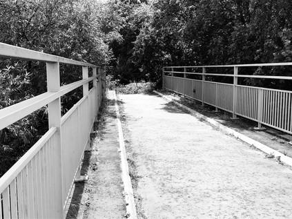
The path continued south, skirting the broad, open scrublands of Furze Ground and Copley Plain. These spaces, often appearing suddenly between the trees, are a striking feature of the forest and a reminder that this is wild and ancient land. Some of these areas have been cleared for centuries, not least those nearer to Chingford which were denuded of trees as early as 1543 when Henry VIII built his hunting lodge 'The Great Standing' nearby. But there have always been swathes of rough scrub, marsh and grassland at the heart of the forest, and it's perhaps a little surprising that they make for some of the most dramatic views during the long walk under the trees. The path also descended here, delving deep into the valley of one of the streams which combine nearby to form the Debden Brook. Today though it was a ghost waterway, and at the floor of the valley the path crosses only the dry streambed. The largely redundant bridge and only a damp layer of rotting foliage indicating the presently absent waters. For a relatively minor waterway which is largely unnamed on maps, the Debden Brook has a marked effect on the area. As it curves east towards the River Roding the arc of the stream describes the extent of human habitation - the edge of the suburbs. This currently moribund little rivulet is the last defence of rural Essex against burgeoning London. My descent into the valley was followed by a steep, lung-busting ascent towards Goldings Hill where the busy A121 crossed the forest, providing a link between the eastern suburbs and the main road into London. Crossing the road was a challenge, necessitating a swift and careful totter along its narrow margin to reach the staggered continuation of the path. This fast-flowing rat-run beneath the trees is a sobering reminder that nowhere in Epping Forest is ever really far from arguably the world's busiest and most complex metropolis. But as I disappeared under the trees again, I felt like I could be a continent away from London.
Beyond the road, the path dipped and bucked into a series of further, even steeper valleys which formed the various tributaries of the Loughton Brook, emanating mostly from sources on Broom Hill to the West, and again mostly running dry due to the recent weather. The ponds which form along the brooks were not yet dry, but they were green-tinged and algae-covered, insects flitting over their surfaces while fishermen fruitlessly dangled lines into the dead, still water. The walking was challenging but pleasant here, the tree cover making for humid but thankfully shady conditions. My boots were doing the job they were designed for at last and appeared to be responding to a rare reprieve from pounding asphalt and pavement by protecting my feet well from the trips and twists of the forest floor. For a while here, time became soft and pliable. I couldn't say how long I'd been in the forest or how far I'd travelled. The path ahead was my only focus, and studying the form and foliage of the woodland ahead is all the thinking that was required of me. It felt both liberating and terrifying to be released from caring about much beyond the immediate landscape and I felt my brain rebelling. My ever-active and somewhat disordered mind sought to fill my synapses with anxieties about work problems, my bank balance, politics - but they wouldn't stick. The huge, unknowable and ancient forest demanded all of my attention, and if I dared to let my mind wander into human concerns it reminded me with a misplaced branch or a knotty crag of earth that it had the power to trip me up in every sense. I've never been someone who talks about 'oneness with nature' - that always strikes me as an artificial state, sought by those who seek a sort of environmental superiority over the rest of us with our petty worries about everyday things. For a little while though, and I'm not entirely clear how long, in fact, it made an odd sort of sense. It wasn't a spiritual or even a particularly esoteric experience: it was simply the strangeness for an urbanite of being entirely consumed by a living thing bigger than oneself.
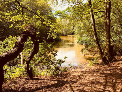
I was returned to my normal, sceptical self by taking a wrong turning. Consulting the map I noted I was still east of the A104 which forms a spine through the forest. My aim was to cross the road and stay for as long as possible in the broader and denser areas of the forest, in the angle between the encroaching suburbs of Chingford and Loughton. As the forest continues to the south it becomes more sporadic and disconnected, though no less dense and remote in places. I retraced my steps to a crossroads where a group of older tourists, distinctly unprepared for the terrain ahead, appeared to be wandering aimlessly too, and I headed west towards the road. Like the other road crossings in the forest it felt like a traumatic imposition on the peace and calm, but perhaps in the case of this main route out to the M25, even louder, faster and much harder to cross. When I finally made the dash, I found myself on a somewhat indistinct trail which runs parallel to the road through a broad plain of dry, yellowing grassland. A warning on the gate indicated that cattle may be nearby, and they have left their own special evidence too, necessitating careful walking. My route converged on a more established path at Palmers Bridge, though it was currently an unnecessary structure, with the long straight ditch beneath the wooden footbridge entirely dry. I followed the ditch towards Connaught Water, an ornamental lake built around 1882 by flooding a formerly swampy area of the forest where many streams converged. The lake was named for Prince Arthur, The Duke of Connaught who had accompanied his mother Queen Victoria on her visit to Chingford when she dedicated the forest to the people. Arthur went on to become the first Forest Ranger alongside other honours, including becoming the tenth Governor General of Canada. The lake was extended in the 1890s with large, wooded islands established to create impressive views from the lakeside path. More recent innovations included a wooden boardwalk which snaked around the western edge of the lake, allowing a generous throng of visitors to get closer to the waterfowl which strut and wade in the lake, occasionally flapping away from more enthusiastic children as they approach. Connaught Water is also the source of the Ching - fed by the dried-up brooks and streams which arrive from further north in the forest, a twin-bored concrete culvert at the southern end of the lake allows water to run down a cascade into the muddy beginnings of the river. When I walked the Ching, I started to the south of this point - so a pilgrimage to the source was long overdue. However, there really was no source to speak of: the pipes were dry and the bed of the river had clearly not been damp for some time. I crashed along through the bracken which was, prior to the long spell of dry weather, a deep reedbed beside the water. Eventually, I was forced to surface at the crossing of Rangers Road. Beside me was the 'Essex' sign which had signified the start of my previous walk and to the west was Chingford Plain. Queen Elizabeth renovated Henry VIIIs original 'Great Standing' here as her hunting lodge and it still stands today, an isolated and rather plain timber-framed building next door to the much more elaborately mock-Tudor former Royal Forest Hotel. The hotel is now a Premier Inn - a singularly ostentatious one too, with many rather unusual features to accommodate the old building which houses it. The two buildings sit in curious harmony - the genuine heritage piece and the plausible Victorian fake - while a modern visitor centre commands a view over the plain towards the forest. My business didn't take me this far west today though, and after crossing Rangers Road, busy with school holiday traffic, I plunged back into the woods to repeat a section of the walk beside the Ching which I'd last done in freezing temperatures. I'd slipped and slithered over the muddy ruts back then, but today I was more at risk of tripping over the cracks in the parched ground.
The route south soon became much more familiar via a reunion with the Ching at the edge of Whitehall Plain where a tiny bridge crossed a rather pathetic trickle of muddy water. But it was at least now a stream of sorts, showing that even an unprecedented dry spell couldn't quite quash this little waterway's aspirations. The walk across the plain, entirely alone and largely free from any hint of the surrounding city was a rather special moment, which I perhaps hadn't fully appreciated on my last visit because staying vertical was more of a concern in the icy horseshoe ruts. Today, the baked earth and dry grass crackled underfoot and the sun beat down on me relentlessly. I ambled along slowly, pacing myself - there was some way to go, and the weather was exhaustingly hot now. As the river and the path converged again at the crossing of Whitehall Road, I had three choices. On my winter visit, I'd taken the path to the west of the little concrete bridge parapet which seemed a fairly sensible option in those conditions. There was also a seemingly more official path further to the east which would likely have been a lot safer too, but in my concern to find a route that day, I'd entirely missed it. That didn't seem appropriate for today either - instead I wanted to disappear into the tiny gap to the immediate east of the bridge, where a less well-used but clearly evident pathway descended steeply to the bank of the river. I reasoned that I knew this area well enough to find a way out of any scrapes I got into, and plunged into the tangle of woods. This part of the walk was actually ridiculously good fun - tiny paths, little more than faint desire lines cut by dog walkers, criss-crossed the land along the edge of the river. Despite being in a narrow flank of the forest between two densely-populated areas, I was absorbed into the woodland entirely. I tramped around, relying mostly on my sense of direction and carefully dodging the gnarled roots and banks of tall holly. Occasionally the detritus of late-night couplings was evident in wet-wipes and condom wrappers, and I marvelled at the resilience of these folks who would be exposing bare flesh around some seriously robust holly bushes and nettles! Realising I was drifting to the east I took a very minor path which wound back towards the river and found myself on the edge of a very clearly marked PRIVATE field with no obvious exit beyond the swaying, reedy grass which had grown to near shoulder height over the course of the summer. Above the sea of yellowing stalks I could see suburbia encroaching on the forest, closer than seemed possible just moments ago while I was plodding along the barely-evident forest tracks. I retraced my steps and set off into the dense knot of trees again, more aware than ever of how quickly this familiar landscape of streets and houses could return to nature given the opportunity.
The ornamental boating lake in The Highams Park was busy with visitors on this hot afternoon - a far cry from the ice-bound edges of the water which I'd found on my previous visit. I took a path which hugged the lake rather than the route I'd taken on my last visit, surprising a group of youngsters daring each other to skinny-dip from the opposite shore. They continued egging each other into diving into the water, little bothered as I passed by. Dogs and birds both enjoyed the water too, splashing and flapping their way into the deeper parts of the lake while their owners lazily ambled, too hot to walk faster around the perimeter. The whole concept of 'Highams Park' appeared to be a contested one: the park itself, created in the 1930s was named very specifically with the definite article which differentiated it from the name commonly applied to the neighbouring district. This drift west into newly laid suburbs largely followed the rechristening of the railway station as 'Highams Park and Hale End' in 1894, two decades after opening to serve the latter of that pair of then distinct settlements. Some it seems, believe that there is, in fact, no differentiation to be made between the two former villages - while others resolutely disagree. Confounding local historians further, the manor of Highams - sometimes known as Higham House or Hall - lies further east, beyond the forest's edge facing Woodford Green. Built for Anthony Bacon MP in 1764 on his purchase of the ancient manor of Higham Bensted, the hall briefly served as a military hospital and is now a private school for girls. The Ching snakes around the western shore of the lake, deceptively appearing to feed it but remaining in fact an entirely separate waterway aside from an overflow at the southern end. The parkland here were formerly part of the extensive grounds belonging to the Highams Hall, landscaped by Humphry Repton and eventually purchased by the Corporation of London when it moved to preserve the forest.
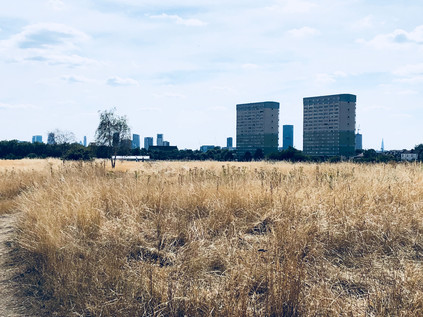
I was now entering a part of the forest which I knew well and also one where a previous walk had faltered - and I'd found myself anticipating this part of the walk perhaps most of all. After negotiating around the striking modernist blocks of the Best Western hotel which now looked tired and somewhat dated, I headed back into the forest along a familiar track. The A104 was still close by on my left, revealed as I passed an open grassy space between houses. Traffic was already braking, slowing for the congestion of Waterworks Corner up ahead. The trees closed in above me again as I passed the clearing where the memorial to preacher Rodney 'Gypsy' Smith stood, before taking the path that led onto the North Circular footbridge and crossed the route I'd taken along the edge of the forest when I walked the length of that road. Suddenly, I was beyond the edge of the trees, above the carriageways and surrounded by a clamour of traffic noise. To the west, the Lea Valley shimmered under the bright sun, and the towers and chimneys of Tottenham and Edmonton swam in a distorting heat haze. To the east, the traffic banked and peeled away to the south, the brief knot of Saturday traffic around the slip roads to Waterworks Corner slowly negotiating the exit. There was something about this spot - distinctly of the forest, but out of the trees - which somehow amplified the experience of walking in the woods: a green, moist silence becomes an immediate sensory overload of white noise, bright light and unforgiving heat. The road remained impressive and daunting, despite being part of a well-walked circle now. I fought an overwhelming urge to retrace my steps along its forlorn, ragged edge. Instead, though I continued southwards, navigating the narrow strip of raised ground between the A406 and Forest Road which is crossed by another, quieter footbridge. Beyond this was the raised field of tall grass where my last attempt to cross the forest had come to grief: at the end of the path was a steep downward slope which had become a wintry, wet mudslide. Today though, it was a sheer but navigable scramble of smooth, dusty earth. I half walked and half slid to the bottom, a sense of almost ridiculous personal pride achieved in this simple task. Perhaps I'd become more adventurous since my last visit, or perhaps I just felt more at ease in these woodland perambulations now? In any case I was safely down and could once again emerge briefly to cross the road and enter the last, straggling edges of the remaining forest.
Pride is never advisable on these excursions, it's fair to say, and immediately on re-entering the forest on the eastern side of the road, I lost my bearings. The paths were not easy to follow in this area, and I found myself circling the same spots while looking for what should have been a well-worn route to the east of the Forest School. I'd walked a dog near here before with a former pupil of the school who had shown me around the impressive facilities after hours, and I foolishly thought I could follow my instincts to get out of the bind. Instead, I found myself retracing my steps more than once and feeling none the wiser. I finally found the right route, taking me close to the perimeter of the school buildings and across Snaresbrook Road near the point that a tangle of drainage ditches split away to feed the Hollow Pond and the Eagle Pond. Hollow Pond started life as a series of pits left after gravel was extracted for road building. Quarrying ceased in 1878 and the pits filled with water and were abandoned to gradually return to nature, until 1905 when unemployed labourers were drafted into the forest by Leyton District Council and the Forest Conservators to landscape and extend the pits into a large lake. Soon becoming a popular resort close to the growing suburban districts of East London, a well-used but muddy bathing lake was converted into Whipps Cross Lido during the 1930s with costs shared by Leyton and Walthamstow's councils. The Hollow Pond, on a blistering summer afternoon, was still busy with locals lazing around its banks and it was easy to imagine that if the Lido had survived the 1980s it would have been much used today. Meanwhile the quieter Eagle Pond teemed with waterfowl which skidded onto its surface and lurked in the shade of its wooded edges. For some years now, the Surrey-based Swan Sanctuary has used the pond as a point for releasing birds back into the wild after recovery from sickness or injury, and with fishing now banned the pond was an oasis of calm in the busy afternoon. The incongruous bulk of Snaresbrook Crown Court reflected in the water - a huge and imposing but slightly gloomy building by George Gilbert Scott and William Bonython Moffatt which was originally built as Wanstead Infant Orphan Asylum and became a court only in 1974. My path took me between the ponds, well away from the crowds and onto a long, dry pathway of dead grass and baked earth which cut across the flats towards The Green Man roundabout. To the south, I could see the impressive villas which fronted Whipps Cross Road closing in, marooned between the busy road and the open ground. My path climbed to cross the Central Line before delving into the centre of the vast road junction. Somewhere on the fringe of this junction the mood switched - all day I'd felt connected to the forest, even when it had been little more than a narrow strip of land between busy suburbs. This terriroty was now of the city. A constant, low-level drone hummed in the air: traffic, conversation, aircraft. In the forest I had been insulated. I felt disorientated, and uncharacteristically, weirdly unnerved. The temperature was well into the mid-thirties now and I'd begun to feel tired and thirsty as the last of my supplies from Epping were used up. In some ways, it felt like entirely the right conditions in which to approach London: activated, edgy and a little distracted - the natural traits of the city. Beneath me, the A12 contorted under the junction in a tunnel: the road was yet another planning compromise, a testament to further abandoned grand plans and a legacy of road-building policy which just wouldn't cut in it these days of environmental impact assessments and consultation.
One last patch of woodland took me further south, along the aptly named Bushwood, a curving street of solid Victorian homes which faced the last vestige of the forest as it dwindled into the edge of Wanstead Flats. As soon as I could break away from the road, I took a path along the edge of the woods, eager to spend the last mile of my walk as close to the forest as I could. The path crossed the head of an avenue of trees, partly replanted and under restoration, before heading across the northern edge of the Flats. My view to the south was striking: Fred Wigg and John Walsh, two tower blocks dating from 1966 backlit by the strong afternoon sunlight. On 12th December 2011, a flat on the 13th floor of Fred Wigg caught fire. It took the London Fire Brigade five hours to control the blaze following a full evacuation of the block. A few residents were treated for smoke inhalation or hypothermia, many having left their houses quickly on a cold evening in their nightclothes. However, there were no casualties and the fire was contained in the flat where it broke out. It stands as a striking contrast to events years later in West London: here, the original construction of the tower - while considered ugly and tired - held fast and the evacuation ran smoothly. This unremarkable block should have returned to obscurity after attaining a briefly newsworthy status, but in 2012 it hit the front pages again when residents sought permission to begin a Judicial Review of the decision to site air defence missiles on the roof of the building during the Olympic Games. Permission for the review was denied - legally correctly given the government's prerogative powers in defending the realm, but this was just another instance where the Games, unstoppable and somehow beyond criticism, rode roughshod over the lives of ordinary people in East London. Thinking back to that year as I passed the towers, a landmark one in my life in many ways, I remembered well the mood of tension and frustration: no less-than-positive comment on the Games could be passed without summoning the wrath of the part-time patriots who couldn't see past the TV coverage. It was going to be good for London - good for people who lived in places like Fred Wigg. We ought to shut up and stop moaning. The jury is still out on the economic benefits of the London Olympics, particularly in these areas outside the immediate environs of the Queen Elizabeth Olympic Park and its hinterland of newbuild residential towers. Today the blocks named for esteemed local councillors Fred Wigg and John Walsh await refurbishment, the work delayed awaiting the outcome of the Grenfell Enquiry and a ruling on whether the borough should pay for any resulting cost implications. The sun beamed momentarily through the open ground floor spaces of the two blocks, lighting up my path ahead. Beyond, the towers of the Isle of Dogs shimmered in the middle distance while out on the flats people sunbathed and picnicked. On afternoons like this, being in London felt like a privilege - and even the noisome aroma of the overheating, overtaxed sewers and the thrum of traffic nearby didn't make it seem any less attractive.
Stumbling wearily onto the pavement, I turned south onto Woodford Road and passed the sign which welcomed me to Forest Gate. I thought back to the start of my walk, and the faded sign hanging in the trees outside the Forest Gate Inn near Bell Common. As I headed south, the last tapering tail of Wanstead Flats became the final edge of the forest. Beyond this point, all was London. The city takes over in earnest here, and any sense of the ancient, loamy depths of the woods very swiftly fades. A tall housing block, Capel Point, stands sentinel over the edges of the Forest. The pulse of the city returns, and I'm swept along into the rhythm of other walkers again - a strange feeling after being largely alone since leaving Epping. I pass the quiet station at Wanstead Park, trains shuttling overhead under new electric wires, and press on south to Forest Gate station. The area is vibrant and diverse, the businesses reflecting this. There is noise and colour, endless diversion - a strange experience after a day dominated by the green of the forest and the sun-bleached yellow of the heath. As I collapse onto a bench to await the new, sleek purple train which will in time, become a Crossrail service, I contemplate the walk I've undertaken. Since I first stumbled into the forest, almost by accident, I've been captivated by its history and its strange otherness. I always considered myself capable only of urban walking, but some of my first forays into more adventurous exploits on less established paths began walking the trails and tracks in the forest. It may seem like a tame, unwilded place to many - and may seem like a dull and commonplace spot to those who live locally, but Epping Forest is a magical and strange place. A place where people live uncommonly close to genuinely ancient woodland, and where reservoirs and road junctions are hidden under the boughs of truly venerable Oaks, Planes and Hornbeams. I'm more convinced than ever after walking its length that there is really nowhere quite like the forest. I'm also very aware that I've only explore a tiny fraction of its vastness, and as the train pulls away from Forest Gate for Liverpool Street, I know I'll need to return.
You can find a gallery of images from the walk here.
Lost::MikeGTN
I've had a home on the web for more years than I care to remember, and a few kind souls persuade me it's worth persisting with keeping it updated. This current incarnation of the site is centred around the blog posts which began back in 1999 as 'the daylog' and continued through my travels and tribulations during the following years.
I don't get out and about nearly as much these days, but I do try to record significant events and trips for posterity. You may also have arrived here by following the trail to my former music blog Songs Heard On Fast Trains. That content is preserved here too.
