London has an enviable reputation as a resilient city. It has been burned and flooded, bombed and relentlessly attacked from within - yet it stands. Its people, in particular, are regarded as stoic and resolute - defiant against all the odds. Even during the recent terrorist attack at London Bridge, they were to be found hurling chairs and pint glasses at the assailants, rather than turning tail and running. Some of this is, of course, hyperbole - and some wishful whimsy - but there's no denying the endurance the city has shown over a couple of thousand years. But London has two key weaknesses which have resurfaced over the millennia to threaten the city's hard-bitten citizens - the very air and water which sustain them. Both have rebelled against being used to support the sheer concentration of humanity that the city presents and both have proved real threats to the health of generations of Londoners. During a weekend where Sadiq Khan stepped up his efforts in a campaign to detoxify the air in central London using some slightly confused but well-intended statistics to prove his points, I found myself approaching a solution from an earlier age. A time when the importance of clean drinking water wasn't an established scientific fact, but the evidence of Londoners' senses told them things weren't good and that something needed to be done to sustain the supply without the torrent of filth that had begun to choke the natural rivers which tumbled towards the Thames.
It was good to set out early, stumbling from our Shoreditch hotel towards Liverpool Street for early coffee - wondering quite how the NatWest International Markets employee had the early-morning energy to grope and manhandle a female colleague as they waited for a huge order of drinks for their team back at the office. The barista made my drink swiftly and with a raised eyebrow and shake of the head, passed it through the front of the stall rather than the serving window, which was fully occupied by the amorous pair. Downstairs the station was eerily quiet, the first few trains of a Sunday morning beginning to shudder into life. I was familiar with the run out to Theobalds Grove from an earlier walk, but the chance to set out early and watch misty dawn rising over the east of the city was a rare opportunity. I saw the territory I'd walked, some of it drab and downbeat in its day-to-day life, glowing and burnished in the dawn. I had a long walk ahead but mercifully, due to a lack of real planning, I had only the vaguest idea of the total distance I'd cover if all went as I hoped. The scheme was simple enough - to strike out west from Theobalds Grove and to find the New River. Then to follow this artificial waterway, venerable despite its name, to its terminus on the fringe of the City. The New River has wound through other walks in the north of London - tantalisingly paralleling my travels along Green Lanes, crisscrossing my excursions from west to east through Woodberry Down, and complicating my search for lost rivers and roads. I'd also visited its usually forbidden terminus around a decade ago during an Open House weekend, when an eccentric Islington local decided to give impromptu historical lectures and appeared to actively loathe the New River for some unknown slight. Today though, I'd stick with the River as far as I could, navigating reasonably close to its path where its course disappears or dives inaccessibly between back gardens. As my few fellow passengers trudged off towards their homes or jobs in Waltham Cross, I turned west towards the Hertfordshire countryside. This was an ambitious undertaking, which had been a long time coming...
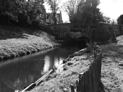
After a brief suburban trudge alongside the almost-hidden Theobalds Brook which was screened from the adjacent and properties by a low brick wall and a line of trees, I found myself taking an unexpected turning beside Cheshunt FC's home ground. Here, the Paul Cully Bridge climbed over the A10 as the road beneath took a dead-straight course towards the M25 and Central London. The bridge was opened in 2010 and named for a late councillor who had long campaigned for an improved link between the communities in this part of the Borough of Broxbourne. The opportunity finally came from a fortuitous mix of Sustrans funding and the decision to host Olympic events at the nearby Lee Valley White Water facility within the borough. A strange video exists of the gleaming white bridge, lined with schoolchildren who are slowly passing a flag bearing the ill-starred London 2012 logo over the bridge, inch by endless inch. Councillor Cully's case for the bridge proved well-founded, as it appeared to provide a useful link to a local school, and between the communities that cluster along the railway line and the valley floor here. Despite its perhaps ill-advised white paintwork looking mossy and traffic-stained, it was clearly well used at times - though quiet this early Sunday morning. Between the distant shapes of factories and housing looming in the mist a vast flat area of former green belt land, part of the estate of King James I's Theobalds House, had recently been parcelled up as 'Park Plaza' - though only sporadic development appeared to have taken place west of the Great Cambridge Road so far. The great house which King James acquired in exchange for Hatfield Palace in 1607, and where he died in 1625 was swiftly and surely destroyed during the interregnum, with the estate passing between the crown and various nobles after the restoration. By 1888, the estate was in the hands of the Meux family whose fortune had been made in brewing. Lady Meux had been a City barmaid herself, and on hearing of the impending destruction of Temple Bar, the now inconvenient gateway which bottlenecked traffic passing along Ludgate Hill, paid the sizeable sum of £10,000 to have the structure dismantled and re-sited on the Theobalds Estate. It remained, slowly decaying after Lady Meux's passing, until 2003 when the campaign to return it to the City finally succeeded. Having made a more expensive and equally painstaking return journey, it now sits in a somewhat anodyne new development at Paternoster Square - but is at least preserved in good condition. As the bridge descended into the fields beyond the road, pockets of persistent mist floated in the dew damp grass. The sun picked out the droplets of water on a low gate leading down to the New River path which curved gently in from the north. Here my walk was to begin in earnest, with just the distant murmur of the M25 for company.
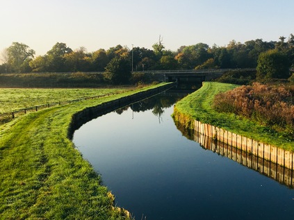
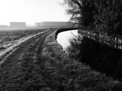
The New River path is largely a permissive right-of-way which runs, with some breaks and diversions where necessary, between the point where the waters part from the Lea at New Gauge in Amwell roughly to the river's current and former endpoints in Central London. For much of its route, it is a simple, flat grassy space beside the river provided under the sufferance of Thames Water, with a few more formal surfaced sections where it intersects with other's land and developments. For that reason, it felt sensible to tackle the path now rather than during the comparatively muddy winter months when parts may well become impassable. I could perhaps have travelled further north to start walking closer to the source, but my intention was to reach the city in a single day of walking on the basis that I had more time than usual and didn't need to maintain a furious pace. That said, it was hard not to be lured out into the flat, open Hertfordshire countryside which flanked the settlements chained along the valley. I consoled myself with several additions to the list of walks I might take, and set off down to the river, immediately passing under the busy B198 via a modern, graffiti emblazoned underpass. The river curved gently into view around an unharvested field, it's surface a still mirror of the morning sky. The channel ran between wooden boards, broadening slightly to encompass an island where Lady Meux is said to have kept a menagerie, though the only animal life here now was a squadron of ducks that patrolled the pool around the island. To the south-east, the low anonymous hulk of News International's print works rose from the mist ominously. The clamour of the road was growing, and I knew I'd soon be crossing into London. These last few yards of countryside felt precious and worth savouring as the path turned south and crossed a byway which led towards Tottenham Hotspur's training Bullsmoor ground. Soon though, the river was swallowed by the twin concrete tunnels of the aqueduct which carried it over the six lanes of the M25 careering towards the sliproads of Junction 25 and the tunnel under Bell Common. The footpath ran across the roof of the channel, providing a broad dry crossing point that emerged having crossed to the western bank of the river. This habit of changing banks at crossing points would persist for much of the walk, and soon became part of the routine of walking this surprising and sometimes confoundingly elusive waterway.
Given how long the sound of the motorway had prefigured my crossing from the north, it lapsed surprisingly quickly into silence once I was within its circle. The river soon reverted to its sedate, grassy state for the journey south. A kink in the otherwise remarkably direct course took the river around the grounds of Capel Manor, which can be traced back to 1547 when 'Capels' inscribed on a contemporary map denoted the seat of Sir George Capel and his line - the Earls of Essex. Now the simple but elegant 19th-century replacement building is occupied by Capel Manor College - specialising in horticultural and agricultural pursuits. The college is set in extensive gardens, which in turn hide the ruins of the 15th-century manor house. It's clear that this spot on the fringes of London, perhaps a day's leisurely ride out, was the chosen home for the influential and well-connected until relatively recent times, and still harboured a number of expansive if more modern well-heeled dwellings even now. As I meandered with the river I spotted a curious thing - a crablike claw, stripped of flesh up to the solid, razor-like hooks but still pink and fresh, was discarded on the grass. There were in fact several here, all seemingly recently deposited. I pondered the distance from the De Vere Hotel, now occupying Theobalds House, wondering if a fox had raided their waste bins? However, these weren't the last similarly intact claws I'd see on my travels - and some research indicated that the River Lea and its associated system had been invaded some years ago by aggressive American Signal Crayfish. Their aggression, along with a plague transmitted by these non-native incomers had all but exterminated the native species - but perhaps now something was preying very effectively in turn on these new denizens of the river? There were certainly stories of bucketloads being hauled out by restaurateurs, but this looked a little smaller-scale - maybe an ambitious fox or a bird?
I passed through a kissing gate of a type which was to become very familiar over the course of the walk, which took me across Turkey Street leading west from the station of the same name which I'd passed through earlier on my journey out to Hertfordshire. There is nothing to connect the street or the brook from which it takes its name with the seasonal fowl, and it appears far more likely to be a corruption of a local family name. The brook presented a genuine challenge for Myddleton when plotting the course of the New River. The channel uses gravity to convey water towards the city, carefully hugging the contours of the landscape to gradually descend from the northern heights. The valleys of the various tributaries of the Lea which carved into the higher land thus proved problematic, and the only sensible solution at the time of building was to take the otherwise straight river in broad loops around the heads of these streams. Thus, as the footpath descended into the surprisingly steep gully in which the Turkey Brook runs, the original course of the New River swung west into open land. A path followed it, and the temptation to take it was strong - but the wish to see my route through, along with the desire to get a look at the placid and shallow Turkey Brook at the foot of its valley kept me on track. The New River was straightened by the building of the Docwra Aqueduct in 1859 which takes it above the brook, and then directly south via a long straight section that emerges from culvert where the path ascends from the valley. The old course of the river is patchily extant, a ghost waterway in places and a weed-choked reedbed in others, but can be walked - providing the potential for another future expedition perhaps?
It was here, contemplating the huge detour which the river had taken to follow the 100ft contour line around the valley, that I began to really appreciate the undertaking that the New River represented. Edmund Colthurst had begun the work on receipt of a Royal Charter in 1604 but soon ran into financial difficulties. Myddleton took on the task of completing the works in 1609, with Sir John Backhouse providing considerable support, not least in the form of expensive land in Islington for a reservoir at the river's head. Even then, the project threatened to collapse as landowners refused to grant leave to pass over their fields, fearing inundation of crops and drowning of their stock should the channel burst its wooden retainers. Even then, the value of these lands on the edge of the city was a vexed question, and the great tradition of British reluctance to get behind new developments is not a new one it seems. Only the intervention of King James I as a guarantor and shareholder saved the project, and finally by 1613 the river was bringing fresh water from the springs of Amwell to the fringe of the City at Sadler's Wells. I realised with some reluctance as I approached the crossing of Carterhatch Lane that the section which I was walking now, passing through Forty Hill with its 17th-century hall and estate, was probably the last truly rural stretch of the river which I'd see today. Beyond here the river was hemmed in by development on both sides, the path discontinuous and sometimes elusive. It was remarkable though that the New River had survived above ground quite as far into London as it has while other more venerable rivers were fouled and spoiled, and finally cast into hidden culverts. The influence of the King with his edict that casting filth or carrion into the river or planting trees close to its banks would incur his 'displeasure' seems to have been oddly effective. The New River Company, founded in 1619 to manage the river and its associated supplies of water to the City survived too, managing the waters until the formation of the Metropolitan Water Board in 1904, proving the perhaps surprising point that publicly owned utilities are a surprisingly modern phenomenon.
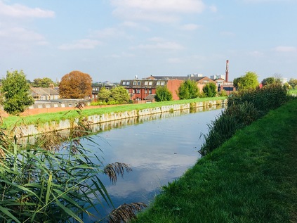
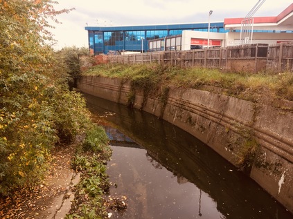
Forced to step away from the river here for a spell, I crossed to the western side via a pedestrian bridge and ventured into the hinterlands of Enfield. The river once made another loop here, passing along Southbury Road and into the town centre in a channel which has been preserved as a civic amenity. The businesslike waters now flow underground by a more direct course, but the vivid green of the algae bloom in the channel makes for an interesting walk into the town, which was just beginning to awaken. Sunday morning in Enfield was slow to start - the sizeable supermarket on the edge of town not open yet, and the smaller businesses only now beginning to spring into life. Here in Enfield, even the disconnected loop of the river disappears under the buildings on the north side of the main street, and I decided to pause for coffee at a spot which might well have been over the course of the old channel. I didn't spy the river again until I reached the bridge at the edge of Town Park, where I recalled seeing the river for perhaps the first time many years ago. This green space is the last remnant of the great Enfield Old Park - a hunting ground for royalty and a reserve for game - and the loop of the river is overhung by weeds and plants here in a way which would be unthinkable along the well-tended length of the working channel. The once sprawling park has endured numerous indignities over the years: being enclosed by act of parliament in 1777 and then suffering the fate of much of the modern green belt in the borough by being parcelled between several golf courses in the late 19th century. With both the Great Eastern and Great Northern Railways well established by the turn of the 20th century, the growing desire to move out of the city and to commute from the suburbs made development of the land irresistible and much of the remaining park disappeared under various well-to-do estates south of Enfield. I crossed over the river loop, leaving it to turn back east towards its original course while I started the steady climb up Carrs Lane, a sudden delve into a rural and tree-shadowed thoroughfare that bisects Bush Hill Park Golf Club. It was strange to be walking through a tunnel of greenery with the swishing and thwacking of club and ball just beyond the hedge, cries of delight or dismay echoing through the trees near gates sternly marked as PRIVATE which allowed members to pass from the green to the next tee by crossing the lane. Named for a prominent Victorian landowner, William Carr, the lane was once part of the drive into the Old Park and up to Windmill Hill on the western edges of Enfield. Now it holds its nerve as the last sliver of public land in a privatised and primped landscape of flags and bunkers.
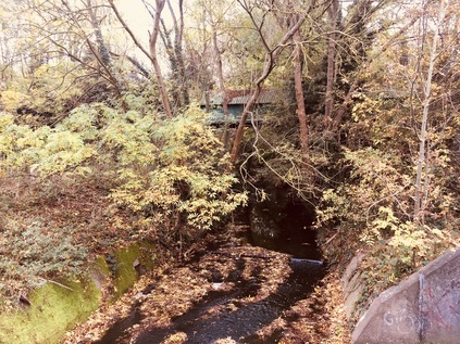
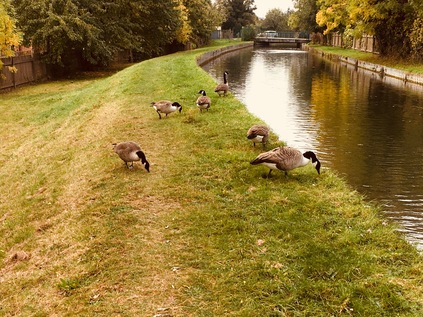
After a few minutes of pleasant country walking, Carrs Lane deposited me on a busy corner near to familiar ground at the top of Bush Hill. Several of my walks had brought me close to this point where the New River flowed back into the open and along a raised bank of earth which was erected in 1786 to replace a timber and lead aqueduct known as the Bush Hill Frame. The structure carried the river over the steep and narrow valley of Salmons Brook, the little stream still trickling below the raised channel. I was curious to revisit the Clarendon Arch which I'd stumbled across on a previous visit, but sadly the narrow staircase down to the viewing platform was fenced off and the whole site was looking a little decrepit and unloved. Under the road here the stone arch has allowed the passage of the river over the brook since 1682, and it was truly a saddening sight to see this small but significant piece of history hidden from view. I returned to the road and pressed on south to Mason's Corner where I met Green Lanes, and where I could once again access the river bank. Now, for quite a distance, the course of the ancient drover's road and the river were inseparable - both taking advantage of the flat land and slightly descending contours to advance on the north of the City. The road and the river swayed closer and further apart as they progressed south, with the river regularly passing under shallow bridges carrying suburban side-streets, heralded by the now-familiar green kissing gates, often necessitating a switch to the opposite bank. For the first time here I began to encounter others on the path - since I left Theobalds Lane I'd seen only a handful of dog-walkers on the path, all of whom had been keen to bid me 'good morning' but now mute joggers and self-absorbed walkers were more often sharing my route. Thankfully, given the grassy and often uneven surface, cyclists were less commonly spotted here unlike on the towpaths of Central London where they cannoned uncontrollably along the narrow ledges beside the water. Despite the river's relatively broad and uncluttered banks through Winchmore Hill, the path became surprisingly fractured here, often deviating into roads and alleys. I found myself trudging along the tantalisingly named River Avenue which mocked me by following every minor kink in the route of the river which ran beyond its back gardens. Under a suddenly gloomy and oppressive sky, I finally regained the path properly near Palmers Green Mosque via an uninviting alleyway and a clamber up steps set into the bank beside another gate sitting in the midst of the grassy bank, strangely isolated from any fence. Soon after setting off, I was confronted by a persistent and immovable gang of geese blocking my way. I tucked my hands well into my pockets, my chin into my chest, and pressed on, swerving around the biggest of the birds as he strutted along the path looking for food, apparently unconcerned with the foolish human murmuring for him to 'stay calm'.
The river turned west and I was again forced to detour by road, briefly walking north along Green Lanes to find a footpath back to the bank via steep steps down beside the fine municipal architecture of Southgate Library. This curve of the river felt familiar, with the railway high on an embankment to the west, screened by mature trees which parted to reveal the brick culvert of a bridge. Here Pymmes Brook passed under the river on route to Edmonton. I had missed this secluded part of its route when I walked this way, being pushed out to the North Circular to cross the valley and regain the brook. The road was close, a tell-tale sign of passing traffic rising above the swish of the trees and the distinctive fumes beginning to sting my nostrils. I recalled my brief visit during my circumnavigational walk and particularly remembered the narrow, litter-strewn and nettle-lined passageway which led from the road to the river near one of the automated gantries which sieved and scraped rubbish from the water. Today it was in action, its metal claws lazily grabbing dripping boluses of mud, twig and leaf from the New River and piling them on the concrete hardstanding beside the road. The path onwards was complicated by a road crossing, but I soon found the continuation of the route in a small park near Russell Road. I rested a while here and ate lunch while contemplating my progress and the seemingly impossible distance still to travel. For the duration of my stay in the rather windswept trap for road-litter, fumes and dust, an older man had sat nearly still, his only movement a finger scrolling at the screen of a 'phone. He wore a thick, padded anorak, zipped to the neck despite the warm autumn afternoon and the heat radiated from the road. When I moved on he stayed, still scrolling, still looking intently at the small screen. The well-tended banks of the New River were once patrolled by 'walksmen' and their assistants, travelling together on adjacent banks, clearing the river of obstruction and preventing access by bathers or others who might make mischief. I wondered if any of them had rested too in this spot, before turning back towards the City - and whether this mysterious character was descended from them?
Heading south along the river, the sound of the road soon slipped into the distance. Now I was inside the North Circular, the landscape was relentlessly suburban on both banks, with the river running directly south. The sky-scraping antenna at Alexandra Palace became a fixed point for orienting my walk, and after another crossing at Whittington Road, a switch to the west bank saw the ground rising steadily alongside the river as it edged alongside slopes which led towards the peak of Muswell Hill. Ahead, the river disappeared into an uncharacteristically ornate tunnel mouth, its arch barely higher than the surface of the water. As late at 1993, the kilometre-long brick roof of Wood Green tunnel was inspected once each decade by engineers crouching on shallow, flat-bottomed boats. By 2012, with changed attitudes to workplace safety now entrenched, the river was dammed at each end of the tunnel and the opportunity was taken to undertake a more comprehensive cleaning, involving removal of over 1700 tons of sludge and debris which had accrued over the 150 years since the tunnel opened. The route of the tunnel was easily discerned above ground, with a near-continuous string of linear green spaces running for much of its length with meaningful hints to the river's presence in their names: Myddleton Gardens, Hidden River Path. These spaces were far better used by joggers and families than the river path, which had remained almost eerily quiet since I left the North Circular. With the grim totem atop The Mall peering over the terraces, I became aware that I was closing on Wood Green which was never an edifying prospect on a Saturday. I passed from park to park, crossing streets that effortlessly bridged the subterranean river, before ending up in the more sprawling, tree-filled green of Nightingale Gardens. After scuffling through the leaves to the edge of this park, I found the river again emerging beside a curious cluster of streets wedged firmly between Bounds Green Railway Depot and Alexandra Palace station. The southern mouth of the tunnel was less elaborate than its northern counterpart, perhaps because the river was above ground for only a few short metres before it was plunged under the railway embankment, once again out of sight and largely out of mind in the tangle of industrial backroads, rails and gantries.
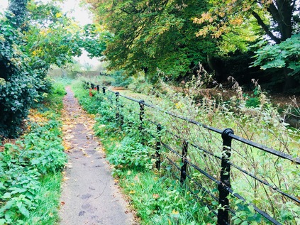
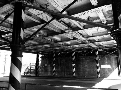
I emerged from a white-tiled underpass that carried the footpath under the railway lines, and suddenly found myself beside the river and walking just inches from the placid waters as they emerged from their own culvert. The path here was busier - not least because it formed a useful link to Hornsey High Street, passing a modern new development of homes which edged confidently up to the water and the squat brick-built pumping station, one of a number on this stretch carrying the dates of 1993 or 1994. I'd seen this development on my walk along the A504 and despite my natural objections to this form of encroachment on rivers, it still seemed like a reasonably well-thought-out development in a good location. The busy path ended at a typical New River Path kissing gate, and I just managed to skip through before the gent who had been bravely off-roading a pushchair along the bumpy ground ahead of me started trying to manhandle his contraption back onto the footpath. From my previous visit, I knew that the way was largely blocked here - the river passed under the railway via a modern concrete culvert, which carried it beneath the East Coast Mainline and along the edge of Hornsey Carriage Sidings. I needed to head along Turnpike Lane a little way, reprising a short stretch of my previous walk, before turning aside into Wightman Road. Confronted by a gentle but steady rise, I set out at a decent pace to conquer it painlessly and in the event managed to miss a turning which would have returned me to the river - if only briefly. In fact, Hampden Road was the scene of another of the encounters where I'd considered walking the New River in the past, while stalking across Harringey to find the remains of the Moselle during the heady Olympic summer while dodging discarded mattresses. Instead, I slogged on uphill through the suburban backstreets, with the river shadowing the fan of railway tracks below, until it entered a culvert carrying it under the road and into the back gardens of the Harringey Ladder. This section was also off-limits, the privacy of the locals being maintained by gates at each crossing. This stretch of the walk was a little dispiriting, with a sustained uphill slog to contend with and no easy sign of the waterway I was purportedly walking. Then, at the peak of Wightman Road, London opened before me. The tips of the towers of the City rose over the horizon, and the Shard speared the now clearing sky. Many times before I've written about walking towards London, but somehow this walk, from decidedly rural beginnings, felt genuinely like a walk into London. My feet were sore - but no more so than if I'd tried to rush one of the shorter walks I usually take - and so I pressed on, downhill towards a nasty snarl of a mini-roundabout where I needed to cross the street to get to Finsbury Park. The traffic was relentless, every opportunity to zip across scuppered by a thoughtless manoeuvre by a motorist. I almost despaired of the crossing and began rethinking routes - but persistence and a sudden window of opportunity caused by a white van driver stopping to shout at a driver he considered in error allowed me to cross and enter the park. The river resurfaced, pleasant paths and railings on each side. Here the noble purpose of supplying drinking water to the City was relegated and the visual amenity of a broad, clean waterway in a parkland setting was being vigorously promoted by the maps and signs around this corner of the huge park. I followed the river on its shaded side, crashing through piles of fallen leaves to walk close to the railing. The only hint of the true reason this fine waterway flowed through the park was a small, seemingly hand-lettered plaque affixed to the palisade near where an access road crossed. Finsbury Park rolled pleasantly off to the south and west, the near-endless green expanse busy with families enjoying the surprising autumn sunshine. I headed for the gate - there was still a way to go.
I crossed Green Lanes again and made swiftly for the adjacent gate to get back to the river path. Again this stretch wasn't unknown to me, cutting across several recent walks and curving sinuously east then west to enclose the pair of Stoke Newington Reservoirs near Woodberry Down. That said, I'd not walked directly alongside this stretch before, and I was keen to be alone on the path again after the long stretch of walking on pavements and busy roads. I was almost alone aside from some dedicated joggers who thudded by on the grassy path. Beside the path a screen of trees separated the northern section of the Woodberry Down estate from the river, this area has been largely untouched by the regeneration of the area so far. To the north of the water, the land fell away steeply to Eade Road and the Haringey Warehouse District, with the tall chimney of Maynard's sweet factory now proudly advertising the Oriental Carpet Company to the surrounding area. On the road below a police cordon was slung between lampposts and the river fence, a long stretch of the thoroughfare now off-limits. At the end of the cordon, a Police car blocked the street, its occupant leaning out of his door and enjoying the afternoon sunshine. The tenants of the nearby New River Studio complex seemed concerned enough to be bringing their outdoor seating indoors, looking worriedly back at the scene. The Police officer didn't share their urgency - he was clearly in this for the long haul, enjoying the chance to rest in a quiet industrial zone. My own quiet was disrupted by coming upon the Seven Sisters Road at a strange tangle of a crossing. Beyond the road, the river passed under an overhang of trees, before emerging at the eastern end of Woodberry Wetlands. Now fully open, this impressive conservation project which had returned wildlife to the fringes of the eastern reservoir and the riverbank seemed to be proving the critics of regeneration right. in the garden of the cafe - inevitably perhaps built from reclaimed shipping containers - a wine-laced reception was underway with lots of chortling and snorting, and lots of eager chatter about primary school places and OfSTED reports from the newly arrived and predominantly white inhabitants of the newly rising towers of Woodberry Down. Meanwhile, the path beside the river was pleasantly democratic - I weaved around a happily dawdling family of Orthodox Jews out for a stroll involving tricycles and scooters and negotiated a couple of animated West Indian men backslapping and mock-arguing their way along the river. The footpath changed from a rough riverside track to a carefully surfaced and sculpted 'river walk' winding needlessly to and fro along the bank, and the clientele changed too - cyclists with all the right gear but no warning bells, birdwatchers dressed like Bill Oddie when he really means business. The Wetlands had attracted crowds and were being enjoyed - but there was just the sense from the strolling new locals of Woodberry Down that they didn't really want the visitors here. This was their bit of London - bought and paid for, and we had no right to be enjoying the view across the reservoirs. The tall reed beds which had been allowed to encroach on the river signalled another shift - beyond this point, the New River has no official purpose. With roughly a third of the river's volume already decanted to the Coppermill Waterworks at Walthamstow, here the reservoirs are fed by the remaining flow and the last stretch is kept in water for entirely cosmetic purposes. Algae bloomed on the sluggish surface as walkers tramped by, harrumphing with dismay when I stopped to snap a picture back across the silvery sheets of water that stretched out towards Hackney. It was almost two years since I first stumbled into Woodberry Down unintentionally, and a great deal had changed. There was still a chance of course that this would settle down - that the new inhabitants would mesh with this longstanding community as London's incoming populations tend to over time. But as I crossed Lordship Road, there was a commotion of screaming and thudding. An angry and persistent voice raised in protest. A bunch of youngsters, clearly not perturbed by recent events in London ran towards the commotion. I slowed my pace - tried to decide how to proceed, carefully surveying the reactions of others up ahead. No-one stopped walking, no-one seemed bothered except to get a good look at what was going on. As I reached the roadside the boys who'd run to get a good view were coming back along the path. "It's OK" they reassured us all walking towards them, "It was just a bloke from one of the tower blocks up there going bonkers and shouting. The ambulance has come now." His crisis seems to stand for the strange tension in Woodberry Down on a hot October afternoon when no-one quite knows if they belong or not anymore.
I was back on Green Lanes, on the section where it suddenly seems quiet and insignificant after its long run in from the northern heights. The wide sweep of flat, green Clissold Park stretched out to the east, and a little too late I remembered that there was in fact a tiny isolated loop of the river's old course inside the park, stopped up and preserved for the sake of history. Instead, I pressed on south, to the junction with Petherton Road. This street bears perhaps some of the last significant above-ground evidence of the original course of the New River before reaching the city, with the impressive run of well-to-do homes and former shops divided by a central green space humped over the culvert which carried the river through respectably Canonbury. This area had long been a blank to me - a strange hinterland between the busy confusion of Highbury and the ancient mysteries of Hackney. It felt, on the surface, like a continuation of leafy Islington terraces, a pleasant walk between dog waste bins and creaky old benches, trying to stick to the narrow path which snaked along the centre of the park where the river used to run. At Canonbury Station, the Overground railway passed below, out-of-commission for the day for more works. Beyond the station, the Borough of Islington has tried hard to celebrate the New River, by way of a linear park with a winding approximation of the river at its heart. The park was surprisingly well-established, having been laid-out first in the 1950s and improved and maintained over the intervening years. This 'New River Walk' was busy with strollers too, all of us meandering along the banks of the shallow proxy of the river. A few students with visiting parents were evident, showing them how pleasant the area was and delivering a confusing version of the history of the river. I didn't mind too much - it seemed like a generally good thing that the river was remembered here, and it was strange how it seems so much more remarkable to those of us who didn't grow up with it at the foot of our gardens perhaps? The park was a cool, green haven from the surprisingly fierce sunshine of the late afternoon, with surprising fountains and hidden artworks providing unexpected interest along the way. Just when I was beginning to feel like perhaps this was just a bit too cleverly managed and inauthentic, and had little to do with the river which had once flowed here, the water took a broad meander around a circular brick watch house - the last remaining segment of the original course above ground in Islington. The scale of the achievement struck me again here - fresh water, conveyed entirely by gravity across the undulations of Middlesex and into the heart of London using Tudor technology and created by sheer effort of manpower. This tiny river, sometimes seemingly insignificant or forgotten on the journey, often flowing across other walks and routes which had always seemed so much more urgent or important for me to take, was a genuine wonder of London. I finally felt like I'd paid it some of the tribute it deserved by walking this far.
After crossing the upper reaches of drab but swiftly gentrifying Essex Road, I delved into the hinterlands again to find Colebrook Row. While no water flows here now, the route of the river which Charles and Mary Lamb's home overlooked is maintained as a stretch of green space running along the middle of the fine, Georgian terraces. Lamb wrote of his friend 'G.D' - possibly the radical poet George Dyer - walking apparently deliberately into the river to nearly meet his end by drowning. Lamb's horror and frustration at this 'self-destruction' is directed at the river - an unreal, unnatural channel which he regards as having none of the desirable qualities of a genuine watercourse:
Waters of Sir Hugh Middleton - what a spark you were like to have extinguished for ever! Your salubrious streams to this City, for now near two centuries, would hardly have atoned for what you were in a moment washing away. Mockery of a river - liquid artifice - wretched conduit! henceforth rank with canals, and sluggish aqueducts. Was it for this, that, smit in boyhood with the explorations of that Abyssinian traveller, I paced the vales of Amwell to explore your tributary springs, to trace your salutary waters sparkling through green Hertfordshire, and cultured Enfield parks? - Ye have no swans - no Naiads - no river God - or did the benevolent hoary aspect of my friend tempt ye to suck him in, that ye also might have the tutelary genius of your waters?
I was distracted myself here - either pondering Lamb, living here in horror at the river while fretfully protecting his matricidal sister from her own demons or perhaps trying to figure out which of the rather fine townhouses belonged to former mayor and BREXIT agitator Boris Johnson? In any case, I found myself suddenly and unceremoniously deposited on City Road in strikingly familiar surroundings near The Angel. My walk had almost ended, but I needed to push on just a little further to truly finish things. My feet felt heavy and inflexible but didn't hurt - I had perhaps passed that point some miles back - so I pressed onward, crossing the road and passing through Owen's Field and onto Roseberry Avenue. This small, private park bears a memorial to perhaps the last, and most destructive act of the New River. On 15th October 1940, the blast from a bomb-making a direct hit on the Dame Alice Owen School above fractured the pipeline carrying the river through Islington to its Clerkenwell terminus. The resulting flood engulfed the school's basement where 150 folk were sheltering from the air raid as they had many times before. With access to the surface blocked by the collapsed building, all of them perished in the deluge. This sombre ending to the walk was a reminder that conditions in London have always been hard, and that sometimes the very developments which are intended to improve and sustain the population can be unintentionally destructive in their own right. The best efforts to respond to the needs of a growing city can just as easily exclude, embitter and destroy. Planning for the future, for the unexpected developments of a city forever in flux, is an always essential task - though it seems at present to play second-fiddle for a sort of desperate opportunism. This is evident both in the endless towers of speculative 'luxury' developments creeping out of the ground along my route today and in the well-intended but poorly thought through schemes of the current Mayor.
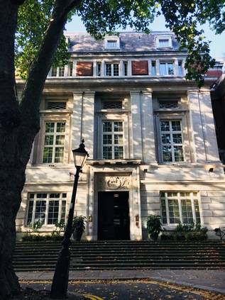
Finally at New River Head, the fringes of the city deserted as ever on a Sunday, I looked up at the grand former headquarters of the Metropolitan Water Board and the sleek modernist lines of the Laboratory Building beside it and figured that if unlikely schemes can be achieved anywhere in the world, London is probably the place. To bring fresh, clean water to this spot from distant Hertfordshire in a time when William Shakespeare - or the man who wrote the works attributed to him at least - was a living memory, was truly a remarkable feat. London changes, often not for the better, but is always remarkable. I shuffled off to find a way back to our hotel, wondering how my feet would feel in the cold light of tomorrow morning. I'd finally walked the New River as I'd long-promised - and the river had raised questions and new routes to walk along its entire length.
You can find a gallery with more images from the walk here.
The curious hidden exit of West Finchley station opens onto the long suburban wind of Nether Street. By the 14th century this route, sometimes known as Lower Street, was already regarded as an ancient way. Now it trickled with Saturday morning traffic and occasional joggers, a string of quiet local stores leading away from the station. A quick survey of my surroundings indicated the distinct declivity to the west of the road, and a short trek between ranks of pleasant homes led me towards the bottom of the valley. From the top of Fursby Avenue a pair of glowering youths, hooded and hands wedged into pockets watched me from a bench, occasionally spitting on the ground. I felt their frustration - it must be hard to rebel in Finchley, where there's almost no-one around to pass judgement. I glanced back, hoping that they'd recognise my effort, before I plunged into the trees and began my walk along the Dollis Brook. I could have struck out further north, given how eminently walkable this tiny but proud waterway is - but in truth even coming this far had been a last minute decision. This walk had a difficult genesis - one option among three, in a month where I knew I'd be in London more than once. I'd originally intended to disembark further south to pick up the River Brent at Hendon, or the Dollis Brook at Finchley Central - but here I was just close enough to the edge of things to feel like I was walking into London. If the fairly exclusive golf course would permit it and I could strike out directly north west, I'd find myself crossing open countryside as far as the M25 at London Colney. These strange frontiers with their unsettling sense of being the last-street in London exist all around the perimeter, but perhaps feel strangest here on the northern flank of the city. Whatever the circumstance which got me here, it felt good to be walking beside water. Easing a sore left foot into action, I set off along the course of the brook which edged around allotments busy with gardeners hauling in their late crops.
Having tramped the edges of a good number of waterways in London, I'm used to being largely alone on these walks. The occasional cyclist or jogger sometimes appears, but largely the footpaths which flank streams and rivers seem to be off-limits on weekend mornings. The officially sanctioned activities take precedence: shopping, DIY and so on. The Dollis Brook however, appeared much beloved by the locals. My walk through the edges of Finchley was busy with dog walkers who shadowed me: when I paused to take a photograph they seemed to stop to watch their animal grubbing in the generous carpet of leaf-fall. When I set off again, I'd hear the panting and pattering behind me. It was clear that being out here without a lead dangling from my wrist marked me out as an odd-ball. The owner of a particularly nervous little terrier asked me urgently "Is your dog behind you?" presumably worried it would go for her trembling charge. When I replied that I didn't have a dog with me, her relief quickly turned to concern. If I wasn't walking a dog here, what on earth was I doing? The brook babbled pleasantly, but it seemed to be nothing more than a backdrop - for the young religious pamphleteer who was regretting starting a conversation about Jesus with a park drinker, or for the pair of designer-clad women trying to navigate their way through a conversation about a Muslim friend who wore a veil at a wedding with their liberal credentials intact. "Well of course if she chooses to...." "Yes, but I'm not sure if it's sexist, or racist. Y'know?" "Maybe it's a personal thing really. Not our business?" "No. We can't judge" "But she did look stunning!". Their dogs, ignored and bored by the chatter, plashed into the nearby brook.
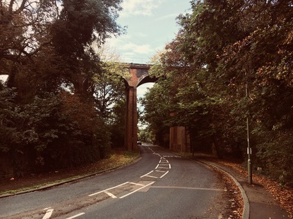
The path crossed and recrossed the Brook to negotiate a minor tributary joining from the east at Lovers Walk, then skirted a pond almost entirely buried within the trees which lined the valley. Suddenly, I was deposited on Dollis Road - a furious B-road which lurched around a blind bend from Finchley to Mill Hill, traffic barely slowing for the curve. Forced to cross the road, I carefully waited time before heading under the slender legs of Dollis Brook Viaduct. This tall copper and honey-coloured brick structure carries the rather forlorn stub of the Northern Line over the Dollis Valley towards Mill Hill East station, providing the so-called Underground with its paradoxical highest point above sea level. The line which passed overhead had suffered a chequered history: opened in 1867, the Great Northern Railway's line to Edgware was reduced to a branch line as early as 1872 when the line from Finchley to High Barnet came into use. Transfer to London Transport in the 1930s offered a new lease of life to the line, and double-tracked and electrified it would form part of the ambitious Northern Heights plans, with a new link to Edgware and beyond to the speculative new horizons of Bushey Heath approved. The war intervened - but unlike many of the schemes slated for delivery, a little work was actually completed with a single track over the viaduct electrified and opened to Mill Hill East station in 1941. However, that is largely what has remained since, and now outside the peaks a shuttle train operates high above the valley, with the course of the railway beyond now largely developed but still discernable by the broad curving sweep of new-build homes on its tell-tale footprint. I lingered under the viaduct long enough for the shuttle to clatter overhead, road traffic drowning out the noise of the train. Rather like the Piccadilly Line's crossing in Arnos Park, the row of voids in the brickwork stretched ahead creating a strange optical illusion of infinite arches, and under the nearest arch the brook trickled, unheard and unremarked by the passing drivers.
Beyond the railway viaduct, the path beside the brook was hemmed into a narrow green tunnel between suburban streets, and again it was the preserve of dog walkers with their evident suspicion of those without canine accompaniment. At Windsor Open Space the path opened into a wider linear park, spreading to the east of the Dollis Brook. I had passed close by before and soon found familiar territory where the footpath sloped down into a narrow subway to pass under the A504. Soon afterwards a bridge carrying the arms of Middlesex lifted the traffic of the Great North Road over the valley towards its confluence with the North Circular. I made slow progress through these bottlenecks, pausing to let dogs pass by, with their panting owners trotting after them in pursuit. This area was familiar from walking around the North Circular, and I noted the pleasant little playpark where the Mutton Brook trickled in from the east, a family of children clambering over the equipment while a tired mother lay back in the surprisingly bright morning sun. Nearby the Dollis and Mutton Brooks finally met with their joined waters becoming the River Brent, which started its sluggish swing to the west by skirting Decoy Pond and forming the western extent of Brent Park. The North Circular was asserting its presence here, and I was reluctant to encounter it. I've no objection to the road - and even have something of an affection for its strange loop around the northern suburbs of London - but I felt like in some ways I was still processing the complete circle I'd recently completed. There was however, no escape from Brent Park without briefly joining the haze of dust and fumes, as I encountered the first of many surprising and frustrating diversions here with a footbridge and park exit onto Brent Street closed for repairs. I stepped reluctantly onto the pavement beside the six lanes of traffic, knowing that the twinge of protest I felt in my foot as I misplaced it on a flagstone was the price I'd pay for walking beside this road today. As soon as possible I retreated into Brent Street and took to the side streets of Shirehall Park. The rumble of the road was never far away as I ambled between decent villas and pleasant gardens tucked into a curious corner between the North Circular and the A41. A family wandered towards their car, either unconcerned or resigned to the road and its environs being a guilty, dark orange stain on the Mayor's recently released pollution map. I crossed briefly into the scrappy edge of Hendon Park to climb the footbridge over the Edgware branch of the Northern Line, soon finding myself beside the impassable shudder of the A41. To the south the road was soon entangled in the complex junction with the North Circular - I'd negotiated that before and I didn't have the energy or patience today. Instead I struck out north along the rather typical arterial route flanked by rows of fine houses which never expected to sit on such a major route. I soon found a grubby subway beneath the carriageways which delivered me to the road's western side immediately beside a pedestrian entrance to Brent Cross Shopping Centre. It wasn't what I'd planned, but it was time to brave a crossing of the retail jungle.
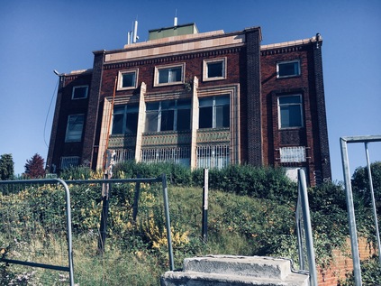
Getting into the Shopping Centre was the first challenge. The sloping footpath led me along the edge of an orbital route, peppered with roundabouts and zebra crossings which appeared to be entirely ignored by the drivers racing for parking spaces near to the doors. Once within the loop of access road the signs 'To The Shops' led me between two huge concrete car parks, towards the functional grey rear of the structure. The path divided and I could 'Use both doors for shops'. I muttered 'surely either?' to myself but realised that Brent Cross isn't interested in the individual shopper - it speaks to the collective mass. Some of them had already arrived. Less than an hour into the centre's day, there was a dedicated band of customers sluggishly navigating the complex, scoping out their next move. They moved slowly, filling the broad aisles and failing to acknowledge my sweaty bustling around. I wanted out of here as soon as possible - malls unsettle me. Never comfortable with large empty spaces, the weird light and muted echoes of sound disturb my balance and awareness just enough to make me queasily nervous. I shuffled behind the touring bands of shoppers to the toilets, then down into the lower levels to find a cold drink. I settled for a nearby WH Smith rather than detouring back towards other options. The crowds had grown steadily since I arrived, and they were even less inclined to give way than the cyclists and dog walkers on the river path. I struggled out through John Lewis into the car park, and didn't pause until I'd skirted the car park and found another footpath out of the site. I didn't particularly care if I looked suspicious on the plentiful forests of CCTV cameras now - it felt like an age since I'd felt the less-than-fresh air outside. I slowed my pace, walking gratefully along Brent Park Road, and considering my options. The river ran parallel to my route, but to take a closer walk along it would involve navigating the complexities of Staples Corner once again. While the return to the North Circular hadn't felt as jarring as I'd expected, thoughts of navigating the highwalks and crossings at that junction once again weren't edifying. Instead I passed under the concrete embankment carrying the nascent M1 and then negotiated a series of ever-lower bridges carrying slip roads and the tracks of the Midland Main Line. Finally I emerged on the A5 - following the straight track of Roman Watling Street. Crossing the tide of traffic divided by a high metal fence was impossible - instead I needed to walk north here, towards West Hendon and the start of a recent walk. The growing decay of the businesses along the main road was starkly contrasted with the tall, modern apartment blocks growing behind the Victorian terraces and tired 1980s car sales forecourts, offering views across the reservoir. The decorative frontage of Philex House was a welcome surprise, derelict but still remarkably detailed and impressive. The still extant electronics company had followed the pre-Olympic exodus of industry up the Lea Valley ending up in Bedfordshire, but its fine old headquarters still stood - for now at least. I finally crossed the street at the curiously named Cool Oak Lane - a brand new Range Rover occupying the central lane with his bumper distorted from a recent skirmish at the lights. He gestured angrily at his 'phone behind the toughened glass windscreen - a mute rage at the injustice of the A5. Meanwhile Cool Oak Lane was remarkably close to where I'd crossed the street previously, and I kicked myself for not having spotted this way to Brent Reservoir. The lane narrowed to a tiny bridge over the neck of the lake, cars signalled over in turn. I spotted a crossing button and pressed, claiming my own pedestrian-timed gap in the sequence. No time to snap a shot of the vast body of water stretching to the south west and shimmering with bird life. I had to reach the west bank before the tones ended.
The northern banks of Brent Reservoir felt pleasantly wild and unloved. The rough path littered with cracked horse chestnut shells and a growing mulch of fallen leaves, climbed to shadow the water but remained within the tangle of autumnal woodland. The footway wound around the lake, dipping inland to avoid denser clumps of trees, with occasional cleared areas leading towards the lake to allow access for fishing points or views across the silvery water. Waterfowl clucked and skittered from the undergrowth into the deep, cold water. Autumn had certainly come to Brent, and I sensed darker skies closing in after the sunny morning. I realised I could have scrubbed around to find an obscure path beside the river had I stuck to the south bank, but I'd have effectively been delivered to the same problem: Neasden. The widening fan of sidings around Neasden Depot present a huge barrier here, and a fairly inconvenient situation for locals - thought the railway is of course the very reason the suburb exists too. The streets near the depot give away the lofty and distant pretensions of the Metropolitan railway perfectly with Verney, Quainton, Aylesbury and Chesham Streets butting up against the sweep of rails, describing the distant green termini of inter-war Metroland. But for well over a mile, the district is divided - the options are to head south for the complex junction of the North Circular or to head north to Wembley Park. It's a long walk, and a traffic choked drive whichever way you head - and during events at Wembley Stadium, it must be near impossible. The river continues, resolute and undiverted, under the lines in culvert. Aware of the cost of these diversions, both in time and in distance, I turned north into a residential area leading to Chalkhill Park. Parents creaked their way through exercises on the outdoor gym equipment while children played. I paused, listening to the trains rattling by mere feet away while I rested and regrouped. Missing the route to the south, along the riverbank in a deep, unloved urban gulley felt like an omission. Perhaps it would be easier to manage in the winter with less overgrowth? In any case, this wouldn't be my last diversion of the day.
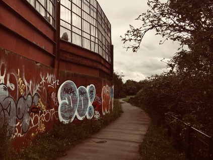
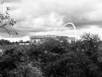
One unexpected bonus of having to head north via Wembley Park was a sighting of the Wealdstone Brook. With the stadium's signature arch looming giddily overhead and the wrap of neon advertising screens around its perimeter casting an unreal blue light over a growing district of towers and retail outlets, it was comforting to find this little river occupying a gully in the floor of a deep, wide culvert. The brook is seemingly a somewhat ephemeral stream in drier seasons, but it flowed nonetheless. Wembley felt like a western reimagining Stratford in a way that the Westfield outpost at Shepherd's Bush never quite has. Perhaps it's the availability of open, former industrial land to pepper with student accommodation and luxury flats, or the relatively poor finances of the host borough allowing them to be persuaded to part with extensive permissions to allow rapid, high-rise development? In any case, like Stratford, the job is unfinished here too. A few steps along the edge of the Wealdstone Brook and I was deep into a unwelcoming and litter-strewn industrial estate which skirted the railway land. The brook meandeed back and forth, and I was intrigued by following its progress - so much so that I strayed past a gate and into a contested street which appeared to be privately owned. Trucks thundered between warehouses and cars were haphazardly abandoned without any thought for access. I was the only human here who didn't glow in hi-vis, and I was conspicuously not hard-hatted or safety-booted. A group of young Polish men watched me from a perch on a convenient concrete block, scanning me as I walked by and murmuring. They were more likely to wonder why I'd want to come here than if I was permitted to be here, I reasoned as I tried to exude confidence and purpose despite a growing limp and a sheen of sweat from walking in a coat on what has turned into a warm day. Finally back on semi-public land, I crossed Atlas Road and passed into Brent River Park. The name promises much, but the reality is a narrow strip of woodland between warehouses and aggregate depots - in its own way though, it is an oasis. Deep below the path, the Wealdstone Brook met the Brent, and the invigorated river turned southwards again. The walk here was surprisingly pleasant given the somewhat down-at-heel feel to the area, and I was largely alone until the underpasses which carry Great Central Way and the railway which it is named for overhead. A cyclist caught up with me, politely dinging his bell as he passed. The path broadened into the edge of Tokyngton Recreation Ground - and again I've been here before, having briefly entered the park to walk parallel to the North Circular. Today I walked the full length of this rather fine green space, noting that the Brent was considerably less noisome and more animated than the still, green waters I found back in the summer. The path was uneven and surprisingly tough going as my feet tired and ached, but I pressed on for the crossing of Harrow Road. A huge crop of Shaggy Ink Caps, a surprisingly large mushroom sometimes known as Judges' Wig, peppered the grass between the river and the path. Above the trees the arc of Wembley Stadium fills the middle-distance, a reminder of the diversion I've taken to get here. The river disappeared into culvert alongside the concrete staircases and tower footings of Wembley Point, and once again I was marooned beside the North Circular briefly, and reminded of how the road and the river are intricately related here. I pressed on into the industrial hinterlands of Stonebridge Park, passing under the railway from Euston and near the Ace Café. The sky was greying distinctly and the day feels ominously short now.
I wasn't sorry to pass under the odd combination of aqueduct and bridge carrying the Grand Union Canal over the A406 and to turn aside from the road again. The Brent surfaced behind the grimly utilitarian Travelodge and I was able to walk close beside it once again on Queensbury Road which marked the edge of the Abbey Estate and the southern edge of Alperton. An unofficial but well-worn path ran along an embankment beside the river, with a broad strip of grassland separating it from the road. On the other bank, a wall of industrial premises filled the space between the North Circular and the river. My hasty planning indicated that this makeshift footpath joined an official route which passes under the Piccadilly Line beside the river, but it soon became clear that the way was blocked by building works. Faced with another diversion, my spirit was almost broken. The only escape was to cross a tiny footbridge over the Brent, edge my way between industrial units on a permissive path and return again to the North Circular. I found myself approaching the Hanger Lane Gyratory once again, this time from the east. Little changes here - the traffic is still solidly blocked - moving almost imperceptibly around the junction, and the fumes hang as heavily as ever above Hanger Lane station on its isolated island site. This time I turned north onto Ealing Road to regain my route. The river took a more direct journey, and reaching it as it passed under Vicar's Bridge seemed to take a long hike. Here at least though, the Borough has had a short-lived outburst of pride in the waterway which provides its name, with a battered but sizeable sign marking its crossing. Beside the bridge, an ill-maintained but wide and street-lit path with an associated cycleway disappeared around a corner. This felt initially promising, and I headed into the cool green tunnel formed by the overhanging trees, skirting a bunch of off-duty supermarket workers necking Fanta laced with vodka and kicking off their weekends in a somewhat down-to-earth style beside the Brent. The river was hemmed in by buildings and ran swiftly in a channel here, but I was pleased to be beside it again. The direct footpath offered some hope of making a little more progress than I'd expected given the day's frustrations and an unexpectedly shorter route might keep me moving for a little longer. But then, suddenly, the path disappeared. The flagstones ceased, and the cycle path stuttered into a muddy emptiness with just a single streetlamp as an ellipsis. This was at least an indication that there was some intent to go further, but presumably the cash ran out. Instead I'm forced to turn aside into the nearby Industrial Park. The threatening clouds choose this moment to burst above me. The dry, dusty pavements reeked in the rain. There was obvious way forward and I found myself involuntarily back at Vicar's Bridge, drenched and having gone nowhere at all. It's the final straw for my tired feet. I have enough energy left for a push onwards to find transport home, but not more. The Brent - assisted by my foolhardy lack of planning - has beaten me today.
I trudged along Alperton Lane, the rain coming down heavily now, knowing that the river was weaving its way along the edge of the golf course some way to the south. A dated brown sign welcomed me to the London Borough of Ealing, while the tail-fin of the Hawker Hunter jet stationed atop the headquarters of Vanguard Storage was camouflaged perfectly against a grey sky. The strange collection of objects here are the personal collection of Mac McCullagh, the firm's owner, and from other angles field guns and buses can be seen topping the fine brick buildings of Vanguard's headquarters. My aim now was Perivale Station, a mile or so away along Western Avenue, which I joined at a noisy junction near a drive-through coffee shop. I resisted the urge to enter and rest - if I didn't press on to Perivale right now I'd probably never get my legs moving again. I calculated the time and distance wasted on diversions, skirting around obstacles and badly-planned turns, and compared it with the three miles or so left of the river to Brentford. Giving in felt like a defeat, but it had been a noble effort. Walking west always feels tougher going, and today had been a fine challenge. My one last treat was to be a pedestrian passing of the splendid Hoover Building, completed in 1933 and designed by Wallis, Gilbert and Partners in textbook art deco style. However, as I approached I realised that the main block had disappeared behind scaffolding and screens to protect the Grade II listed building during refurbishment. The smaller buildings at each end of the long, low sweep of the block were all that could be seen - but this allowed me at least to get a glimpse of the canteen building, a modernist gem in its own right. Beaten yet again I turned north and headed for the curiously stubby curve of Perivale Station, with an additional wing and tower extension cancelled as a post-war economy. It remains a fine building though, and the curved glass clerestory was a welcome sight today in particular. Once inside the sinuous canopied stairs led me up to the island platform with views back over Wembley - and tantalisingly, south towards Brentford. I let an eastbound train pass, enjoying the calm of the empty station. The rain had stopped and a golden sunset was promised by the western skies. I reflected on my hubris - imagining I could set out with almost no planning and manage to deal with the twists and turns of an urban river. I was walking well off my territory, straying into the unknown in a way which felt liberating and challenging - but which had rather strangely sapped my energy. The remaining walk along the Brent to the Thames promised further revelations, and it could wait. I hobbled towards the arriving train, plotting my next excursion in the west...
You can find a gallery of photographs from the walk here.
London's Other Orbitals: Unbreaking the Circle
Posted in London on Saturday 2nd September 2017 at 10:09pm
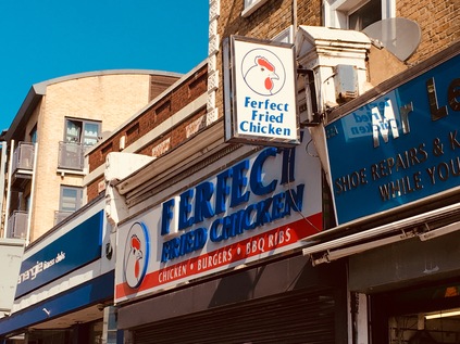
Despite my careful attempts to end the last leg of my walk somewhere I could easily pick up the threads, my arrival at Forest Hill had been a little fraught. With rail services not calling today due to planned engineering works I'd somehow entirely missed, I'd headed instead to Catford via a departure from the impressively extended and modernised Blackfriars station. While there, my bank card had been rejected by the ATM leaving me in a state of mild confusion and paranoia. I didn't even notice how bright the morning sun had turned as I headed for the bus stop near Catford Station and hopped on board. Not until I'd had managed a successful transaction at Forest Hill Sainsbury's was I assured that there hadn't been some sort of financial mishap. These things always bother me - and the prospect of a conversation with my bank instead of walking this morning wasn't edifying at all. As I stepped back out into the bustle of surprisingly gentrified Forest Hill I sighed with relief. Perhaps I was ready for this after all? Completing the circle seemed impossibly far off - but it had become something of a cause now. This leg of the trip would take me into areas I simply didn't know, and which I couldn't connect with any of my other wanders at all. That in itself felt strange - so many of the unexpected pleasures of the last few walks around the Circular Roads were in turning unknown corners to find familiar views from new angles. This was a different excursion - deep into the suburbs, in almost the opposite direction to that in which I comfortably tend to turn. I dodged sturdy designer prams and expensive bikes to gain the outer edge of the pavement in order to get an angle on the sign of 'Ferfect Fried Chicken' - this legendary local eatery was allegedly unprepared to pay to use the existing name when the shop was purchased from a group of franchises, and so a surprising accurately matched 'F' was tiled over the sign. The fact it makes absolutely no sense appears to have troubled no-one, and so in the midst of the rapidly upscaling Forest Hill townscape, opposite the rather fine old 1920s Capitol Theatre turned Wetherspoons, the errant chicken purveyor remains. This felt like the perfect place to begin walking. The beginning of the end of the South Circular...
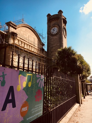
As I climbed away from Forest Hill, still surprised by the upturn in its fortunes in comparatively recent times, I saw the tower of the Horniman Museum appearing at the crest of the hill amidst a cluster of greenery. Charles Harrison Townsend's curious 1901 design fuses Arts and Crafts decoration with a rather foresighted and clean lined modernism, making for an odd but pleasing building, sitting almost at the brow of Forest Hill. The museum itself houses Frederick Horniman's extensive collection of curiosities, purchased with the proceeds of his inherited tea trading empire. The collection majors on cultural and anthropological history, and has a legendary collection of taxidermy and musical instruments. There was no time to check out what sounded like a charmingly odd expression of one man's passion for collecting today, instead I slipped into the surprisingly capacious gardens beside the museum to find a spot to apply sunscreen and chug cold water before setting off in earnest. I found the rather beautiful grounds of the museum busy with locals out for a stroll and families working on what appeared to be an edible garden project. The pathways curled around the site, luring me deeper into the wooded nooks. The temptation to explore further was strong, especially because the northern edge of the site offers impressive views over London from the comparatively high ground of the hill. Instead I set off west, crossing the former trackbed of the London Brighton & South Coast Railway's branch to Crystal Palace High Level. Much of the railway can now be walked as part of a nature trail running between the suburban streets, and which after crossing the South Circular, climbs into the woods of Sydenham Hill. Having never recovered traffic following the destruction of the Crystal Palace by fire on 30th November 1936, the line limped on until 1954. It has the dubious distinction of being the first electrified mainline railway line to close in London. Now it's a barely discernable hump in the road, the path disappearing into the Lapse Wood Walk housing estate where some remains of the line can be spotted by the eagle-eyed. I trudged along the road towards it's awkward junction with Lordship Lane, choosing unwisely to attempt to cross near 'The Ferns', a very early attempt at constructing a home entirely from concrete dating from 1873 by Charles Drake's Patent Concrete Building Co. In disrepair for a while, it was good to see that a recent refurbishment had restored it to former glory, while retaining the name of the property. I had a while to ponder this feat of engineering as I waited for a gap in the traffic on the South Circular...
I had only the vaguest idea of Dulwich. Somehow I'd cobbled together an idea of the place through the oddest disconnected parts: Margaret Thatcher, the Picture Gallery, the exclusive, private college which produced the odious Nigel Farage. While all these things form part of this curious place, there is something stranger at work here. Dulwich, despite being sandwiched between areas not far away which are challenged and struggling, is an incredibly genteel neighbourhood. The green, wooded slopes of Sydenham Hill rise high above the broad playing fields of Dulwich College, home to the Old Alleynians - named for Edward Alleyn, actor and founder in 1619 of 'God's Gift College'. Beyond them, the almost impossibly tall transmitter tower at Crystal Palace strikes the skyline. Snaking around the edge of the sports ground is Hambledon Place, a gated community of large modern dwellings, perhaps surprisingly built by Barratt Homes, in the style of the large mansion houses which line the other side of the South Circular in Dulwich. Behind these gates, a battle-scarred Margaret Thatcher briefly reflected on her ousting from Downing Street. She had taken her husband's advice and purchased a bolt-hole to which she could escape when her increasingly inevitable downfall occurred, and the proximity to a good golf course bears his influence too perhaps? Dennis is reputed to have suggested she could wander down to the village with her basket to shop, and then a car could pick her up and take her to the Lords for a vote, which perhaps suggests more about Dulwich than it does the Thatchers. In the event, Margaret and Dennis didn't spend a great deal of time in Dulwich before their repair to Belgravia, and the local association with them is perhaps unwarranted. I lingered on the corner trying to decide if I could poke my camera through the automated gates, festooned with cameras and electronics. As I decided, a large, sparklingly clean Landrover cruised up to the gates, the driver a middle-aged Indian man wearing shades and the garb of a country gent out for the shoot. "What are you doing here? Why don't you fuck off?" - there was no pause for a response between his two plainly rhetorical questions. I silently did as I was told, cursing my failure to defend my ground on the public highway outside the gates. There was something in his response which typified Dulwich too. As I've walked the Circular roads, I've encountered a surprising number of clandestinely privatised places: edgeland strips of littered scrub protected by a forest of cameras, retail parks under constant surveillance, gated communities like Hambledon Park. But there is a more sinister edge here in the affluent south. There are areas where a tyranny of manners guards access - where you might 'look' wrong and the fear of being asked what on earth you think you're doing here guards against intrusion. Perhaps only in Britain - maybe only in London - could this work so effectively to repel the unwanted? I definitely felt that I wasn't required here in Dulwich, and as I hurried along the perimeter of the college, its beautiful gothic buildings largely concealed by scaffolding as it was buffed and repaired for another lucrative school year, I was acutely aware of the this entire area being carefully managed. The Dulwich Estate centres on the various schools and colleges, and its long and complex history records generations of very smart investment, clever capitalisation of legacies and maximisation of income. Indeed the estate still operates the only remaining toll road in London, though this most traditional but financially savvy of institutions does allow locals to pay via an electronic tag. The rigorous preservation of a certain kind of English village life, coupled with an astute sense of being an island within a vast city makes Dulwich feel self-aware, a little apart, overtly stage-managed. I wasn't sad to pass over the boundary.
The transition from Dulwich to Tulse Hill was however, something of a jolt - the quaint wooden fingerposts and crimped lawns of the Dulwich Estate gave way to the well graffitied and apparently disused Variable Message Signs which were about the only hint of the strategic importance of the South Circular. A few stray flags on lampposts urged me to 'Love West Dulwich' - an area which appeared to consist entirely of an attractive if rather sparsely used railway station and a tricky to navigate crossroads with the route to Herne Hill. The quiet suburban area clung to its eastern and more affluent neighbour desperately. There really isn't any West Dulwich aside from the railway - but they're trying really hard to believe there could be. A low bridge where sleek, new Thameslink trains passed overhead marked the boundary, and yet another badly thought-out gyratory spun the road around the Victorian centre of Tulse Hill. It struck me here that the most problematic spots on the South Circular were often where well-meaning attempts to improve traffic flow had been implemented. This area was largely undeveloped until the early 19th century, and only really became populous after the railway arrived in 1868 when the difficult geography and the straggling forested remnants of the once extensive Great North Wood finally gave way to a district of rather plain and functional terraces. The last thing I expected to detain me on this leg of the walk was surprising architecture - but descending from the heights of Tulse Hill, the South Circular curves along the edge of the Palace Road Estate. This early 1970s low rise development was built by the Greater London Council and designed by their chief architect, Sir Roger Walters. His modern but subdued buildings snake along the awkward rise beside the road in attractive zig-zagging blocks which lengthen towards the western boundary of the site. His work for the GLC is remarkably distinguished if somewhat unsung, with the Thames Barrier and the rejuvenated Covent Garden bearing his signature. He is perhaps less well known for Perronet House at Elephant and Castle, a modern social housing block dating from 1970 which uses unusual design features to give all residents an aspect at both sides of the building, uninterrupted by external communal corridors. Wikipedia, ever resourceful, reminds us not to confuse him with Roger Waters. We won't, I'm sure. As the road headed further down Streatham Hill towards Clapham, an equally curious building rose steadily above the brow. First a curious pyramid appeared, then a tall, striated brick tower and finally a squat and solidly modern looking church beneath. Christ Church by James William Wild in fact dates from 1841, and is a truly remarkable building. While now essentially an inclusive and suburban outpost of the Anglican Communion with its extensive estate of dull urban churches, this building appears to belong in another time. Meanwhile its patterned brickwork and Star of David rose window seem to come from another continent entirely. After delivering a number of solid but unremarkable parish churches in Hampshire, Wild travelled extensively in Egypt and the Middle East. A period of mysterious inactivity followed his return to Britain, after which he worked on the complex of museums in South Kensington and their outpost at Bethnal Green, now the Museum of Childhood. Perhaps the building that owes most to Christ Church though is his Italianate water tower at Grimsby Docks. The church is an arresting sight in the slightly mundane surroundings of this part of the road - a welcome relief from the suburban monotony of the hinterland separating the boroughs of Lambeth and Wandsworth.
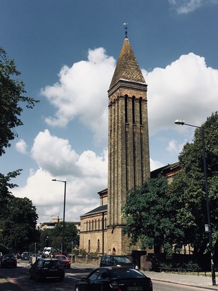
Shortly after Christ Church, the South Circular crosses the A23 on its long trek to Brighton. From here, for just a short section, the road is a broad six-lane dual carriageway. Oddly, this is also one of the quieter sections with most traffic apparently content to head along the radial roads into London or out to the suburbs and the coast. The South Circular soon returns to its ponderous, pottering single-carriageway meander into Clapham, through pleasant terraces and bursts of more recent development. It strikes me that this part of the route must be more affluent - there is a Tesco Metro or Sainsbury's Local on almost every major junction, something distinctly lacking in the eastern quadrant. I'm also aware that I'm starting to head north towards the river, having passed the most southerly point of the road's curve some way back. The arc of the South Circular is shallower than its northern counterpart, returning to the Thames much closer to the West End, and stretching out an arm along the river to the western suburbs. Now though, the road arrived rather unexpectedly at Clapham Common. The junction was busy with traffic from all angles, and crossing was difficult - but sure enough, tucked away between the branches of the road was the squat cylindrical tower which signified the shaft leading to one of the Deep Level Shelters. This network of extremely deep and well-protected tunnels were built when the public demand for shelter from the blitz began to overwhelm capacity around the city. The tunnels echoed stations on the Northern and Central Lines, with the intention that they would be linked together to form an express tube network in peace time. Progress on the building was slow due to wartime labour shortages, and by their completion in 1942 the intensive bombing had largely subsided and demand for shelter had reduced. The Goodge Street shelter became General Eisenhower's wartime base, and other stations hosted troops in transit, but the tunnels were hardly used for their original purpose if at all. They also failed to live up to their intended post war use as new Tube lines, but almost all of the tunnels have found a peacetime role: as document stores, telephone exchanges or even for a brief period during the 1951 Festival of Britain, a hotel. Now however, the rather sorry looking Clapham Common entrance is overlooked by a line of very fashionable eateries and bars stretching along the edge of the common. I knew this area was becoming more desirable and the demographic changing, but to see it in such a sudden burst of activity after the resolutely suburban progress of the South Circular was a shock indeed. But perhaps it shouldn't have been a surprise - Clapham has been fashionable since its earliest development as a suburb, with the spacious villas surrounding the Common providing homes for the 'Clapham Sect' - an informal but influential group of evangelical Anglicans numbering among them William Wilberforce and Henry Thornton. The atmosphere of intellectual and religious freedom which was enjoyed by the 'saints' as they were known, saw them wandering the common between their homes to discuss matters of social and liturgical importance. It was among these houses where the rigorous parliamentary campaigning was plotted which led to the abolition of slavery throughout the British Empire by 1807 and the later emancipation of all slaves in 1833. I followed my route around the smaller, western extension of the common, realising that I would actually lose the A205 briefly for a few miles here as it shared a route with the A3 on its western journey to Portsmouth. The South Circular was now firmly in brackets on the signs - an indignity which its northern cousin never quite succumbed to. It was hard to imagine members of the sect scurrying across this busy swirl of traffic, eager to impart their ideas on freedom and faith to each other.
The road passed swiftly through the busy crossroads of Battersea with its lines of tall, red-brick shops snaking away north towards the railway, and then crossed the northern edge of Wandsworth Common. The Common, though still a large tract of open land even now is divided by a griddle of railways and roads, with a neat arrangement of grand Victorian villas known as the 'toast rack' eating into its western edge. I strayed from the road briefly along Spencer Park to find the memorial to those who perished in the Clapham Junction rail crash in 1989. The simple curved stone commemorates both the 35 victims of the crash, and those who worked to help them on the morning of 12th December 1988 when a simple but ultimately catastrophic signal failure resulted in a collision involving four trains in the deep cutting below Spencer Park. Some of the first on the scene were staff and pupils from the nearby Emmanuel School, and as I contemplated the difficulty of clambering over the palisade fencing and down the steep bank to the railway to offer aid, some of the current pupils passed by heading back from sports practice. It was hard to imagine these young people, full of chatter and innocence, having to deal with some of the horrors that day. The carving on the stone shows a hand grasping another from above, which felt perfect for this memorial. The safety culture of British Rail was changed greatly by the crash, but just a few years later the privatised railway would need to relearn some of these lessons all over again in other parts of London. As it stands, the railway in the UK is now possibly one of the safest in the world - but it felt cruel and tragic that this incident and others like it were the necessary catalyst for this change.
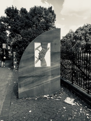
Soon after passing Spencer Park, the road crossed the rather grander A214 - one of the few completed relics of a scheme to connect two of the unbuilt and much maligned London Ringways, which would have included a rather steep, ski-jump of a flyover if fully realised. Ploughing south from the infamous Wandsworth Roundabout, the road is a broad dual-carriageway in a deep concrete cutting which gouges deep into the Common. Rising again to the south, the road is a broad, urban arterial with a tree-lined median - and is perhaps one of the best indicators for what the road network of London could have looked like had the Abercrombie plan or even the GLCs later revisions come to fruition. As it is, the A214 soon becomes a fairly mundane suburban route out to Crystal Palace and West Wickham, leaving this section in Wandsworth a somewhat over-engineered and marooned hint of what could have been. The A3 and South Circular continued west in combination, passing 'Mount Nod' - an abandoned and currently inaccessible Huguenot Burial Ground - and descending into the valley of the River Wandle which the road crosses in Wandsworth Town Centre. My only vague knowledge this area was from frequent travels on the railways which pass largely beneath the town, and I was a little surprised by Wandsworth. The eastern approaches pass the impressive Town Hall which still provides a civic centre for the Borough. A wedding was taking place in the inner courtyard, perfectly framed by the Portland stone entrance which faces the street. Along the wings of the triangular building, stone reliefs depict scenes from local history above manicured lawns and pristinely weeded flower beds. Years back, I'd stayed in a down-at-heel budget hotel a little way towards Clapham Junction and had developed an assumption from its hinterlands that Wandsworth was a grim and unprepossessing place, being swiftly encroached upon by dull riverside apartment blocks. If only I'd strayed a little further from my digs perhaps I'd have found this building and thought differently. Disappointingly there was no access to the River Wandle at present as the redevelopment of the former Ram Brewery has temporarily closed the pavement on the north side of East Hill. Behind the wooden fences a range of waterfront properties can be seen rising slowly to form the almost inevitably named 'Ram Quarter'. Wandsworth is about to change it seems - and The Ram, an inn which can trace its history back to 1550 or thereabouts, is again a central part of the story. Young's brewed their last beer here in 2006 with production subsequently moving to Charles Wells in Bedford - but the developers of the site in Wandsworth have committed to the presence of a 'nanobrewery' in the former laboratory building to continue the tradition. For now though, the northern side of the street was off limits, the old Inn's frontage disappearing behind hoardings to rise again as a protected feature of the site. Forced to cross the street I noted that the river disappears under the Southside Shopping Mall here surfacing some way south, and as I strolled through the reeking clouds pouring from a grill in the pop-up street food market on the broad pavement covering the river, I rather wished I could see it. The Wandle is possibly the very first London river aside from the Thames which I'd learned about by way of Michael de Larrabeiti's novel The Borribles which I read as a child in the early 1980s, long before I'd ever visited the capital. The vision of a dark, confusing and unforgiving city conjured in this novel with hidden layers of meaning has perhaps never quite left me. It was also perhaps the first book which treated me like an adult, refusing to pull punches or sugarcoat disappointment, and it left a strong impression of a dirty, shifting city with curious culverts and sinister people living altogether disconnected lives in the unknown suburbs. The characters squatted in derelict houses, openly questioned authority and spent their time evading the Police. It's hard to imagine the book being published for children now - the concept of young adult fiction had re-emerged in the 1960s and the discovery that there were books other than those about the triumphs and tribulations of football teams or impossible space battles arrived with my slightly advanced reading age. It's fair to say that de Larrabeiti's work stayed with me for long years after reading it, so much so that on an expedition to Streatham Cemetery to research William Kent twenty years later, a glimpse of the River Wandle played a part in reigniting a reading and walking habit which in many ways led me to this very point, hovering above the same river. I thought back to that walk from Haydon's Road station through industrial hinterlands. It took me a good while to find the nerve to make that kind of trek, and now it was practically my modus operandi. Times changed, but the oldest of influences seemed to remain. I was disappointed not to spot the Wandle today - but knowing it flowed into the Thames nearby, and passed beneath my feet was curiously edifying.
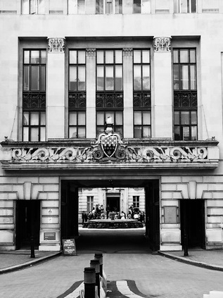
Climbing up West Hill out of Wandsworth, I began to realise just how far I still had to go. The sun was still bearing down on me, and the long, flung out arm of the South Circular seemed endless. I was determined to reach the end of my walk today if I could. I bought more water from a Tesco nestled uncomfortably into a tiny, rather quaint corner shop building and set off again. It wasn't easy going, in part because it soon became apparent that this section was going to be relentlessly suburban and featureless. I put my head down and walked, crossing the site of Beverley Brook which was now in culvert with only an old bridge wall remaining beside the road, and skirting the wild and interesting edge of Barnes Common to the north of the road. Here the Thames, the railway and the road ran in parallel along the same flat plain, and signs frequently directed me to stations for places which were notionally on my route, but were in reality just a little way from the South Circular. The lack of importance of the road explained its largely unimproved state here in the west. There were always other routes to get to places more quickly or directly. The A205 was a bypass for nowhere. At East Putney, the Underground provided a brief distraction with an intriguing pagoda sitting in front of the brick built station entrance, while white stuccoed totems declared the station name across the broad V-shaped gap between the lines. Entirely over ground here, two fine old iron bridges pass over the road - the easternmost arm of the junction carrying the little-used curve from TfL's network to the mainline railway at Point Pleasant Junction - one of the few pieces of track in London which I haven't travelled on. Putney straggled along the road a little, the main and far more affluent centre a little to the north around the mainline railway station. Soon the road returned to suburbia. I began to seriously wonder if I would complete the walk today - my feet were tired but still game for the walk, I was hot and tired but not unexpectedly so. It was the sheer unrelenting suburbanity that was sapping my will. The suburbs of the south are different to those of the north - often more uniform, less grouped into villages defined by ancient geography. The south benefited from large swathes of common land which have been worried away at over the year to produce vast estates of visually similar homes ranked in long, straight avenues. It felt like I was walking directly across one of these. It felt never-ending.
The South Circular ploughed on through a place which might have been East Sheen or Mortlake, the main business streets of the latter having moved south, away from the river over centuries in favour of riverside dwelling opportunities. The A205 now formed the long and pleasantly prosperous High Street, traffic sluggishly navigating the side-streets, nosing into unlikely parking opportunities. At Milestone Green, the road from Mortlake Station to nearby Richmond Park crossed, and I realised an odd thing about the South Circular - in the effort to give the road a much-needed identity in the absence of an actual coherent route junctions have been 'named' like those around other major routes. However, the names appear to have little local resonance at all. The last few miles had produced numerous named 'gyratorys', 'Red Rover' and now this junction - none of which seemed to have gained any traction as a local feature or even any obvious history. The South Circular's disguise was wearing ever thinner as I approached its ending. It had one more trick up its sleeve though - up ahead, as the shopping area of East Sheen dwindled into the ubiquitous run of small offices and tyre dealers, it made its last abrupt ninety degree turn to the north. The road ahead continued, unperturbed to Richmond while I was directed to turn right for Ealing and the M4. I climbed a railway bridge and passed between Fulham and Mortlake Cemeteries on a lazily curving trajectory along the tongue of land on which Kew nestles, in a broad meander in the Thames. The National Archives were held here, beyond the perimeter of an unprepossessing and oddly sited retail park. The solid, concrete block giving an assurance of the safety of our history despite much of the collection now being digitally stored of course. A final railway crossed the road - bringing the District Line and Overground from Gunnersbury where this whole sorry enterprise had begun for me. I could smell the Thames now. Around Kew Green, the road developed a new character - artisanal stores, little bistros, gastropubs with deliberately distressed furnishings and lots of grey paintwork. It felt oddly familiar - distinctly like North London, and a jarring change from the quiet suburbs I'd just crossed. As I navigated around double-pushchairs with wheels built for off-roading, complicated families groups filling the entire width of the footway and endless pavement cyclists with no regard for humanity, the appeal of quiet suburbia began to feel stronger. Across the street, my walk had one final surprising building too - St Anne's Church, built in 1714 but much extended by the patronage of both Kings George III and William IV. The red brick and verdigris of the church winked between ancient, swaying trees as I pushed on, asking my feet to give me just another mile or so if they could. The sun escaped from cloud cover again, and the church glowed on the green. It was a curiously inspiring sight.
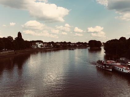
The arrival of the Thames was heralded by two events - a sudden cool breeze drifting from the east, and the arrival of a noisy group of over-dressed wedding-goers attempting to have their picture taken on the busy riverside path. The bridge arched gently over the silvery surface of the river, and I dodged oncoming pedestrians to get a picture looking eastwards. The wooded thicket of Oliver's Island divided the flow of pleasure craft, now largely a nature reserve but historically a toll booth for river traffic with legends of Civil War era tunnels to Strand-on-the-Green on the northern bank. I paused for a while - this wasn't quite the end of the road, but it was a significant enough milestone to make me reflect on this trip. I summoned the will to push on, tired and beginning to feel the effects of a cold which had dogged me for the last few days, but which I was determined not to succumb to. Landfall brought me to the boundary between the boroughs of Hounslow and Brentford, and the busy junction in front of the Express Tavern. The view to the east was dominated by the tall water tower of the Grand Junction Waterworks Company - now the London Museum of Water and Steam. I however, needed to turn west along the final section of the South Circular. Now the road was north of the river, it had become a busy and businesslike continuation of the North Circular at last - a four-lane dual carriageway running between dilapidated shopfronts and retail parks. It seemed comfortably familiar, and the sight of the towering glass hotels and offices around the beginning of the M4 up ahead felt almost like coming home. I picked my way around the south-eastern quadrant of Chiswick Roundabout, alongside Surrey Crescent - the remnants of a row of once rather fine houses which were largely demolished to create the flyover, opened to much ceremony and glitz in 1959 by Jayne Mansfield in a 'skin-tight crimson dress'. These slightly grubby but grand homes have survived in its shadow against the odds. I turned the corner onto Chiswick High Road and rather suddenly found myself at a familiar spot. Above me was the roadsign which I'd taken a snapshot of before heading off to walk the first section of the North Circular. I recalled the amused tourists from the nearby hotel who had sniggered at me for taking the picture, and wondered if they'd imagined I'd planned to walk all the way around the city, back to this spot? I'm not sure at that point whether I'd even quite formulated that idea fully then. Certainly, there were times - especially on this tough final leg - when I'd wondered why I set myself projects like this? When I had complete control of the rules, why would I make them harder than they needed to be? This walk had taken me into southern suburbs I'd been content to 'know' only through passing by train, areas where I felt alien and uncomfortable, where I was in many ways, lost. I'd seen places which perhaps only locals would normally regard, and then only with the tired eyes of the familiar. I'd surprised myself by finding places I'd wanted to revisit to explore, ideas for future excursions and connections back into my past reading which intrigued me. I stood beneath the sign and felt the need to celebrate - I contemplated emptying the refreshingly cold contents of a bottle of Sprite Zero over my overheating and aching head, but I thought of the tourists and figured I shouldn't give them the excuse for another chortle at my expense. I calculated that the journey around the North and South Circulars totalled around fifty-three miles of walking which had taken me into the depths of suburbia, into the forest, along the banks of hidden brooks and through the complex geography of the city. It felt like a strange privilege to be able to make this circuit, and to spend time researching and recording what I'd seen. I often questioned if my records of these walks were ever read by anyone, but figured it didn't matter. I wasn't the first to walk around London, I wouldn't be the last and I had few original insights to impart. But I'd honoured a city with which I've had long and complex dealings by walking around it. For a few moments at least, while my aching feet were forgotten in the thrill of completion, It felt like an entirely sensible thing to do.
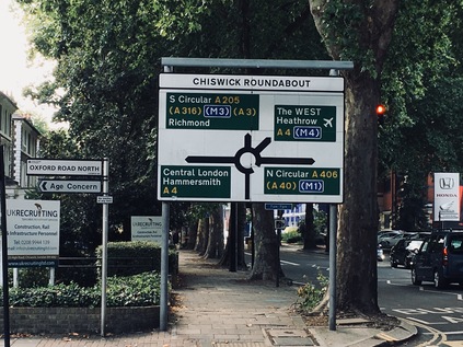
I shuffled the short distance to Gunnersbury Station and caught a train, deciding to cross the street and change for the Circle Line back to Paddington when I reached Hammersmith. As I sat on the train, trundling quietly over the rooftops on a viaduct with the sun picking out the yellow London Brick of the rows of houses beneath, I suddenly realised my route would pass the wreckage of Grenfell Tower. As we left Latimer Road station, the blackened view into the lower floors of the block filled the windows of the train, shockingly close to the line. Stripped back to the concrete core on this flank, the gaping windows gave a view entirely through the gutted structure. It was horrible to behold, and terrifying to imagine being within the conflagration. As the line curved to the west and the building slipped slowly into the distance the full horror was revealed, standing like a single dull, dead tooth in the blue sky. I looked around the sparsely filled carriage, but everyone else was busy reading, talking to their fellow travellers or just looking at the floor in the time-honoured way of the Tube. I wondered if I was perhaps the only one who hadn't seen this before? The only one who hadn't had to live with this expression of loss and death above me on my daily comings and going? It was a haunting image - so different to seeing it on the screen and often reduced to a backdrop to a political dialogue - either a timely reminder of inequality or a tragic bandwagon jumped by protesters depending on one's viewpoint. I don't think I'll ever quite forget the sight of the tower, abandoned but still glaringly present in the skyline. It haunted my dreams on the sleepy train ride home, vying with the views of collapsed viaducts in Los Angeles back in 1994 for its utter alienness and unreality. Whatever the outcome of the investigations and discussions which the fire has precipitated, whatever the fate of the officials and trustees who appear to have slalomed around regulations to create the conditions in which this could happen, these events are an exclamation mark in the story of London life. A point for pausing to consider the gravity and complexity of life and death in the city. As a full-stop for a circumambulation of London, it was both fitting and sobering. I hadn't just walked around a landscape or a museum, I'd circuited a living and dying metropolis of diversity and disparity, where eight million souls struggle beside each other. When I'm next asked the question 'why?' I make these walks, perhaps I have the beginnings of an answer...
You can find a gallery of pictures from the walk here.
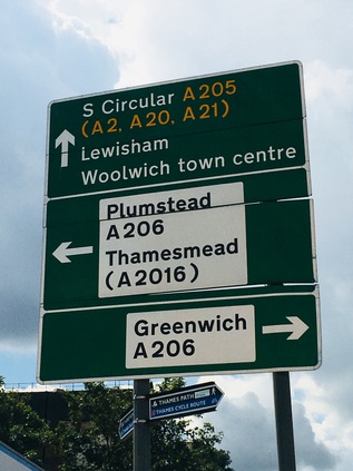
London's Other Orbitals: The Missing Link meets The South Circular
Posted in London on Saturday 5th August 2017 at 11:08pm
I've never considered myself a particularly superstitious or ritualistic person - but there are some things I like to do just right, often boxing myself with arbitrary restrictions in the process. Readers of my last piece on the walk around the North Circular might recall that I pushed on to Ilford, as much to end the walk somewhere I could easily get back home as anything. However, that day I'd also made a considerable effort to begin the second part of that walk from almost exactly the spot I'd left the road weeks before, unwittingly binding myself into a set of rules which would make the start of today's jaunt a little more complex. I arrived in Ilford in surprisingly fine weather and surfaced from the station just in time to catch a single-decker 366 bus which swiftly whisked me east, deep into the hinterland of the town centre and between huge cinema and shopping developments. We emerged onto a more traditional suburban terraced street near the prosaically and perhaps optimistically named 'Cost Effective Newsagent' and plunged into the huge expanse of late-nineteenth century development which sprawls south of Ilford and into Barking. I was beginning to get restless - I wanted to be walking, and the bus appeared to be wandering off route around endless diversions. I was distracted, at least momentarily, by the appearance beside the road of the Loxford Water - a tributary of the River Roding which flows above ground for only a very short stretch. Thus we pressed on into the suburb of Loxford - once an ancient manor in the ownership of the ever powerful Abbess of Barking, now a collection of schools, clinics and homes which range along the edge of the borough boundary. Arrival at Barking was disorienting - the looping bypass always appearing to deliver me at the station from an unexpected angle. The bus had no opportunity to wait here in a crush of terminating routes and so we set off again, passing the site of the Abbey and crossing the Roding to Highbridge Road which runs parallel with the North Circular. At last the relentless stream of traffic I'd been tracking these past few walks was beside me. I couldn't easily walk the stretch between Ilford and the end of the road at the Thames, beyond re-treading the very approximate routes I'd already used to walk the Roding and Barking Creek, but I could at least ensure it was part of my journey. This missing link, connecting the arc I'd begun at Chiswick back to the Thames felt like an important way to begin today's venture.
The bus left the thundering A406 behind to skirt the industrial sites of Fresh Wharf and the Police Custody Centre, while the road rose, carriageways dividing in preparation for the huge interchange with the A13 a little way south. We meandered around the private roads which allow access to the Newham Borough Depot at Jenkins Lane, skirting the inlet of Hand Trough Creek, and reappearing south of the A13 amidst the retail parks of East Beckton. This part of the trip was intriguing to me - I'd walked some of these areas in attempts to stay close to road or river and usually felt deeply unwelcome in these odd public/private interzones. Today I was being chauffeured around their perimeters, untracked by cameras and uninterrupted by security guards. It felt like a luxury. My immediate impression of the area, now I could see how the various zones fitted together, was how little of it has actually been developed. Ghost exits leave roundabouts for development opportunities as yet unrealised, provisional concrete roads to nowhere crack to reveal nature creeping through. This area, first an ancient marshland and then a safely distant haven for the most unappealing of industries, is now beginning its third life as an investment - a valuable but unrealised asset on a balance sheet. The roads between retail parks retain all the characteristics of these areas: a margin lined with wild flowers and weeds, an eddy of litter swirling around the gutters, dust and particulate matter settling on the remarkably hardy marsh plants which prosper because they're left to do so. Occasional lay-by middens mark areas where truckers park up for the night - piles of food wrappers, beer cans and discarded low-rent pornography. What's possibly most disturbing is how reassuring all this feels after the artificially sculpted world of the retail parks. Pylons stalk across the marshes towards the river, and a partly-finished luxury housing development appears on the horizon. I'm almost at my stop...
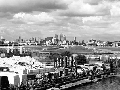
Galleon's Reach DLR Station sits above the roundabout where the North Circular arrives - now known as the A1020 or Royal Docks Road but still signposted as part of the great semi-circle around the city. It's a much quieter proposition here too, as the A13 has taken up the main flow of traffic east and west. The road that I join to head south is signposted 'North Circular, Woolwich Ferry' and immediately rises to cross the Sir Steve Redgrave Bridge over the Royal Albert Dock. It feels good to be walking at last in the morning sunshine, the heat haze rippling the runway of London City Airport as I take in the impressive, sweeping view - the distant city, the towers on the Isle of Dogs and the bulk of Tate & Lyle's plant in Silvertown. Beyond them I see green tree-lined slopes on the south bank of the Thames and I realise that I'll soon be climbing into those unknown parts. 'South of the River' - an old cliché, but a strangely accurate one perhaps. Who goes south of the river in lieu of the apocryphal unwilling taxi driver? Shady characters with bodies to bury, corrupt coppers working a scam and selling the story, semi-gentrified comedians and artists who grew out of Shoreditch? I'm aware of my prejudices and trying hard to push them aside. When I've walked the Thames Path or the Ridgeway I've found the southern boroughs surprisingly diverting - but gazing at my map before leaving I see only an unknowable expanse of suburban streets. I have to convince myself that the East felt equally impenetrable and blank once too. The road is silent as I turn west into North Woolwich. I can hear distant giggles and shrieks of playing children in Royal Victoria Gardens and smell late breakfast being prepared in the fine row of redbrick terraced house on Barge House Road, but there is no sign of anyone on the street. This is still the North Circular - as confirmed by the signs for the Ferry which impose prohibitions on explosives, corrosives and other dangerous materials. Such cargoes are consigned to heading east to Dartford to try their luck on the bridge, or the Blackwall Tunnel which is inexplicably signposted hereabouts like it's just around the corner. Nowhere on the circuit has the road ever been deserted completely, until now. I passed the impressive columns of the 1854 railway station building, now derelict yet again after the closure of the museum, and beside it the site of the tiny utilitarian platform I'd used just before the railway closed here in 2006. At this point I had a decision to make: to take the foot tunnel under the river which descended from the solid, brick rotunda ahead of me, or to turn the corner and wait for the ferry. I decided to stay above ground - true to the route of the road, and to take advantage of the rare chance to cross the Thames by boat. The rather workmanlike ferries are not designed for sightseeing during the brief crossing, and with a small group of other pedestrians I was directed below deck and told to remain seated while cars and trucks rumbled onto the ferry overhead. From the open side of the ferry I could see us slowly pushing away from the north bank, passing the former Steam Boat Pier which once served the Great Eastern Railway's short-lived competing ferry service, and turning south. The silvery carapaces of the Thames Barrier gleamed to the west and the forest of tall, new buildings which now formed an almost unbroken chain into the city marched into the middle distance. And so, as we docked at Woolwich Pier the missing link was complete - by means of a convoluted bus ride, a walk and a boat trip I'd approximately tracked the final few pedestrian-unfriendly miles of the North Circular to the banks of the Thames. Beyond the ferry terminal a long straight road could be seen heading uphill and away from the river. It was time to explore new horizons...
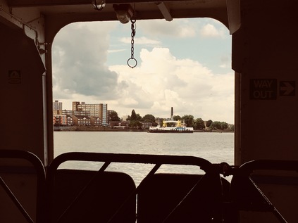
And so the South Circular began. It's important to note just how different this road is to its northern counterpart. While long stretches of the North Circular are purpose-built to near-motorway standard using the geography of London's brooks and rivers to snake swiftly around the suburbs, the plan for the South Circular never quite made it that far. While some sections where the route crossed open, easily purchased land were improved in the early twentieth-century zeal for roadbuilding, other sections simply plot a tortuous route through suburban streets climbing steep hills and crossing major roads at junctions which regularly snarl into long traffic queues. The South Circular isn't so much a road as a route - a collection of sign-posted fragments which attempt to provide drivers with a barely optimal route through a dysfunctional network. Skipping from urban centre to urban centre, the road was only ever going to be a temporary measure. Patrick Abercrombie's ambitious Ringways should have swept all this away - including great chunks of the suburban sprawl I'd be walking through. This ambition for clearing a new path never chimed with public opinion, and was ultimately the downfall of the plan. By the early 1970s the road's fate was sealed - there would be little done to improve the South Circular beyond minor tweaks to priorities at junctions, and while each was probably a minor triumph for a harassed planner, there was no overall strategy. A final attempt to radically alter the road network in the south was detailed in the Roads for Prosperity White Paper in 1989, but like many of the schemes in that ill-fated document, they had disappeared by the change of government in 1997, quietly disposed of to avoid further public disquiet and an emboldened environmental lobby. My walk around this odd historical aberration would be different too - indeed it felt more like the process of charting a lost river running between suburbs than that of walking a grand highway around the city. The road did however have a somewhat more attractive beginning than the North Circular: ascending from the roundabout near the ferry terminal one of the few purpose built sections of dual-carriageway on the route curves between two places of worship which have co-opted former palaces of entertainment. On the left of the road, its solid brick back facing the road, is the former Granada Cinema - now the Christ Faith Tabernacle Cathedral. This impressive modernist building opened in 1937, with a luxurious interior which has been mostly preserved by a succession of new tenants including, inevitably, a bingo hall. Luckily, the location has remained in almost constant use, and its current owners have gone to some effort to source fittings and furnishings from the same makers as the originals. In cinema's golden age of studios sparring for the best stars, across the street the striking art-deco Odeon Cinema set up shop in direct and defiant competition during the same year. The Odeon survived a little longer as a cinema - becoming the Coronet in 1983 and later being altered to include a second screen. A short time after its final closure in 1999 the New Wine Church purchased the building to become Gateway House.
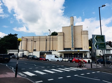
As I began the climb away from Woolwich High Street between these two impressive temples of earthly delights which have bucked the secular trend, I spotted the rear of the Royal Artillery Barracks up ahead. It was here where Wellington Street meets the South Circular that Fusilier Lee Rigby met his untimely end at the hands of Islamist terrorists in 2013. The site isn't formally marked - there are memorials elsewhere in Woolwich now - but the concern that any marker on this ill-fated spot might become the target for extremist abuse seems unfounded. The railings beside Elliston House remain an unofficial memorial, adorned with St. George Cross and Union flags, scattered with flowers and tributes. The site is tidy and well-kept, flowers fresh and flags clean - and it has been kept this way by locals since the terrible events took place. Sometimes, memorials are spontaneous and simple, rather than resulting from grand municipal gestures. It was sobering to cross the eerily traffic-free rise of the South Circular to find this spot, a quiet urban corner on the edge of the leafy barracks site. I wondered how I should write it into my account - whether I should let it pass unremarked out of quiet respect? This is after all an account of a journey which, though opinion intrudes, tries hard not to stray into polemic. But there is no doubt that this corner has become a part of the story of Woolwich and it felt wrong to pass by without contrasting the quiet suburban scene I found with the act of incalculable violence which took place here. My patriotism is tinged with realism and a sense that in an open, well-connected world we can likely never again presume to close ourselves away from the affairs of other places - but when they are brought into our lives screaming hatred and discord, it should never ever be quietly accepted. A little further up the hill, beside the road is the Royal Garrison Church of St. George - almost destroyed by a flying bomb on 13th July 1944, this spectacularly decorated church was originally erected to support the moral and spiritual well-being of the artillery officers stationed at the Barracks, largely in response to the outcry about conditions servicemen faced during the Crimean War. The remains of the church are carefully cared for, with a large arched roof erected to protect the remaining mosaics from the elements. The church is sometimes opened to the public, and inside Fusilier Rigby is commemorated alongside other Artillery officers who have fallen, including those killed by the IRA at the nearby Kings Arms public house in 1974. The ornate, multi-coloured brick pattern of the church is the work of the Wyatt brothers, and sections of the walls still stand to give some idea of how grand this place once was. This was definitely somewhere to revisit on one of the rare opening days, and a fitting place for a more official memorial.
Outside the church, the South Circular has for the first time diminished to become a single-carriageway road. To the west, the broad expanse of the parade ground in front of the grandiose front elevation of the Barracks is empty and quiet, stormclouds rolling overhead ominously. I'd been promised thunderstorms, but so far my walk had been warm and dry. Traffic zipped by the broad pavement, untroubled by queues. This felt so strangely different to the experience on the A406 where the pedestrian was relegated to the fringes of the route, suffered angrily by the traffic. At the improbably named Ha-Ha Road I briefly wandered onto Woolwich Common. This expansive and semi-wild area of grassland was once part of a much bigger tract of open land belonging to the Manor of Eltham, with encroachment towards the currently remaining common area taking place in the 18th Century. A portion to the north became Barrack Field, while to the south east, the Royal Military Academy claimed land, opening to recruits in 1806. A less permanent but equally audacious land-grab took place in 2012, when the temporary structure of the Olympic Shooting Venue was erected on the common. Today the common was busy with people walking or sunbathing, ambulances occasionally darting along Ha-Ha Road towards the Queen Elizabeth Hospital which loomed on the eastern edge of the land. Moving south, the common is divided by the South Circular with the triangle housing the former Academy now part of an exclusive, gated community known simply as The Academy, Woolwich. The pinnacled towers of the central block rising against the backdrop of the wooded slopes of Eltham Common and Oxleas Wood, looking not dissimilar to those of the Tower of London. On the western side of the common the smaller but equally fine buildings of Victoria House, the former Medical Corps. officers mess stood in an isolated crescent on the corner of Shooters Hill Road. This fine but oft forgotten building has provided additional accommodation for the popular Greenwich Free School in recent times, and may at some point form a more permanent part of a new Primary School extension. For now though, it sits a little unloved in an overgrown and wooded corner of the common, fronted by a solid and smart but very firmly closed block of mid-century public conveniences.
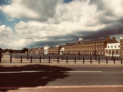
Shooters Hill Road stretched arrow-straight to the east and west, tracing the path of the ancient Roman Watling Street from Dover to London. I remembered the couple we'd met on our visit to the Edith and Harold statue in St. Leonard's who said they lived near here, and despite retiring and the possibility of moving almost wherever they wished, had never wanted to leave. Shooters Hill Road was markedly busier than the South Circular here, which seemed very much the minor player at the crossroads. The steep hill rose away to the east, towards the strange Gothic folly of Severndroog Castle. This monument to Commodore Sir William James and built by his wife, takes its name from a corruption of Suvarnadurg - the local name of an island fortress near Goa of which James commanded the successful overthrow in 1755. Run as a tourist attraction by the London County Council in the early twentieth-century, the building passed eventually to Greenwich Council who finally decided they could not fund the upkeep. Derelict and boarded up since 1988 the folly fell into disrepair and its future was threatened until a preservation group formed in 2002. Happily in 2014 the doors once again opened to the public. Looking back along Academy Road, it was remarkable how steeply I'd climbed from the Thames. Here the route began to turn gradually west, and the land sloped gently down into the valley of the Quaggy River. It was hard to recognise the strategic importance of the route from its appearance here - two lanes of traffic with broad expanses of bus lane filling much of the carriageway. Motorists were regularly reminded of the route of the road with South Circular A205 signs nudging them in the right direction when it wasn't entirely obvious where to go - which was fairly often. The road ambled through pleasant suburbs, with decent housing lining the route not unlike that around the North Circular - if perhaps a little quieter and less battered by road grime. At Well Hall Roundabout I briefly stopped for provisions at a Tesco Metro housed in yet another disused cinema building, this time the Well Hall Odeon built in 1936, becoming the Coronet in 1981. The building fell into disuse from 2000, but now forms part of a modern development of shops with an entrance hall and sweeping circular canopy topped by a glass staircase tower still betraying its origins as a theatre. Leaving the store I reoriented myself and turned onto Rochester Way, the 1927 route of the A2, where the South Circular immediately veers off at a crazily arranged junction. It's a short walk to the new course of the A2, a wide elevated viaduct taking the road above the A205, with the railway crossing soon after. A train accelerating away from the 1985 resiting of Eltham station crosses the scene, passing near the elegant planned gardens of Well Hall Pleasaunce. Suddenly, at last, the road is busy. After miles of almost eerie quietness, the South Circular is a clogged, groaning mess. Traffic nudges into lane, drivers apparently surprised by the complexities of the interchange, set against a backdrop of a terrace of almost cartoonishly textbook mock-tudor villas. Traffic noses under the bridges, slowly emerging to the west. Suddenly I'm again walking a suburban dual carriageway flanked by mid-century houses arranged along a separate access road. Sadly this access road obscures the crossing of the Quaggy River, a tributary of the Ravensbourne which has flowed south and east from Lewisham. I pause at a rank of urban shops, watching the drama unfold as a local carelessly shunts a car into a bollard in a low speed collision, shrugging their shoulders then disappearing into the Co-op.
The gathering storm clouds are massing to the north and west, and while for a time I'm in the bright halo of sun on the edge of the churn of brownish-black sky a tell-tale change in the wind signals that I'm not out of danger. Soon enough, large cold raindrops start to patter around me as I walk onward, the land rising again beyond the Quaggy. A rusting sign hangs over the footpath, welcoming me to the Borough of Lewisham somewhat unconvincingly. On a memorable passing over the border between Greenwich and Lewisham once before, I was ceremonially blessed with a huge steaming pile of dogshit. Today it may be a watery tribute instead. It feels like I'm outpacing the storm, but distant rumbles of thunder and the unreal flashes of lightning inside the bruise-coloured clouds signal a downpour. When it finally comes it's sudden and intense - a typical summer storm. I hunch into the roadside under the overhang of a tall hedge near Burnt Ash Hill. The gullies of the road swiftly give up and flood with rainwater - the traffic does much the same in apparent sympathy, trailing into a single, sluggish carriageway running slowly through glum, damp suburbs. Eventually, the rain rather suddenly relents as such intense storms often do, and the ionised air is fresh and clear. I returned to slopping along damply, a soaking from a passing white van now the biggest risk. Luckily for the most part, the pavements were broad despite the narrow road. This area felt forgotten and somewhat lost - not quite Lee and not quite Hither Green, hemmed in by railways and not really on the way anywhere. I know the name Hither Green from my railway travels, but often wondered at its origins - thus I'm amused to see that a nearby street is named 'Further Green'. A low railway bridge ahead of me narrows the road even further, traffic snarling instantly at the lights which control passage. I edged under, staying as far away from the sizeable puddle where the road dipped to pass under the railway. Emerging into the light, the rain seemed to have passed completely and the clouds were rolling away to the north. A weak sunshine was breaking through the gloom ahead, though the road was less than bright. The long straight road headed directly west, a narrow avenue which was adequate on a quiet Saturday afternoon but would clearly buckle under peak traffic conditions. It was easier to see here how this road gained its poor reputation. I put my head down and walked, noting again the carpet of squashed sloes which seemed to have littered the route all the way from Woolwich, a carpet of lurid purple squelches on the grey flagstones.
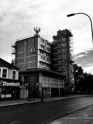
I'd begun to tire early - a little like my first outing on the North Circular in fact - and couldn't pin down quite why. Perhaps it was the delayed start to the walk which had sapped my energy, or the strange and oppressive atmosphere before the storm. Maybe though, it was just the long uphill slog which had formed the early part of the route. In any case, I'd already begun to consider where I'd leave the A205 today. One option was Catford - with two railway stations on separate lines which tangle around each other both offering escapes from the road. Arrival in Catford wasn't inspiring however - Brownhill Road became a dull, urban arterial running between sadly rather run-down terraces of large, once rather grand Victorian homes. The rakes of green bins outside each property signified their new status as houses in multiple occupation, their front gardens given over to parking spaces or makeshift refuse tips. Up ahead I could see the brick ziggurat of Owen Luder's threatened Milford Towers - the Barbican of the South - stretching across the street. An important building but one which hadn't been entirely successful in terms of living space, the refurbishment of the surrounding shopping centre will soon claim it. Towering in front of Catford was a somewhat ungainly concrete block with a zig-zagging glass stairway tower, curiously staggered curtain walling, and an impressive crop of aerials and antennae. This challenging and strange building was Eros House, another Luder building which was originally intended to be part of a larger scheme. As it stands, it is dynamic but queasily out of balance with its surroundings. Once though, this was the exciting future for down-at-heel Catford:
A monster sat down in Catford and just what the place needed. No offence meant: this southward extension of Lewisham High Street badly wanted stiffening. Now there is a punchy concrete focus [...] The gaunt honesty of those projecting concrete frames carrying boxed-out bow windows persists. It is not done at you and it transforms the surroundings instead of despising them. This most craggy and uncompromising of London buildings turns out to be full of firm gentlenessRegenerating Catford appears to have always been a tricky business - mixed land ownership and a fairly hands-off policy by Lewisham Council until recent times have made for a patchy process which doesn't seem to have reached the lives of most of the residents of Rushey Green - one of the most deprived neighbourhoods in the country. Immediately beside the oddity of Eros House was the Catford Gyratory - a huge squared circle of a traffic island where the A21 to Hastings intersects the South Circular. I took the gyratory in the anti-clockwise direction mostly on instinct which advantageously avoided the circumnavigation of a truly huge Mecca Bingo hall. Arriving at the pedestrian crossing where the road from north to south joined the junction, I'll admit some pleasant surprise. A parade of remarkably smart local stores jostled for business with some High Street names, their facades broken only by the protruding sign for the Catford Centre with a giant fibreglass feline gazing across the street at the old village green. Beyond the KFC and echoing the curve of Catford Broadway with its straggling street market, is the rather wonderful art deco Broadway Theatre. The building fits into an awkward site with some ingenuity and remains in use today. The gothic-style stone features were designed to be in keeping with the style of the former Lewisham Town Hall building, now demolished and replaced with the low concrete sweep of the Town Hall and Civic Centre which arrived in the late 1960s, complementing the theatre's shape if not its decor. These buildings too are now partly redundant, with the confusingly christened 'Old Town Hall' now housing local businesses. Catford surprised me - far from being the butt of 1970s TV comic's gags, or the depressing southern nexus for bent coppers and gang violence which it seemed to suggest in the 1980s, there is a strangely positive feeling to the place. I'm curious to come back and explore a little more.Iain Nairn - Nairn's London - 1966
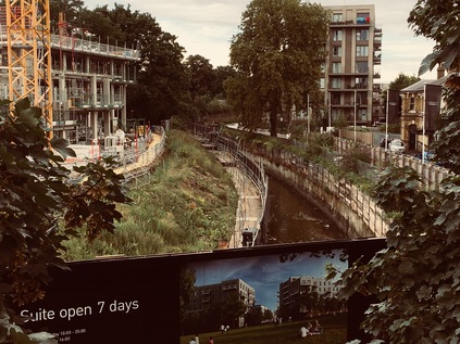
I left Catford via a crossing of its two railways, each with their own local station - first Catford Bridge on the branch line to Hayes, then Catford - served by Thameslink. Between them the River Ravensbourne wound under the road, soon to become the River Pool for the remainder of its journey south. The railways hug the river valley here, using this notch in the landscape between Catford and Forest Hill to escape from the gravity of London. To the south, the pristinely mown playing fields of St. Dunstan's College line the edge of the South Circular as it rises gently to the west. I'm immediately back in suburbia as soon as I've passed the impressive College buildings. It feels like a long, hot slog now to Forest Hill where I've decided I'm going to end today's walk. As I make my way along the street pursued on foot by a hurrying bridegroom and his driver who appear to have either broken down or decided to flee the scene ('there's nothing here, no shops, no garages, NOTHING!') I spot a removal van at the side of the road which appears to have come all the way here from my coastal hometown. I glance at the driver, who looks back - but there's no recognition. Why would there be? We'd neither expect to see a familiar face on this most inconsequential stretch of road. The road curves, thrown off line by the need to cross under another railway up ahead at an awkward point. The course of the route is so improbable here that even more of the regular signs are needed to remind the driver: A205 South Circular. It feels at times, as I've tried to follow the route of this odd, almost makeshift way around London that the signs are trying to convince us that there really is a road, that we haven't just imagined the South Circular by means of some collective, hyrdrocarbon-induced hallucination. This is a route which does what you'd least expect and often at the most inconvenient of times. It echoes perfectly the often truculent, sometimes wilfully perverse and always darkly humorous south-of-the-river character. I climb the surprisingly steep rise to Forest Hill station and shuffle tired feet onto the platform just in time for a London Bridge service. Just like my first attempt at the North Circular I feel the road has beaten me today - I didn't get as far as I'd hoped by any measure. But perhaps that's how these roads work - they're designed not to be taken as a whole, because they're never the most direct way between two points. They are experienced piecemeal - fragments of a journey on route to other places. Who would be stupid enough to try to walk their entire length? Before we depart I take note of my surroundings in preparation for another ritualistic future reconnection with the route. Soon, the train clatters into the much-modernised London Bridge station on the edge of the City of London - a station I haven't used in a good many years - and I navigate my way through the unfamiliar concourse out into the sunshine bouncing from the lower tiers of The Shard. It feels a long way from the ferry, and even further from the curious centre of Catford.
You can find a gallery of images from the walk here. Or you could explore the first and second parts of the North Circular.
Lost::MikeGTN
I've had a home on the web for more years than I care to remember, and a few kind souls persuade me it's worth persisting with keeping it updated. This current incarnation of the site is centred around the blog posts which began back in 1999 as 'the daylog' and continued through my travels and tribulations during the following years.
I don't get out and about nearly as much these days, but I do try to record significant events and trips for posterity. You may also have arrived here by following the trail to my former music blog Songs Heard On Fast Trains. That content is preserved here too.
