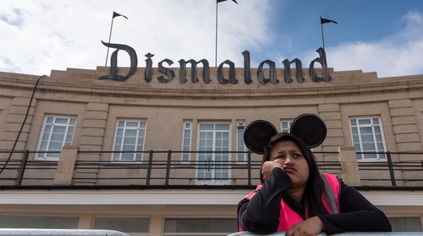
 I first visited the Tropicana on a school trip - probably sometime in the late 1980s. I wasn't a swimmer, so joining a small number of sick, limping or otherwise unpopular kids, I skulked around the margins of the site. There was a model railway, a café, and plenty of space to sit and ponder how much more fun the other kids were having in the pool. Even then there was a sense of gloom about the place: beyond the huge fibreglass pineapple that dominated the site - and which gave it perhaps it's only truly 'tropical' credentials - the plaster was already peeling, the colourful murals of palm trees and blue skies flaking under the pressure of a spending crunch. After an interminable day that was perhaps remarkable only because it didn't involve being in school, I was glad to leave the place. It is miraculous that it struggled on as long as it did after this, finally closing its doors in 2000, outdated and outpaced by tastes and time. Left behind - a portent of things to come for Weston-super-Mare perhaps?
However, as the last fifteen years have proved, the Tropicana is privileged space. It occupies a slot in countless thousands of memories. It has figured in the summer holidays of locals and visitors alike - and thus it is recalled in that special way that childhood summers always are. It never rains, the colours are brighter than reality, the days longer, food tastier. These memories have been trampled by the steel toecaps of reality for long enough for the site to be almost mythical, and for a town prone to almost terminal apathy, the public can be easily roused by even a perceived threat to the hallowed quadrant on the sea front. For years though, it has only truly existed on the pages of Council Executive reports and architects drawings. The site has variously sprouted huge hotels, cinemas, towers of housing. Always with those shadowy sketch-people milling around them which proxy for reality in these artist's impressions. Developers have come and gone. Opportunistic local bruisers have tried to make political capital from the ruin, while simultaneously proposing to raid the public coffers. Eventually we reached the point of no return - the Tropicana was to be demolished. It felt like a necessary exorcism. But still it is attached, decaying and prone to infection. Weston's ever-grumbling appendix.
The reaction to Dismaland has been both entirely surprising and utterly predictable. The surprise has largely centred on the miracle that this most scrutinised and picked-over of sites could be transformed so completely yet so secretly before us in plain sight of the town. Indeed, that the much-maligned Council could have allowed - sponsored even - something of this nature has bewildered people. Their normal knee-jerk reactions stopped in mid-ascent towards the collective groin of the elected members. The - entirely accurate - story that only four people in the organisation knew the whole truth is equally astounding in the leaky rumour-mill of the Town Hall. But there are more predictable voices at large - many rehearsing the bizarre belief that the Council is stupid enough not to see the double-edged swordplay it indulges in by inviting an event called "Dismaland" onto its prized promenade - indeed onto this most sensitive of local sites. Rolling eyes and folding arms, they tell me that the event will pass into history with the momentum not seized. That it's all a bit rubbish because they don't get 'art' anyway - and probably wouldn't get tickets if they tried. After all, Weston is a bit crap, right? For a few days, this low-pitched drone has surrounded the place, cloaking it in the very miasma of gloom that the curator is trying to foster. If anyone has been gamed, it's these very doubters who are now playing a key part in the set-piece on the seafront.
I've written and talked a lot about the seaside resort problem - and on one of its many levels, Dismaland taps right into this. It reminds me of a family I saw tumbling out of an Eastbourne café one Saturday morning a few years ago. As they picked the stringy bacon fronds from their teeth they summed up the issue in a single question: "What the fuck are we going to do until dinnertime?". The disappointing attraction, the underwhelming spectacle and the hours of time killed between cheap food and beer binges are summed up in the premise behind Banksy's installation. The venue is also perfect. Seaside towns are different from 'towns by the sea': they've chosen not to change and have resolutely stayed on rails laid in the late 19th century. The family seaside holiday of guest houses, fish and chips and beach-hogging is the preserve of a now itself nearly mythical working class. Fortunes dwindle, buildings peel, capital retreats - and now these towns regularly appear at the top of child poverty ratings and unemployment figures, suffer disproportionately from addiction and crime and oddly rank highly in their negative responses to immigration despite being some of the most resolutely white parts of the nation. That fear of the incomer, that disparaging view of those who arrive in town - the tendency to bite the hand of the 'grockles' that feed them is burned deep into Weston and it's natives. They are about to suffer the biggest influx of incomers for many, many years - it's going to be entertaining to watch.
The other equally gloomy if somewhat quieter voices are those from neighbouring towns, decrying the desperation which leads a place to accept Dismaland as its defining moment. There is a touch of green around their gills for sure - it's a ludicrously good coup, and a glance at the economic benefits from Banksy's Bristol exhibition a few years back rightly makes them seethe with jealous rage. Their prime concern is the town's brand - how it can recover from this shock to its system without suffering the sting in the tail of the term "dismal"? But they miss a point here - the town simply doesn't have a brand. It's one of those reforgotten resorts which has been at this crossroads for years - Stag venue? Retail centre? Dormitory town? The options are unedifying at best - but this offers an alternative. As the world was griping about the ticketing website failing and the early-invitees smugly sharing their pictures of the site yesterday, the Chief Executive of North Somerset Council was changing tack - pop-up shops in town would be encouraged, creative events and industries promoted. This is tremendously significant - the received wisdom before was that if we wanted to attract big High Street names, it was always better to have an empty shop in town than some scruffy little independent cluttering up the place. The truth is perhaps the opposite: another Poundland or charity shop is a much bigger disincentive, while the major chains watch successful independents like vultures waiting to swoop. Let them do the hard work before we arrive. There is finally a bit of coherence to the vision for the town. It remains to be seen if it plays out as they hope - but I think the textbook regeneration doom-mongers are a little more spooked than they admit.
I've yet to visit Dismaland - but I'm excited to have this opportunity on my doorstep. Quite apart from the playful, irreverent fun of the pieces Banksy has assembled, the sense of an event and the sheer oddness of revisiting a childhood haunt transformed completely, there is a more substantial edge to this. The exhibits play into the concerns we should all have about our public spaces - privatisation of access, spiralling security measures, domination by faceless brands and franchises. I'm also excited by the debate that seems to be emerging: the ideas about what local government is for, what public spaces should host, and what kind of vision we should develop for that most difficult of places - a fading seaside resort on a muddy estuarial reach. I hope too that in time, the doubters are at least quieted by the success of this enterprise - but I know they won't be. After all their lemon-sucking cynicism and their desperate clinging to irony is as much part of the show as the crumbling Disney castle silhouette.
Crossing London can be a trial at the best of times, but today offered some special challenges. I knew in advance that various parts of the Underground network were out of action, but my early luck in tumbling onto a replacement bus service lured me into thinking this might well be simpler than I'd hoped. The bus lurched around a couple of corners from Paddington, rather suddenly depositing us in a back street which the driver claimed was Baker Street. It wasn't by any stretch - but a brisk walk, down into the station and finally onto a Metropolitan Line train for Aldgate - and I felt pretty smug. I was beating the city at its own game. Another quick walk to Tower Gateway and onto the DLR platform - a train was waiting silently for departure, so I made the walk down to the front to get the best view. As we meandered between landmarks from my previous excursions, I thought about my next move. I could, very reasonably, choose to use the cable car to traverse the river on this occasion - it would deposit me exactly where I wanted to start and afford me some interesting views. But for some reason, I decided that it could wait for another day and foolishly I bailed out at Canning Town. As I descended the stairs and saw platforms taped off I remembered that this part of the Jubilee Line was closed too. I turned and fought my way back up to the platform through a throng of disgruntled travellers. Perhaps this wasn't going to be so simple after all... As I waited for a Woolwich bound train I pondered how my early start had been squandered, how my intense fear of escalators could elongate an already epic journey, and finally how London had a treacherous habit of confounding those who dared to claim they knew the city even passably well.
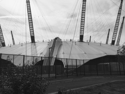
I finally rolled up to North Greenwich Bus Station a good deal later than planned, and desperately requiring coffee. In fairness the crossing of the city, once I'd given in to its circuitous nature, had been interesting. A pleasant arc across the rooftops of Silvertown and North Woolwich, then a bus ride through territory I'd walked on the south bank a month ago, mostly strangely indistinct and suburban. I knew we were close when Bugsby's Way made a dip under the railway lines to Angerstein Wharf and the now abandoned eco-Sainsbury's store appeared. Stepping out of the bus station, I ventured towards the Dome - I'd avoided it last time, when I felt deeply out of place here. I didn't feel any more comfortable this time - but I was less ragged and sunbaked, and there were far fewer people around this morning. Spying a familiar coffee vendor's logo I ventured inside the building, to find that the store was being refurbished to "improve my O2 experience". I left and found a rival chain, busier than it deserved because it appeared to be the only coffee on the Peninsula. After another interminable delay I decided to drink and walk. There was no more time to waste at this millennial folly. It had already drawn me into spending longer than I could spare on it. I struck out for the river, finding the path just a few metres from where I'd turned aside a month ago. The river shimmered under cloudy skies, the marine breeze tempering the heat of an already strong sun. On the path, Gary Hume's "Liberty Grip" gave the finger to the dome - a huge bronze casting based on store mannequin parts, This is a part of an impressive exhibition - The Line - which brings public art out into the Lea Valley, The Royal Docks and the Greenwich Peninsula. I'd missed the publicity for the opening back in June, but have oddly found myself stumbling around the route between the artworks almost instinctively. Indeed, it's only a short walk from Hume's work to the second, far more unassuming piece - Thompson & Craighead's "Here" sits in the middle of the pathway, a regulation British road sign pointing out into the river, roughly on the Prime Meridian. The destination? Here. The distance? All the way. While I enjoy the conceit, I'm soberly reminded of Iain Sinclair's words:
An involuntary return to the point of departure is, without doubt, the most disturbing of all journeys
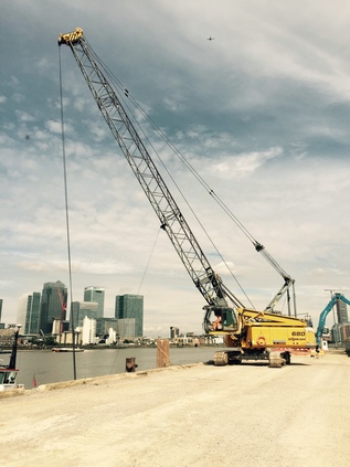
Rounding the curve of the peninsula, the views across the river provide a new take on old haunts - the diamond-paned lighthouse at Trinity Buoy Wharf gleams in the late morning sunshine, while behind it the bigger expanses of City Island's red hoardings reflect nothing. It's possible - almost - to ignore the gravity of the Dome here, as the tangled skyline of the Isle of Dogs draws the attention. Across the water in Blackwall I see the flapping stars and stripes on Virginia Quay, and somehow this makes the city skyline seem entirely elsewhere - an unexpected transatlantic transport from an area rich in such escapes over the years. I press on, turning south, the tradesmen's view of the Dome evident. Delivery hatches, cooking smells, containers lined up and marked with the names of food concessions. The path deviates a little from the river here, slipping around an unfinished building site and skirting the edge of the Blackwall Tunnel Approach Road, the red stone gauging arch sitting proudly in the expanse of flat former marshland, like a fragment of transported Glasgow tenement. Pushing through a narrow section of path and challenged by frustrated cyclists, I emerge at Victoria Deep Water Terminal - a place designed apparently to test my nerve and my prejudices. Firstly - it looks like I can't pass. I am so conditioned to expect exclusion and prohibition, that I can't imagine that the way through this desert of aggregate dust and swinging crane jaws can seriously be a footpath. There is also an alternative route marked for cyclists, and I wonder if I'm condemned to fight my way through them instead, but unexpectedly the hard-hatted inhabitant of a small safety station motioned me forward and gave a signal to the crane driver. I approached and hugged the fence while the empty jaws of his bucket wheeled overhead. As he dropped them into the hull of the ship he called me forward. I tried to calmly pass by as I felt the bucket raising again behind me. My trials weren't over - a smaller machine was shifting a pile of dusty grit across the path with a much lower derrick - again I was called on, offered effusive but mute thanks with a hand gesture and hurried under. As soon as I dared, I turned and snapped a picture of the wharf in literal full swing, the towers of Docklands behind them. Like a tiny history of British industry in the last century. Meanwhile, across the river the Isle of Dogs was broadening into perhaps the most famous river bend on TV, leaving its towers and financial centres behind in favour of low-rise housing, slum-clearance estates and the occasional prefabricated block. From here it was hard to conceive of how the area had figured so readily in recent history - newspaper disputes, fascist councillors, insider trading all seemed unlikely headlines when reflected on the quiet red-brick waterfront dwellings with their little post-modernist flourishes and nautical round windows. The path here was unexpectedly secluded, trees overhanging the riverfront, abandoned jetties rotting in the water, framed views of the other bank between fronds of water-loving foliage. Looking ahead, the western turn in the river provided views of where I was heading: the hulk of abandoned power station at Greenwich dwarfing the grandeur of the Royal Naval College.
In fact the walk towards Greenwich instilled a false sense of security. The river path is quiet, sometimes feeling almost rural in aspect. The developments which encroach on the path are well-intentioned if sometimes clumsily executed attempts to fit the area's provenance. There's no doubt that Greenwich recognises the importance of the Thames to the borough, even perhaps cultivates its myths. There is permitted dereliction. Piers quietly decay behind 'Danger' signs, remnants of older industrial uses when we were less sentimental about - or perhaps less aware of the equity in - the river front. Suddenly, the scene shifts, from the tangle of buildings around the bulky power station, the hospital building emerges - a squat, white plastered tower built in 1616 and decorated in vivid red and gold. The gardens are prim and pristine, the path stepping up to the tower ornamentally. Looking ahead, the river path is narrowed and hemmed in by the railings which surround the Royal Naval College - there are suddenly people everywhere, enjoying the gasps of sunshine between ominously long cloud breaths. I deviated briefly into the College grounds for a picture, remembering being here years back, at a summer conference. I was in awe of the buildings then, amazed at this rather prosaic, educational use of protected heritage assets - but approaching from the river, it's easier to see how this fits into the tourist trail - Maritime Greenwich, home of time and place, centre of the historical universe. I wait for an unobstructed shot across the perfectly cropped quad between the blocks, the distant view into the park signalling a walk not yet attempted. Indeed this view could have been entirely different if Flaxman's Brittania had been built. Our very own Statue of Liberty could have dominated the view here. It is simply not worth returning to the river here - the crowds blocking the narrow strip of path unclaimed by the College are sluggish, stopping for frequent selfies against the fence. Instead I cut across the grass, passing the Meantime Brewery and out on the plaza surrounding the Cutty Sark. Since I last visited this vessel has completed a phoenix-like cycle: both burned and risen again, with the area around it turned into an amphitheatre of naval history. A Saturday market is in full swing, the school holiday crowds fully exploited by local artisan food huts and coffee vendors while a string quartet plays in a tent. After deviating briefly to get supplies I grab an overpriced coffee and take a seat a little way from the action. Across the river, Island Gardens nestles between the towers of the Isle of Dogs. I remember similar rest stops there many years ago. It looks quiet and cool - the grass most assuredly greener in fact, and I feel a pang of regret for being this side of the river. It will pass, its just the consequence of this tide of people intruding on my usually solitary, utterly selfish walks.
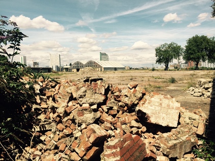
Leaving Greenwich by the river path is a new experience, and improves on the usual route: there was always a sense of disappointment as the perfect heritage-groomed town centre gave way to sprawling suburbia on route to the station. But the Thames Path feels more honest - leaving Greenwich means entering Deptford. First though, the disadvantages of travelling with ancient maps are made apparent. I expect a dog-leg via Creek Road to cross the mouth of Deptford Creek, but instead find a shiny, modern footbridge spanning the water where it meets the Thames. It appears to be part of the planning gain from a new development - Greenfell Mansions - which flanks the river on the western side, a stack of apartments topping a nearly-empty café and hairdresser. A glance back down the creek as it turns back east is equally uninspiring, skirting more modern, anodyne blocks before the road bridge. Below footpath level the steep sided channel is sluggish and brown, a remnant of its industrial past and remarkably a conservation area, though little of historical note remains. The real ruins are further along the Creek - here it's all about exploiting the river front. Soon after crossing the Creek it's necessary to turn aside from the Thames briefly as the path is broken where the Borough of Greenwich begins to peter out. Forced to edge around an electricity substation, I realise that I'm about to pass into Lewisham and wonder how the boundary will be marked? I soon find out at the corner of the improbably named Twinkle Park - no signs or ceremony, just a pile of steaming dog shit strewn haphazardly across the path and impossible to avoid. I slide ridiculously in the ordure, grabbing a railing and checking to see just how much dignity I've lost. I'm alone luckily, scraping a boot pointlessly on the dry ground. Welcome to Lewisham, and time to find some grass to clean my boots. However, there's little foliage to exploit as the vast Convoy Wharf, formerly the Royal Dockyard, interrupts the river path. The site is now an endlessly flat plain of cement with the vast hangar of the Olympia Warehouse describing a dark sine wave on the view towards the Thames. The large and irregularly shaped site soon gives way onto the street, and I poke my camera through a railing just feet from a security cabin with no apparent response. It's abandoned, quiet and dusty, the archaeologists have left after digging for history as a planning condition. The site belongs to News International - an artefact of an urgent acquisition of various large off-city plots of land for Murdoch's union-busting masterplan which eventually saw his fortress land over the water in Wapping. After trudging miserably through a low-rise, litter strewn municipal estate I make for green space as a priority. Firstly, I stumble into Sayes Court Park - an unprepossessing, unkempt square of yellow, parched grass which once housed John Evelyn's house, and which is linked to the nearby dockyard by historical association. Land deals and wartime appropriations have left this space for the people, a central formal garden listlessly trying to leverage the antiquity of the site. Next is Pepys Park - dedicated to the other local diarist who worked in the Royal Dockyards when not busily exploiting his patronage elsewhere in the city. The park serves - and indeed shares a name with - a important post-war housing development which I barely even note today aside from its remaining highrise block, Aragon Tower, leering over the path. Life here has been surprisingly well documented because of the approach taken to replacing the former industrial slums which served the dock workers - and its perhaps not unexpected decline. The park is remarkably quiet and unexpectedly capacious. I cross the flat playing fields, before plunging into a wilder, stepped area given over to wildlife. From the second floor of a building on the edge of the park, a parent is unfurling a hose pipe to fill a children's paddling pool on the park edge. It's good to see people using this space, living in it, not feeling constrained by rules or practicalities. The artificial gardens of Greenwich seem a long way off here. The park climbs back towards the river path and Deptford Strand, where in 1593 Christopher Marlow was allegedly killed in an drunken brawl at Eleanor Bull's home. The most notorious unsolved murders in London seem always to come from north of the river, but this one remains a deeply suspect case and by modern accounts seems more of an assassination with Marlow punished for his "epicurism and atheism". The Strand now is a quiet, private space, free of conspiracies with the wine warehouses and the Victualling Yard converted into pleasant, if expensive dwellings to front the right-to-buy paradise.
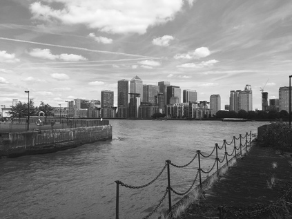
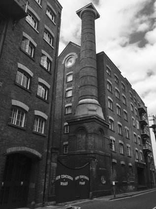
Turning north to follow the dramatic curve of the river, I cross the mouth of Greenland Dock by way of a climb up the boards of the arched Victorian footbridge in preference to the modern roadway, This is the southernmost remnant of the Surrey Commercial Docks which once riddled this bulge of land with waterways, clustering around the Grand Surrey Canal. All the signs direct me to Surrey Quays or Rotherhithe stations - the assumption is I don't want to be here and the assertion is to leave swiftly. Indeed, there is little of note on this odd peninsula, and the low rooftops which have crept relentlessly over the in-filled docklands are strangely suburban in nature. Everywhere the eye is drawn to the north bank, to Limehouse Church, or east to the ever-brooding towers on the Isle of Dogs. A distant parade of No. 277 buses wink in the sunlight as they amble around Westferry Circus, running empty on a weekend afternoon. Suddenly I'm alerted by the unexpectedly rural sounds of sheep, as I find the path delving into the fringe of Surrey Docks City Farm. I'm tempted to wait time here, find a bathroom and a place for refreshment in this oddly charming little nook, but time is pressing and with the compromised transport options and being urged to wash my hands to prevent transmission of animal diseases, I feel the need to press on. I make a note to revisit though, as I know these sheep would be popular with others back home! The path is interrupted again, this time by a confusing Doubletree Hilton Hotel, sprawling across several buildings with unclear rights of access to the river. A token ferry service runs - often empty - across to Canary Wharf Pier apparently just to allow the hotel chain to claim its Docklands provenance. The service is sponsored by Transport for London - a little known, little used crossing, funding justified by the apparent importance of plugging a gap in the infrastructure between Tower Bridge and Woolwich. Reaching the tip of the Rotherhithe peninsula, I cross a stymied and sluggish inlet which disappears into a string of ecological parks in the centre of the former docks. The riverfront road is called Sovereign Crescent here - a nod to the former King and Queen Wharf in name only - nothing is left here of the past. In fact nothing gives a clue to the former nature of this area for some considerable distance, until the rotunda housing Brunel's Thames Tunnel portal appears a little inland and reminds me of a brief walk here when I was exploring the old East London Line. Further inland still there is a historic district to explore, with unexpected links to Scandinavia - but not today, I'm sticking to the river out of bloody-mindedness. I've almost reached my target. Footsore and surprisingly sun-reddened giving the earlier gloom, I detect a change in the fortunes of the area - in typical London style I have made the unannounced switch into a new locale. This is Bermondsey. Where Rotherhithe and Deptford have largely turned their back on the river, Bermondsey was an early adherent to the cult of gentrification. The situation is perfect - close enough to the City to benefit from rising rents, but south of the river - so out of the pernicious grasp of the Corporation. As industry retreated from London and the wharves closed, so the great docks on the north bank were levelled and left as desolate film sets for apocalyptic epics. Here though, there was a swifter turnover. The first loft conversions east of Brooklyn arrived before Docklands had left the drawing board. The narrow streets still wind between tall brick warehouses, bridges still cross haphazardly between them, sometimes dripping with foliage. It's dark, redolent of the river, the reek of Dickens' prose hanging heavy about the streets. Approaching the end of my walk I'm undecided - I know of many interesting landmarks I'd like to find deeper into Bermondsey, but the river is the focus and I feel compelled to stay with it to the planned point of departure. I make a short diversion along Mill Street to take in New Concordia Wharf with its towering chimney and retro-painted gateway, before plunging into a gap between buildings to reach the narrow footbridge over the River Neckinger at its confluence with the Thames. The path is busy with well-dressed people shuttling between the waterfront restaurants near Tower Bridge and the up and coming Bermondsey boutiques. A dusty river-walker is not required here. I push through to get the view - warehouses clustering haphazardly around the dark inlet which partly encircled Jacob's Island - a once notorious slum. Now, The Shard glowers over the tall blocks like a sliver of glass dropped into the landscape. I'm jostled as I try to take a picture. Nearby a young women is comforted by a gaggle of friends after a romantic disaster. The trials of Bermondsey life have changed little over the century in some ways, but are unrecognisable in many others.
Just short of Tower Bridge I leave the path, skirting the Design Museum and heading inland to make a loop back to London Bridge station via the heart of Bermondsey's increasingly fashionable artisan district. The long tunnel under the fan of railway lines leads me to the edge of the redeveloped station site with its arches once bustling with industry now closed for redevelopment and relaunch as gentrified boutique units. A new-build business district flanks the station with glass-fronted chain eateries and bars. I wait for a bus, knowing that the Ride London cycle event is blocking the streets of the City, and that I have a long journey west ahead of me. My journey to Tower Bridge - an unofficial goal - was not quite completed in the end, but my walk along the river covered the ground I'd broadly hoped I'd manage. Turning back west for recent walks was not an easy decision in some ways, and using my limited visits to stray from the main centre of my interests was a gamble. But it has paid off - and I find myself intrigued and eager to explore more of these areas which again I've only skirted over by rail. As I idly gaze into the glass of the bus window I realise that my face is tender from the sun, my hair wild and sweat-drenched. I feel foolish here in the City, amidst the cyclists and their irritatingly healthy glow. It's time to head home.
You can find a gallery of images from the walk here.
Today's walk started a little sooner than I'd planned. With trains from London Bridge to Kent disrupted by engineering, I'd had to figure a different route across the city and out to my planned point of departure. It promised to be the hottest day of the year so far and a Tube journey wasn't entirely welcome - but I figured if I could do it early and quickly, it would be fine. I made a complicated zig-zag across the city - to Westminster and onto the Jubilee Line which took me as far as Canning Town - passing under the Thames four times. On more familiar ground at Canning Town I found myself caught in the strange ebb and flow of an Excel event - the Docklands Light Railway platform would fill and empty like a time-lapse movie of commuters as a parade of Beckton bound trains came and went. Finally a Woolwich train arrived, and we left - mercifully quiet and without faces pressed against the doors like those heading for the exhibition centre. The DLR ride was an unexpected delight - as we curved onto the narrow isthmus of land between the Royal Docks and Silvertown I realised I was seeing my recent walks from above - able now to navigate the landscape and see how my sometimes formless rambles fitted together. In the brilliant sunshine, Millennium Mills cast a surprising shadow over the silvery water of the docks. A business jet made its final descent into London City Airport, casting a wake of ripples over the surface. The Tate and Lyle sugar works loomed over the line ominously. It was almost a disappointment to enter the long, sinuous tunnel heading once again under the Thames to emerge at Woolwich Arsenal. Embarking at Woolwich was equally curious - I'd been here once before, a little after the DLR extension opened - and remembered the cavernous station well enough. This time though I ascended to the street and found myself in a small, busy town centre - not unlike Barking on my last walk in some ways. The station sat at a crossroads, the old Arsenal gateway leading out of the plaza. Surprised to find I'd made better time that I expected, I headed for a nearby coffee shop to plan my next move.
It's easy to mythologise places, letting their recent past stand in for the present - but Woolwich gave away few secrets. The enduring story here is the military legacy - the vast Arsenal site now being redeveloped into stratospherically priced housing units. The Arsenal has always been a gated community - but its payload is changing. The core of the site is preserved, the long brick halls and broad walkways cleaned and primped - left just a little tastefully distressed as is the fashion. The edge of the site though is a genuine battleground - and where Listed Building status gives way, slender towers of new housing are growing swiftly. I'd planned to get the bus for the short hop to Plumstead, but these building projects had closed the stop. I crossed the street in the already remarkable heat, and started to pace out the distance to the next bus stop. Realising it was practically in Plumstead, I decided the walk had already begun and let my new boots take the strain. It was a good morning to be walking this strangely overgrown dual-carriageway. Plumstead came upon me suddenly, with the road collapsing into a confusion of roundabouts and bridges. The centre - such as it is - turns away from the maelstrom of traffic - a bend which ascends to cross the railway at an oblique angle, and dips down to pass a row of tired, dirty shopfronts. The glowing lemon stucco of the Plumstead Radical Club shone back at the grimy station entrance. Down below trains waited to start their journey, having been denied passage further into London by the works, while empty Rail Replacement buses ticked over aimlessly beside the entrance. I ducked into a shop to buy water - as much as I could comfortably carry - and then headed across the street to find the point where I'd originally planned to start walking.
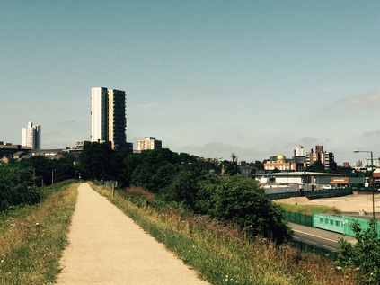
The Ridgeway is a curious path. It shares it's name with a much more important, and longer, prehistoric trail - and I think when some saw my plans to walk a route with the same name in just a few hours, they feared for my safety and sanity. But this more modest path is no less interesting to me. Starting at an innocuous brick pumping station under the curling sliproads and footpaths at Plumstead, it climbs atop the Southern Outfall Sewer and drives an arrow-straight course for the Thames at Crossness. It is perhaps shorter and a little less frequented than The Greenway - its northern equivalent - but it provided a perfect way to begin this trip. Once up on the ridge covering the huge pipes, the gravelled surface stretched endlessly ahead. North of the path was an endless industrial estate, with the shimmering rooftops of Belmarsh Prison. South was an expanse of railway sidings, leading to the green slopes of Shooter's Hill. I felt that familiar and strange thrill of range anxiety that always accompanies a walk into unknown parts, and set off for the river. It soon became apparent that both the water and the sunscreen I'd tucked into my bag were going to be more than necessary. With the light reflecting up from the prefabricated structures which skirted the path, and the sun beating down from above with little shelter, it was hot. It reminded me of another ill-advised journey on a hot day which had nearly floored me a few miles north of here in fact. But it was early, and I'd decided I was going to pace myself sensibly. As the Ridgeway edged along it's straight course, I noticed a couple of young men pushing a broken down BMW on the road below. Their shouts echoed oddly in the quiet morning, the silence and space distorting distance and, for a while, their voices seemed to follow me. There was little other sign of humanity out here. Perhaps it was just too hot, or perhaps it just wasn't somewhere people walked? Not for well over a mile did I see anyone on the path, and when I did it was fleeting crossing - the Ridgeway is an inconvenient barrier between housing on the east and the main road with its bus stops on the west. People ascended, puffing and pink in the sun, and paused briefly for breath before descending again. In the distance, the towers of Thamesmead loomed ominously with the path driving straight at them, save for a dip under a new road which crossed at ground level and necessitated a brief diversion where the official route swung away, diving under the carriageway before ascending again. Finally, the hypnotic straightness was broken by Harrow Manor Way swinging in to its junction with Eastern Way - another dive away from the main path, with a branch leading off to an impressive footbridge carrying the "Green Chain" footpath. Ahead of here, the Ridgeway was reduced to a scrubby, worn track on top of the sewer. It still had it's processional gateway entrance, but the path looked unloved and a little forbidding, with a deep green chasm of undergrowth and trees running along it's northern edge. I decided to press on carefully, testing my walking boots on rough terrain for the first time.
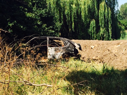
With a little greenery, around the walk felt cooler if a little lonelier. Just a short scramble away, South Mere glimmered up between the angular grey blocks of Thamesmead's older residences. A PA system was being warmed up for a party by the lake. Reggae thudded out of the trees. I slugged water, wiped sweat and hurried on with the wind turbines which signified the approaching fringe of Crossness Treatment Works providing a landmark. With the housing petering out, the road beside me became a long, private entrance to the works, and the strangely quietly dual-carriageway which had been shadowing, out of sight to the west began a loping ascent to cross my path. Again I was forced off route, down a sandy track with a choice of routes. I could turn left and head into the low rise estates of Thamesmead West, or head on for Crossness. Still early enough in the day to be dedicated to my purpose, I regained the path and pressed on. Here it was barely recognisable as a walking route and appeared to disappear into the hedgerow ahead, with the curved shimmering flank of Crossness above it. I turned the corner and came upon a mess of litter, a deep ditch and a burned out Vauxhall. Getting across would have been a serious undertaking, with little guarantee that I'd have gained any advantage. Rather miserably, I turned back to the junction and turned west earlier than I'd hoped. A quick trudge along an estate path brought me the apparently abandoned Thamesmead Golf Centre - a corporate looking glass box, set in front of a driving range. It looked to have been closed for some time and now found use as an overspill car park for the locals. Crossing the entrance, a gravel track led over a playground towards a crest. As I climbed I could smell the river, and as I reached the top of the rise its broad, silver sweep was revealed. Slow running and magnificent, it glimmered invitingly despite this stretch being caught in a filthy pincer movement by Crossness and Beckton sewage plants. It felt like an oasis. I decided to relax a while leaning on the wall beside the old steam pumping engines of Crossness. Hidden in the undergrowth was the final metal arch of the Ridgeway, it's route between here and the abandoned car lost in a tangle of bushes, the former driving range of the Golf Centre now serving as a paddock for a small group of working horses.
Resisting the urge to head east along the edge of the Crossness plant, I turned towards the city. There were a surprising number of locals relaxing alongside the path - a couple of older women gossiped over a flask of tea, while a group of children defied the heat to caper around a lethargic dad, pawing listlessly at the screen of a 'phone. Out here at the edge of its reach, the Thames Path revealed itself as an amalgam - once off the core route through the officially sanctioned tourist spots, Local Authorities had been left to safeguard the route with varying degrees of success. Greenwich had done a fair job it seems, albeit in a piecemeal fashion depending on the depth of the pockets of the developer who wanted to edge their work up against the Thames. The initial section of the path felt like a country lane, soon turning inland, and dividing into a higher and a lower path which divided and reconnected frequently. Across the river, the scrubby edgelands of Dagenham were giving way to the container yards and industrial sprawl of what will be, if the Mayor's plan succeeds, the rail-connected new suburb of Barking Riverside. Following the river's slight southward turn, I was surprised by a shimmering distant view of the Isle of Dogs, with the gleaming towers blinking back at me in the powerful sunlight. It was approaching noon, and I was well into my supply of water - but my feet felt sound and I wanted to press on, the very presence of the river and its associated breeze cooling me a little. Soon, even the seemingly endless expanse of Thamesmead petered out and it was evident how the land here had been parcelled up for development, leaving this forlorn corner a tantalisingly blank space in my crumbling 1995 London A-to-Z. It was still largely blank - a wide swathe of rough scrub stretching inland to the edge of a supermarket compound. The area deserves it's peace too - the quiet dignity standing in place of any more substantive monument to the terrible event which befell the SS Princess Alice off Tripcock Ness in 1872. Overloaded and crewed by inebriates and incompetents, the steamer was broken apart in collision with the huge Bywell Castle with a loss of at least 650 souls. Most of those pitched into the water struggled for the north bank, into a choking tide of raw sewage entering the river at Beckton. But here on the south bank there's no indication of the horror which remains the worst maritime disaster in the capital. At Tripcock Ness a lighthouse stands on the outcrop of the shore, painted red and fenced around. Clambering down to view it I was horrified to see the lank hair of a child dangling from the spikes of the fence - before realising it was a weirdly realistic doll, impaled oddly on the fencing. If I wasn't already uneasy enough at the strange silence, this sent me climbing back to the path - almost glad to return to the steady patrol of courting Eastern European couples who appeared to be the only locals braving the punishing afternoon heat.
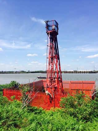
Beyond the desolate patch of Tripcock Ness, the newer reaches of Thamesmead soon encroached on the path again. Here, no doubt with contributions solicited from the developer, the path was a broad paved sweep with a tall brick parapet running beside it. Regular stairs led up to the streets, and there were occasional bursts of well-intentioned but dated and heavily vandalised public realm: benches with pointless towering ironwork, repurposed and de-natured cannon, empty planters, curious concrete plateaus of no clear purpose. I spotted a family fishing over the railings - the father bare-chested and pot-bellied, looking critically at his son who hefted a rod. Suddenly the tip quivered and described a dramatic parabola. The boy reeled furiously, walking his catch along the river, coaxing it towards the shore. It dragged him east - seemingly trying to head for the ocean. I paused to watch as the father followed, skittering back to gather their possessions as it became clear the contest was destined to continue its tidal progress. Resuming my walk, and draining the last of my water my thoughts turned to sustenance. I was beginning to feel a little light-headed - partly from the heat and also because it was a while since I'd eaten. With the last new apartments of Thamesmead West behind me, the low brick structures of the Royal Arsenal site were alongside. Away from the indiscriminate building on the southern edge of the site, the place looked remarkably well-preserved. The redevelopment was sensitive, if soullessly sanitised. Life had been primped out of the tidy stone blocks and the grid of narrow streets between them. Londoners however, defied the conventions as always, and the strip of grass between the path and the development was full of sunbathers, reading, picnicking or basking in the summery conditions. I turned aside to obtain supplies here, heading into the Town and completing a circle of sorts. Woolwich had woken a little, it's pedestrianised zone full of groups of youngsters and tracksuited men barking into handsets as they winced into the sun. I stayed long enough to shop, and headed back for the river, taking a bench near the Ferry Terminal to rest and eat. Low tide work on the loading bridges meant that the ferry was suspended for several hours, a boat at the closed terminal bobbing quietly while it's two sister ships sat idle upstream. A cyclist, apparently unconcerned at the lack of other vehicles, slalomed around the cones and rode up to the terminal in defiance. As I left he was raising his arms in either confusion or dismay.
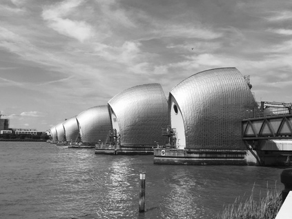
I realised I had a fair way left to walk at this point, and began to worry about time. As I resumed my walk, casting an eye over to Silvertown and the Royal Docks on the north bank, I crossed the mouths of the comparatively tiny remains of Woolwich Dockyard. One bay was full of sinuous black fish, competing with litter to find their way around the pond. The path was provisional here, half-rebuilt, lurching between broad segregated walking and cycling provision and stretches where everyone was condensed into a narrow riverside channel. Finally the path gave way entirely at the end of a block of recent housing, a high fence blocking the way. I doubled back through the estate following the "interim route" signs which seemed all too permanent, and found my way onto the thundering A206. I felt sick and tired, the sudden hit of heavy particulates and scorched air just a little too much. I was beginning to flag, and I wasn't sorry to turn into the gardens leading up to the Thames Barrier which were at least cool and quiet. Back on the shore, I paused to look at the ominous but impressive shells of the structure stretching over to the northern bank - where I'd stood just a few weeks ago. Beyond I could see the bulk of Millennium Mills again. The area was becoming strangely - and pleasantly - familiar now. I reluctantly resumed walking, hugging the shore until the path merged with Anchor and Hope Lane. Outside the public house crowds lolled in the sun, the busy beer garden stretching across the street to the industrial foreshore. The lane plunged west, delving into the dusty stockpiles of the Cemex Works, gantries towering overhead and reaching into the river. Nearby, the long-elusive railhead of Angerstein Wharf found its terminus. When I'd thought about travelling there on railtours it had seemed so remote and elusively not of the city. Now it seemed comparatively close to the towering buildings of the City and Canary Wharf. I found myself shadowing a walker with a baby strapped into a papoose on his chest. He ambled slowly in the heat, the listless tot lolling tiredly against him. I wondered about the wisdom of bringing baby along this dusty, dirty route as he walked just a few paces ahead of me - but finally I passed him and pressed on apace. Surely though, as I paused to read a sign describing the area, he passed and again fell into step just inches in front of my every step. I realised that the heat, fatigue and an increasing worry about the time were conspiring to make me irritable. I paused awhile and let people pass, before resuming for one last push to North Greenwich.
And there, in the shadow of the stretched white skin of the Millennium Dome to coin it's original name, I found myself reluctantly cast back into civilisation. Crowds wandered around the restaurants and stores despite the lack of any specific event. A stream of Salvation Army officers from a nearby convention poured across the site, their uniforms augmented with concert-style backstage passes. I realised I was red and wild-haired, my shirt patched with sweat like an extra from Platoon. People glanced, averted their eyes, then stared openly at this oddity stumbling through their midst in tiny steps, each measuring a manageable dose of knee pain. I turned away from the Dome, unable to face the fin-de-siecle circus tent on these terms. It had me at a disadvantage. Instead I made for the station and perused the bus stops. The Underground felt impossible - too hot, and too direct. I needed perspective and a slow bus ride would provide that. In the event, I waited far longer than I could really afford for a specific reason - I wanted to head through the Blackwall Tunnel. When the over-stuffed single-decker bound for Stratford arrived, I squeezed on and relaxed a little. The bus meandered around the North Greenwich Peninsula, finally nosing into the traffic of the Tunnel Approach Road, and soon passed under the protective gauge arch before slowly slipping into the tiled channel which burrowed under the Thames - my last crossing of the day. I was heading back west by way of a change at Bow Church - a familiar switch with a sting in its tail as the bus became ensnared in the Cycle Superhighway works around Bethnal Green. At Liverpool Street I cut my losses and made an unsteady, low speed dash for the Circle Line.
Until today the south bank of the Thames had seemed inert and distant, oddly less rich in meaning and history than my favoured spots on the northern flank of the river. However, today began an unwinding of the river on new terms - old vistas seen with distance and context, and new paths which were rich with possibilities and roads untaken. As I turned off the path at North Greenwich, on the edge of the maritime borough's core, I knew I'd need to pick up this walk again soon.
You can find a gallery of images from the walk here.
The trip out east had been interesting, despite the dull skies and lightless quality to the morning. I'd rarely used the Underground east of Whitechapel - usually preferring to walk or take the bus - but it was expedient for my plans today. As we rose from the earth at Bromley-by-Bow and scudded over the now very familiar Lower Lea Valley, I picked out landmarks which were in some ways best seen from the train - the silver trickle of Abbey Creek, the green wilderness of Channelsea Island, and the distant curve of currently forbidden pathways. Rising from the Hammersmith and City Line at Barking, the air was damp with flecks of undelivered rain. I sheltered under an awning at the pleasant little coffee stall and watched the morning opening up. The street was busy trying to be unprepossessing: a drooling, Somali beggar hassled us for coffee money and cigarettes, another guy punched angrily at the ATM buttons before turning and vomiting mango-yellow in disgust on the pavement. Across the street the oddly named Kennedy Chicken was opening for business, inexplicably appropriating the unfortunate President's name and bookending it with Liberty raising her torch aloft. Barking was just like I'd always found it - a cartoon version of the 'east end' people think they know, a boiled-down and purified zone of cockney bluster. A melting pot of cultures and interests where you're never really sure it's safe to laugh along with the joke. Finding my bearings, I pressed on through the bedraggled remains of the market, into the older crossroads at the heart of the town. Above me, some fine buildings - and ahead of me the green space of the Abbey Grounds. The remains of the Abbey were deserted and windswept - a litter trap for the neighbouring Abbey Retail Park which spoiled any hope of imagining the Abbey's 13th century glory days or as the seat of power for Queens, Saints and Abbesses. I struck out for the safety of the river - always the best course of action.
My plan for today was hazy and hurried - but had a couple of focal purposes. Firstly, I wanted to open my account with the River Roding. With my attention almost entirely absorbed by the Lea and its related streams and canals for years now, looking further east has felt almost disloyal to the imaginary scope of my nebulous project. Recently, though as my perambulations have brought me further out of the city, I've looked to find new bounds to prevent my already unmanageable sphere of interest from exploding entirely. The Roding has presented a convenient edge now for a while. After the docks, after the ranks of terraced housing of East Ham there has to be an edge to the map. But of course, every edge demands exploration - a psychic continuation sheet into the unknown. I found the river easily enough - mostly by way of a remarkable smell. The hot weeks of early summer had cooked the Roding into a stinking brew, a mixture of saline, marine notes with raw sewage ported in directly from Beckton on the west bank. At the bridge a flood defence scheme had been constructed, the channels split - one flowing lazily, the other backed up and brackish. Looking north, the river continued straight and featureless, hugging the North Circular and providing a boundary for the retail park and a direct if apparently impassable route to Ilford. To the south it broadened into the town's ancient wharf before contorting into Barking Creek. Rotting barges ranked against the west bank, buffering the car breakers yards of the ironically named Fresh Wharf. The low, grey sky pressed heavily over the estuary, and I was acutely aware of being the only pedestrian for some distance. I also realised that my lack of planning had left me slightly lost and with only a theoretical idea of how to get where I was heading. This was, of course, exactly why I do this stuff....
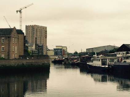
After a wrong turn onto a high footbridge, which could have shredded minutes from my walk in fact, I headed south alongside the A406. A wrecked Mercedes sat strangely abandoned in a lay-by beside the road - apparently well within the gaze - but outwith the interest - of the permanently manned security booth at the entrance to an industrial park. I edged by the sentry box, expecting trouble but getting none, finding myself in a nature reserve of sorts. What nature would dare come here is unclear - Hand Trough Creek, a gummy inlet of the Roding, lapped at the edge of the path. There were fading information boards and carefully cleared paths - but my route led me in a different direction today. Passing under the North Circular, I squeezed into an alleyway cramped beside the entrance to Newham's 'Central Depot'. A parade of dustbin lorries and odd little golf-cart powered gully-suckers rattled by. The alleyway turned north and hugged the road, taking me to a junction which joined the bridge I'd rejected. Turning west here and edging the grounds of a mid-century prefabricated school, I realised I was walking parallel with a stream or drain. I couldn't find a name for it, but it was significant enough to earn a well-built stone culvert entrance when I final rejoined civilisation at Folkestone Road. The difference here was palpable - firstly, the silence. No traffic moved. The streets were peppered with off-duty taxis and white vans ticking over before their next foray into the suburbs. A light dust of moisture was in the air, and the pavement began to give off their characteristic smell of relief that the heatwave had broken. Near Gooseley's Playing Fields I found my way to a footbridge over Newham Way and into the Beckton Triangle Retail Park. As I zig-zagged up the ramps to the bridge, I noted a pair of joggers looping back and forth over the structure, up and down the stairs, over and back in seemingly endless repetition while the traffic on the A13 shuddered beneath them. After a brief stop at a vast Sainsbury's store for sustenance I set out to find the Greenway. Having walked the western ends of the North Outfall Sewer for some years, this mysterious eastern terminus had always seemed exotically distant - but in truth it all ends at a gateway on a dusty footpath between shopping complexes. Having checked there was no way beyond the fence, I climbed onto the long, straight ridge and began walking west, with the cloying waft of sewage occasionally drifting from below. Beside the path I noted Britvic/Pepsico's manufacturing base and wondered if the presence of the city's filth is why I really didn't like Pepsi so much?
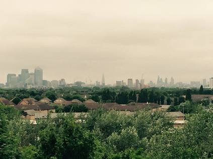
Soon, my second objective came into plain sight. From this direction, little more that a green, wooded tump above the endless sea of off-the-peg white-roofed warehouse blocks. A junction in the path was still signposted for Beckton Alp - but the bridge which led from the Greenway had been removed, the footings still resolutely embedded beyond the fence. I'd expected this - there wasn't any clearly mapped way in from this direction - but it gave me an uneasy feeling about the Alp. It's perhaps not unreasonable to be sceptical about the place - this is the final remains of a toxic heap of spoil which at its ugly zenith stretched all the way from the Gas, Light and Coke Company's works. The heap largely covered the ground which was annexed by the London Docklands Development Corporation for the expansion of the formerly tiny hamlet of Beckton. Now just one, isolated peak of the heap stands, landscaped and neutralised, and for a while the home of an ill-fated attempt to run an urban dry ski-slope in an attempt to capitalise of the long held alpine nickname for the piles of toxic waste. The former enterprise is almost gone, save for a litter of concrete blocks and some wooden platforms. But a zig-zagging path remains, and I chanced upon an unmarked gate in the palisade fence which led to the foot of the climb. I wasn't entirely sure about this - there were few pedestrians around, and it was clear that this gate was locked at points. I slipped inside, and started climbing, doubling back and forth, soon enveloped by the overgrown vegetation. The path was fractured by roots, littered with junk and untamed brambles. It was clear that people didn't come here much - and when they did, almost certainly only to escape or to be unseen. I felt the rising range anxiety - the gate was long out of sight, and the summit wasn't yet evident. As if mocking the Alp's former glory, a rough, steep mudslide of a path took a direct route between the angles of the official route - and for a while I considered attempting the scramble back down. But then, unexpectedly, I came upon a further gate, which was firmly and impassably locked. Above me I could see the tall, iron monoliths which signified the summit. Each was adorned with a splash of ill-executed graffiti which spelled out some kind of coded message to the city: a Star of David, a phallus, the Microsoft Windows logo, a swastika - and finally the inexplicable legend 'Lord Cunt'. I pondered the meaning briefly before turning to catch an unexpected and hazy prospect across the city. Despite the gloom, the low, pregnant clouds and the middle-distance haze, I could make out the gleaming towers of Docklands, the indistinct bulge of St. Mary Axe, and between them the dark obelisk of The Shard. In the foreground, a slash of green and terracotta where Beckton sprawled between the mothballed Royal Docks and the Northern Outfall Sewer. It was time to make a descent, objective only partially achieved this time.
After poking around the fringe of the Alp site for a while, looking for any other potential entrance which might allow a complete ascent, I admitted defeat and braved the complex puzzle of road crossings to resume the journey along the Greenway. I had walked the western end of this permissive footpath topping the great sewer many times, but I'd never quite managed to walk all of it. The Greenway has been partially closed at various points along its length since around 2009 by my reckoning. Firstly it was severed to allow the Olympic Park to be built largely behind blue wooden fences - with a later concession to public interest with The View Tube cafe. Then it was closed further east to allow temporary bridges and widened stairways to be installed in advance of the games, anticipating crowds flocking in from the somewhat distant station at West Ham. The need to dismantle these and remove the Olympic 'overlay' took up more time, and soon enough its most recent closure began - this time to replace the bridge at Channelsea as part of the larger project to dig a new sewage tunnel. This recent closure severs the route from West Ham to Stratford - a ludicrously long stretch given alternative access routes to the path which could have been considered. In any case, the section from Beckton to Balaam Street was new to me. I set out feeling a little apprehensive - I realised my new boots were doing a superb job at calming my feet, which would usually be protesting by now, but were letting me walk far faster and harder than usual. My knees complained bitterly at this treatment, and the long gravel ribbon stretched ahead endlessly. I felt like I'd walked forever, but stopping briefly and turning back I see the imposing tower's of the Barking Flood Barrier at the mouth of the Roding. By a trick of the flat ground and elevated position, they still seem immense and close by, like I've never really escaped from the River. Beside the path, beyond the iron railings and carefully selected hedgerow planting, ranks of suburban terraces stretched across the flat plains between the Lea and the Roding. In the middle distance, the solid diagonal of the Boleyn Ground's terraces - home of West Ham until the Olympic Stadium is ready, bitter years of legal dispute now it seems quieted. Between the pitch and my path, a vast Jewish burial ground edges the Greenway, whilst on the south side, the sprawling modern low-rise blocks of Newham Universtity Hospital parallels the walk. Flanked by death and decay, after being largely alone since leaving the market at Barking, a welcome hint of life starts to reappear unexpectedly - there are cyclists complaining about walkers, and walkers swearing quietly under their breath at cyclists. Bells ring passive aggressively. People join the path with their shopping, schlepping homewards along the convenient direct route. A hoodie-cowled youth dances from foot to foot, shadow boxing and wheeling at an invisible opponent. The Greenway is resolutely alive again as I cross Barking Road into territory I've already covered.
Despite knowing the way is blocked, I walk as far as the fences cutting the path. There is no activity beyond, at least as far as I can see. Below is the slash of waste ground beside Abbey Creek and the railway from which I looked over this territory at the start of this morning's excursion. I descend onto the broad, busy trough of Manor Road, flanked by high walls and dotted with 'Greenway Diversion' signs lifted straight from the London 2012 storeroom. Crossing the street I meet a group of walkers poring over maps, trying to navigate back onto the footpath. They consult the official 'Capital Ring' guidebook and argue about where to head next. There is a degree of hysteria in their voices, decanted into a busy, unknown East London street, off the edge of the sanctioned guidebook. Their walk stopped being pleasantly edgy and urban, and became strangely real as they wheeled out of Abbey Lane. I leave them bickering over directions, and head over the railway towards the head of Abbey Creek. I was here not too long ago, and little appears to have changed. The bridge carrying the sewer is still swathed in plastic, still an apparently work-less work site. I nose into Canning Road again, but find the oddly secretive Mosque has posted sentries. Young men, lazily hanging around at the crest of the street, eyeing strangers and yelling incomprehensibly at those who dare to pass the edge of the site. Channelsea Island is beyond, the huge open swathe of de-industrialised wasteland - one of the last truly empty lots between the city and the docks - subject to dispute. I move on, taking the Channelsea Path into Stratford. I have a minor objective here too - three years back I poked around the Carpenters Estate looking for remnants of the Channelsea north of the High Street, tempted by a tiny remaining slash of blue on a 1995 A-to-Z map. This time I was determined, and although one short open stretch appears to have disappeared under new apartments, by climbing onto the footbridge between Station Street and Jupp Road I could see the line of greenery edging out from under the new blocks and leading into a narrow, algae-filled concrete channel. The river was compromised and diminished, funnelled into this tiny, reeking gap between the Jubilee Line and the road - but it was there, holding out despite the relentless development of the area. Beyond the station it disappeared again, possibly underground - or possibly simply stopped up with concrete. Descending from the bridge, I returned to the High Street and cutting between new-build flats, walked along the edge of the Waterworks River. A new frontage - with sales brochure public art and planting - leads to Bridgewater Road and the concrete bridge still bearing dire warnings for passing under it into the "Olympic Park Work Site". The mouth of the bridge is stopped up for work, while a nearby building being demolished on the river-front teems with artists, tramps and addicts, all vying for a bit of the less-than-prime real estate before it's gone. Oddly enough, this has a little of the feel of how this area used to exist - on the margins of everyone's life, quietly democratic - it's almost nostalgic to clatter uncomfortably over broken down hoardings to return to the pavement.
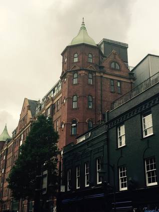
I pause in the park for a while to rest my knees - it's busy, strangely warm, but still weirdly inert. Families queue for the ascent of the Orbit, while others descend and enter the nearby restaurant. There's not too much else to do here just now, but still they come - a tide of pushchairs and toddlers, wide-eyed grins fixed on the slashes of colour of the generously planted meadows. I cut across a grassy area and find it strangely hard going - the grass is coarse, the turfs still separate grass tiles with rough edges. Like an ill-fitting Donald Trump hairpiece, the grass hardly disguises the remediated surface underneath. I linger longer in the park than usual - partly just pleased to find a place to sit and rest after a long unbroken walk from Barking. But also, because I find myself feeling more at peace with the place now. Perhaps it's because the public accesses are starting to open - walkways along the rivers beginning to feel complete, bus routes running through the park - or maybe because the original purpose of the event seems distant now that other mega-events are breaking free of the back pages and becoming predictably bad news? In any case, I miss what is lost, and I wish I'd known it better - but I can at least walk objectively through the park now. I hop gingerly aboard a single-decker heading for Shadwell - I had one last aim which I'd all but decided wouldn't be possible, but which might just work with the assistance of this route. The bus snaked through the park, onto Fish Island and then through Bethnal Green to Whitechapel Road. After a long wait and a perilous crossing of the Cycle Superhighway related roadworks, we plunged into the relative calm of Stepney. I disembarked at St. Dunstan's Church - a little earlier than perhaps I needed to - and after a few yards of crazy zig-zagging managed to get my feet back. I struck out along Stepney Way, using the Royal London Hospital's lofty helipad as my landmark. Despite cutting across the territory endlessly to get elsewhere, I didn't know this triangle of land between Whitechapel Road, the Highway and the City at all well. It had turned warm and humid in the late afternoon, with a relentless sun breaking through the clouds and bouncing back from the glass of the hospital's new buildings. As I entered the old heart of Stepney, there was a sudden and almost magical switch. The streets were lined with Victorian terraces, squares of decent red-brick houses, corner storefronts which were still shops and restaurants. It seemed like a world away from the dry, dusty sprawl of Whitechapel which at times feels like a low-aspiration theme park of urban horror compared to this strangely comforting vision of the Old East End. It was cleaned and primped into modern acceptability of course - the legendary squalor and hardship buffed vigorously away from the streets, bricks scrubbed clean of soot. Then, almost without warning after, executing a deft switch of direction to superstitiously skirt the grounds of the hospital, my objective appeared looming ahead: the great, mullioned frontage of Tower House - formerly Jack London's "monster doss house", now luxuriously appointed dwellings. The old, pointed archway entrance a blank face, its mouth sealed. A new glassy tunnel entered beside the western tower leading to a bored concierge and security gates. As I tried to get an angle for the shot in the cramped narrow street, the woman's entrance of the East London Mosque opened and a silent tide of black-swathed women erupted into the already busy street. I was bustled by the crowd and eyed with suspicion by men waiting in cars which looked not unlike that ill-fated Mercedes I saw wrecked in Barking hours back. I pressed on, camera hidden now from view, skirted the ancient brick wall of the Whitechapel Bell Foundry and made a dash for a bus back to civilisation.
It's hard not to feel cheated in some ways by today's walk - Beckton Alp closed for business, the Greenway still impassible at Channelsea - a long and relentless slog along sometimes reeking byways. But I realise too that as I cross and recross this territory, as I become more familiar with its contours and topography, so it yields more of its secrets. And there are many, many more to be found here it seems.
You can find more pictures from the walk here.
Lost::MikeGTN
I've had a home on the web for more years than I care to remember, and a few kind souls persuade me it's worth persisting with keeping it updated. This current incarnation of the site is centred around the blog posts which began back in 1999 as 'the daylog' and continued through my travels and tribulations during the following years.
I don't get out and about nearly as much these days, but I do try to record significant events and trips for posterity. You may also have arrived here by following the trail to my former music blog Songs Heard On Fast Trains. That content is preserved here too.

