
Single Ticket #15 - Shambles Miller 14 years ago
Posted in SHOFT on Thursday 12th July 2012 at 7:07am
 Shambles Miller retains an almost unique claim to fame here, in that he is the only artist ever to write a song with a name so long it consistently made iTunes crash. The limitations on file path lengths in older versions of Microsoft Windows aside, this is just the kind of acute observation which I'm sure would delight Miller who has a habit of turning the tiny, often mundane and minute events of everyday life into a tumble of touchingly humourous lyrics. He has maintained a slow but steady flow of releases over the past couple of years, including a pair of EPs which received a fair amount of very positive attention at the time. This, his first 'single' as such brings together a couple of more recently written songs and showcases Shambles's voice and guitar in two very different approaches to recording his songs.
The skiffle-tinged shuffle of "Confessions" bursts with wry wit, David Bowie impressions and buckets of pathos. The almost impossibly catchy song is built around a rousing, sing-along chorus where Miller perhaps correctly observes "the world doesn't really need another break up song". But most songs of heartbreak aren't created quite like this, and lack the sense of self-deprecating but gentle humour which Miller manages to cram into his lyrics in every surprising couplet. I'm not going to quote huge passages of lyrics, because the surprise and delight of each line tumbling in is all part of the charm of this song. Driven by Neil Slorance's slinky double-bass playing, and with perfectly placed touches of backing vocals from Florence McDonald, there is a proper, old-fashioned and irresistible pop song at the core of this one. On "Pieces", the second track here, the instrumentation is stripped back completely leaving Shambles to deliver the song alone over an expertly picked guitar reel, uncannily sounding like a Glaswegian Billy Bragg raised on Ivor Cutler's Peel Sessions. It shares a theme with "Confessions" taking a different tack around the break-up theme, throwing in a deft W.B.Yeats reference and looking inwards for it's explanations. Shambles's vocals are laced with regret and defiance, heartfelt but never descending into schmaltz or self-pity. This is simple and direct, by the end redemptive and echoing with wisdom and experience.
Despite his relatively low-key approach to self-promotion, there is much more to Shambles Miller than the average guy-and-a-guitar act. I find myself writing that a lot, but there are a bunch of musicians emanating from Glasgow - not least Randolph's Leap's Adam Ross and Beerjacket who are, along with Miller, redeeming this oft-abused art form. Coupling genuinely inventive songwriting with touches of observational comedy which shame some of the professionals in the field - and most importantly an ear for a naggingly memorable tune - Shambles's new single absolutely demands a listen.
Shambles Miller retains an almost unique claim to fame here, in that he is the only artist ever to write a song with a name so long it consistently made iTunes crash. The limitations on file path lengths in older versions of Microsoft Windows aside, this is just the kind of acute observation which I'm sure would delight Miller who has a habit of turning the tiny, often mundane and minute events of everyday life into a tumble of touchingly humourous lyrics. He has maintained a slow but steady flow of releases over the past couple of years, including a pair of EPs which received a fair amount of very positive attention at the time. This, his first 'single' as such brings together a couple of more recently written songs and showcases Shambles's voice and guitar in two very different approaches to recording his songs.
The skiffle-tinged shuffle of "Confessions" bursts with wry wit, David Bowie impressions and buckets of pathos. The almost impossibly catchy song is built around a rousing, sing-along chorus where Miller perhaps correctly observes "the world doesn't really need another break up song". But most songs of heartbreak aren't created quite like this, and lack the sense of self-deprecating but gentle humour which Miller manages to cram into his lyrics in every surprising couplet. I'm not going to quote huge passages of lyrics, because the surprise and delight of each line tumbling in is all part of the charm of this song. Driven by Neil Slorance's slinky double-bass playing, and with perfectly placed touches of backing vocals from Florence McDonald, there is a proper, old-fashioned and irresistible pop song at the core of this one. On "Pieces", the second track here, the instrumentation is stripped back completely leaving Shambles to deliver the song alone over an expertly picked guitar reel, uncannily sounding like a Glaswegian Billy Bragg raised on Ivor Cutler's Peel Sessions. It shares a theme with "Confessions" taking a different tack around the break-up theme, throwing in a deft W.B.Yeats reference and looking inwards for it's explanations. Shambles's vocals are laced with regret and defiance, heartfelt but never descending into schmaltz or self-pity. This is simple and direct, by the end redemptive and echoing with wisdom and experience.
Despite his relatively low-key approach to self-promotion, there is much more to Shambles Miller than the average guy-and-a-guitar act. I find myself writing that a lot, but there are a bunch of musicians emanating from Glasgow - not least Randolph's Leap's Adam Ross and Beerjacket who are, along with Miller, redeeming this oft-abused art form. Coupling genuinely inventive songwriting with touches of observational comedy which shame some of the professionals in the field - and most importantly an ear for a naggingly memorable tune - Shambles's new single absolutely demands a listen.
Shambles Miller - Pieces
"Confessions" is available as a download or a physical CD release via Bandcamp. If you purchase the CD version you'll probably get a little note from Shambles along with a drawing. Mine involved a Seinfeld reference, along with a battle with an anatomically incorrect octopus. How can not want in on this kind of deal? You can also purchase Shambles's first two EPs from here for the absurdly tiny price of £1 each.
The Japanese War Effort - Surrender To Summer 15 years ago
Posted in SHOFT on Tuesday 12th July 2011 at 10:07pm
 Summer isn't a great time for music in lots of ways. As the entire industry appears to decamp to the ever growing list of festivals and new releases dry up, somehow the general public enters a strange, collective stupor where only the most inane rubbish seems to be played as loudly as possible through open car windows. So to combat my seasonal prejudice, The Japanese War Effort had to produce something pretty special, and in conjunction with the sterling efforts of Song, By Toad records they've pulled off something of a triumph here. Firstly, I've got to mention how great this record looks. Sliding the disc out of it's sleeve reveals a marbled ten-inch record, pressed on opaque vinyl shot through with an explosion of colour not unlike a Damien Hirst splatter painting. The sleeve itself is a bold and rather stunning, a close-up colourful picture of tooth-breaking seaside rock - a packet of which accompanies each order. Once again I'm struck by how the physical artefact is increasingly important at this end of the market. The opportunity to own something that has thought, care and inventiveness at it's heart supplanting the immediacy of the 'having it first' iTunes culture which sadly guides pop music nowadays, losing the sense of anticipation of hearing new music in the process. To clarify the personnel here, The Japanese War Effort is effectively the solo vehicle for Jamie Scott - half of Conquering Animal Sound. Whilst on this record he takes a very different approach to that of his other project, there are threads of similarity which bind them together. However on "Surrender to Summer" there is a sense of experimentation and playfulness which makes it feel more like a low fidelity garage band than the crystalline otherworldliness of his work with Conquering Animal Sound. That's not to suggest anything sloppy or unfinished about this EP where every track threatens to develop into a miniature pop anthem. Some of them indeed do - while others meander delightfully off on their own terms.
Opener "Summer Sun Skateboard" is an air-punching call to arms - because, after all summer is for the geeks too. It's full of the pasty pre-sunburnt optimism you hear in airport departure lounges, with some strange lyrical twists and an almost absurd amount of things happening. But it sounds wonderful - constructed cleverly from a patchwork of throbbing bass, jittery effects and skilful flecks of guitar. Throughout, Jamie Scott's vocals vary from a distant distorted megaphone rant to a strange uncomfortably-close-to-the-microphone chant. By contrast "Beach Buddies" fades in with a shoegazey screed of guitars and reverb shrouded vocals. Swiftly joined by the trademark metallic percussion and organ drone, the song mutates into a rather melancholy lament before it finally finds it's anthemic sweep of an ending. This is possibly my current favourite on the EP if only because it's neighbour-irritatingly loud - certainly enough to drown out the distant thud from the car stereos in the traffic jam outside.
"Pool attendant" is the EP's risqué seaside postcard, beginning with a damaged Blackpool Tower Wurlitzer noise, which is soon buried in an stirring electronics. A squall of analogue synthesiser noise bounces around one of the more involved compositions here. After a flourish of keyboards, it ends with subsonic bass and Jamie menacingly whispering "I shouldn't be kicking kerbs over you quite so early". The low rumbling bass sticks around into the next track, and is joined by what sounds remarkably like an original Rolf Harris Stylophone on "Bucket and Spade". Embellished with a shimmer of electronics as Jamie intones quietly above the noise, I'm curiously reminded of "Drums and Guns" era Low with it's sparse, spacious menace. Finally "Yr Tanlines" closes the record with its swooping, gorgeous pop melodies dotted with disturbing squalls of noise and stabs of static. This is perhaps as close to Conquering Animal Sound as the EP becomes in terms of both sound and the construction of the track, but it's still worlds away from their more restrained other-worldliness. Discordant vocals repeatedly asking "ever felt so small?" over the layered sheen of noise and all too soon this oddly captivating record is stuttering to a close.
This EP is a loose collection around a theme, owing more perhaps to the humid, drunken British summer than any slick continental variant. It's always tricky when someone already known for their work elsewhere releases something on their own terms, and despite the day job of its protagonist, The Japanese War Effort material has a clear identify of it's own - strangely but ultimately successfully leaning more towards shoegazing, lo-fi noisy pop than straight-down-the line electronica in many ways. It's rare to find musicians who can live comfortably in several worlds at once without suffering a crisis of confidence, but Jamie Scott appears to be one of these. Coupling this playful, exuberant and inventive music to the beautifully conceived packaging and design, this becomes both a must have artefact and the soundtrack to the more discerning listener's fleeting British Summertime.
The Japanese War Effort's "Surrender To Summer" EP is available from Song, By Toad Records on resplendent coloured vinyl including a digital download code. Alternatively, it can be purchased via iTunes or Amazon - but in doing so you would largely miss the point, and indeed miss out on free sweets.
The Japanese War Effort - Beach Buddies
Decided to head for London today, with the intention of covering one of the shuttle services to Birmingham International which Virgin Trains are providing during the extended blockade on the West Coast Main Line. So, down to the station for the familiar 05:50 departure which was uncharacteristically late. This meant a swift change at Weston, and an ever quicker dash for Mr Spinks who needed to collect tickets from the machines and had expected to have about 20 minutes to do so. On board and in a quiet First Class coach with moments to spare. Surprising amount of activity along the route, with a fair number of locomotives out and about. Having planned to get the 10:00 departure from Euston, no great need to rush or worry about time - so finding the Circle Line closed was no great worry. Onto the Hammersmith and City, and since the entire ticket gate system seemed to be out of action, a free ride to Euston Square. Had a wander around Euston on arriving, with The Chief's Trainset led by 90028 in Platform 17, along with a Thunderbird and the Caledonian Sleeper with 90019 on the front. Network Rail staff proved a bit sniffy on the photography rules, but no major problems.
Joined the pair of Voyagers for the 10:00 with a surprising amount of other passengers. Had heard these services were quiet a couple of weeks back, but certainly didn't seem so today. Virgin, ever trying to turn setbacks into advantages, had provided a clever little leaflet entitled 'Where are we going?' which explained the reasons for the diversion, why the train was different, and gave a fairly full description of the route onto the Chiltern Line. People seemed to respond fairly positively to the efforts to keep them informed by the staff, and we received the usual Virgin good service. A shame there were no Advance fares for these trains though, as the full First Class service was on offer! Soon off, with little of the extended stopping which had been mentioned in previous weeks. Slow running certainly, as we took the line to Acton Wells Junction, then onto the Great Western Main Line where we'd come into London. Then, via Greenford and a short section of the Wycombe Single to South Ruislip where we joined the Chiltern route proper. A mixture of comfortable running and crawling behind local units, but no delays and no outright stops as such. Decent weather seemed to be the order of the day as we progressed north, taking the line via Kenilworth to reach our destination at Birmingham International.
A swift change onto a Glasgow-bound Pendolino here, missing a passing Class 92 hauled freight in my efforts to check we weren't going to scoot directly up the WCML to Preston or something! Would dearly love to have stayed on board for a longer trip, but today it was just a short hop to New Street and a fairly quick change for a Stafford-bound semi-fast service passing Bescot and calling at Walsall. Bescot now appears to be little more than a dumping ground for a host of aging locomotives. However, a bit of activity with a Class 08 with a cut-down cab, and a gaggle of 66s at the north end of the depot. At Walsall, got confused by the horrible shopping centre on top of the platform, and ended up missing the train to Wolverhampton. This meant an hour long fester in Walsall. Not a happy moment for me as I trudged through the town feeling gloomy, getting annoyed at the locals and finally settling for a fairly good pint of Banks' while I waited patiently for the next service.
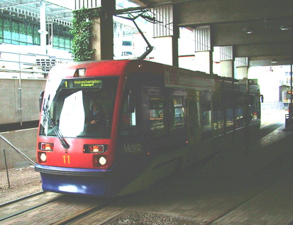
The reason for the wait when I could of course very easily gone back to New Street, was the need to cover the curve back to Pleck Junction which I'm certain I've never done - a combination of 170 and 153 turned up and duly covered the required track, arriving at a rather windy Wolverhampton a few minutes later. Since we had some time to spare, and since Mr Spinks had yet to cover the Midland Metro line to Snow Hill, we decided to take the tram back to Birmingham. Passed a bunch of youngsters beating the crap out of each other one the way to the tram terminus at St. Georges, as a reminder that we were in the West Midlands. Nice. Not sorry to leave Wolverhampton and Walsall, having had memories stirred of a very miserable long wait for the cancelled Electric Scot Farewell tour back in December!

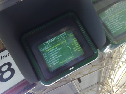
Had a camera disaster resulting in the dingy image above, and generally began to write my day off as not one of the best, despite some interesting journeys. Mr. Spinks however insisted it was his lucky day, and things did seem to start working out rather surprisingly well on arrival back at Birmingham. After a wander down to New Street, noted that 1V63 was about 40 late from Newcastle and showing as cancelled south of Birmingham. However the screens said 'On Time', and a curious train had appeared on the Live Departure Boards timed a few minutes later than the 16:40 and marked 'Starts Here'. The crew turned up, and were equally surprised to see an empty Voyager set roll in. Soon away, the only passengers in First Class on a replacement unit - with the rest of 1V63 still somewhere north of Derby as we sped south down the Lickey! The strange turn of events continued as we arrived back in the south west. We laughingly speculated about a delay meaning we could grab the 17:53 instead of waiting for the 18:53. On checking, indeed it did seem to be delayed by a few minutes. On arrival though, things were going very badly for most folks at Temple Meads. Lineside equipment failure had knocked back all the Severn Tunnel traffic, and our train was 40 minutes down at least. We chatted over various possibilities for recovering the service, including First Great Western's latest favourite tricks, turning the service at Weston (bad for us) or running fast to Weston (possibly better!). In the end, in a rather surprising move, the train ran around 50 late with the first stop at Highbridge. Tried not to grin too much as we wandered past disgruntled Westonians and boarded the unit, meeting a gent who'd been on the first train out with us for what we dubbed 'The Highbridge Express'.
The driver took full advantage of a non-stop run, and by a rough calculation we covered the 27 miles or so in around 26 minutes, averaging close to 60mph in the rather lively 143621! So, a strange and varied days with some unusual turns of luck. A good trip, an interesting route and a quick ride home.

It's been a long hot day, in uncertain territory. My customary summer foray into academia has arrived again. It sort of crept up on me this year. Without the strange structure which the appeal season used to give to my summer, I found myself starting this week at work with only a couple of days in which to do quite a bit of rather unpleasant stuff. Nevertheless, I found myself packing this morning to head to the station in already blazing sunshine.
Having scored a couple of First Great Western's new 'Firstminute' fares, I was enjoying weekday First Class for a budget price. A change at Bristol and into the quiet, cool carriage for a couple of hours of living the high life - or at least being fed complimentary coffee and peanuts in a seat which actually fits me! On arrival at Paddington, a sweaty and crowded tube trip to Cannon Street which seemed to take ages. Cannon Street was, as always when I visit outside the peak, eerily quiet. Onto the waiting 465, which like all of its class has a strangely toilet-like aroma, and over the gleaming river towards London Bridge. Then moments later we're skimming the rooftops of South East London en route to Greenwich.
Arrived at a dusty and baking Maze Hill station and shouldered my bag for the walk to the University. I'd visited Greenwich once before, not straying far beyond St Alfege's Church before heading back onto the train. This time, coming from the East I was amazed by the size and symmetry of the Royal Naval College and the Queen's House. It took me a fair while to figure that I was actually heading for one of the wings of the College to regsiter. Awed and confused by the buildings and their royalist nomenclature, I resorted to asking an employee who seemed himself rather confused as to which block was William and which was Mary.
After a frustrating afternoon mostly spent arranging a replacement key for my room in the Halls of Residence, set out to explore in the hopefully cooler evening. A short walk from my door was the Cutty Sark, beached and tired. Beyond the ship, in the plaza surrounding it was the cylindrical drum of the Greenwich Foot Tunnel entrance, and beyond in the haze was One Canada Square towering in the cluster of blocks forming Canary Wharf. After a fairly unsatisfying pint in a Youngs' pub, found a really good Indian restaurant. Wandered some more, before retiring feeling slightly apprehensive as always about the conference and whether I'd somehow be exposed as an utter fraud.
Lost::MikeGTN
I've had a home on the web for more years than I care to remember, and a few kind souls persuade me it's worth persisting with keeping it updated. This current incarnation of the site is centred around the blog posts which began back in 1999 as 'the daylog' and continued through my travels and tribulations during the following years.
I don't get out and about nearly as much these days, but I do try to record significant events and trips for posterity. You may also have arrived here by following the trail to my former music blog Songs Heard On Fast Trains. That content is preserved here too.
