London Ordinal: The A1 - Walking into the Light
Posted in London on Saturday 12th January 2019 at 11:01pm
A month ago I didn't expect to be here in London. Arriving at the bustle of Paddington station on one of GWR's flagship new trains for the first time, I was a little early. The skies over Berkshire had seen a reassuring red dawn fade into a marine silver sheet which didn't bode well, but otherwise, things had gone to plan so far. I wasn't used to this - it had been a month of confounding twists, difficult turns and unwelcome disappointments. The turn of the year had seen our annual trip - always a highlight, and despite being a little shorter and more austere this time around, a welcome break from the routine. A plunge back into a fractious and grumpy working environment where the low rumble of national politics invaded every decision had made for a difficult week too. Delay was everywhere, inaction was the standard response. I was itching to get walking again. I didn't linger at Paddington, heading directly for the Circle Line and hence to Kings Cross St. Pancras. I was there only long enough to charge my coffee cup, grab a swift but unusually fancy breakfast, and head down onto the Thameslink platforms with BTP officers slaloming around me to apprehend some early fare-dodgers who'd somehow spoofed the gateline. As they dashed around the corner towards the stairs, one of them carefully discarded his takeaway espresso cup to better make pursuit. It was good to be back in London: outwardly civilised but always on the brink of something. As my train snaked into the station and we escaped from the tunnels somewhere north of Thomas Hardy's graveyard packed with human jam, a grey morning opened before me. A new year and a new project. Time to get moving, again, at last.
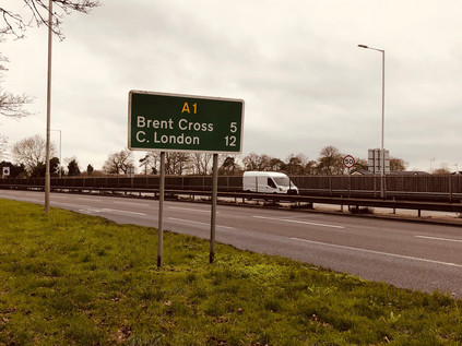
My journey out of London was the usual experience: as the interval between the suburban stations began to lengthen, more greenery crept into the window views. The sprawling city relaxed like a muscle, its margins ragged and ill-defined. I disembarked at Elstree and Borehamwood. Outside the official administrative margin, but still inside the concrete circlet of the M25 - at least, just inside... I didn't know this part of the world at all well. It was a map-smudge between Barnet and Edgware which remained unexplored, and despite being formally and spiritually in Hertfordshire, it felt perhaps more like a suburban satellite than some of the towns which had arbitrarily crept into London in the 1965 redefinition of its boundaries. While Enfield and Barnet felt like small, independent market towns which had only accidentally strayed into the city's ambit, Borehamwood felt exactly like a suburban enclave should. I navigated out of the station car park with some challenge and set off along the High Street - a haphazard grouping of national chains and local traders inhabiting a dissonant mix of 1930s shopping parades and 1990s plastic-fronted retail centres. It was busy and self-contained, and in the unexpectedly temperate January morning, not a bad place to start walking. I peeled off to the south long before the strip of shopping opportunities had ended, heading into the residential hinterlands with their mix of bungalows and modern church buildings. The road leered above me, a long straight row of tail-lamps rising ahead of me into the trees. Borehamwood ended slowly, persisting along the road out of town. Cresting the hill, I saw my route creeping in from the north to converge with my current bearings. My target today had, in fact, suggested itself a long time back, but felt like the wrong walk back then. I didn't want to be that road walking guy who endlessly recounted treks along the byways of London for their own sake. There were two considerations though: firstly, I was that road guy - a consistent string of ambulations focused on routes ancient and modern proved it. Secondly, I'd probably always been thus. My earliest memories are of lying on the living room floor puzzling out an interchange or scratchily drawing Primary Route signs after Kinneir and Calvert. But after all, who cared anyway? No-one was reading. I could walk wherever I wanted, write whatever I felt and remain largely unashamed of my preoccupations. I felt a sudden flush of freedom when I was pondering my walk on the train into London this morning. I was going to begin a new year with a new plan: five long walks along the principal A roads leading into London. All of them converged on the shifty, ill-defined 'Centre' of the city. All of them crossed the boundary at an inconvenient and distant spot somewhere in the scrubby, semi-industrial edgelands. This was just my kind of walking. At Stirling Corner, after visiting the local branch of Morrisons where sleepy Saturday-morning people appeared intent on crashing and colliding into each other with an alarming lack of care, I finally found the A1 arriving fresh from its bypassing of Borehamwood. A fire engine howled around three-quarters of the roundabout, quicker than braving the traffic lights and turning directly south. Traffic momentarily stopped and pulled aside, then ebbed back into the space it had left for the emergency vehicle as if nothing of note had happened. To the left, the road was simply signposted 'The NORTH', to the right the familiarly abbreviated 'C. London' which I always seemed to be heading towards - I crossed the busy carriageways gingerly and began walking. The next sign told me it was five miles to Brent Cross and twelve to Central London, while the clouds closed in overhead to form a grey, sound-deadening mass. Cap pulled tight and head down, I set off along the narrow footway beside the litter-strewn laybys which signalled my passage out of the Home Counties and into Greater London.
The road was broad but divided into narrow lanes which pushed the slower moving juggernauts closer to my path. I hugged the margin of bushes carefully, trying not to let my shoulder protrude in case of a stray wing-mirror. Having walked some fairly major routes around the city, this felt more precarious than any so far. The tarmac scythed through a patch of green - to the east, the public open space at Moons Moat, damp and edged by a forest of leafless, intertwined trees which presented a grim barrier against the road. To the west, a golf course - the scourge of the greenbelt - and then the M1 and London Gateway Services, formerly known as Scratchwood, after the belt of tree-covered hillside here. The services were reached by an aborted junction - a half-finished roundabout which whirled rest-area bound traffic illogically around itself before allowing them access to M&S, Starbucks and the other facilities. The M1 made a dramatic break for freedom here, curving sharply to the west and finally parting company with the railway line it had shadowed for miles out of the city. The history of the motorway and my road are inseparably linked, twin grey lines ploughing north through the lesser-valued patch of north-western suburbs which are not quite Hertfordshire, yet. Just a few days before I'd stood at the corner of Leith Street and Princes Street in Edinburgh - the start, or indeed the end of the A1 depending on your viewpoint. We'd followed its bleak and impressive beginnings south into England on our journey home, twisting into the low grey clouds which hugged the coast. It felt fitting to begin the year on this route. A band of light tinted red by the pinkish grey cloud cover broke through to the south, making the wet pavement gleam. It felt like a premature sunset. I walked towards the light...
I finally got my bearings at Apex Corner. Approaching from the south on my first visit this swirl of traffic had seemed like the end of civilisation, the A1 stretching away into the trees. Now it was a welcome return to suburbia where the road slowed and quietened somewhat, at least temporarily. I edged around the roundabout above ground rather than descending into the subways, and as a result, I witnessed the aftermath of a minor traffic incident. The police were already on scene, cars with deformed plastic fenders askance and airbags hanging flaccidly post-inflation neatly sequestered on the central reservation. I turned south, heading into the environs of Mill Hill. The land climbed to the east, into the rural edges of London which I'd skirted on the A5109 - sleepy Totteridge and the muddy slog over the fields to Whetstone lay beyond. To the west, the landscape fell away into the valley of the Dean's Brook which formed an early headstream of the Brent. The road continued south through suburban sprawl which was neither Edgware nor Mill Hill quite yet, impressive double-fronted houses and gated villas stepped up the bank, away from the road. Some of them had grand entrance stairways sweeping up to their gates, designed for impressive arrivals by equally prestigious motorcar and likely not used now that they provided access only to the litter-strewn carriageway of a shuddering, congested expressway into London. A street of shops led away west to Mill Hill Broadway station, the settlement's spiritual and commercial centre as defined by M&S Food, lying some way from the brow of the hill with its impressive views over West London. Away beyond the northbound carriageway a small knot of red brick civic buildings clustered together - the stocky, almost ecclesiastical tower of Mill Hill Fire Station glowering over the single-storey public library opposite. I continued along the route south, passing the exotic crop of domes which housed the telescopes of the UCL Observatory. Opened in 1929 the low-rise buildings were sleek, whitewashed blocks very much typical of their time, supporting the silvery domes which housed the range of telescopes, the earliest of which was manufactured in 1881 with the most recent installation just last summer. The road bisected the expansive spread of Mill Hill Park, accessed from the A1 only by a gloomy looking footpath leading to a subway linking the two segments of green space. As the road began to rise above the level of the back gardens abutting its course, I experienced the unsettling jolt of recovering a memory: I had scanned this part of the map in detail for a previous expedition. Ahead was a site of double abandonment.
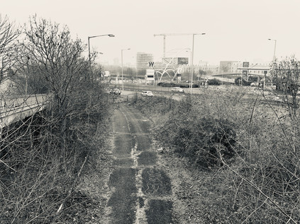
Plans to extend the Northern Line have never fared well, and the interruption posed by World War Two cancelled many of the projects in the New Works Programme which would have seen these northern suburbs better served by the underground, largely by integrating the Edgware, Highgate and London railway into the system. This railway, authorised by act of parliament in 1862, carved an ambitious and costly path into the Middlesex suburbs which were growing over the hills and valleys north of London via audacious tunnels, viaducts and embankments. It also filled a marked gap in the growing Underground map. While the former Palace Gates line is a better-known casualty of post-war austerity, now the Parkland Walk, a further scheme was also cancelled. Currently, some Northern Line trains don't make the awkward curve east towards High Barnet, continuing instead to the rather lowly single-platform terminus at Mill Hill East. Historically, High Barnet was the branch line and this, the mainline, originally reached Edgware by way of the route which passed under the A1 here. The line was near ready for conversion to Electric operation by Northern Line trains when hostilities curtailed the plan. Parts of the route still appear walkable while much has succumbed to encroaching development, but this section of the line's course survived to serve again, becoming the temporary terminus of the M1. Built piecemeal over the course of the 1970s, the route of the motorway into London was a bewilderingly challenging project, the final course of which depended on the plans for the Ringways and the complexities of squeezing a major road into the narrow channel through the hilly edges of the suburbs in which the Midland Mainline already ran. For a time while the politics and practicalities of motorways into urban London were evolving, a temporary terminus was constructed swinging traffic east to join the A1 here, just north of Fiveways Junction. Looking down on the abandoned sliproad, last officially part of the M1 in 1977 when the final section to Staples Corner opened, I was amazed to see a fairly intact road surface and mossy but extant metal crash-barriers below. In fact, the route saw a third incarnation when, following the IRA bomb at Staples Corner in 1992, it was resurfaced and pressed back into use as a terminus for the motorway once again. Maintained as a strategic priority until the early part of the 21st century, the road was now beginning to return to nature once again. A footbridge zig-zagged over the curve as it began its ascent to rejoin the A1, and at the end of the ramp I found a spot where I could scramble over a patch of wet grass to stand on the surface, exit blocked by locked barriers and huge concrete blocks, while the traffic on the A1 unsuspectingly sluiced surface-water towards me. I pondered this tiny rediscovery as I picked my way back to the footpath: my walks were often overtaken by these fragments of microhistory which, taken in isolation, seemed inconsequential. But I found a strange solace in standing on this rather heroic bit of infrastructure which had returned and returned again to serve the ever-evolving transport needs of the capital.
I negotiated the grim, clattering flyovers of Fiveways quickly but was careful to note the group of cast lions standing atop pillars around the junction. David Annand's sculptures, commissioned by the Highways Agency as a foil to the unrelenting noise and inconvenience of the frequently traffic-snarled junction, delighted in the punning title 'Civic Pride'. I ascended a bleak, narrow sliproad to join the traffic braking hard to readjust to urban conditions at the end of a higher-speed trip along the M1, my route rather suddenly changing pace too, and reverting to life as a rather quiet arterial route. Like all approaches to London, the road was flanked with large, mid-century villas which were now forlornly marooned alongside six lanes of traffic, and I trudged through a persistent drizzle along the dusty service roads which was all the separated these homes from the bursts of traffic emitted by the junction. At least the steady mizzle of precipitation kept the dust down. The road banked downhill, navigating its way into the confluence of the Dollis and Mutton Brooks below. The terrain here felt comfortably familiar - I'd previously crossed the route at Finchley Lane, and stalked the course of the Dollis Brook along the valley floor. I knew I was closing in on the North Circular near a point where the walk I'd taken there had begun to feel impossibly long and debilitating. The junction, where Great North Way folded into the North Circular as Falloden Way, was a complex entanglement of traffic signals and lane choices. Traffic approaching it fenced and jostled for position in the correct channel, space was contested and fractious. My irritability with the surroundings was rising too and I felt like I was picking up something of the road's temperament, but I resolved to stick to the tarmac and not use the path along the Mutton Brook as I had on a previous crossing of the valley. This would also allow me to get a look at the impressive frontage of the Finchley United Synagogue. Approaching the building, several things were apparent: firstly that security was very tight - yellow jackets and headsets teemed around the entrances and escorted departing worshippers to their cars. Also, the facade of the building was so impressive that I needed an angle on it. I crossed to the grassy triangle of Charter Green and turned to frame the building in my camera. The vast finned shield gleaming in the grey morning like a huge radiator, pairing with the defiantly lofty sword of La Délivrance, Guillaume's wartime sculpture purchased by Lord Rothermere and insistently sited here to enable him to see it when driving to his mother's home. The moment I clicked the button, the yellow jackets were triggered. As I turned to walk away, they shouted after me and heavy footfalls could be heard. A small group of them joined what was to be a short and low-speed pursuit as I figured that engaging was going to be the better outcome here. They caught up with me on the green and a couple passed by to ensure I was fully encircled. The leader stepped forward, a stocky but well-spoken young man bedecked with badges of authority and communications technology. "Do you know what the building is?" - I agreed I did - "So why did you take a picture of it? Can I see your camera?". I sighed - this all felt predictable and I dreaded writing of it. These challenges by extra-jurisdictional hi-vis have become all too common and are generously over-written. Anyone who dares to walk outside a set of unspoken but apparently acceptable routes will suffer such events at some point. I railed at the thought of having to describe this here, throwing myself open to derision for my hackneyed, privileged white-guy psychogeography yet again. But, however much I bristled the rule is to stay polite and firm - and I did. I first spelt out the deal - yes, they could see my camera so long as we agreed they couldn't remove it from me, handle it or attempt to delete any of the images I'd taken. Also, that despite their well-executed encirclement they had no power to hinder or detain me. A little taken aback by the well-practiced nature of the delivery I suspect, the young ringleader agreed readily - as keen to end the debacle as I. I showed them my litany of dullness: grim shots of a litter-strewn Dollis Brook, crumbling concrete stairs to nowhere, gantry signs above a rain-gleaming roadway. He looked confused but satisfied I was no risk, or at least not to the Synagogue. The yellow jackets relaxed at his relief, hands returned to pockets. They scanned the green for more pressing matters while their leader wrapped things up here. "I'm sorry sir, you'll understand why things are like this just now?". I agreed I did, and that I too was sorry that he needed to apologise for this here, now in Britain. We talked a little more - about how they'd seen protests from both the far-left and far-right, and how the temper of the debate was changing, getting edgier and more directly anti-semitic. We parted on good terms, and he returned to guard the synagogue. That last phrase is something I still find myself surprised and saddened to be writing in 2019.
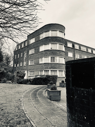
Beyond this encounter the road felt muted and strange. After forking from the North Circular and curving south and east, it also seemed quieter and somewhat less important. This peeling away of traffic as the road crosses significant routes was a feature of London's radials which I'd forgotten until now. Slowly, even the greatest roads towards the City dwindle, and the A1 appeared to have lost a good deal of its strategic heft back at Henly's Corner. Now, the road hugged the valley of the Mutton Brook which wound back and forth under it, occasionally evident beneath a tangle of greenery before it disappeared into Northway Gardens. This stretch of road dated from the First World War, and was built to serve an extension to the model cul-de-sacs of Hampstead Garden Suburb which hugged the contours of Highgate Hill. Founded by Dame Henrietta Barnett who had, with her husband Samuel, also masterminded the Whitechapel Art Gallery and Toynbee Hall, the suburb took its cue from the beginnings of the Garden City movement. The suburb was to be an egalitarian enterprise, providing dwellings for all classes of person in detached houses with gardens. There were to be hedges rather than walls, and the streets would be broad and tree-lined with a much lower density than was then common, even in the suburbs. The homes to the south of the road were fine, cottage-like and attractive - and it's no wonder that the area continued to feature a number of celebrities among its freeholders. To the north of the road, the houses were a little less elaborate and more prosaic, but the magical effect of the suburb seemed to linger over them too. I wandered into the Co-op on busy Market Place and shared my concerns about the poor quality bananas with an elderly but spirited German woman who seemed less inclined than I to let this pass unremarked to the manager. Back out on the road, I ate while I walked, mindful of the time and the challenging distance ahead. I was curious to stray south towards Sir Edwin Lutyens' Central Square with its two churches and impressive school buildings, but that was for another walk. One which might equally stray along The Bishops Avenue which crossed my route nearby. Part of a cluster of streets named for Arthur Winnington-Ingram, one-time Bishop of London and prolific local landowner, this street has become an almost ludicrous proposition: sometimes regarded as the most exclusive street in London, it winds south from East Finchley towards Hampstead Heath and is lined almost entirely by mansions. The list of owners read like an unlikely collision of mid-century British culture (Katie Boyle, Sir Billy Butlin, Gracie Fields) and flat-out crooks (Emil Savundra, Asil Nadir). Nowadays, the properties are in the hands of Sultans and Saudi royals, many of them maintained only as investments in the overboiling property market which London currently provides. They still launder money through this odd little enclave, but it's all above board nowadays. On the A1 though, no such lofty denizens were found - save perhaps for an infant Jerry Springer raised in the sweeping moderne blocks of Belvedere Court - and in fact I realised that I'd seen few people walking at all, even in this relatively pleasant suburban stretch. My route was fast closing in on the old road north - a route I'd crossed and recrossed on my earlier walks through Barnet, Whetstone and Finchley - and now I met it at a dour, choked gyratory where the terraced houses ended in an abrupt demolition plot. The rest of the terrace had long since been cleared for the new road's progress exposing, the internal geometries of the chimneys to Bakers Lane. Here I turned south again, back onto the original route of the Great North Road into London.
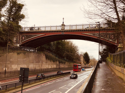
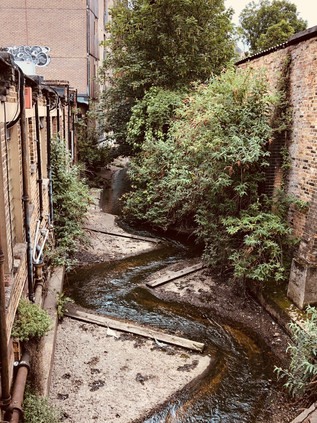
For a brief stretch the road felt familiar - I'd blundered unexpectedly into Highgate once before when navigating between the north and south sections of the Parkland Walk, and then - as now - it was a shock of bustle and pedestrian activity. I jostled with small groups of other human beings at the street crossings, narrowly avoiding properly equipped cyclists in their expensive an unforgivingly tight kit. It's fair to say that I'd hardly strayed from relatively affluent areas of North London on this route, but this felt much more ostentatious. For a while at least, the focus shifted from the grey asphalt strip which had defined the walk to the smells of tiny delis and the chatter of young people outside stores. I was glad to be able to gaze down from the path onto the roof of the decaying surface-level railway station which had once graced the Northern Heights line. Its quiet repose beside this busy street was comforting, and the temptation to plunge into the trees and enjoy the walk along the leafy chasm left by the ghost railway was very strong. Instead, I left Highgate behind, heading south along the deepening cutting of the former turnpike built to avoid the steep hill and originally proposed as a tunnel by engineer Robert Vaizie in 1808. In 1812 the tunnel workings collapsed and it was left to John Nash, the darling of Regent's Park and its Regency terraces, to rescue the project with a brick viaduct above the deep chasm which gave the area the name Archway. Replaced with an elegant cast iron bridge carrying Hornsey Lane in 1893, the crossing still defines the landscape: as the road dipped to pass through the geological outcrop of the Northern Heights, the towers of the city were framed by the flanks of the cutting with the ornate bridge above bearing the arms of Middlesex. London shimmered through the window of the bridge, cloaked in a grey mist with a rosy cloud drifting across an attempt at an early sunset. It was hard not to be awed by the idea of blasting this culvert through the side of a mighty and ancient hill. The hazy view of London in the middle distance brought to mind the legend of Dick Whittington, turning again from these heights to return to London, taking up the office of Lord Mayor three times. The area has subsequently adopted Whittington as its genius loci with a modern hospital bearing his name climbing a substantial way along Highgate Hill. The real Whittington had a more prosaic ascent, and one not so unusual to modern audiences - having never truly been a poor man, he came to the City to turn his hand to trade and then to more lucrative money lending. He gained favour by making loans to King Richard II, and was directly installed as Lord Mayor upon the death of Adam Bamme in 1397. The Crown had previously seized the lands of the City due to misgovernment, and an early act by Whittington was to regain these lands for the huge sum of £10,000. Richard II's deposition and the subsequent reigns of Henry IV and Henry V did little to affect his good standing, and he brought surprisingly modern changes to the medieval City, including facilities for unmarried mothers and a vast public convenience known as Whittington's Longhouse. On his death his generous gifts assured him a place in the memory of London, allowing the building of a library at The Guildhall, extensive rebuilding of Newgate Prison and repair of the crumbling St. Bartholomew's Hospital.
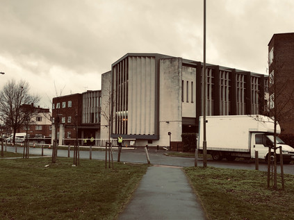
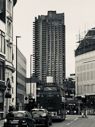
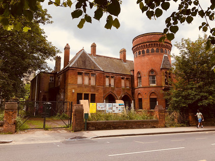
The Turnpike rejoined the old route north at the foot of Highgate Hill where a predecessor of the Whittington Hospital still broods on a corner site. The Holborn Union Infirmary opened in 1879, providing separate accommodation for Male and Female patients in an imposing yellow brick neo-gothic building with tall wings to the north and south. By 1895 the site had already been extended, a pattern which would follow throughout the twentieth century as local need grew and treatment evolved: at some point, glass verandah were added to the south-facing walls of all blocks to allow tuberculosis patients access to sunlight and fresh air. In 1944 the hospital merged with the nearby St. Mary's Hospital and Highgate Hospital to become the Archway wing of the new Whittington Hospital. It remained part of the new NHS until 1980 when functions were centralised on the current Whittington site. The building fell into decay until it was jointly purchased by UCL and the University of Middlesex in 1998 to provide a new campus for health and professional studies. Now it was again abandoned and boarded up: a Victorian imposition in the ever-modernising whirl of Archway. The forlorn, somewhat forbidding building is part future movie set, part sad hanger-on from what the locals will tell you were better times. It's harder to picture this rose-tinted past from the perspective of arrival via the A1 which was once a far less pleasant experience. Nowadays, the newly regenerated and partially gentrified Archway bustles and crackles with activity. The once dominant road network which marooned the area in the midst of a churn of impenetrable traffic has been defanged by closing a section of the gyratory. Instead, a paved market area leads through the centre of the pattern of old streets which pre-date the motor car. Outside a branch of Starbucks, a wedding party was being photographed in their finery, holding freshly brewed drinks. I must have looked askance, as an onlooker leaned over to confide "It's OK, they work there. It's where they met". I suspect I hadn't been the first disapproving passer-by in a street where pleasant, independent businesses rubbed shoulders with multinational mainstays. My last visit here had been in the early 1990s and plainly put, Archway had been a traffic-choked, grimy dump at the time. We'd played a gig at a pub more used to Country and Western acts on Junction Road, promoted by a wiry old Fields of the Nephilim fan with the unlikely moniker of 'Slim Chance'. To a country boy - Somerset via Worcestershire - the pavements had reeked of unfamiliar cuisine and the area radiated menace. It was perhaps my third trip to London, and first out of the western edges and into these cosmopolitan northern districts. Even setting aside my novice status, it was hard to see why the Archway of the late 20th century could be a nostalgic time or place for anyone who'd lived here. Not least because of the presence of the baleful gravestone of Archway Tower - a darkened tooth which seemed to overshadow their memories and anchor the zone in that era of bad politics and worse dental health.
The tower was completed in 1963 by Oscar Garry and Partners, providing seventeen storeys of office accommodation for government departments, financially advantageous by being well outside the central area, but still eminently accessible by Tube with Northern Line station in the basement. By 1967, via a process of selling-off and leasing back, it provided offices for the then Department of Health and Social Security, which remained on two floors near the top of the building until 1994, a little after our awkward gig just along the Junction Road. For almost all of its existence, it has been despised by most locals and those passing artists and musicians who often decamped here from points north on their journey towards fame or infamy. The ground around the tower swirled will ill-winds, caused by pressure differentials around the stark sides of the building, and the rite of passage of attending a dehumanising interview in the building to obtain benefits seems to have been amplified in horror by the looming fabric of the tower. As buildings go, it doesn't appear an especially terrible one - but it is perhaps hard to love because of its imposition on the low-rise suburbia around it. Archway developed slowly in the 19th century as the slums of Somers Town and Camden were cleared and railways threaded into the city, and the terraces of London Brick which gradually filled the lower flanks of Highgate Hill weren't built to bear this overshadowing behemoth, clad for much of its working life in gloomy black marble. My own memory returns as I catch sight of the glowing blue of the station sign beneath the tower: walking up Junction Road into an eddy of people and traffic, dodging beggars and drunks who were haphazardly tottering away from the tower as if repelled by its magnetism. We paused at the station entrance to meet a friend of one of our party arriving from a long trip in from Sheffield. She was late, the single working escalator disgorged endless passengers, but never her. Finally, her knitted hat peeked over the emerging steps, shoulders hunched against the city, looking small and a little terrified at the prospect of Archway being slowly revealed to her as she rose. My friend threw himself onto the filthy cigarette-strewn pavement in relief at her arrival, oblivious to the ominous dark stains creeping from the walls. Above us, with no light left to reflect from it, the building disappeared entirely into the darkening night sky. It appeared to me rather like the object on the cover of Led Zeppelin's 'Presence' - an ill-defined and inert but obviously sinister absence of a thing.
The tower lay empty for some years while rumours of demolition and gentrification competed for column inches in the local press. No-one agreed on the right course of action - and everything was unfunded and impossibly hard to accomplish while Archway was essentially a huge island in the strategic road network. The local eyesore was, however, a rallying point for the discussion about what Archway could become. In 2012 an art installation by Ruth Ewan used technology to present a live view of the Island site without the tower. It was memorialised in a booklet of reminiscences called How to Make Archway Tower Disappear which included the stories of workers from the DSS office, musicians, artists and local residents. Among them, the comments of local MP Jeremy Corbyn stand out: for him, the tower was a deliberate brutality wrought on the poor - both those employed by the state and the unemployed who plead their cases to them. He fuses form with function, seeing the Tower's rather unremarkable 1960s vernacular as an assault on an older London. A pre-welfare state London which was surely less fair and more precarious to live in perhaps? The non-committal nature of his localism stretches into the current political unravelling, and the question remains where are any of us, actually from? There's no plan in all this - just an appeal to an impossible, distant past on all sides. Apparently the most remarkable aspect of the tower was the view across London in every direction from the upper floors:
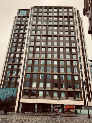
There are some nice parts of London You can see them from hereThe site was finally redeveloped and rebranded as Vantage Point in 2016 and today is clad in neutral tones, fading into the winter skies and only reflecting a little light back from carefully tinted window panes. The slab-like visage to the north and south is mute and softened by the cladding and it begs to be ignored as an unremarkable residential block. It is still, by far, the tallest building for some way around, despite competition from its contemporary 1970s neighbour, Hill House which now shimmers in mirrored glass, bouncing light onto the new pedestrian area outside the utilitarian, stocky brick Post Office. Whether it was the opposing wind channelling along the new market square or the magnetic force of the monolithic building, it was hard to escape the drag of the Tower. I briefly considered a diversion to find the site of our musical endeavours along the street, but there was too little time, and while the sky was clearing to reveal a brightness ahead, the sun was fast sinking. I wanted to reach the city in the light so I headed on towards it, passing into the edges of Holloway.Saint Etienne, 'Archway People', 1993
The Great North Road has its very origins in Holloway with a new road opened by the Bishop of London, owner of much of the land around Highgate Hill, by 1318. This safer, straighter escape from the city laid the foundations of the direct route north which survives at least as far as Archway where newer alignments take over. Much else about Holloway is unclear - and while tempting to understand its name as a rural hollow-way, worn deeply into the ground by the cattle heading for Smithfield, it is as likely to be a reference to the Hallowed Way to pilgrimage at Walsingham. In either case, modern Holloway bore little relationship to either a via sancta or an ancient cattle track. The much-improved pavements were broad and busy, carrying steady traffic from the station at Upper Holloway to the Tesco Metro and Sainsbury's Local which fronted up to the curious brick missile silo of St. Gabriel of Our Lady of Sorrows. The area fizzed with energy largely due to the presence of residential accommodation for students which is strung between the Archway Campus of Central St. Martins and the dour, overhanging concrete tower of London Metropolitan University. In the midst of this was Emirates Stadium, home to Arsenal and on any other Saturday, a little over 60,000 of their devout. Today, the team was across town, playing at West Ham's London Stadium in the midst of the Olympic Park. The eateries and pubs of Holloway were busy, but not overwhelmed and I longed to step in and rest in the increasingly fancy looking premises as I headed south and deeper into Inner London. I crossed a rubicon at Nag's Head - I'd passed through before, both on an excursion along the A503 to distant Wanstead and when I was heading back from an attempt on the North Circular. As such it felt like a boundary to a known London. A string of local businesses and familiar bookmarkers signs clustered alongside pound shops and takeaways, hugging the crossroads. It felt almost comfortingly typical - like I was home in a semi-suburban London I knew better. Beyond here, though I'd not walked much of the remaining route, I knew I was within the range of buses and trains which would get me back to somewhere near where I needed to be. My range anxiety melted away, and it became clear that it was perhaps the presence of slight frisson, a mild fear of the unknown which had kept my feet moving thus far. I felt heavy and tired, the remaining distance weighing on me as the road dwindled into a less important link between the City and the suburbs. It felt like the A1 was giving up on me, rather than the reverse. At Highbury Corner I felt myself pass through another shockwave of the nearing city - the station pulsed with activity, the population diversifying and the volume increasing. This felt like the London I'd known from my earliest visits. The darkness of Archway couldn't penetrate this far, the Tower was gone from my view now.
The pace accelerated, the city drew me in. Soon I was on Upper Street, with memories of snatched meals and happy reconvening after days spent walking. On Islington Green, Sir Hugh Myddleton stood guard, the remnants of his New River trickling underground now, streets away. Traffic careered around the junction and I realised what a destination in its own right this little corner had become. Shoppers filled the pavements, spilling into the road and precipitating attacks of honking as they blundered back onto the kerb. Despite the usually glum retail prospects for January, there were plenty of store-branded bags in evidence. Islington was fully gentrified, at odds with its radical associations and celebrated position as a centre of political influence. The seagulls, in particular, benefited hugely from the footfall, pecking at discarded scraps and strutting along the edge of the raised pavement. Since the 1960s the area has been dragging itself slowly up - terraces rejuvenated by middle-class owner-occupiers, cracked panes exchanged for CND stickers and wind-chimes on the porch. The district is home to a very specifically London kind of left-wing thought: intellectual rather than spiritual, honed in academia, hard to pin down and utterly dependent on the success of capitalism for its continued existence. This is where people voted to remain in the EU and can't for the life of them see why anyone wouldn't. This is where injustice is felt acutely and argued against loudly, but is often genuinely experienced just streets away with stoic silence. But, a kind of centrism which appals the true believers on both wings has its shameful heart on the sleeve of Islington. It's no surprise that the Blairs settled here on their journey to Downing Street. The people of Islington can win - or lose - elections for parties. These people hold the precarious balance of the Europe question, the next General Election, and probably the Bake Off final in their digits. In Britain, you always have to win the middle or lose the game. Jeremy Corbyn is duty bound to relentlessly play up his ascetic 'Good Life' credentials to continue living in the heart of the increasingly well-off, gentrifying Borough. There was, however, little sign of anti-capitalism today as Upper Street vibrated to the chirp of chip-and-pin transactions and steamed in the fragrance of chain restaurants. I pressed on, passing the Angel and crossing City Road. I was in very familiar territory now - inside the loop of the 205 bus route - but there were surprises still to be found. I'd never walked along the northern part Goswell Road - always preferring Bunhill Row or Whitecross Street to enter the City from the north with a nod to either George Gissing or William Blake. Suddenly, rearing above me like a chequerboard slab was Turnpike House. The entrance was via an elegant bow-like arch at the foot of the block, with tantalising hints of green space beyond. For the second time on this walk I thought of Saint Etienne. My appreciation of their work had begun early, with a crop of vital, life-affirmingly retrospective pop anthems which emerged in the 1990s. But we drifted apart: I found my niche in noisy low-fidelity art rock, and they strayed alarmingly into club territory. Worlds would occasionally collide in the following years with a snatched hearing of a new single or an appreciative glance at the ever glamorous Sarah Cracknell on TV, but I imagined that my London of grimy concrete and semi-industrial suburbs would never again align with their West End swagger and black-and-white movie chic. Then, almost a decade after I'd first heard them, a new side of Saint Etienne began to emerge: lyrics which read like Louis Macneice poems full of North Circular kitchen-sink drama, odes to suburbia, even a brace of films about London. The first of these Finisterre arrived in 2002, directed by Paul Kelly and scored by the band with a gritty, sometimes rather angular sounding electronic pulse. It was a hymn to the London of the early 21st century, but it drew unashamedly on the documentary films of the past, nodding knowingly at The London Nobody Knows along with the work of Patrick Keiller. The second film, What Have You Done Today, Mervyn Day? toured the site of the future Olympicopolis on those two fateful days in 2005: the announcement of the 2012 games coming to town, and the terrorist attacks on 7th July. Between these two anchors, Tales From Turnpike House was released. A gleefully London-themed pop opera of an album with a cast of almost depressingly real characters languishing, living and loving in an alienating, modern city. Bob Stanley and Pete Wiggs, unashamed Londonphiles and historians of the urban speculated that their Turnpike House would be somewhere in Croydon, on the fringe of London - but the clues were there: the architecture and alignment of the building was perfect, and The Birdman of EC1 lived in just the right postcode district.
I paused for a while here, enjoying the modern sweep of the arch under the building - a shallow portal into the greenery beyond while the grid of flats began to light up in a cryptic coded pattern as residents arrived home. The block marked the edge of the City of London, an alternative portal to replace the former Aldersgate which would have given entrance to The Barbican. Now the three concrete towers of the Chamberlain Powell and Bon designed complex: Cromwell, Lauderdale and Shakespeare, aligned across my route in silhouette against the pale red of the sunset. Their jagged shadows adumbrated on the light I'd been walking towards all day. Aldersgate, spanning the Great North Road, was recorded as early as 1395 when the Lord Mayor's sword-bearer was gifted the mansion above the gate. It was rebuilt in 1617 and repaired after the Great Fire before finally being demolished in 1761. Now the ancient way was flanked by modern, anodyne commercial facades which were dark and quiet on a weekend afternoon. It wasn't always this way, and the street has more than a hint of the supernatural about it: here the Bishops of London were housed to shorten their journey from Fulham Palace to St. Paul's Cathedral, and in 1738 John Wesley underwent his profound religious experience and conversion to Methodism as recorded in The Aldersgate Flame, a sculpture sited nearby. Naturally, not all such experiences were what they seemed and in 1554 Elizabeth Crofts, a serving girl, was hidden in the wall of a house on Aldersgate Street, her disembodied 'heavenly voice' giving dire warnings about the consequences of the marriage of Catholic Queen Mary I to Prince Phillip of Spain. A crowd of around 17,000 attended over the following day to listen before the wall was demolished and Crofts discovered as its source. This final stretch - along the former Pickax Street - was hard on the feet, but was a strangely uplifting walk: a trip I hadn't dared to think would take place had led me along a route which had been unexpectedly compelling. I trudged through the low-rise blocks of the Golden Lane Estate, and circumnavigated the brick rotunda of The Museum of London which posed as a non-descript traffic island, from some angles at least. The dome of St. Pauls was looming between the crystalline reflections of the Barbican in the fascia of Cheapside offices which hid the little church of St. Vedast. The tourists lingered, aiming for a final shot of Paul's Cross in the golden hour, the sky a fine orange band behind the stark white ashlar of the building. I didn't really know where the A1 ended - or indeed began - but it couldn't go any further than the end of New Change where it met Cannon Street. I turned the corner to mark and ending at the point where I'd contemplated the possible loss of these walks back in December, in front of the Phoenix on the south door.
After lingering in the Cathedral precincts for a while, watching tourists wrapped up in winter gear framing their perfect selfies against an unforgivingly blank sky, I summoned the effort to trudge a little further, to Ludgate Circus and a familiar old coffee stop. Resting my feet there in the quiet, surrounded by students flicking at 'phone screens and staff gossiping about other crew-members, I reflected on today's walk - and on the optimistic chance that I'd be able to continue these walks despite my concerns at the end of the year. There was much to consider - new twists in my own tale to work into the coming months - but having broken ground on a new project, one which would see walking challenging miles in sometimes inhospitably non-pedestrian zones felt good. As ever, I agonised over the rules I'd impose on myself: I'd walked the 'modern' route of the A1 after all, not the ancient Great North Road - had I already invalidated my own plans? Or perhaps that walk, through the ancient villages of Middlesex, was a different walk again. At least, for now, it felt good to be contemplating the continuation of these trips.
A gallery of images from the walk is here.
Risings on the Commons: A walk in the South Eastern quarter
Posted in London on Saturday 2nd June 2018 at 10:06pm
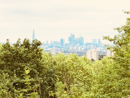
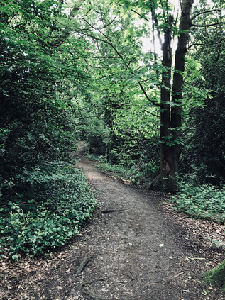
A sweaty clamber up from Honor Oak Park brought me to the top of One Tree Hill, and as the curtain of summer foliage parted Central London unravelled before me. Since the beginning of the ascent from the roadside near St. Augustine's Church I'd been mostly alone - with just glimpses of dog walkers through the trees - and I was glad. Already drenched and with eyes streaming with allergen-sponsored tears, I felt like a mess - and certainly not suitable for public viewing. The tree-framed window through which London was visible swayed hazily at its edges - perhaps the view would have been more expansive in Autumn, but for now I was content to look on a shimmering city of cranes and towers which rose in the middle distance. London abstracted - no visible sign of the chimerism of inequality or the growing concern about violent crime amongst young people which seemed to be the dominant narrative now. This was an unreal city which, from these southern slopes at least, appeared to be a painted backdrop. I'd meant to come to One Tree Hill for a long time - intrigued by the name, and directed here again by a recent episode of the excellent London's Peaks podcast, I'd finally found the route to fit the urge. My recent walks had occupied me in the south-eastern corner of London, which while something of a diversion, was not unprecedented. This fringe territory where endless suburbs blur into the edges of provincial, unreconstructed Kent had interested me for a long time and the views east from the Thames foreshore were always a draw. So, I'd scored a hasty and uneven line roughly north-easterly along the map - connecting One Tree Hill with my recent travels and roughly approximating the tangled and somewhat unloved Green Chain through South London. The day stretched ahead of me, sweaty and pollen-flecked. It was time to set off...
Before I left One Tree Hill I wandered the top of this significant peak, circling the concrete base of a First World War gun emplacement which sat at the summit to counter zeppelin raids. Sometimes more prosaically known as Honor Oak Hill, the hilltop has been strategically significant for some time, with an East India Company semaphore station established here in the eighteenth century, and the provision of a warning beacon during the Napoleonic Wars. The single tree after which it is named is known as the Honor Oak - where legend has it that Queen Elizabeth rested on her journey to Lewisham, and for centuries a marker of the southern extent of the Honour of Gloucester. This vast feudal estate comprised 279 manors by 1166 when the tree would have been situated in the midst of the still impressive extent of the Great North Wood. The hill later passed to the ownership of the Abbots of Bermondsey before the Dissolution of the Monasteries put paid to their tenure too. The slopes then took on a largely unremarkable existence, with little attention paid to their frequent but informal recreational use until 1896 when the local golf club attempted to enclose the land with a six-foot high fence to deter the locals. The formation of the Honor Hill Protest Committee - including numerous local dignitaries - soon followed, with the aim of protecting the public right of way to walk on the hill. The interminable administrative process of dealing with numerous landowners and vestries threatened to drag on for far too long for a number of local folk who on 10th October 1897 broke down the fence and stormed the hill. A reported crowd of 15,000 dispersed peacefully after singing 'Rule Britannia' at the summit. A week later with ranks swelled to over 50,000 the mob was more unruly, with stone-throwing and fire-setting taking place. Ten were arrested for trespass and fined or imprisoned which appeared to successfully quell these guerilla tactics. However, the protest continued through more ponderous legal channels, not finally being resolved until 1905 when the recently formed Borough of Camberwell purchased the land. The view - once claimed by Sir John Betjeman to be "As a prospect [...] better than that from Parliament Hill on Hampstead Heath" remains impressive - and with this last outcrop of the range of hills which climb steadily from Croydon being visible from some distance, it is no suprise that it has attracted a mythology - from Boudicca's last defeat to Dick Turpin's look-out.
I skirted the foot of the hill via the woodland path which wound between the trees, shadowing Brenchley Gardens. This broad, curving road sat on the embankment of the former railway branchline to Crystal Palace which I'd encountered previously on the South Circular. Beyond the railway alignment in in an unlikely symbiosis, the vast underground Honor Oak reservoir was covered by the well-kept greens of the Aquarius Golf Club. Glimpses of the view across the Thames filtered between the buildings as I followed the road to the gates of Camberwell New Cemetery. I passed the through imposing white-painted gateway and walked the ceremonial route towards the Mortuary Chapel - a rather traditional ecclesiastical-looking building by Sir Aston Webb and his son, Maurice which opened with the cemetery in 1927. A path took me towards the more impressive Crematorium by Maurice Webb working alone which was built in 1939 in a modern style with a fine square tower and stained glass window. While the bereaved rolled up to refresh flowers and tend graves, it felt strange and perhaps wrong to photograph this building, but there was a curious life and buzz about the place which prevented it becoming entirely macabre, assisted by the fact that the paths of the cemetery were surprisingly well used by those heading for the nearby recreation ground in football colours for a junior match of some apparent importance. This corner of London - not quite Forest Hill, not quite Peckham - is a strange city of the dead with the former boroughs of Camberwell and Lewisham both locating their respective Necropolis on the line dividing their turf. The tracks of the railway lines to Brighton parallel the old administrative boundary, occupying the former route of the ill-fated Croydon Canal, and I crossed their deep cutting via a slightly forbidding footbridge and entered the often overlooked village centre of Crofton Park. This suburb on the site of the original hamlet of Brockley largely exists only because of its own small and somewhat unloved station on the lines into Blackfriars. Near the station, the Rivoli Ballroom stands resolute - the last extant example of the opulent and somewhat kitsch dancehalls which would have graced almost every suburban High Road in the mid 20th century. My route continued east via the long curving route of Brockley Grove, a pleasant street of decent houses which faced the tall, swaying uncut grass of Brockley and Ladywell Cemetery. Formerly separated by a wall, these two burial grounds opened within a month of each other in 1858 as Deptford and Lewisham Cemeteries respectively, and didn't finally become a single cemetery until 1948. Given their proximity to the Naval Yards of Depford, both feature a number of nautical burials, not least that of William Rivers who was killed by 'falling from the maintop of HMS Sapphire at Hobart Town on November 5th 1877 aged 19'. Now the wall separating the two sites had fallen, and both had returned to nature to a great extent - but at the Ladywell end a rather grand iron gate still worked hard to outshine its neighbour.
Stately Brockley Grove dissolved into Ladywell Road and once again I crossed one of the imperceptible lines which divide South London communities. The road began a gradual descent into the valley of the Ravensbourne via a ladder of terraced streets leading south, all given clumsy-sounding compound names to honour the Victorian builder's sizeable flock of children: Elsiemaud, Amyruth, Arthurdon and so on passed by as I trudged towards the much-gentrified centre of Ladywell. I quickly recognised the pleasant little village around the railway station from a previous walk, but I hadn't noted during that riparian approach just how jarring the transition was from a proud but struggling mainly black neighbourhood into the resolutely white hipster-magnets of the bakeries and taverns which clustered around the bridge. Beneath the road, the River Ravensbourne gurgled in its concrete prison while the heat which was now beating down on the tarmac made the cool flow of even this beleaguered watercourse seem oddly attractive. I moved onward, descending from the bridge and soon leaving Ladywell to enter the hinterlands of Lewisham. I hadn't originally intended to head this way - my plans suggested a route further to the south, even perhaps rewinding part of my perambulation around the South Circular - which felt less than edifying today. But the need to find a drink had driven me towards civilisation which was perhaps no bad thing. The route also led me past the remarkable Ladywell Bathhouse. More lately known as the 'Playtower' this remarkable survival of a 19th century swimming pool and bathing facility is part of a cluster of former civic buildings beside the Police Station and Mortuary buidlings. Erected in 1884, and designed in part by the local architect Thomas Aldwinkle, the building was remarked on by the Kentish Mercury as 'quite an ornament to the neighbourhood, standing in striking contrast to the ancient church behind it. The building has a remarkable local history - having hosted record-breaking swimming champions, political meetings, Olympic standard gymnasts and finally a play centre until final closure in 2004. Since then the building has decayed and suffered arson attacks - to the extent that it was named one of the ten most at risk buildings by the Victorian Society in 2015. Boarded up and abandoned, the building awaits its fate - which more optimistically appears to be conversion to a Curzon cinema sometime soon.
After the rather quiet civic island on the outskirts of town, the sudden rush of Lewisham High Street was something of a shock. Traffic pulsed through the lights, and I tried to plan my next move while navigating the busy pavement. People stood around outside shops as if stunned by the sudden heat, and I slalomed around them in an attempt to find somewhere to stock up on liquids before taking on the steeper hills later in the walk. My initial plan of dashing across the street and back into the suburbs was soon abandoned - this stretch of High Street had little to offer and I was forced to head for the centre of town. The skyline was a broad frieze of blue sky and tall cranes - the same knot of new buildings I'd seen from the river on an earlier visit. Close up the new developments were uninspiring and formulaic: stacked geometries of primary colours and too-clever angles. Names were to be assumed by interpretation from some ancient use of the ground on which these new buildings sprouted, resulting in a proliferation of granaries, mills, stables and the like. A little way to the north, the High Street divided around the gloomy brick stacks of the former Riverdale Centre. Dating from 1977 this surprisingly large shopping centre is due for an upgrade soon, and in some ways is remarkable in retaining considerable footfall despite new developments nearby which have effectively killed-off similar centres around the capital. That said, the offer here was in the mid-to-lower sector of the market which was echoed in the drab facades of the clearly struggling High Street which glowered across at the centre. Between the run of bus stands and the stores, a steel band belted out music to a heat-subdued crowd which nodded and shuddered lazily to the irrepressible clamour. I swerved onward, finding myself at the unprepossessing corner of Lee High Street. A wall of buses waited to turn the corner, and I wondered if I'd made the right choice of walk today. The sun had dipped behind low cloud and the air had become a sticky, fume-laden soup which coated the inside of my dry mouth unpleasantly. I withdrew cash but couldn't find anywhere to spend it - Lewisham had almost defeated me. It remained an overheated and frustrating mystery - and just as confusing and unwelcoming as it had felt on my previous brief passes through the territory. Perversely, I wanted to understand the place even more as a result. The road ahead - the A20 - which was still somewhat anachronistically signposed 'Channel Tunnel' swiftly became a typical London escape-route which could be at any corner of the compass with the ubiquitous ranks of hair salons and kebab shops tumbling along both sides. Preparing for a dull stretch of walking, I glanced along the oblique junction with Clarendon Rise and was stunned out of my mental grumbling. Firstly, a beautiful Hindu temple stood rather surprising among the garages and back-entrances, set a little back from the road and in a tight, corner site. The decorative plaster front dripped with carvings and reliefs, the gable divided by an impressive stacked tower which glinted above its drab surroundings. At ground level beside the temple a faded blue railing signified water. I've come to know these tell-tale gaps in the streetscape well and always investigate them for potential brooks and streams. Sure enough, trickling grimily below the road the Quaggy River snaked out from under Lewisham and headed east. This gave my walk something of a new energy - and I struck out with a little more effort than I'd managed on the last stretch.
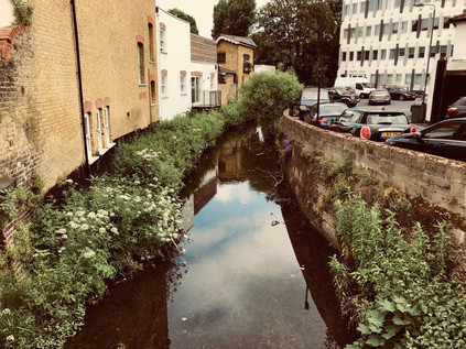
The Quaggy soon slipped out of site. Forming the boundary of back gardens and mediated by flood relief schemes, it is an anonymous river for much of its course. My own first encounter was years ago at Lewisham Station where it passed below the platform in an unremarkable concrete culvert helpfully accompanied by an Olympic-funded information board. Here though it was still cocooned, but it felt wilder and intruded somewhat more on its surroundings. The land dipped towards its shallow valley, and the street patterns followed its torturous curves. The Quaggy was still making its mark it seemed. I pressed on via road, following the straighter route while the river looped lazily to the south. I could have deviated away from the road and headed for Manor Park, but I was confident I had the river in my sights again. Sure enough, as I poked around the outskirts of the Sainsbury's at Lee, the river again appeared passing under a nondescript bridge nearby. Its neighbours had built a platform to sit above the waters beside their business, and it was hard to tell if this was a slight on the apparent unimportance of the river or a genuine attempt to make the most of otherwise urban surroundings. Once I finally found my way into the store, I shopped swiftly and considered my options - I could try to approximate the route of the Quaggy, ending up at the South Circular a little further away than I'd hoped - or I could use it as a loose guide and strike out into the uncharted private avenues of the Cator Estate? I opted for the latter, disappearing into the leafy and primped Manor Way and soon feeling unpleasantly oppressed by the experience. Once past the gates and the rather disapproving glare of the red-brick gatehouses the road was straight and dull, lined on one side by ranks of pleasant and expensive looking homes while to the south the land fell away to become Blackheath Park on the banks of the Quaggy. Much of my walk through the estate of John Cator (who's other lands I'd encountered before) was spent worrying about finding an exit or being turned back to the start by an overeager security guard. In the event, the exit showed up first - after passing a little extension to the estate posed around an ornamental lake formed from what appeared to be the sometimes elusive Mid Kid Brook stream, a grim access path led away behind a block of untidy garages next to the less salubrious homes of Casterbridge Road. Here I noticed a phenomenon which had seemed at first unlikely but for which evidence was now harder to ignore: the endless parade of 'Saturday dads' walking or wheeling their children along the quiet afternoon roads. Across Lewisham and Ladywell I'd seen the same parade - a faintly depressing sense of resignation on the faces of the pushchair driving men while their offspring chattered excitedly or dozed in the heat. I sensed the frustration and defeat of many of them, among sometimes more hopeful scenes. Aware of my perhaps unfair assumptions, I took my spot in this parade and slalomed along a much-diverted path through a development zone bounded by view-defying temporary wooden fences covered in computer-generated scenes of urban paradise. I need not have worried about finding a way out - the proprietors of Kidbrooke Village really seemed to want me to head this way and to see all of their promotional material...
And so I found myself in one of the most uncanny zones of London I've experienced since those heady pre-2012 days in Stratford. Put simply, Kidbrooke Village didn't exist, despite the best efforts of Berkeley Homes to convince me it was here. This was the site of the Ferrier Estate. Constructed between 1967 and 1972 by the Greater London Council, when completed the estate consisted of nearly 2000 homes in eleven 12-storey prefabricated blocks and associated low-rise units linked by walkways. Perched on the edge of resolutely White British Greenwich the estate didn't fare well and became a convenient spot to manage demand for social accommodation by the flawed strategy of housing many families who were on the margins of the Borough's population on the same estates. A combination of sharply increased numbers of refugee families, a dizzying mix of languages and ethnicities and a policy of generally abandoning maintenance and improvements meant the fate of the estate was sealed. It was often mentioned in the same breath as the other two inconveniently troublesome South London 'hell holes': Heygate, Aylesbury, Ferrier. Only total erasure would exorcise these failures of policy - at least in the minds of those who had, in some cases presided over their construction. And so they fell, and thus by 2012 much of the old estate had gone and Kidbrooke Village had moved from a hazy, watercolour sketch on a drawing board to a concrete plan. Meanwhile the Ferrier residents were being scattered around the capital and beyond. Berkeley were going to do this differently, however - they'd build a community, not just houses. And so in the midst of the landscaped wetlands which may or may not be fed by the vestigial waters of the Kyd Brook, the 'Village Centre' squatted the corner of a modern block. Looking worryingly temporary in nature, the doors were closed today. Few people were around, and while I unenthusiastically downed an unripe banana, only a few more dads and a powered-wheelchair passed by. I located a waste bin - pristine and empty of course - and headed east towards the station. The parcel of vacant land between the railway and the village was being slowly filled in - a new academy and more housing were promised on the glossy hoardings surrounding the plot - and the road onward was lined with scaffolded blocks awaiting their final fit-out. It struck me here that Kidbrooke was no more - the station served the new village, but any sense of a historical Kidbrooke had been erased. The suburban hinterlands stretched away north - but the place had been bypassed twice already, and the focus had shifted south. I navigated the pedestrian subways under the confusing junction where the improved route of the A2 bucked and reared northwards towards London noting there was no indication of how far away Kidbrooke was on foot among the direction signs. In fact, this spot in the underpass may as well have been the real village centre - and indeed perhaps once was?
The footpath emerged from its cool, green tunnel at Kidbrooke Green Park. This parched lozenge of parkland bounded by the old and new routes of the A2 was scattered with sunbathers and dog walkers who didn't appear to regard their local bit of respite from the suburbs as a historically important scrap of ancient wetland at all. This remaining corner of the former village green is evidence of a set of historical compromises which could have led to a very different landscape hereabouts. Kidbrooke as a suburb is a recent development, having largely grown up along the route of Rochester Way - a bypass for Shooter's Hill which offered traffic a flatter, less taxing route out of London from the 1930s, slicing into the green in the process. The remains of the village green were then later proposed as the location of a vast interchange between the southern and eastern flanks of The C Ringway - the urban motorway which was to have connected the North Circular to a replacement for the South Circular. This road would then have turned east and scythed an utterly destructive course through South London's suburbs on a viaduct. Little of this road was built, but evidence of the extent of its impact can be seen in the strips of new development which fill in the once reserved motorway corridors which languished while the plan was debated by the GLC and the Boroughs. The complex twist in the A2 here also gives a clue as to how much would have been entirely obliterated by the South Cross Route as it ploughed west towards Brixton and Camberwell. The plans were not popular with the London Boroughs, and in particular were fought bitterly by Eltham and Greenwich, and despite a number of proposed concessions they were finally buried with the remains of the inner Ringway plans by 1973. The people of Kidbrooke likely have the residents of Blackheath to thank for this, as the organised opposition to the devastating destruction of shops and homes in their village forced consideration of a cut-and-cover tunnel which delayed construction and escalated costs to unsustainable levels. There may not be much of Kidbrooke's Village Green to see now - but there could have been far, far less. It was becoming extremely hot walking weather now - and I clocked the temperature at approaching thirty degrees as I crossed the yellowing grass of the park and emerged on Rochester Way. The long straight carriageway shimmered in the heat between its generous pavements and wide verges. This was classic London arterial: a textbook example of how roads into and out of town were envisaged in the earliest days of the motor age. I set off, fixing my eyes on the wooded slopes rising in the near distance. I was keen to get back under the trees and to shelter from the overbearing sunlight as soon as I could. The ribbon of tarmac unravelled endlessly ahead - a modern-day Watling Street on which surprisingly little traffic bothered my ears. A bypass that had been bypassed already, its lifespan as a major route ended by the wider and louder A2 which was still within earshot to the south, offering a thrum of white noise to the still and hazy afternoon heat.
A diversion into the quiet side streets had given me an initial hint of how steep the ascent would be from this direction, but I wasn't fully prepared for the slope which rose between houses to climb a meadow and disappear into the trees. Shooters' Hill had been a challenge last time, but approaching from the south the ascent was steeper and less forgiving. I fixed on a bench halfway up the rise towards the crest and leant into the climb. As I approached I noticed that a family had set up their picnic under the trees opposite the bench, and my British reserve wouldn't allow me to collapse sweating and panting just feet from their chosen spot. So I pushed on, suppressing my heavy breathing enough to pant a hopefully nonchalant and breezily casual 'Afternoon!' as I trudged by. At the top of the hill I found a fallen tree I'd been aiming for had just been alighted on by a cackling and capering gang of exchange students with lurid backpacks and packed lunches, so I leaned against the cool trunk of a venerable tree and rested, surveying the panorama of South London which was revealed from this height. The view southwards often feels less impressively sweeping - perhaps because the hillier terrain of the south doesn't permit the same vast panoramas seen toward the north. It struck me however, under the canopy of ancient woodland here, that there would once have been a sea of treetops as far as I could see - the Great North Wood stretching south into a hazy green distance. I turned back to the climb, wanting to find my way deeper into Oxleas Woods. The footpaths were busy with families, a distinct aroma of sunblock and ice cream preventing me from feeling like I was truly treading ancient byways here. Nevertheless, the woodland paths felt surprisingly wild in places and I was able to head deeper and lose myself in the greenery. The mossy trunks and ceiling of foliage tinted the view green, and kept me pleasantly cool while the path crunched with fallen twigs and seed pods. I slowed my pace to enjoy the cool respite offered by this venerable swathe of woodland. In the process I managed to regain both composure and a reasonable core temperature, at least until I emerged in the remnants of formal gardens which had belonged to one of the large properties which once flanked the woodland where the sun beat down on me once again. The water tower at the top of Shooter's Hill dominated the view - and I soon found myself near The Bell once again, waiting to cross the busy flow of traffic and looking back over the scene of my recent walk in from Kent. My aim now was to further retrace that route, at least as far as the Shrewsbury Tumulus. I wanted to take the mysterious route of Mayplace Lane down the hill towards the Thames. Sure enough, the curious little track was waiting beside the swaying grass on the burial mound, just as it had apparently waited for time immemorial. My oldest maps of the area show the lane bending to the north and slightly east, resolutely retaining its route as generations of new development slowly surrounded it. The street signs suggested the route was not suitable for vehicles - and in fact it appeared it was also not ideal for my aching left knee which clicked and popped ominously as I began the descent on the winding lane which provided a rutted and uneven service road at the rear of properties on Eglinton Hill. I marvelled at the driving skills of residents who apparently managed to get their cars along this track and into the various garages and gardens which backed onto the route. The lane headed steeper down hill, crossing several roads of Victorian terraces which had remarkably allowed this old route to cross unhindered. I was amazed that the unsentimental and economically-minded builders of that era would have willingly left a house unbuilt on each road to accommodate Mayplace Lane. Eventually the route gave up at the foot of the hill near the shops on Herbert Road. The tall, brick blocks of the somewhat infamous Barnfield Estate loomed over the end of the lane as I made my way between buildings and back to more modern carriageways, glad to have followed Mayplace Lane - but still intrigued to know if it had ever reached all the way to the Thames?
I was now heading east again along Plumstead Common Road, which was surprisingly congested and difficult to cross. My aim was to walk a short distance along the road before getting swiftly off the pavement and onto the Common. As I approached I noticed the grass was busy with sunbathers haphazardly scattered across the generous green area which had, like One Tree Hill been hard-won. The Common has a long history of public use, being mentioned in the Domesday Book as Plumstede - a place where plums grow - even then known as common land used for grazing. As the Royal Arsenal expanded operations at Woolwich, large swathes of the Common were secured from Queens College, Oxford who owned the land, to provide space for workers' homes. The coming of the railways rapidly accelerated this process of building new suburbs, and In June 1876 the local populace began to take action to defend their ancient rights. These protests caught the attention of the Commons Protection League and charismatic and radical Irishman John De Morgan in particular - and on 1st July, under his leadership a crowd of 1000 people stormed the common, tearing up illegal fences and marching on the home of Sir Edwin Hughes, local Member of Parliament and at the time, also leader of the Conservative Party. De Morgan was arrested and jailed for seventeen days, but the increasing pressure on local politicans resulted in the passage of the Plumstead Common Act in 1878 and the purchase by the Metropolitan Board of Works which has resulted in the area remaining protected to this day. Near a rank of well-used tennis courts I paused to rest, watching a mysterious black-clad young woman undertaking some sort of outdoor art-project involving a huge carpet of taped-together paper and spray-cans on the footpath nearby. A little way across the common was the football pitch where Arsenal FC had played their first games, originally as the 'football division' of Dial Square Cricket Club, founded by the workers of Woolwich Arsenal. Much had changed on the common since then, and the tiny café next to the Old Mill public house was now 'The Plumstead Pantry' with a nice line in artisan coffee and exclusive baked goods. As I trudged by, glancing up at the brick tower of the windmill which remained in the grounds of the nearby pub, a young customer pushed by, busily devouring a croissant in a cloud of pastry dust and swaggering across the width of the pavement. He paused to glug greedily at a thimble-sized cup of coffee, so I made my escape- scooting by and getting on my way as swiftly as I could. The Common stretched to the east - an impressive swathe of land had been secured by those protests including a spot intriguingly marked on my map as The Slade Ravine. I followed the path rather skeptically, thinking that something as impressive as a ravine would surely have made it into the mythology of London which I'd been reading for years? The path dipped into a tunnel of trees and became a flight of steep stone steps, and two things became apparent: firstly that there was genuinely a ravine in Plumstead Common, and secondly that I'd likely to have to clamber up the other side of this rather deep impression in the landscape! At the bottom of the ravine a series of ponds separated by weirs and filter beds provided a cool, green-shaded haven for wildlife. This strange, venerable place deep in the earth felt safe and hidden, even from the now overbearing heat and the drone of traffic on Kings Highway nearby. Formed by a glacier melting into a fast-flowing river during the last ice age, The Slade was now a dry gully carved deep into the land, dividing Plumstead Common from Winns Common where a Bronze Age burial mound is all that remains of an established dwelling which endured through Roman times. Winns Common was reinhabited briefly after the Second World War when a village of prefabricated homes housed the Blitzed and displaced folk of London. Generations of settlers would have known this spot, and unlike its surroundings, it would have looked remarkably similar to them too.
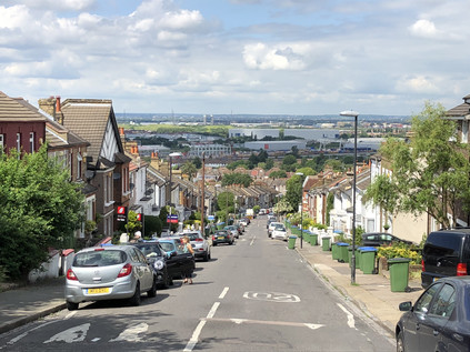
I struggled up the steps out of the ravine slowly, noting another walker following me and picking up my cue to take things equally steady despite likely being a good deal fitter than I. I collapsed onto a nearby bench and tried to look nonchalant as I consumed the last of my water and decided what to do next. I think my fellow sweaty and exhausted walker was jealous of my bench, but there were others to be had not far away! My plan had been to tackle Bostall Hill and descend on Abbey Wood via the site of Lesnes Abbey - but that would have to wait. Another ascent in the blazing sunshine was a little too much to contemplate just now. Instead I decided to strike out for the same spot by staying on the flat as far as I could. After crossing Winn's Common I began the descent towards the Thames, my knee now making genuinely ominous noises as I shuffled downhill passing by a series of geologically-themed squat tower blocks: Crystal, Galena and Marble House. All of them were prematurely decked with the St. George Cross in anticipation of a World Cup to come. From this vantage point the floodplain of the Thames opened out impressively below, with the near distance occupied by the Crossrail depot and the curious industrial estate-like anonymity of HMP Belmarsh, home to Britain's most violent and prolific offenders. Flanked by its sister prisons, HMP Isis and HMP Thameside, all three looked like innocuously vast branches of B&Q from this safe distance. At the foot of the hill, Plumstead High Street pulsed with heat and shuddered with car stereo basslines while we all waited time at the junction with Basildon Road. Fumes and dust hovered in the air, and I was glad to reach an opportunity to turn into the side-streets and zig-zag towards Abbey Wood station. My spirits and my feet had rallied now that the end of the walk was in sight, but swiftly fell again when I spied a bus heading my way marked 'Rail Replacement Service'... I may not have needed to plan this walk extensively, but I had - embarrassingly - left some of the key details unchecked it seemed. I swiftly replanned - and noted a regular bus service from outside the currently closed station which made a circuit of Thamesmead before depositing passengers at Plumstead station, the current extent of operations on the line. This local service seemed infinitely preferably to a slog through the same clogged streets I'd just walked on a hot bus full of disgruntled would-be rail passengers. A short wait followed, before a small group of us were whisked away by a single-decker which navigated the intricate web of roads through this vast and relatively late-come suburb of London. As we passed over the Southern Outfall Sewer at Eastern Way I was able to orient myself by way of an earlier walk in similarly hot weather. After observing the other-worldly architecture of the original concrete blocks and walkways of Thamesmead passing by, I settled into my seat for the remainder of the ride, before joining most of the other passengers on a dash around the corner for a waiting train at Plumstead station.
On the run back over the South London rooftops I pondered today's walk. Everything felt strange and temporary just now, uncomfortably close to the brink. My thoughts and indeed dreams were plagued by decisions I had little power over. This was the perfect antidote - a walk to connect points which had become increasingly familiar, but one which didn't have a definite purpose. With no river or road to follow and no fixed itinerary, I'd failed no-one by turning aside here or there: being seduced into tracking parts of the Quaggy River in Lewisham, but abandoning it to explore the lost suburb of Kidbrooke or even my final diversion away from the route in Abbey Wood. Instead, I'd walked off a little of my anxiety, letting it evaporate into the heat as I let the byways of London take me largely where they chose. I thought back to the moment on the top of One Tree Hill, gazing out over London as an unreal, painted city. I thought too about the protestors who had gathered at One Tree Hill and on Plumstead Common to protect my future right to walk on unspoiled greenspaces within London. The backstreets of Lewisham felt more solid and dependable than any panorama just now, and a bit of steadfast reality was just what I'd needed today.
You can find a gallery of images from the walk here.
From Source to Creek: Walking the River Ravensbourne
Posted in London on Saturday 7th April 2018 at 11:04pm
Anyone who regularly tolerates these missives which emerge from wanders along dusty roads or trickling minor rivers will know how quickly I can turn a pattern of walks into an altogether grander project. As a consequence, I try consciously to vary these itineraries, scattering my trips around the edges of the city in an effort to release myself from any sense of duty. Given a project, I usually collapse under the anxiety of sticking to its rules, and I vowed somewhere on the edge of Tottenham last year that I wasn't going to let that happen again. But somehow, during my last walk, I was utterly gripped by a desire to better understand the rivers which tumble out of the hills on the south-easternmost corner of London. These rivers are familiar in name, their creeks and estuaries crossed when walking the Thames Path, but I don't know them well beyond that. I lack any great knowledge of the areas where they rise, run and combine, and something of this sense of the unknown drew me back to the edge of Kent today. I'd broken my own rules before I'd walked a single step, setting out on a grey but dry morning for Bromley South via a routine familiar from my recent trip. Like last time, I managed to swiftly acquire coffee on my route through Victoria Station and stepped onto a late-arriving train which was almost immediately due to depart again for the suburbs. Soon I was curving through Brixton and Penge, weaving through the rising uplands and watching the view shift from yellow London brick to swathes of green dotted with suburban streets. It was something of a surprise to ascend from the platform at Bromley to find myself on an unexpectedly busy high street curving and falling away to the south-east. There was little time to waste exploring though, a 320 bus bound for Biggin Hill Valley was approaching the stop. This would take me to the edge of London, and to the start of my walk...
I'd never heard of Keston. This wasn't entirely surprising - it doesn't register on the rail network which is my master reference for the suburbs. It was still surprising to find a name which hasn't cropped up at all in some prior perusal of the map though, and I was curious about what I'd find out here. The bus set off south from Bromley along the A21, stopping regularly outside the pleasant villas which lined the busy arterial route out of town. Slowly, the houses dwindled on the western side of the road - Bromley Common was out there beyond the railings. I'd need to cross the common on my route back to London, and just now it felt like striking out into the unknown. It also seemed surprisingly vast from the window of the bus, with long stretches of woodland concealed by the railings and walls. After navigating the tiny knot of a village centre where the road to Croydon crossed our path we were largely out in the country. I disembarked soon after at Fishponds Road, the carriageway overhung by tall, mature trees under which blasts of traffic shuddered by, buffeting my tiny island of safety beside the Transport for London bus stop. The familiar red signpost felt distinctly odd out here - was the frequent service of near-empty double-deckers perhaps an administrative oversight? I picked my moment and carefully scuttled across the road to follow the more generous path on the other side as far as the corner where a sign indicated the entrance to Keston Common. An unmarked but well-trodden trail of crisp, yellow leaves plunged behind an abandoned block of municipal public conveniences and into the trees. I shouldered my bag and headed into the woods, grateful that the track was dry here at least. The sounds of the road were soon muffled by the foliage, and surprisingly quickly the splash of moving water replaced them entirely. A little way into the common, between the trees I saw the clouds reflected in the surface of a sizeable pond. The path wound around the outside of this pair of broad and shallow lakes, first dipping into sudden sumps of mud where the water had overtopped the bank, then climbing towards the source of the river. At the top of a short muddy clamber, in a narrow culvert, the River Ravensbourne rushed by on its journey downhill to the ponds. Up ahead a neat brick circle in a clearing was revealed, clear water bubbling busily into its centre. A father led his wellington-boot clad child stomping through the torrent, the boy squealing with delight and splashing the nascent Ravensbourne across the path. I watched this simple gleeful act of rebellion, waiting for them to return to the path to paddle through the same mud-puddles I'd encountered, before gingerly dipping a toe into the waters myself.
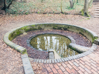
Almost all of the rivers I walk begin a little too far outside the urban boundary for me to track them to their sources and I'm often forced to pick them up from some convenient spot on their upper reaches where they intersect with the transport network. Today though was different, and there was a somewhat magical feeling about this spot known as Caesar's Well. Legend - at least as dictated by R.C.Hope in his 'Legendary Lore of the Holy Wells of England' - has it that a swooping raven directed Julius Caesar to halt his troops on their long march from their landing point in Kent to London and that here he discovered a fresh spring of healing waters. The waters became the Ravensbourne in remembrance of this fortuitous event, and the well bears the Emperor's name to this day however dubious the tale's provenance - certainly there is no record of the Roman Legions reaching this spot during Caesar's expeditions of 55-54BC. Indeed there is recent evidence that the route which the invaders took may have been further to the north, from Pegwell Bay on Thanet. This has also challenged the view that the venture was unsuccessful as Caesar left Britain with the loyalty of several Cantiaci leaders and regarded them in De Bello Gallico as the most civilised of the British tribes. To reinforce how unlikely this tale is, there is another identically named well near Wimbledon with a similar backstory but even less proximity to the invaders' trajectory. But the optimistic nomenclature is not entirely without some foundation: both of Caesar's unlikely South London watering holes occupy locations near ancient camps which were excavated in the flourishing early days of British archaeology, and the temptation to link them to the established Roman narrative would have been strong. It appears that much was inferred on the basis of legend and oral history, and in the case of the spring which lapped at my feet here on the very edge of London, it was it's proximity to the long-presumed location of Noviomagus Cantiacorum which supported the claim. The site of this bustling Roman trading town had long been sought - with speculative attempts to fix its location near Keston dating back to the 16th century. Thomas Crofton Crocker's discovery of a burial site near Keston had all but fixed the location of this much-sought-after settlement in the historical record, with the Society of Antiquaries of London convinced enough to support him in founding a dining club known as the Noviomagians in honour of his discovery. However, during the excavations prior to the construction of the abortive Ringway 3 around London in 1966, Brian Philp discovered compelling evidence of Noviomagus Cantiacorum near West Wickham. Thus there is now a far more likely location for the elusive settlement, and Keston's time in the spotlight is largely over. But Caesar's Well still bubbles with clear water, which some have been brave enough to drink. Having found the source of the River Ravensbourne though, it was time for me to set off across new territory...
Keston Common is a narrow strip of woodland, sandwiched between the widely spread arms of Keston village with the Ravensbourne forming an eastern boundary. I wasn't far from civilisation at all here, but I felt strangely isolated in the forest of bare trees. Spring hadn't reached the common yet, but the morning was warming and there was a slight haze of mist. Navigating was surprisingly tricky - when these trees were green and fulsome it would be easier to discern the pathways through the woods, but just now every gap appeared to be a potential footpath and it was necessary to follow the churned line of hoof-prints and last autumn's mulched leaf-fall to find a way through. I soon adjusted to the conditions, adopting a careful but quick trudge which allowed me to manage even the muddiest sections without slipping or sinking. A mixture of instinct and map reading kept me heading roughly north while trying wherever possible to push to the east of the common, nearer to the river's course. Occasionally, open grassy fields opened on the path and finding a suitable exit was a challenge. This was surprisingly satisfying walking - physically tougher than I'm used to out in the suburbs and mentally challenging too. The river was present but unseen - sometimes heard between the trees through an unexpected splash or the flap of a wing on water. I took a looping route, inadvertently turning back on myself to get closer to the water and crossing a minor tributary of the Ravensbourne which joined it in a deeply eroded gully, both streams still tiny but fast flowing in their natural culvert. Eventually back on route, I emerged onto the busy Croydon Road at a point where Hayes Common, Bromley Common and Keston Common met. The road disappeared into the trees in both directions, a narrow path on both sides - but just visible ahead my route continued between the trees, a narrow path heading into Padmall Wood, a more substantial tract of woodland which stretched north alongside the river. The woodland felt surprisingly wild and solitary, despite the presence of schools and impressively large homes just yards from the path. The air beneath the trees was still and beginning to get humid as the first real springlike morning of the year unfolded around the Common. I thrashed along, picking up a large stick to use as a walking aid, thrusting it into some of the muddier spots to test their viscosity and depth. In the swing of my walk now, I emerged at Barnet Wood Road, a surprisingly fast-flowing east-west rat run across the common. Thankful I didn't have to walk along this pathless channel of traffic I noted that my track was marked by seemingly pointless metal five-bar gates on each side of the road. The gates were overgrown with foliage and hadn't needed to be operated for years. Instead, the path was worn into the ground around the gates. I headed into Barnet Wood, carefully laying my large stave against the gate - I wasn't going to need that now, was I?
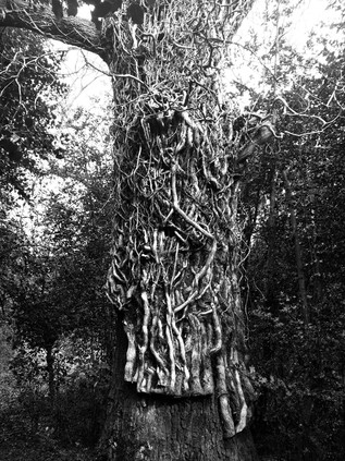
Barnet Wood was a little denser than the woodland I'd covered so far, extending in a narrow tongue along the course of the river while broad grassy plains opened up on the western side of the common. I decided to stick to the woods in the hope of coming upon the river again after what seemed like a long, hot walk since it last appeared. Most of the regular dog walkers and traffic clearly diverted into the open spaces here, leaving the wooded tracks less well walked and surprisingly wet and muddy - I developed a technique of anticipating these patches of deep standing water and skirting off the path via the deep mat of fallen leaves which remained dry and navigable under the trees. The persistent hazard here though was buried roots and creepers which snagged underfoot and dragged along - and it's perhaps fair to say that the large stick I'd left back at the road would have been a useful aid here. It was hard going, but the knowledge that I was closing on the river was encouraging. Then, as I was checking my direction in the anticipation that I'd soon cross paths with the elusive Ravensbourne again up ahead, I let my concentration slip. My foot snagged under a solid root anchored at each end, creating the perfect man-trap. I tumbled forward into a pile of soft leaves with a grunt of expelled breath and a very quick flush of embarrassment at my hubris. I wasn't a proper walker at all, as this entirely proved. A quick inventory of my injuries: nothing major, a scratch on the hand and a little mud on the jeans - the leaf carpet had kept me mostly clean and safe. My right big toe throbbed painfully though - driven into the end of my very solid proper walking boot and subsequently jammed hard against the branch, it had taken quite a battering. I scrambled up and tested it. I'd walk it off, like always. It hurt less when I walked in fact, and so I set off again, finally finding the busy and widening river up ahead crossing under a deeply rutted farm track. I had a choice to make here - the river ran almost equidistantly between the main road to the east, or a woodland track to the west. Following the river directly north was impossible as it disappeared into very specifically marked 'PRIVATE LAND' in Mazzard's Wood. Feeling the need to redeem my credentials after the completely unwitnessed but still somehow shameful tumble, I headed west along the track between barbed wire and electric fences. It was possible to walk in the deep, dried ruts and only encounter occasional puddles of muddy water. I skirted these carefully, often meeting the gaze of horses grazing lazily in the sunshine behind the fences. The track curved north and west, and seemed endless. Despite being alone on the path, I felt uncomfortably exposed walking this narrow strip between carefully enclosed and defended land, particularly after a long solitary trek in the woods seeing barely another soul. Finally I noted someone walking towards me up ahead and I stiffened for conflict, expecting a farmer or horseman to challenge my presence. I summoned the OS map on my 'phone, ready to defend my right to be here and desperate not to be pushed back towards the main road. In the event, the fellow-traveller nodded a brief 'good morning' and strode past me. He was no walker - dressed in white jeans with an expensive designer hoodie, a pale and pristine looking mock-fur collared parka and lots of jewellery, he seemed an unlikely character to meet on this muddy track. I was particularly amazed that he'd navigated the swampy junction I encountered a few yards ahead without incident, as I carefully picked my way along a nearly submerged plank, using the decaying and precarious uprights of a barbed-wire fence for support. Crossing slowly but safely, I turned east here to head for the Rookery Pond where the river fed a long, slender lake hidden in the woods. Now a noted Carp Fishery, this pond belonged to The Rookery, a fine house built on the fringe of the common early in the 18th century by the Chase family, and occupied from 1755 by James Norman. When Philip Norman wrote of the area in Archaeologia Cantiana in 1900, he recalled seeing the Chase Family arms above the staircase of his great-grandfather's home. The Norman family occupied The Rookery until the Second World War, when it was required for military use - finally burning down in 1946 while still in the hands of the Ministry of Defence. The land then remained open due to the newly passed Green Belt legislation until 1965, when the development of the sizeable Bromley College campus was permitted on the site. The fate of Oakley House, the other substantial nearby house on the common from the same era has been a little less dramatic, now serving as an expensive wedding venue. The Ravensbourne still marks the western boundaries of these properties, and my walk finally found it again, a fast-flowing and much larger stream now. Better yet, there was an unmapped path running alongside the river into the edge of Scrogginhall Wood - and on the basis that paths worn down by feet must go somewhere I turned north alongside the river. This was a welcome diversion - I didn't yet feel ready to head out to the busy A21 to slog into Bromley Town Centre, and this path beside the deep gully through which the river flowed was cool and quiet. My spirits lifted, I savoured this stretch of water - perhaps the last time I'd see the river outside an urban setting - even enjoying the odd experience of scrambling down a bank to splash through a stream joining the river from the west. All too soon a weed and litter choked pipe swallowed the river as it disappeared into an earth bank running along the edge of Norman Park. I crashed rather suddenly out of the bushes, a sweaty and muddy creature with a red face and wild hair, surprising dog walkers and skateboarders on the busy path nearby. Traversing the common - just a few short miles of this long walk - had felt like a trial, but was of course a less dangerous experience that in the days when Highwaymen and robbers frequently the paths and lanes hereabouts. Among the dark and often dubious tales of legend, the generally more reliable diarist John Evelyn recorded being robbed here in 1652 when assailants jumped from behind a great oak tree. It was easy to see why these strange, contested lands with their contorted paths and sudden streams blocking the way would have provided perfect cover for those who with knowledge of the ways who wanted to lose themselves. Today, for just a short time at least, I'd become one of them. But now, despite my aching toe, I was eager to continue walking.
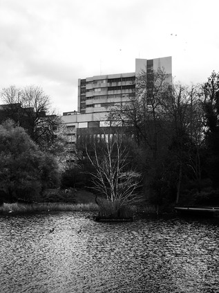
I sat on a bench in the sunlit Church House Gardens, feeling like I was dangling my legs over a precipice onto the playground below. I'd arrived suddenly in the centre of Bromley, having trudged up the almost pristine suburbia of Hayes Road and stumbled unexpectedly on Bromley South station where my day had started just a few hours before. Suitably equipped with refreshments, I climbed the steep curve of the High Street as it led away from the valley of the Ravensbourne. I stopped briefly to admire the striking Churchill Theatre. Designed by the Borough Architect, this 1977 built block emerges from the steep wall of the valley, with lower floors being effectively underground when considered from High Street level. It felt like a building out of time, one which should probably have surfaced ten years earlier. However, it remains busy and popular, housing the main library and a range of performance spaces. It also sits in the midst of the town, pushing its sizeable concrete frontage into the flow of pedestrians scuttling between shops. Now behind me, its lower levels were reflected in a pool busy with ducks, while I gazed down into the deep gully where the Ravensbourne ran concealed beyond the margins of the park. I reflected on the changing nature of the river - from now it would mostly be snatched views from crossings and occasional bursts of foliage on littered banks. Having seen the river develop from its spring, I felt unexpectedly angry at its containment. I was surprised by Bromley though - my brief encounter with its bustling centre was unexpectedly pleasant. In trying to discover notable residents I'd noted H.G. Wells was born and educated here and expected to find a memorial of some sort, but I was disappointed to hear that the only mural had been painted out some time back. Perhaps it was his assertion that Bromley, rapidly growing towards its status as the largest London Borough during the early 20th century as a "morbid sprawl of population?" Wells later noted in a letter rejecting the Freedom of the Borough that "Bromley has not been particularly gracious to me nor I to Bromley". The list of luminaries who have lived and worked here - from Charles Darwin to David Bowie is variously celebrated throughout the town, but Wells is relegated to a blue plaque high on the wall of Primark. Few eyes drift up from the unbeatable bargains to see what it has to say about Bromley's literary son... It was tempting to linger a while longer in the warm park, especially given the dull ache which had settled into my injured foot. But time was pressing, and the walk felt somewhat longer than I'd bargained for. I set off, leaving the gardens and navigating by way of the tall Kentish Ragstone chimney of the former pumping station which towered over the low roofline of the suburbs. Nearby, at the foot of the steep slope up to town, the Ravensbourne reappeared in a deep trench surrounded by solid looking railings. I trailed it through the recreation ground which it bisected before again slipping away underground. The course though, was clear - up ahead an alleyway between the back gardens took an almost perfectly straight course alongside a raised concrete slab which concealed the waters of the Ravensbourne. In 1863, the map showed the river meandering about open fields, here - but just three decades later it had been channelled into a straight canal. Now it disappeared entirely, despite the effort to commemorate its presence in Shortlands by way of a reconstructed bridge parapet near the railway station. I leaned on the railing pondering the flowerbed below and noting that the Prime Meridian passed through this spot on its inexorable journey to the southern hemisphere. Passing motorists stared at me in a mix of curiosity and barely disguised disgust, attempting to discern what I was looking at on the other side of the structure. Perhaps it's not just H.G Wells which Bromley has chosen not to acknowledge, given the way its once proud river is mistreated by the borough just now?
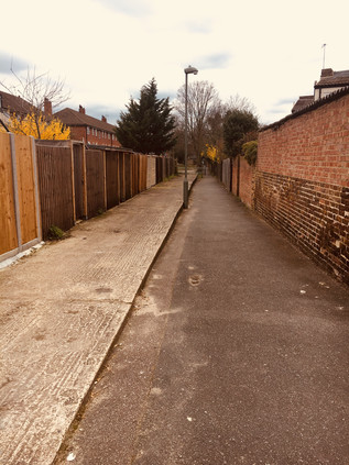
Beyond Shortlands, the river resurfaces in private land. The golf course is fringed by dire warnings about trespass, so I tramped the long, straight track of the teasingly named Ravensbourne Avenue as it shadowed the railway embankment high above. At the end of the road, I pressed onward into Summerhouse Playing Fields, passing manholes with the tantalising sound of gushing water beneath them. Finally, as the swathe of green opened out ahead, the river was revealed, speedily gurgling north along the eastern edge of Beckenham Place Park. This huge park is effectively divided into two by the railway running approximately north-south, with few crossing points available. As I followed the curving course of the river, trains slowly crept between Ravensbourne and Beckenham Hill stations, pausing in the park before making their final approach. The larger, western section of the park is home to Beckenham Place, a fine manor house built on a site with a history stretching back to ownership by the Bishop of Bayeux immediately after the Norman invasion. Later, the lands appear to have been contested and divided between neighbouring manors before being united again as the estate of John Cator MP who built the current mansion. The building was inhabited by tenants for much of the 19th century, the house and land finally passing into the ownership of the London County Council, and nowadays - with boundary disputes finally settled in 1995 - the Borough of Lewisham. In the grounds the first municipal golf course in the country remains operational having served the locals since 1907. All too soon, I found myself in the north-eastern corner of the park, watching the river disappear between houses, guarded by palisade fencing. I was pushed back onto the road, and finally out onto the endless churn of the A21. Freed from the sluggish traversal of central Bromley, the traffic gained speed and thundered through the one apparently 'picturesque' hamlet of Southend. The river briefly resurfaced from its enclosed, suburban meander here, filling a sluggish, green-tinged pond which fronted a dramatically situated branch of Homebase which leaned out over the water towards an island populated with well-intentioned but odd artworks. A few brave waterfowl swam nonchalantly around the island, looking a little lost and confused. As I tried to make sense of the scene a passing drunk pushing a bike began to tell me about his shock at the sudden explosion of a recently replaced inner tube. I couldn't avoid noting his dismay, even over the relentless traffic noise. It was time to make the long march into Catford, with the river flowing just feet away between the industrial buildings of Bellingham.
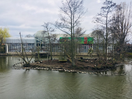
Bromley Road was beginning to feel endless - a long, straight run of impressive villas giving way to parades of shops which had likely once been rather important and salubrious, but now housed decommissioned chicken takeaways and makeshift tyre and body-shops. Up ahead I could see the taller buildings of Catford approaching, not least the impressive municipal block which I'd been taken with on my walk around the South Circular. I was torn here - the river ran a little way to the west where it joined the River Pool, one of its more significant tributaries. A well-signposted 'green walk' along the Pool has been completed in recent years, which takes in the point of confluence, and it felt like an attractive idea to cut across to walk this section of river given the challenge of getting near the Ravensbourne otherwise. However, the scissor-like arrangement of railway lines which converged nearby wasn't easy to cross, and instead, I stuck with my plan to pick up the Ravensbourne again near Catford. I'd seen it on disembarking from a train here, flowing in a deep channel between the two distinct stations which sit just yards - and a few vertical feet - apart, and I was curious to encounter it again at this spot where river and rails tangled together. Beginning to feel the effects of walking in the surprisingly warm weather, I felt myself flagging as I edged around the centre of Catford and arrived at the foot of the rise where the South Circular climbs to cross the railways and the river. The road pulsed traffic from the gyratory, flowing sluggishly west towards Forest Hill - since my walk I was more aware of its tortured geography, and I was impressed that it still functioned at all under the strain. After some initial missteps I finally found the tiny roadway which snuck between the stations, passing an abandoned and decaying ground-level entrance to the elevated Catford Bridge station above, and once again crossed the Ravensbourne. The river was now a surprisingly wide and fast flowing churn of silt-brown water which emerged from under the main road and a cluster of ancient looking sewerage pipes to flow alongside the railway viaduct. Enjoying the cool and shade which the brick arches offered I headed off along the route, diverting into the recreation grounds which fringed the eastern edge of Ladywell Fields. The riverside path was busy with cyclists and dog-walkers here, the river gradually transitioning from suburb to city. Up ahead, glassy towers indicated the looming presence of Lewisham, with the ubiquitous cluster of cranes indicating the locations of ever more redevelopment. I decided to savour this part of the walk alongside the river as it passed over the railway once again by way of a spiralling bridge. I was acutely aware that there may not be much more greenery to see for a while. Across the water, the sinuous curve of the Riverside Building of University Hospital Lewisham echoed the course of the river. There is a long history of caring for the sick and unfortunate on this site, with a workhouse founded here as early as 1612. By the 19th century it was noted by The Lancet that the workhouse had essentially begun to function as a general infirmary, a role it officially gained with building on a neighbouring site in 1894. The gradual consolidation of smaller NHS units and hospitals onto the site enlarged and complicated the hospital until it was comprehensively redeveloped during the early years of this century. The hospital has struggled financially in recent years, hitting the headlines for an anticipated closure of Accident and Emergency services which resulted in protests and court injunctions. For now though, it soldiers on with its modern new buildings shimmering over the Ravensbourne, and not feeling entirely out of place.
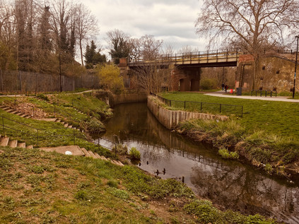
The path rose and turned aside from the river, leaving it to head under the tangle of railway lines which converge on Lewisham. Ladywell fields had been purchased by the London County Council from the Manor in 1889, but the flooding from the Ravensbourne rendered it useless for building, leaving vacant the string of three distinct fields which make up the ragged outline of the park today. At the western edge of the park, the almost quaint buildings and covered footbridge of Ladywell station occupied the site of one of the numerous wells which gave the area its name. In 1648 a miraculous cure for a local woman's 'loathsome disease' was attributed to the waters here and the well was soon celebrated as a holy site. The site became a place of local pilgrimage with its waters offered freely to the poor and infirm: "as God hath freely bestowed His favours upon this water, so it is now dispensed gratis to any that desire it". By 1850, the well was partially covered to accommodate the coming of the railway which changed the fortunes of Ladywell considerably. Descending from the bridge into a knot of pleasant, Victorian shopfronts now occupied by delicatessens, restaurants and artisanal food stores I was struck that this was a place which was once described by a former local I was travelling with as 'a dump'. In fairness, I'd had my doubts as from the passing train it was clear that Ladywell's gentrification was well underway even then, and now the transformation appeared complete. I inadvertently shadowed a couple who were walking from café to delicatessen, gurgling infants strapped helplessly to their fronts as they meandered across the road ogling handcrafted baked goods in the store window. Inviting though Ladywell was, my business lay elsewhere and I marched steadily onward along Marsala Road and into a hinterland of fine terraced houses and oversubscribed on-street parking. This was as close as I could get to the Ravensbourne for some distance as there were few means of passing under the web of railways which flanked the western edge of Lewisham Town Centre. The cranes I had spied earlier occupied the slivers and diamonds of land between the tracks - these rough scraps of space once deemed too expensive to seriously consider as development opportunities now sprouted towers of glass and plastic cladding. I zig-zagged under railway bridges and into a development of low-rise social housing finding the river running sluggish and copper-brown at the end of the street. The regeneration had spread south along the river here to form Cornmill Gardens. This was a unusually well-used open space, part of the Rensaissance SE13 project which had seen the tired but diverse and busy Sundermead Estate unceremoniously demolished to make way for new towers of housing. The river trickled between remediated and carefully sloped green banks, a far cry from the mill stream which would have thundered through this site in times gone by. I picked my way around carefully designed benches - comfortable to perch on, but useless for a prolonged rest - and dodged wandering students with their eyes locked onto their 'phone screens. I realised that while the area felt busy with passing people, it was a purposeless zone. The locals had been tempted out by the first genuine springlike afternoon of the year, but there was little out here in the way of spectacle. Lewisham's real business took place away to the east in its complicated palimpsest of a shopping centre - built and overbuilt to suit the needs of the growing town. People here flitted aimlessly around the atrium of the new Glass Mill Leisure Centre with its Tetris-like curved flank dazzling drivers on the A20. I took a wrong turn here, accidentally heading for the station while trying to navigate by railway and river in a landscape in flux which wasn't yet fully fixed on the ground. After retracing my steps onto Loampit Vale, hemmed in between new towers and older retail parks, I was glad to turn aside leaving the centre of Lewisham and passing under the railway and into the suburbs once again. Near Elverson Road DLR station I found myself on more familiar inner-London territory: decaying but proud terraces being left until the value of their footprint increased, flytipping and out-of-date advertising campaigns on billboards. It was a welcome relief after the forced pace and painted-on smiles of Rennaisance SE13. My feet hurt - especially the one I'd damaged back on Bromley Common - and I began to wonder about successfully making it to the end of my journey. However, I was able to find the river again in Brookmill Park which provided something of an impetus. This long, slender green space slinks alongside the concrete culvert which carries the Ravensbourne, culminating in a formal garden at the rear of the Stephen Lawrence Centre. Here, a trust named for Stephen - the victim of a brutal racially motivated murder in Eltham during 1993, provides opportunities for young people. It shouldn't be a shock to see his name attached to something so absolutely positive given the efforts of his family to find justice and progress over the past twenty-five years. Even so, it was good to see it mentioned aside from the depressingly familiar context of the terrible corruption which likely still afflicts South London policing, and the racism and violence of the drug trade steered by Kentish gangsters. A name becomes a 'case' or a 'scandal' all too easily and as a result is much too easy to pass over without considering the humanity. But in this little corner near the river and the park new enterprises and young local entrepreneurs are afforded space and support from the Trust, and it felt after all that perhaps this untimely, violent death - one of too many in London's suburbs - had resulted in something positive occurring?
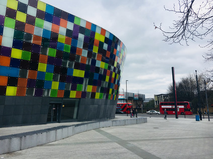
The Ravensbourne buckled and writhed to pass under Deptford Bridge, with the DLR viaduct sloping into the frame and closely shadowing its curves as it transitioned to become tidal Deptford Creek. The incoming tide obscured the wide expanses of muddy embankment shoring up the concrete flood barriers which enclosed the river. I crossed Deptford High Street, looking west along a range of proud facades which had once been a fine street of shops but were now largely shuttered against the relentless London-bound traffic. This was the disputed continuation of Watling Street towards the city, the true route lost under the layers of urban development, but not to the imagination it seems. I didn't linger at this rather gloomy spot, heading instead into the quiet industrial backstreet of Creekside. The river was implicit here, its course could be inferred behind yards and buildings largely via the flashes of foliage or ironwork glimpsed through gateways and between fences. The low warehouses which fringed the western edge of the street overlooked the former wharves which had lined the tidal creek, and I felt suddenly much more comfortable. This kind of interstitial zone between river and industry felt benign and familiar, and despite my growing physical discomfort I stepped up the pace, keen now to make it to the end of the Creek if possible. As I walked I considered Deptford - once a notable place in its own right, now largely an erasure between Greenwich and London. Deptford was the location of a royal dockyard opened by Henry VIII in 1513, was home for a time to John Evelyn and saw the tragic end of Christopher Marlowe - in short, a veritable Tudor-era soap opera of a location. But the recent history here is wholly of decline and obsolescence. The maritime heritage business is saturated by nearby Greenwich and the former Navy Victualling Yard can't compete with a remediated tall ship and a pop-up food market for glamour and Instagram potential. Deptford slumbered, the industrial units silent on a weekend afternoon. At the end of Creekside I took a shortcut through the misnamed Greenwich Creekside development - a jagged insertion of homes and businesses which was not yet fully operational - and not really in Greenwich. The silence between the slivers of glass and steel was interrupted only by the flapping of builders' tarpaulins and the slow grind of metal on concrete as the wind shifted the decaying gates of the only remaining warehouse on the edge of the creek. The quiet was oppressive, accompanied by a sense that permission was required to be here. I wasn't sorry to emerge on Creek Road where the Ravensbourne has been bridged since 1804. Before that time, it's likely that travellers faced a tricky crossing of the 'deep ford' which named the growing settlement, and there are speculative suggestions that a causeway is buried under the sucking mud of the banks for this purpose. Now the Creek is a boundary - both between the Boroughs of Lewisham and Greenwich and between quiet hinterland and tourist mecca. But beside the bridge, on the Greenwich bank, are reminders of the Ravensbourne's role in the development of the city. To the south, a single crane serves the last remaining on the creek, Brewer's Wharf. Operated by the Prior family since 1870, the wharf still receives aggregate deliveries from Essex for concrete production - relieving the choked roads of South London of at least a few heavy vehicles. To the north, a repurposed dock inlet hosts the banal development of New Capital Quay, which manages to look even more unreal at close quarters than the computer generated images which advertise apartments and a recently opened Waitrose. However, the ranks of identikit blocks are almost without value thanks to the discovery that they are clad in the same unsuitable material which exacerbated and expedited the spread of fire at Grenfell Tower. They stand in limbo, sold but now unsaleable - unable to undertake their role in the chain of capital and useless to those who bought them as rungs on the investment ladder. But for many, they are still home - and what a strange, liminal existence it must be. The blocks are under 24-hour guard, their future to be determined not by architects or planners, but by lawyers who argue the responsibility of mitigating the risk. Standing at the centre of the bridge over muddy Deptford Creek, looking up at the dull and somewhat benign looking buildings, it's hard to imagine an easier place to sell: Thames views, on the fringe of Historic Greenwich, near the DLR... Will the tenacious Brewers Wharf or these blighted blocks survive longest?
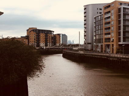
I padded slowly along Creek Road which gradually descended into the churn and haze of Greenwich, imagining this now quiet street lined with spectators for the London Marathon in just a few days time. Up ahead, the cluster of buildings around St. Alphege's Church shone in the unexpected late-afternoon sunshine and the ancient pattern of streets seethed with tourists. There are many points in London where transitions are made - where it is very clear that one has walked into a different zone - but few were as jarringly obvious as this one. Modern shopfronts lined the last stretch of the street as I headed for the mass of people pushing through the narrow thoroughfares of this old town. They walked, heads down, pursuing the next pre-determined point of interest and were never likely to detour towards the sluggish mouth of the Ravensbourne which ended its journey just a few yards away. I was briefly caught up in the throng, trying to find my way to the entrance of the DLR station - even that was carefully named to convince the tourists they were in the right spot: Cutty Sark for Maritime Greenwich. Missing the entrance due to the crush of bodies attempting to exit, I completed a full circuit of the busy corner glimpsing the tide of people heading for the old marooned tea clipper in its dry-dock and leading away towards the fine buildings of the Naval College. Greenwich on a sunny afternoon had its attractions, but the shuffling, jostling and impatient tourists definitely weren't part of the package. Finally finding a way into the station I descended to the platform via the stairs, cool concrete in never-ending flights which folded back on themselves relentlessly. Soon the driverless train arrived to whisk me under the Thames and into more familiar territory. Surfacing on Bow Road, the gritty and fume-filled chasm which has launched or ended so many of my ventures, it felt impossibly distant from leafy Keston, the bubbling well in the woods, and from my clumsy thrashing through Bromley Common. It had been a day marked by sudden shifts and curious comparisons. My damaged toe pulsed uncomfortably in my boot, reminding me that these tiny but revelatory excursions came at a price.
You can find a gallery of images from the walk here.
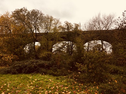
Heading west out of Paddington, minutes after arriving, felt very strange indeed. A few minutes later, as I waited in a steady downpour outside Ealing Broadway station for the bus to Hanger Lane, I tried to rationalise my persistence with today's endeavour. I needed to walk... It had felt like a tough few weeks, and I knew I had an equally challenging month ahead. I also felt like I had unfinished business out here - and despite feeling like a trudge along some damp eastern pavements might have been a far more sensible idea given the promised poor weather, I'd been drawn back to the River Brent which had proved so elusive and wayward on my last walk here. When I'd left the river last time, it had been a reluctant parting - I'd figured that Brentford and the Thames were mere miles away, and ought to have been easily reached had I stepped up the pace and not been confounded by diversions. Thus today's walk felt like it might be worryingly short and on the way into London I'd been concocting possible additions and extensions to fill the day. As it was, the Brent more than occupied my time today, and the walk was not as short as I'd feared...
Sheltering in a shop doorway, just out of reach of the spray from cars hurtling around the Hanger Lane Gyratory, I deployed the hood of my coat and tried to secure it in a spot which didn't wholly deprive me of my senses. Prepared, and steeled for the rain, I set off - much to the amusement of some of the passengers on my bus who had watched me preparing to get going. I realised from my reflection that the look of grim determination I was wearing must have seemed oddly out of place as I strode off along the slip-road down to the A40. I was starting my walk on another typical arterial road. The slick river of tar stretched ahead, red tail lamps winking into the dark distance and neon signs on the nearby buildings appearing weirdly over-bright in the gloom. I woudn't be spending long walking this road, thankfully, but the more pressing issue was that I didn't fully know how far to go. My research for this walk had focused on what seemed like tricky pathless sections further ahead, and I was striking out into the unknown a little here. As I walked, the hulk of the Vanguard warehouse near which I'd abandoned my last Brent excursion dominated the view west. Ahead of it, the river passed under the A40 via an unremarked bridge. I'd been so close to the water before, but tantalisingly it lay just out of sight, between the road and the railway. Near the bridge a wooden kissing gate led into a grassy space beyond and I'd have probably ignored this save for the 'Brent River Park' direction indicator on the post. Beneath, the river was a grey rush - swollen with rainwater from the heights of Middlesex, its course was more urgent and turbulent than when I'd last been beside it. I was reluctant to head into the field given how wet things were, but it couldn't hurt could it? I swung through the gate and left the road behind. The river curved to meet the flattened path, a carpet of fallen leaves providing me with traction underfoot. This was already beginning to feel like the right direction to head in...
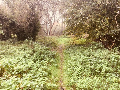
The river wound around the edge of a golf course, providing a boundary between the primped greens and fairways and the much more democratic municipality of Pitshanger Park. I followed its course as closely as I could here, remembering how tricky it had been to walk alongside the river further upstream. The scrubby fields between the road and the park were deserted except for a lone dog walker who patrolled the perimeter, eyeing me with a little suspicion as I trudged carefully around some of the wetter spots on the path. The river turned west, and I needed to retreat to the roads to find it again, doing so via an inelegant clamber over a stile and into the attractive and quiet streets of Brentham Garden Suburb. This rather sleepy and at first unremarkable estate is in fact an early example of a cooperative housing development built to incorporate Ebeneezer Howard's principles as outlined in 'To-morrow: A Peaceful Path to Real Reform'. Published in 1898, this work kickstarted the Garden City movement which suggested the possibility of enjoying the conveniences of city life in almost rural settings. With construction beginning in 1901, Brentham pre-dates its better known and now rather exclusive cousin at Hampstead by some years but being a little further out of the city, isn't perhaps well positioned to become the haunt of the well-to-do and famous. Walking west, towards an entrance to Pitshanger Park, I watched the estate waking up - supermarket delivery vans puttered between streets, families wandered outdoors, wrapped in winter clothes. The rain had almost stopped as I turned into the park entrance which was guarded by a gang of gossiping dog walkers, their bored hounds grunting and sniffing at the floor in anticipation of their excursion recommencing. I set off across the park to its northern boundary where the river was hidden behind a line of trees. There were few others in this part of the park away from the sports club and café, and while still a little damp my walk was quiet and pleasant. At the edge of the park I turned north along a narrow hedge-lined alleyway cutting through the golf course. The river, after being joined by what appeared to be the stub of a forgotten tributary or former diversion, also turned north, and through the hedge I could see it winding between greens and fairways, providing a genuine challenge to errant golfers.
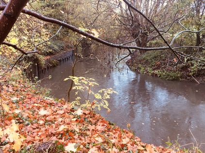
The path divided near a wooden bridge over the Brent, marking the point where I'd expected to enter the park had my excursion through the fields not proved viable. I turned west again, rejoining the river as it took a broad loop to the south and then north along Argyle Road. A detour here took me close to the riverbank as far as Perivale Lane where I feared I was trespassing on the grounds of St. Benedict's School. I tramped back to Argyle Lane, retracing my steps rather than following an arc around the playing fields of a leisure centre which, while closer to the river were clearly muddy and very wet and offered no clue about how I'd escape at the other end. I began to fear that perhaps the Brent was to be as elusive today as it had been on the first part of my walk in from Finchley. I headed west along Ruislip Road East, a long straight route running directly from Ealing to Greenford which the borough had recently improved to favour walkers and cyclists. Frequent banners hung from the fence behind which the river ran, informing me how this five-mile long route was safe, well provided with frequent crossings and speed controls and could enhance my health and wellbeing. Indeed there did seem to be a fair number of people wandering back and forth as I passed under the railway line from Greenford with the Brent churning darkly under the adjacent arch of the bridge. The road began to rise towards a junction with Greenford Broadway, crossing the river by way of an ornate bridge. Beside the bridge a gap in the fence provided a surprisingly anonymous entrance to the continuation of the Capital Ring walking route. I'm still asked fairly often if I'm 'doing' this walk - and equally often I'm told how unattractive and borderline dangerous my questioners found the walk. At this point I'm forced to grit my teeth and suggest that I'm not walking the route but inevitably I'm encountering parts of it on my travels. I'd love to add that circling a vast, complex city like London is bound to take a walker through a variety of landscapes which make up the edgelands, but I suspect they're already busily ticking off their next sanctioned and sanitised walk somewhere. After a brief pause to buy lunch I returned to the inconsequential gap in the fence and plunged into the cool, quiet tunnel between the trees which lined the river here. Near the road there was the usual evidence of temporary occupation: blue carrier bags, Polish lager cans, the marks of extinguished fires and discarded clothing - but soon these petered out too, and it was just me and the river. The Brent was wide and fast-flowing here, swirling with rainwater from the numerous streams and gullies which joined it on its suburban journey. This wedge of parkland, hemmed in by a recycling centre and a large development of inter-war housing was almost entirely deserted. The sky churned overhead, but promised brighter conditions might be coming later, and I happily trudged south, the river tumbling and twisting beside me. The way was marked by infrequent wayfinding posts, and one of these sent me down a flight of wooden steps cut into the steep valley side and onto a rarely walked diversion on the bank of the river. Unsure if this path would safely return me to my route without a muddy scramble, I was a little uneasy about heading onwards - but the lure of the water was strong and I'm glad I continued. This was the closest I'd managed to get to the Brent so far, and it felt good to be walking beside it more directly for a short spell as it cascaded over a weir and swirled around hanging boughs of trees which leaned down into its surface. Returning safely to the path further ahead, I crossed a bridge and found myself on a comparatively well-made stony path passing directly through another golf course, marked by signs warning me that by passing them I accepted the risk of encountering low-flying balls. There were few golfers braving the unpredictable November weather today, so I gladly took the chance and continued. The river was to the east now, denoted by a snaking line of trees beyond the flags and bunkers, and I once again wondered how much more of it I'd manage to see? Above the trees, the steeple of St. Mary's Church in Hanwell was a black silhouette on a turbulent and dramatic sky which seemed to shift to dominate the view from every direction as the path turned with the river. There has been a place of worship here for well over a thousand years, and it struck me that the development of parks and golf courses around it meant that it still provided a landmark from some distance away with little encroachment by other tall buildings. The path rejoined the Brent, crossing it by way of a solid but scruffy metal bridge, and then divided again - the more formal sandy track leading up to the church while a series of wooden flets sunk into the muddy bank took the path into a broad meadow and towards the curve of the river again. I chose the muddier path and stayed with the Brent.
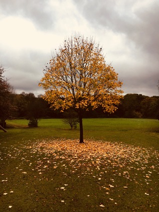
At the top of the steps I found an expansive park, surrounding the fences of Hanwell Zoo and allowing me to take a wet but relatively mud-free excursion along the riverbank as it wandered east around the edge of the Millennium Maze and into Churchfields Recreation Ground. The thunder of trains could be heard over the chatter of children and braying of goats, apparently the only animals braving the wet weekend morning in a compound at the back of the zoo. It occurred to me that I'd soon be passing under the Great Western Railway which had brought me into Paddington a few hours ago, the twists and recursions of today's journey echoing the contortions of the Brent. Now though, the river slunk quietly in a low gully at the foot of the park, screened by high trees and hedges which hid the graceful arches of Wharncliffe Viaduct from view until at the foot of the sloping parkland one of the great arches leapt into view, gracefully crossing the path and the river. This awe-inspiring structure was one of the earliest projects attributed to Isambard Kingdom Brunel, and also one of the first completed along the route west from Paddington to Bristol with trains running above from 1838. The viaduct also has the honour of being one of the first buildings 'listed' for preservation in 1949, and such forms a key part of the bid to have the whole original GWR route named a World Heritage Site. While it remains unclear if Queen Victoria really did insist the Royal Train pause on the viaduct to let her enjoy the view along the Brent Valley, there are now others who linger here - namely a vast colony of bats which live within the hollow archways. The river turns south again here, initially in a brick culvert which neatly brings it alongside the path and under one of the easternmost arches of the viaduct. Looking along the structure, its grace and scale are overwhelming, and perhaps not fully appreciated until viewed from the hay meadow to the south of the line where Lord Wharncliffe's family arms are visible on the central span - recognition of his support for the parliamentary bill authorising the Great Western Railway. I paused here, trying to get a picture which would truly show the sweep of the arches over the valley, an amused dog walker letting his charge scamper in the long grass while he watched me struggling to frame the shot against a dull grey sky. Behind me as I faced the wonder of Victorian engineering, another impressive bulk of a different era loomed: the huge Ealing Hospital - a solid grey block raised above a wide pediment, with ramps leaping and curving from the ground to deliver ambulances direct to the entrances. I'd passed this way countless times, spotting the rather grim building from trains speeding west from Paddington, but up close the building felt impressive, dour and overbearing. Before reaching the Hospital, the river needed to pass under the Uxbridge Road via a low stone bridge. There was a choice of routes here - the path ascended to cross the busy road at grade, or I could stay beside the river and pass under an arch in the bridge built to accommodate the footpath. This passage dipped low, close to the river's edge and appeared worryingly waterlogged. I weighed up the alternative route up to the road, but decided that I was brave enough to attempt the slither down the stone slope and under the bridge. In the edge of the river beside me, a forlorn and slowly moulding office chair was marooned in a shallow pool of greenish water. The roof was close to my head, stippled with drips of calcification and dangling here and there with more ambitious stalactites, but the passage was uneventful save for paddling through an inch or so of water - either rainfall or overspill from the Brent which felt perilously close. The path climbed again, rising to pass close to the eastern perimeter of the Hospital, revealing the inner workings and complexities of the building, rather spoiling the illusion of the futuristic swooping concrete ramps and the rather inhuman face of the tall concrete blocks. Built in 1979, the site fills the nook between the River Brent and the mainline of the Grand Junction - latterly the Grand Union - Canal. To the west of the current hospital the former Middlesex County Asylum, opened in 1831 remains in use as a modern psychiatric unit, still sequestered behind a solid red-brick wall. Known for some time as St. Bernard's Hospital, the facility pioneered early forms of occupational therapy under Dr William Ellis its first superintendent, and was later instrumental in the removal of restraints in favour of less invasive means of protecting patients, including the padded room. The relative humanity of the regime at Hanwell under Ellis is evident in his principled resignation upon learning that the Commissioners and Justices wished to cram more patients than he felt could be properly be cared for.
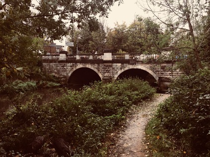
This corner of Hanwell also holds a significant place in the nation's industrial history. Beyond the hospital the path divided, with a spur leading up to the towpath of the canal at the bottom of the Hanwell Flight - a series of six locks with associated balancing ponds built in 1794 to bring the Grand Junction to the level of the Brent, with which it merges nearby. As I emerged beside the bottom of the flight, two young couples were beginning the ascent of the flight, enjoying the sunshine which had finally escaped weakly from the cover of low cloud and not yet tired from, or perhaps fully cognisant of, the effort required in operating the six locks to raise their boat through fifty-three feet. I was tempted to follow the canal but I stuck with the river path as long as I could, taking the path which shadowed its last sluggish twists between the cottages on Green Lane and the canal, before finally reaching the junction under a brick bridge. From here I would be walking the southern part of a route which was navigable to Birmingham and beyond, and which had revolutionised transport in the 18th century. The River Brent, for a time at least, was subsumed into the wide, businesslike line of the canal - but it wasn't entirely absent. The river's meanders and twists as it approached the Thames largely dictated the course of the canal. Where the meanders were too tight and wide the river branched from the canal into foliage-choked and litter strewn loops which tumbled busily over weirs while the canal took a more sedate route through the wide green spaces of Osterley Park. The grand house here has its origins in an Elizabethan Manor which, at a respectable distance from London attracted the Child's, a well-connected banking family who in 1761 engaged Robert Adam to rebuild the house which was by then in considerable disrepair. Osterley House was once set in open countryside, and while its immediate grounds remain a park in National Trust management, a surprisingly large area of apparently unmanaged open land which would once have been part of its substantial grounds shadows the Brent here. To the east of the river this has become a managed wildlife area, part of the chain of spaces which make up Brent River Park. To the west the former Great Western Railway branch to Brentford runs broadly in parallel, passing the curiously named Trumpers' Crossing nearby. On the towpath, a large sign notes the location of the prize-winning length of pile in the 1959 Kerr Cup Pile Driving Competition. This contest, apparently organised by British Waterways, appears lost to history - even Google largely drawing a blank except for references to the sign itself. Both canal and railway pass under a more modern transport innovation here too, with the M4 sweeping above on a curving route into West London via a practical and unadorned concrete and iron overbridge. The traffic shuddered and screeched above, the notoriously bottlenecked road seemingly flowing freely for a welcome change.
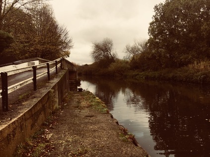
For a while, the motorway, railway and canal ran in parallel along the broad lower Brent valley. The river meandered to the east here, passing around large wooded islands under the road, traffic above seeing a carpet of treetops below and largely unaware of the presence of the waterways. The towpath climbed over the river by way of an elegant iron bridge spanning solid, brick piers. Beyond the fence the silent machinery of a waste transfer station waited restlessly for the next load of detritus from the suburbs. This was once Brentford Town station on the somewhat unloved Brentford Dock branch, Brunel's final railway project before his death. The aim was to secure a GWR connection to the tidal Thames at Brentford - but the line struggled from the start with objections to its construction raised by the Grand Junction Canal Company and the Duke of Northumberland, owner of nearby Syon House. When eventually opened to goods in 1859, and then to passengers in 1860, the initially single track, broad gauge line failed to deliver on its promise in attracting commuters. The anticipated passenger flows to the Dock for ferries to Kew Gardens didn't ever begin operation, but freight traffic grew steadily with cargoes transferred to barges at the busy docks beside the Thames. By the time services were suspended as an economy measure during the First World War the branch was operating as a more conventional double track spur from Southall - but passenger traffic was never strong, in part because the connection to the mainline faced west making through-trains from Paddington unworkable. The London & South Western Railway had arrived in Brentford in 1849 with swift services direct to Waterloo - and the GWR simply couldn't compete. Despite restoration after hostilities ceased, the service was reduced to a peak time shuttle in 1929 and ceased entirely in 1942. Perhaps surprisingly, freight traffic continued to the goods depot at the Town Station site until 1970, with private sidings serving Firestone and other factories along the 'Golden Mile' of the Great West Road - the great mid-century sprawl of industry out to the west of London. Now the line stops short of its former crossing of the A4 while the collected waste of Hounslow, Ealing and Richmond is sifted and containerised at the railhead. Soon after passing under the road near the vast mirror of the Glaxo Smithkline global HQ, the river is bridged by the L&SWR's 'Hounslow Loop' - and with electric trains passing frequently above it's perhaps easy to see why the Great Western's branch never quite made its mark as a passenger railway. I emerged from beneath the Great West Road to find the hulking remains of an overhanging warehouse leering out into the waterway. It appeared that boats awaiting repair were now stored here, somewhat sheltered by the structure which seemed to be in the midst of a long process of overhaul. The path edged around the skeletal building, feeling oddly unofficial - this area was in the throes of redevelopment with the walkway temporarily transferred onto an unnerving floating pontoon in the canal. I trudged carefully along the queasily oscillating plastic walkway, noting the modern apartments which had encroached on the broad canal as it approached Brentford Gauging Lock. Walking here felt like trespass, and I wasn't sorry to emerge on Brentford High Street which felt down-to-earth in comparison to the eerily quiet developments along the canal.
Brentford High Street was surprisingly quiet too, with the Great West Road now taking the strain of much of the through traffic. At this, western end of town things were starting to feel the effort of gentrification - pubs were smartening up and a few specialist stores opening opposite a modern hotel building on the edge of the Canal basin. The towpath continued, descending via a slick, steep flight of stairs onto a narrow ledge which turned east along the Brent's final meander towards the Thames. This part of the walk had looked straightforward from the maps - a last trudge along the path to the confluence - but it was a surprisingly complicated endeavour. Firstly, the path was confusingly discontinuous and was often thrown aside from the water by private stretches of mooring. At one point following the path necessitated clambering up onto a concrete ledge to cross the river frontage of a timber merchant's warehouse which would formerly have received deliveries by barge. There were few people around and sparse signage to indicate I wasn't way off track - making the narrow and unclear right-of-way feel strangely menacing. The afternoon was becoming warm too, with the morning's mist and rain now a memory as the sun beat down on the water, reflecting dizzily back at me. I crossed the river again near a muddy inlet which reminded me that the River had now taken precedence again, and that this was Brentford Creek rather than the managed route of the canal. Immediately after crossing the bridge the route descended a steep staircase down to the grassy riverbank, as the more solid walkway through the Brentford Dock Estate remained private. Design of this development of homes by GLC architect Sir Roger Walters began on the closure of the docks in 1964, and building was finally complete by 1978 - the year of his retirement. Originally proposed for social letting, only around one fifth of the units were rented with leases for the rest sold by the GLC, resulting in the privately managed estate of today. In 1980 the associated Marina development was opened by the flamboyant GLC leader Sir Horace Cutler arriving by boat from County Hall. Cutler was by all accounts very keen on such showmanship, and although his administration is regarded as largely unsuccessful, he raised ideas which later found more general acceptance - not least the extension of the Jubilee Line into Docklands to spark regeneration, the promotion of the London Marathon and an audacious scheme to bid for the 1988 Olympic Games - which failed to find Government support. Cutler also correctly predicted that if elected, the Labour leader Andrew McIntosh would be ousted by the left of the party and that Ken Livingstone would become GLC leader. However, fighting the election on this negative basis seems to have assured Labour of the very victory which Cutler feared. Six years after Cutler's triumphant arrival stunt at Brentford Marina, the GLC which he had himself described as "too big, remote and shadowy" was finally abolished by the Thatcher government, nominally for those same reasons.
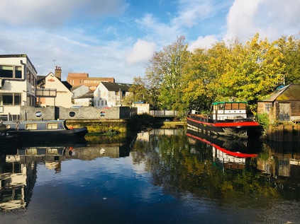
I crossed the Brent for the final time at Thames Lock - the tidal gates which controlled entry to the docks until their closure, and which still allow experienced boaters to access the Thames at designated times. The area around the lock was a pleasantly haphazard zone of chandler's yards and crumbling warehouses which transported me with a jolt to the unreconstructed reaches of the Lower Lea Valley more than a decade ago. Boats of all kinds were visible, some floating queasily askance, others hoisted from the water and in various states of repair or decay, but no-one seemed in a hurry to do much this sunny, Saturday afternoon. Here too, regeneration was slowly encroaching - and the people who I met crossing the bridge over the last loop of the river were upwardly mobile, young and optimistic looking types. Dock Road led down towards Brentford High Street which was a confusing and somewhat downbeat mix of buildings awaiting demolition, new developments and tired looking blocks from the late 20th century. A little further east I found the signposts marking the route to the Thames Path. Here, like some of the places I'd encountered the path in the east of the city, there were discontinuities and complex diversions where the riverfront rights of way hadn't yet been resolved. A short way ahead I found an alleyway which returned me to the final few metres of the River Brent at Point Wharf Lane beside some tidy and well-used residential moorings and some shiny newly built apartments stacked atop a trio of Turkish, Indian and Italian restaurants. The last mile of the Brent had been quiet and residential, and felt curiously private in nature. The river belonged to those who lived beside it and I felt like an intruder walking the path beside their homes. As the path turned east, I realised that I'd unexpectedly reached the point of confluence - and I tried to snap a picture inconspicuously over the heads a family working on their boat. I also calculated that the walk from Perivale to this spot had in fact been around ten miles in length - there was certainly no way I'd have finished this walk on my last outing, and perhaps I'd been too tough on myself for not pressing on to Brentford. after all? My estimate, minus the winding and curving of the river, had been dramatically off beam. Now I needed to head briefly back inland near the giant stainless steel swoop of Simon Packard's 'Liquidity' sculpture - a commission which had almost broken the spirit of the artist - standing resolutely on the quayside at Ferry Lane despite local homeowner's protests at its size.
The Thames Path meandered confusingly again, through a forbidding iron gateway and up a strange flight of outdoor stairs at the rear of Waterman's Park - an apparently abandoned 1970s office complex which felt like a set from a TV show. I expected to be chased along the raised brick gangway by Denis Waterman at any moment. Eventually though, I found my way through to the park proper - a sliver of green which runs along the Thames, the site of the former Brentford Gasworks which closed in 1963. A busy arts centre now occupies part of the cleansed and remediated land, and the river moorings are contested territory - longstanding residents forced out to accommodate luxury boats. Beside me the brown waters of London's river parted to sluggishly churn around Lot's Ait and Brentford Ait - a pair of wooded islets in the river. Up ahead, the tall tower of the former Grand Junction Waterworks Company loomed at Kew Bridge, marking the point where my South Circular walk had returned me to the north bank of the river. This dogged but doomed company had tried in vain to extract clean water from the Brent and the Colne, but resorted in the end to syphoning off the murk of the Thames and using the lofty standpipe tower as a means of filtering out the worst of the filth and detritus. Somehow, even when I least expected it, my walks formed connections and strengthened my sense of the city. My earlier walk along the northern reaches of the river had almost convinced me that these western tributaries would be frustrating to follow and wouldn't form substantial walks, but today had persuaded me otherwise. I waited for one of the trains which had passed over my head earlier to arrive at Kew Bridge and take me swiftly back to Waterloo while I pondered my eastern prejudices. It's true that having been engaged in other parts of the city had made me pine for points east, but if these western walks continued to produce these new and surprising insights into the fringes of the city, then I'd be back to walk more of them. At times during the previous month, the River Brent had felt like a millstone - unfinished work, an incomplete walk sitting on the ledger - but it had in fact been deceptive - a river much longer, swifter and deeper than I'd imagined, and a route surprisingly capable of capturing my imagination. I wasn't the first to be persuaded it seems, and it was interesting to ponder quite what our former Poet Laureate would have made of modern Brentford?
Gentle Brent, I used to know you
Wandering Wembley-wards at will,
Now what change your waters show you
In the meadowlands you fill!Sir John Betjeman - Middlesex - 1954
You can find a gallery of pictures from the walk here.
Lost::MikeGTN
I've had a home on the web for more years than I care to remember, and a few kind souls persuade me it's worth persisting with keeping it updated. This current incarnation of the site is centred around the blog posts which began back in 1999 as 'the daylog' and continued through my travels and tribulations during the following years.
I don't get out and about nearly as much these days, but I do try to record significant events and trips for posterity. You may also have arrived here by following the trail to my former music blog Songs Heard On Fast Trains. That content is preserved here too.
